 It's easy on a rainy Sunday to choose to lie in bed rather than head outdoors. But a walk in the rain is one of life's most beautiful and simple pleasures - particularly if you do it alone. I guarantee that you will return home feeling better than before you went out. Here's how to make it magical:  Keep it simple Put on a raincoat and a pair of boots. Make sure you're warm enough. But that's about all the preparation you need. No-one cares what you look like in the rain. And that is part of the joy of it. Return looking like.a drowned rat, soaked through with a smile on your face.  Choose a soundtrack On rainy days, despite loving the sound of nature, I like to walk with gentle classical music playing in my headphones. The volume is soft enough for me to hear the beautiful sounds around me but the music adds a soundtrack that allows me to connect to my emotions more - like having a first glass of wine, everything just goes a little bit softer, gentler and more out of body. I recommend Ludovico Einaudi as the perfect musical score.
Take a closer look Notice things. Don't just walk blindly. Take your time. Slow your pace. Look at the different shades of green, the contrast of textures underfoot, the symbiotic relationship between plants. Stop and watch the birds, bunnies, squirrels and slugs, all going about their business.
Touch things. There are so many amazing textures in a wood - from beautifully striated bark, to downy soft moss, to tickling grasses or prickly conker pods. Stop, take a moment and touch them. Notice what real feels like, not man made, not manufactured. Just beautiful items handcrafted by nature. Revel in how beautiful this planet is.
Tune in to nature's changing seasons. Spot life's lessons in them Depending on the time of year you walk, there will always be something that nature is busy doing. Even in the bleak winter months where trees are bare, you'll spot snowdrops fighting their way through. As it is mid summer, I saw the last of the elderflowers, a life lesson right there for any late bloomers amongst us. While the rest of the elderflowers have already fallen away, transforming into berries, those late bloomers now stand out shining brightly against the green. No-one's judging them for being late to the party, they're still just as beautiful having blossomed a bit later than the rest. Let that be a reminder to you that everyone fulfils their potential in their own time. Or Conkers, those prickly playthings that always hark the impending sense of back to school. Not exactly attractive on the outside, but beneath their gnarly exterior, they are shiny and smooth and provide hours of fun to kids. Don't be too quick to judge.
Honour the passing of time Whether it's a 450 year old stately home harking back to a different era, or the magnificence of an oak tree that has clearly been standing tall for a very long time, it's worth reflecting that while seasons come and go, together they add up to years of history. I like to pause and think about that, not just the changes that might have happened since that Oak was a mere acorn, but all the changes that have made me, me. I have walked this particularly walk on so many occasions - with my kids when they were little, going swimming in the river, walking and chatting with friends, walking alone - crying - during very challenging times in my life, power walking to train for an event, walking hand in hand with the person I love. I sometimes wonder if each version of myself left a memory shadow on these paths and they quietly whisper hello as I walk past. If I listen closely enough, I can hear them voice their memories.
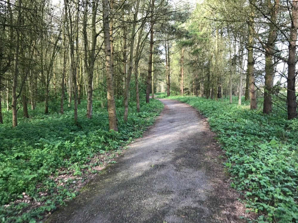
Free your mind Allow your mind to follow free flowing thoughts about everything and nothing. There is no right or wrong way to think. It's simply about being really present in this moment. My imagination comes alive. Instead of trees, I see a cathedral of leaves more spiritual than any church. I see a woodland throne and wonder who might sit on it when the woods come alive at night. I picture fairies dancing on moss. And I ponder why the patterns on the outside of tree bark run up and down while inside its concentric circles. When do we ever get time to think such frivolous thoughts? And yet this is how we thought as children, not about mortgages or jobs or relationships, just about the potential for magic all around us.  Lift your face to the rain, close your eyes and feel the tiny caresses of each drop as it drums on your face. Embrace the wind as it tousles your hair and breathe in gulps of its freshness. This is what it feels like to be alive. To be happy. To be human. To be completely yourself. If you haven't taken yourself for a walk recently, do. You'll be so glad you did. If you're a woman who loves to walk and want company (on the days you're not taking a rainy walk in solitude), join Glamoraks. Get the app and make new friends. This walk was at Beningbrough Hall, outside York, a National Trust property and all credit to the grounds team for constantly maintaining the paths and creating gorgeous wooden seating.
3 Comments
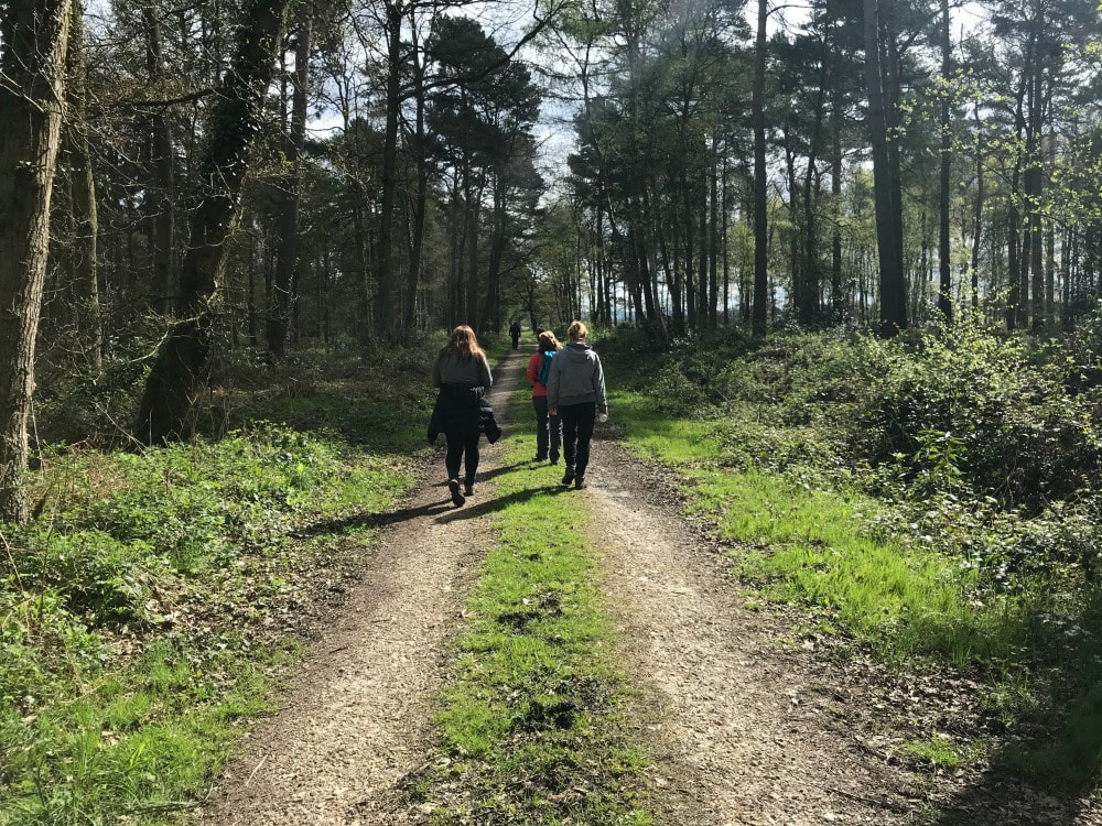
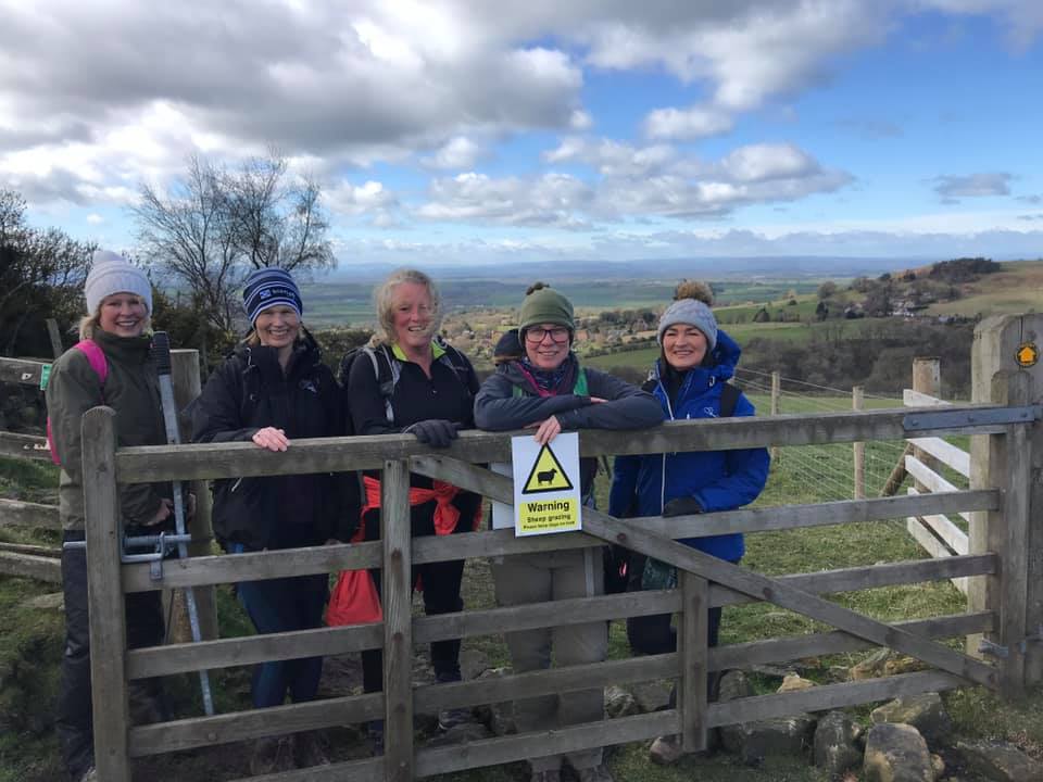
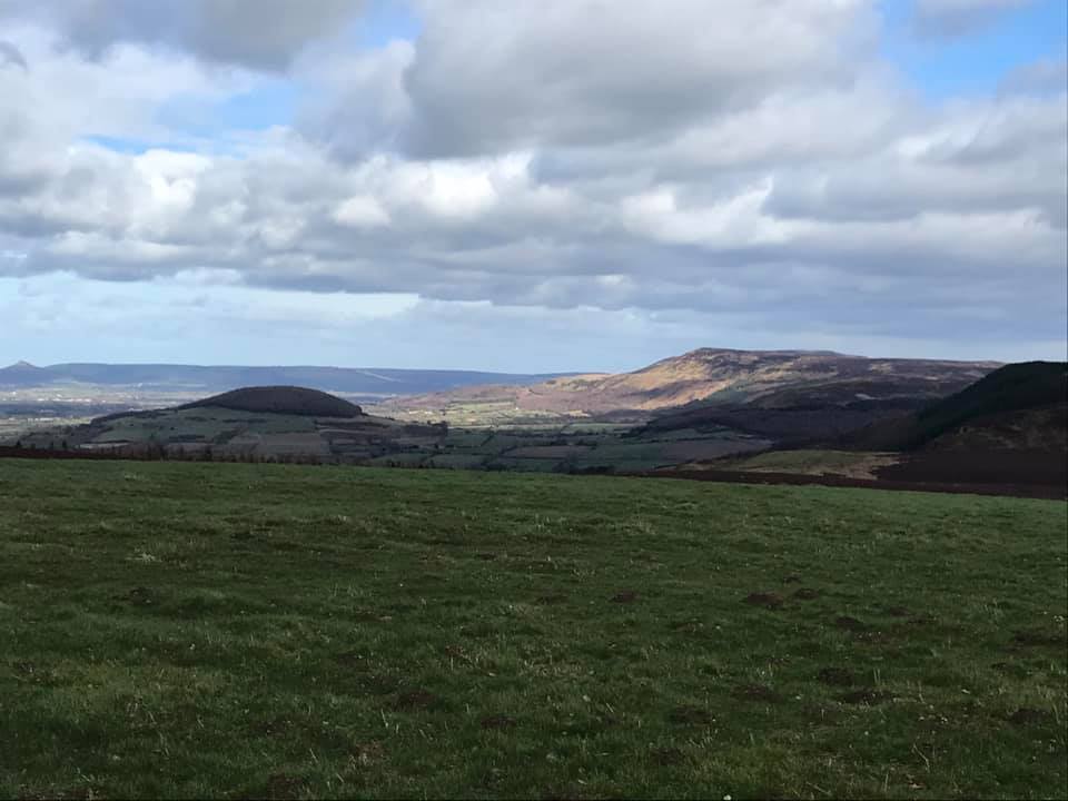
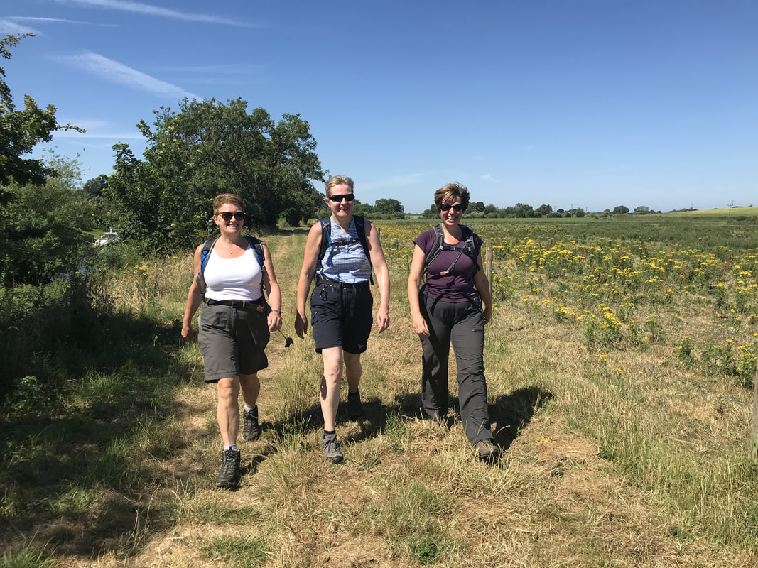
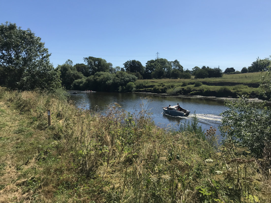
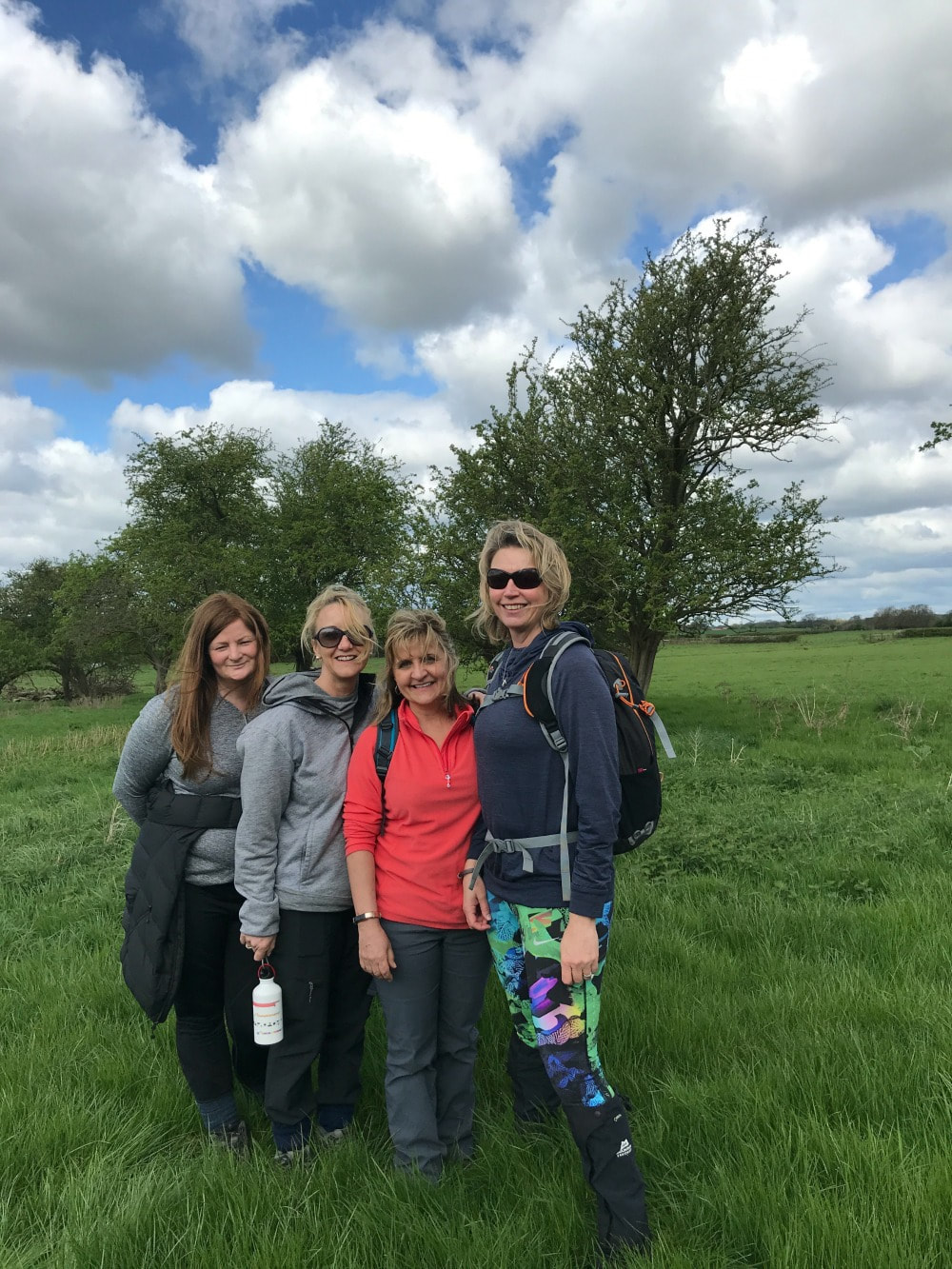
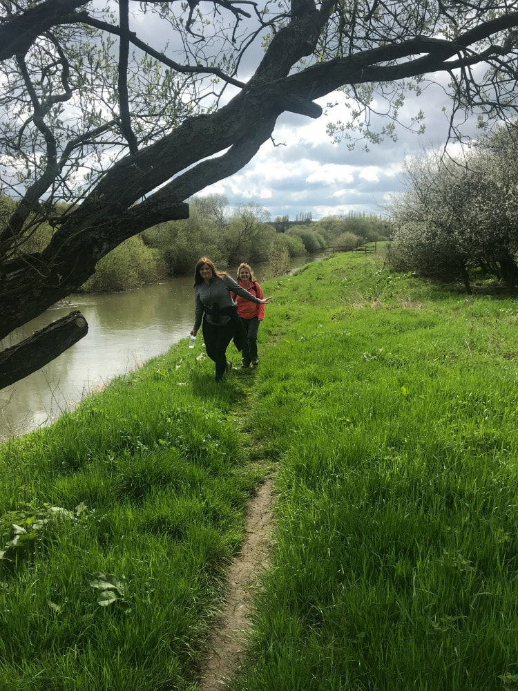
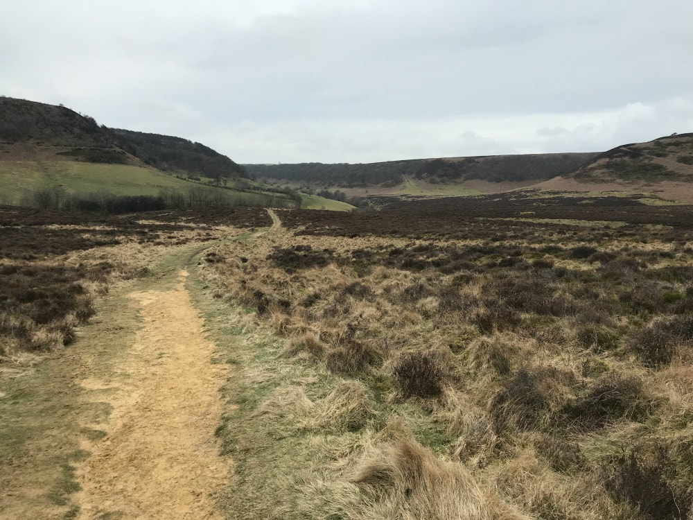
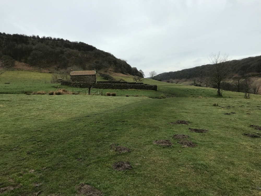
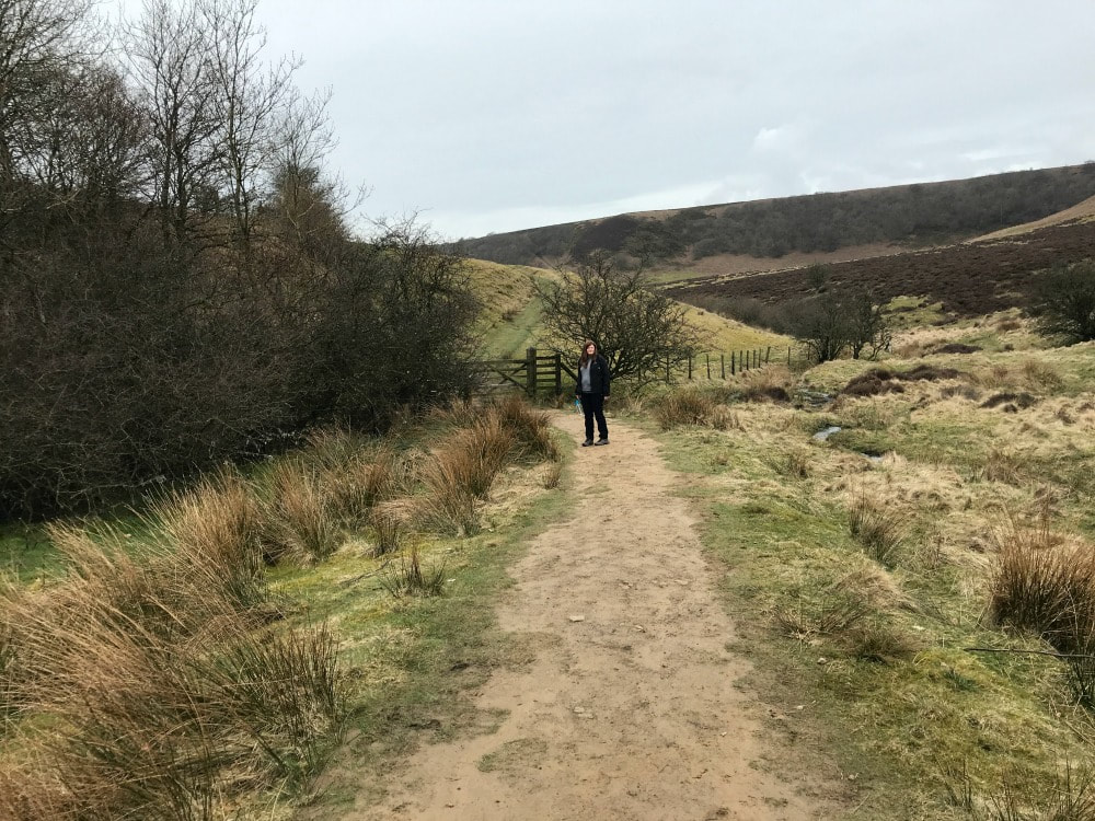
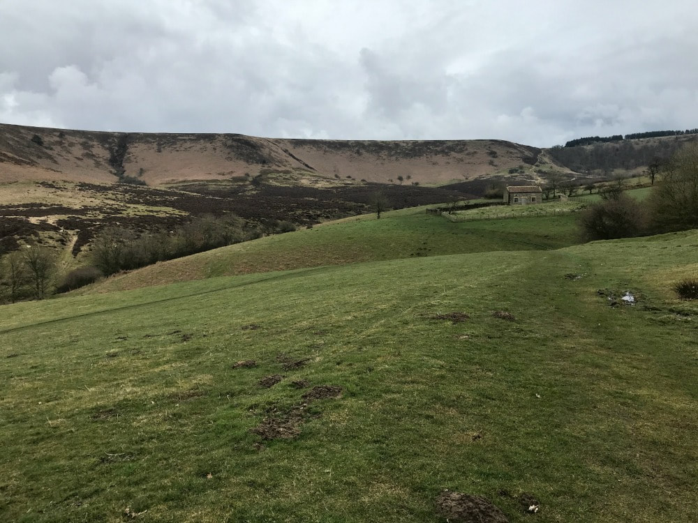
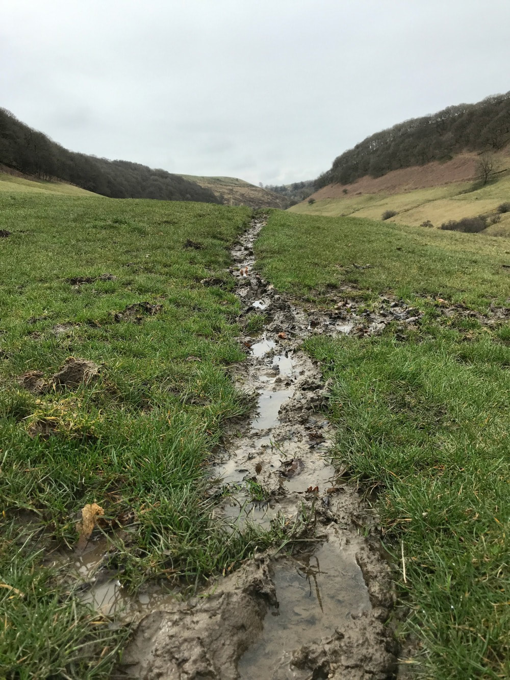
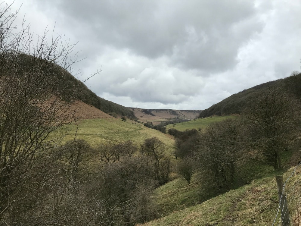
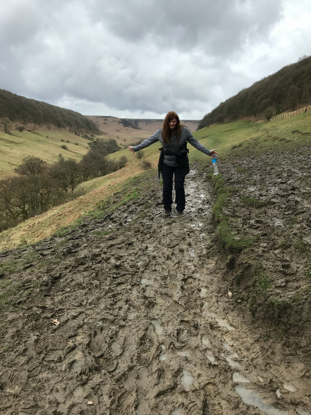
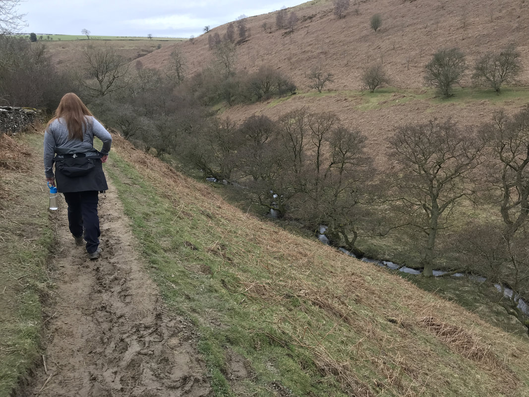
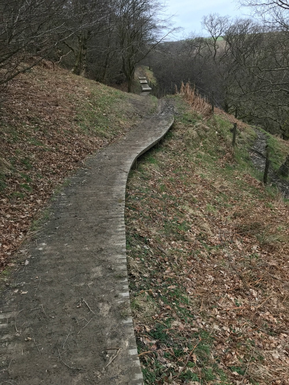
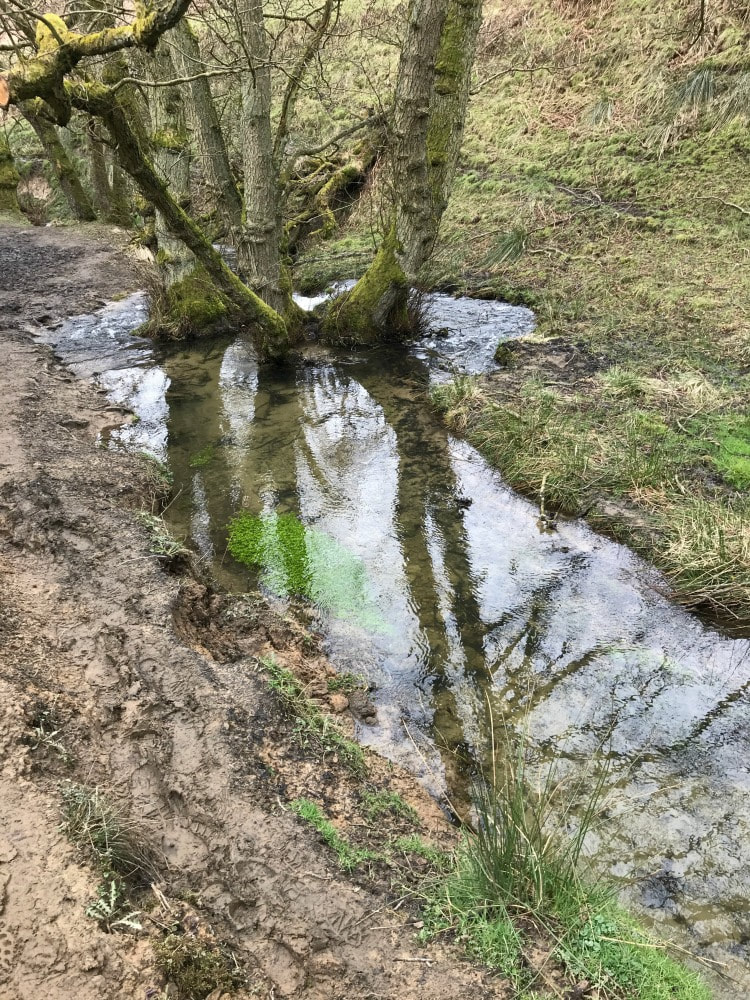
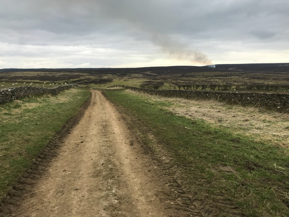
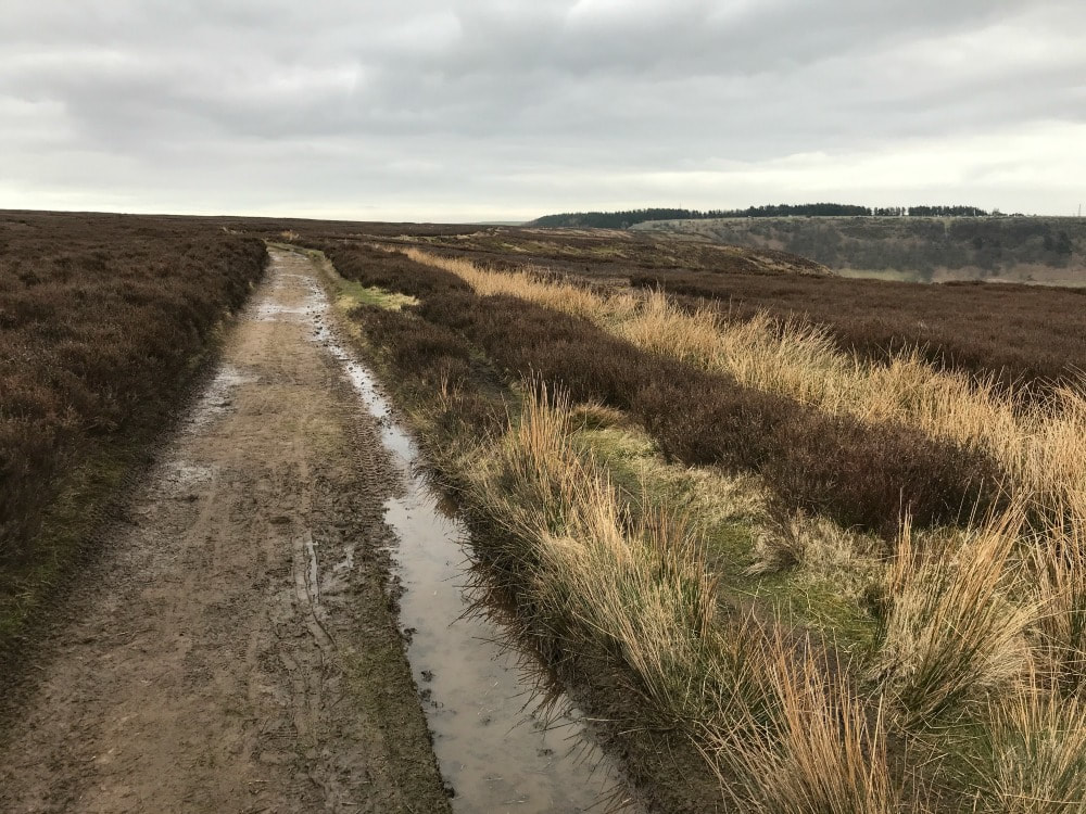
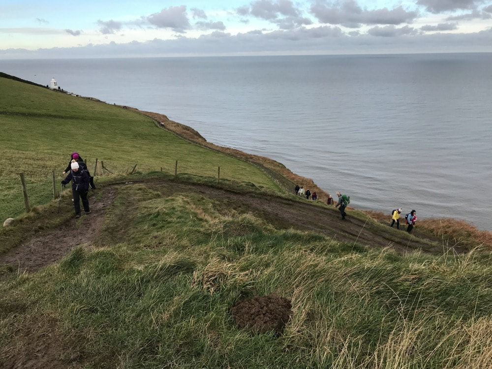
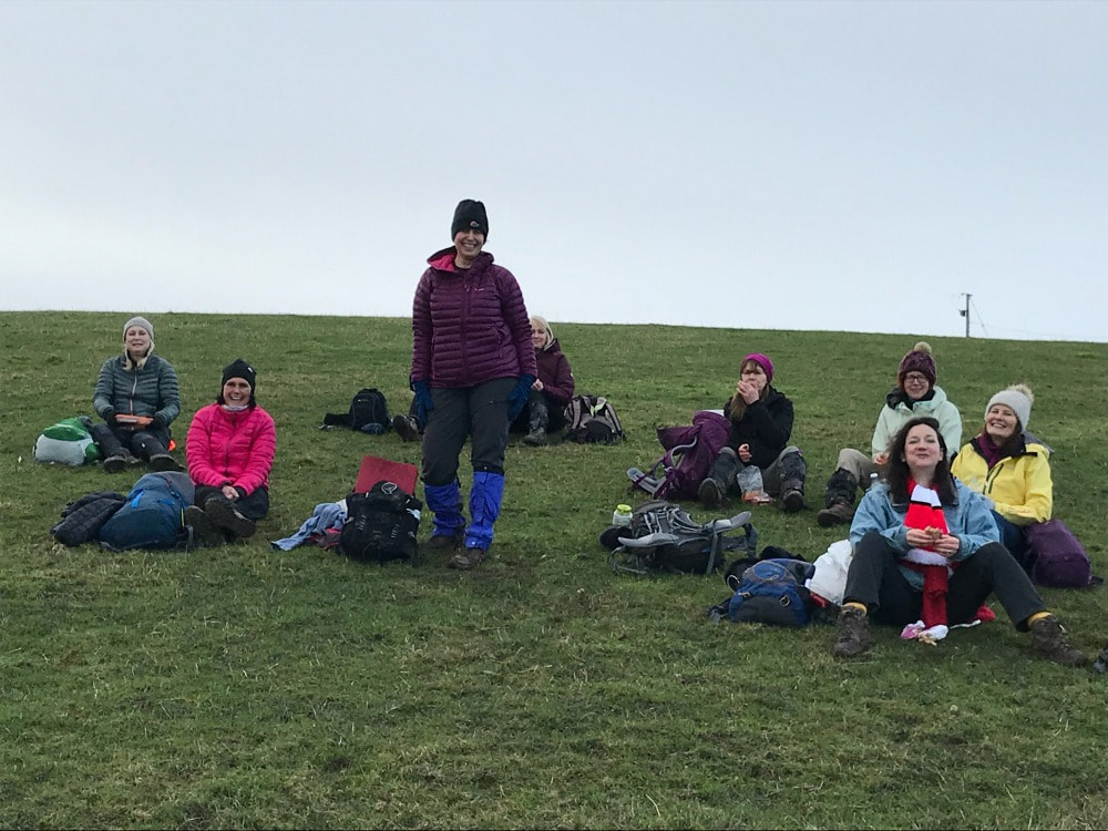
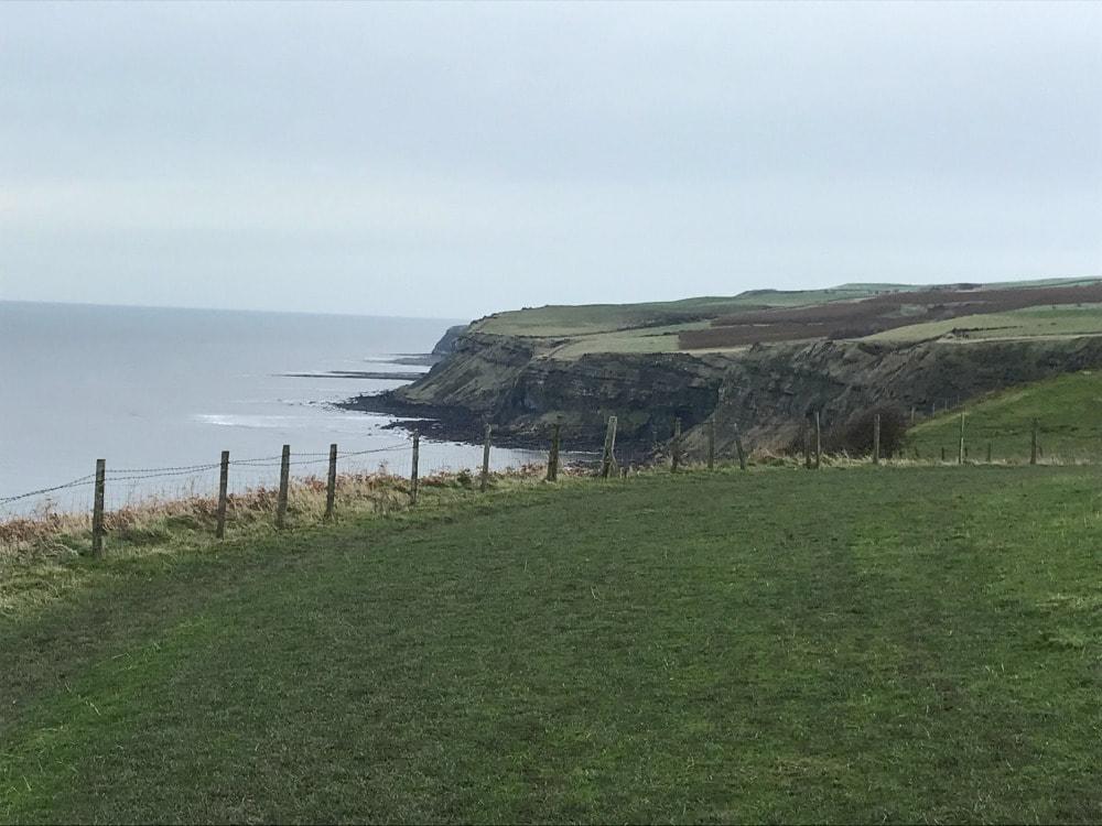
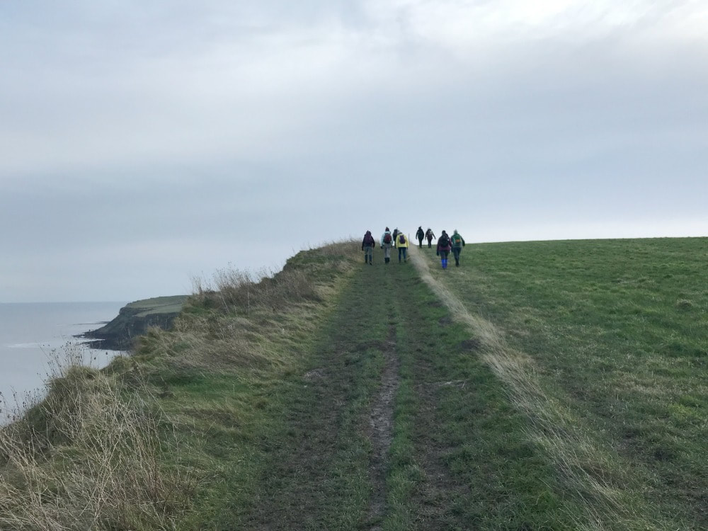
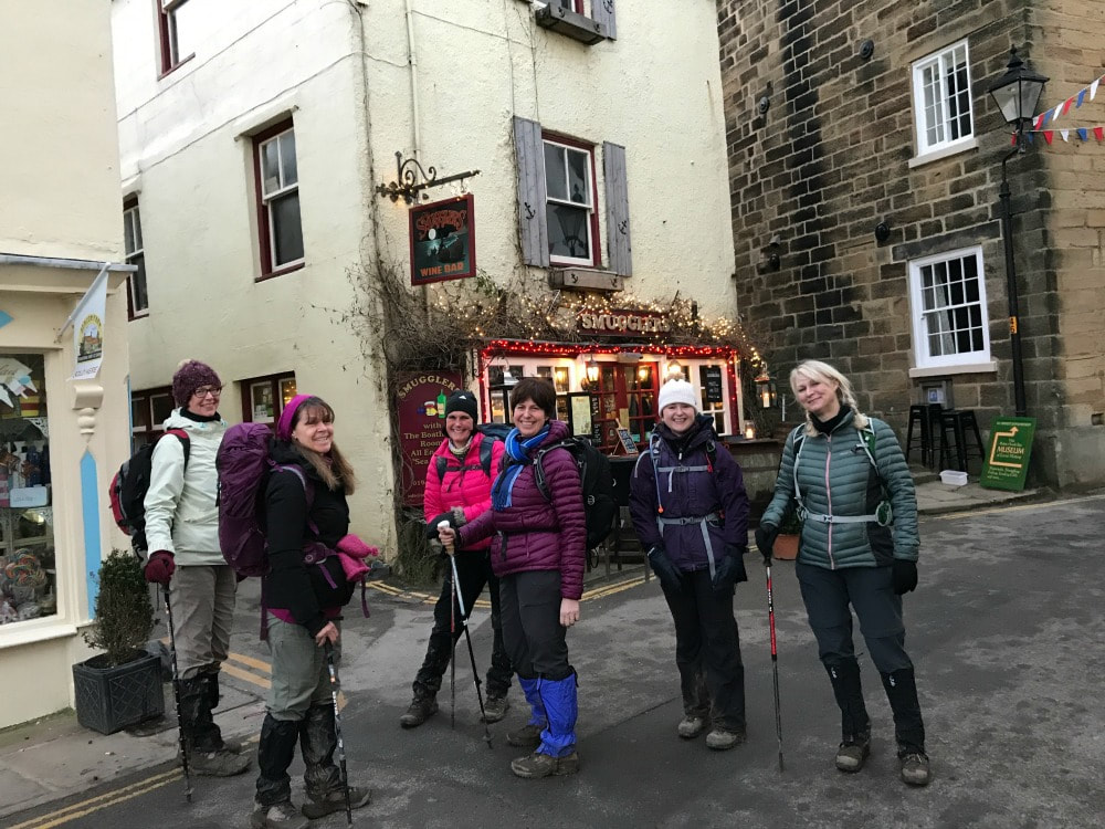
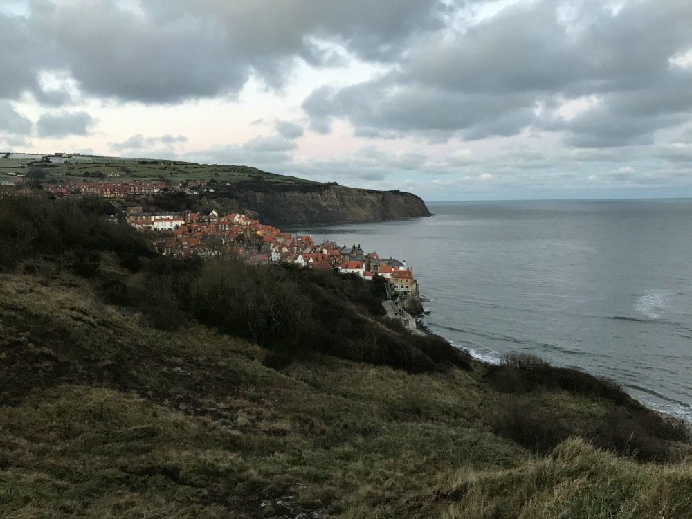
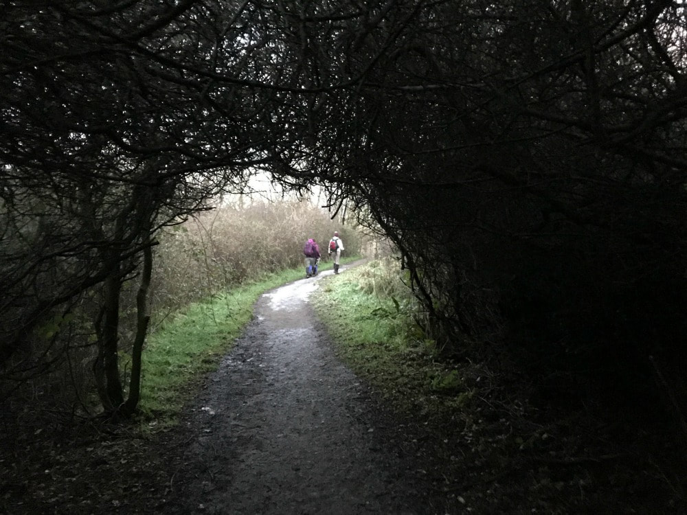
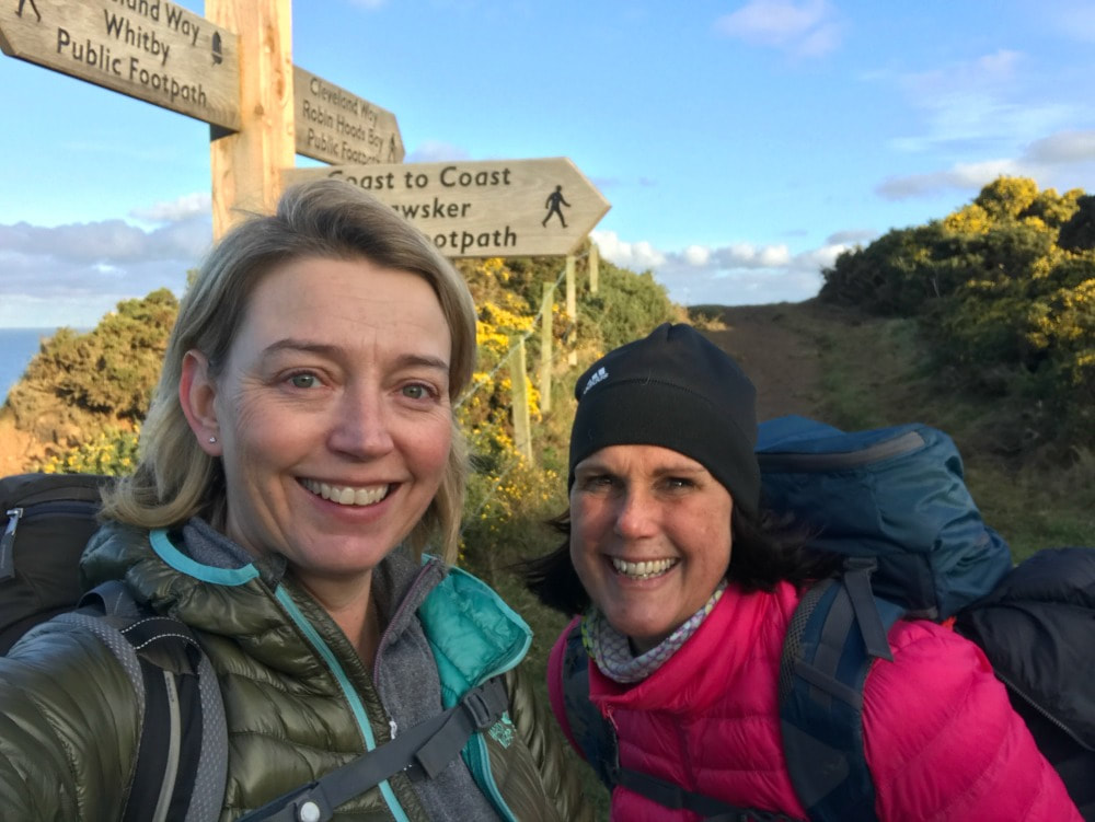
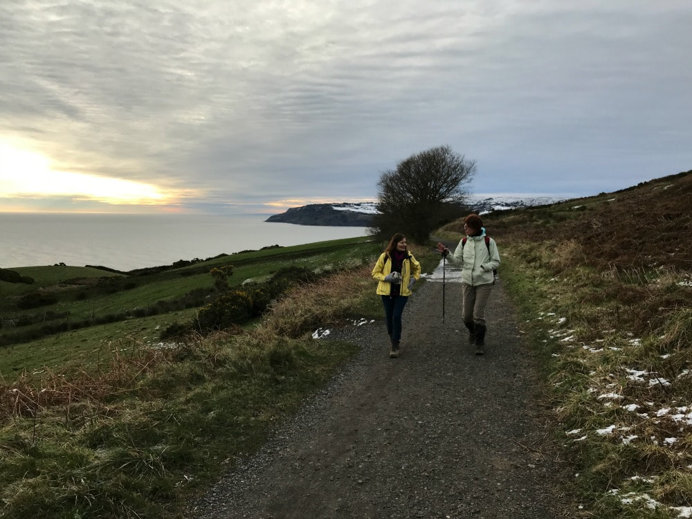
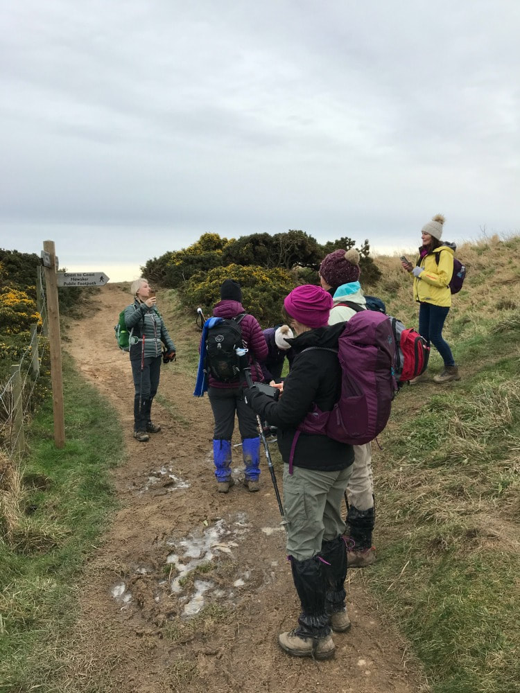
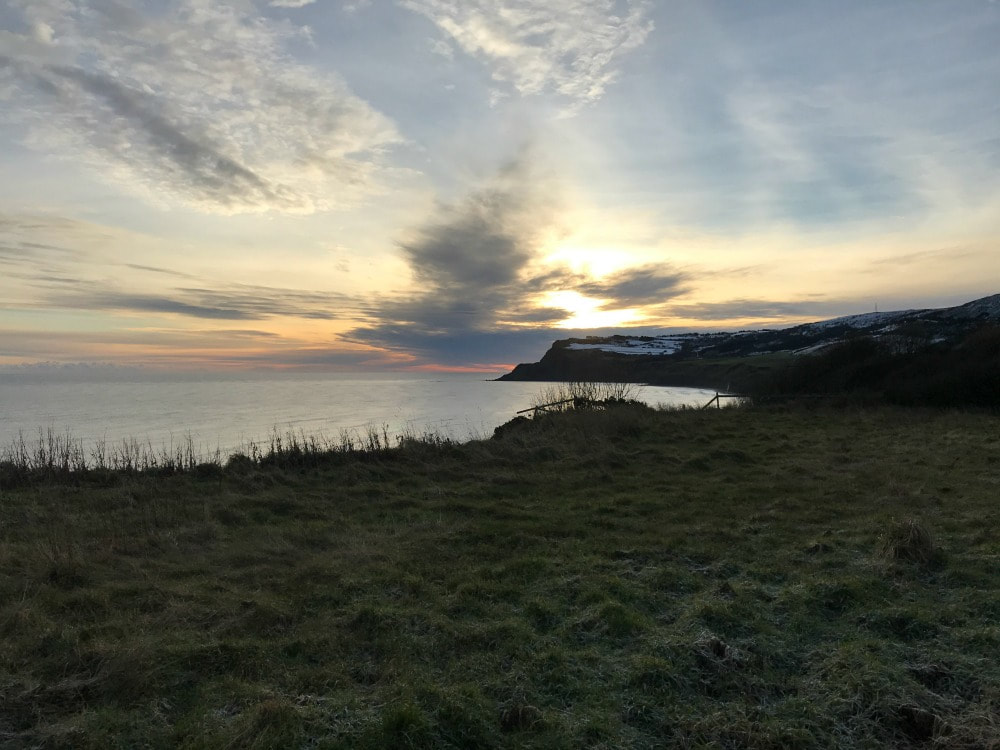
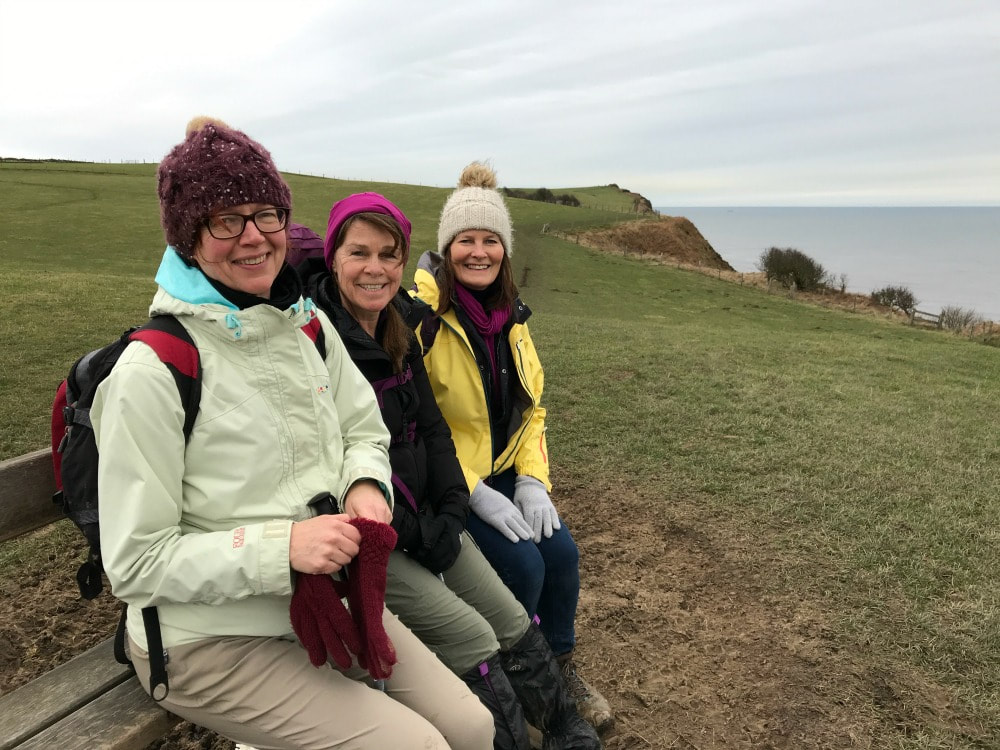
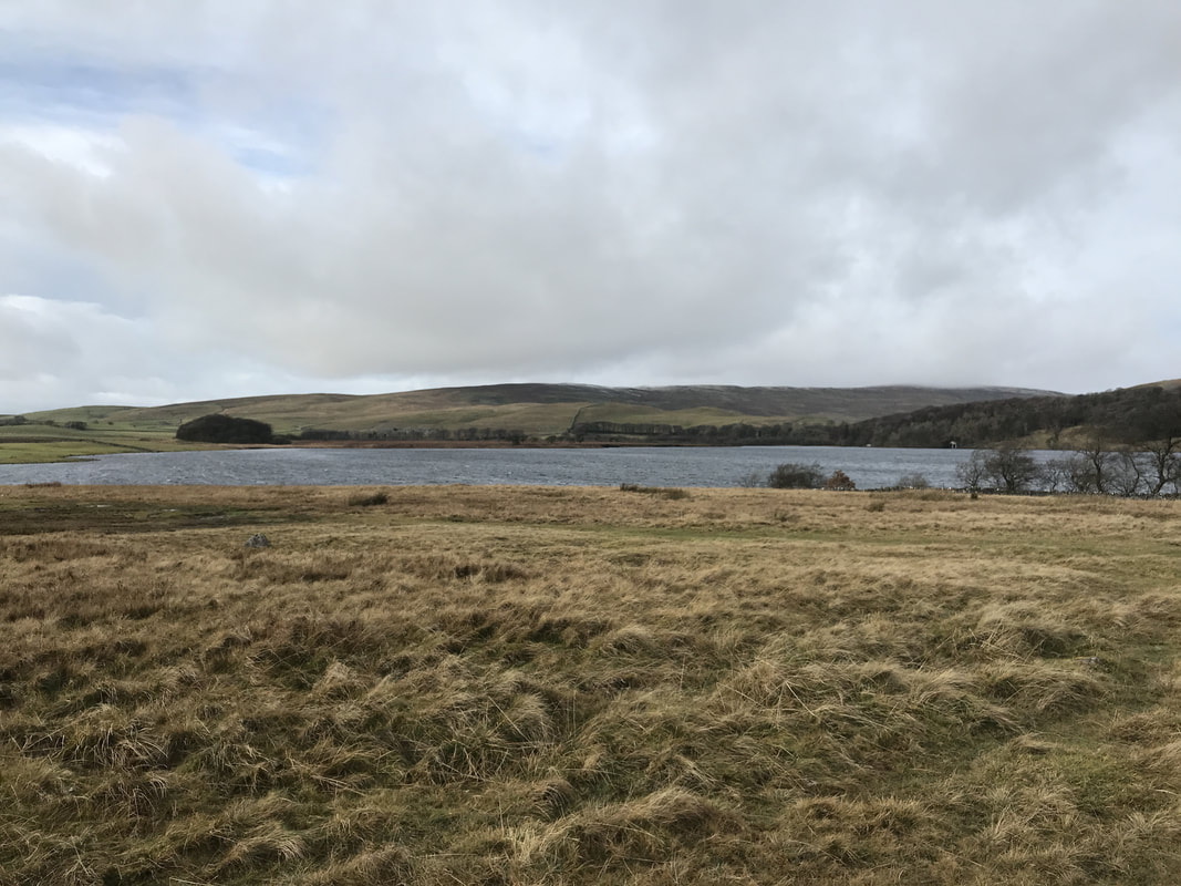
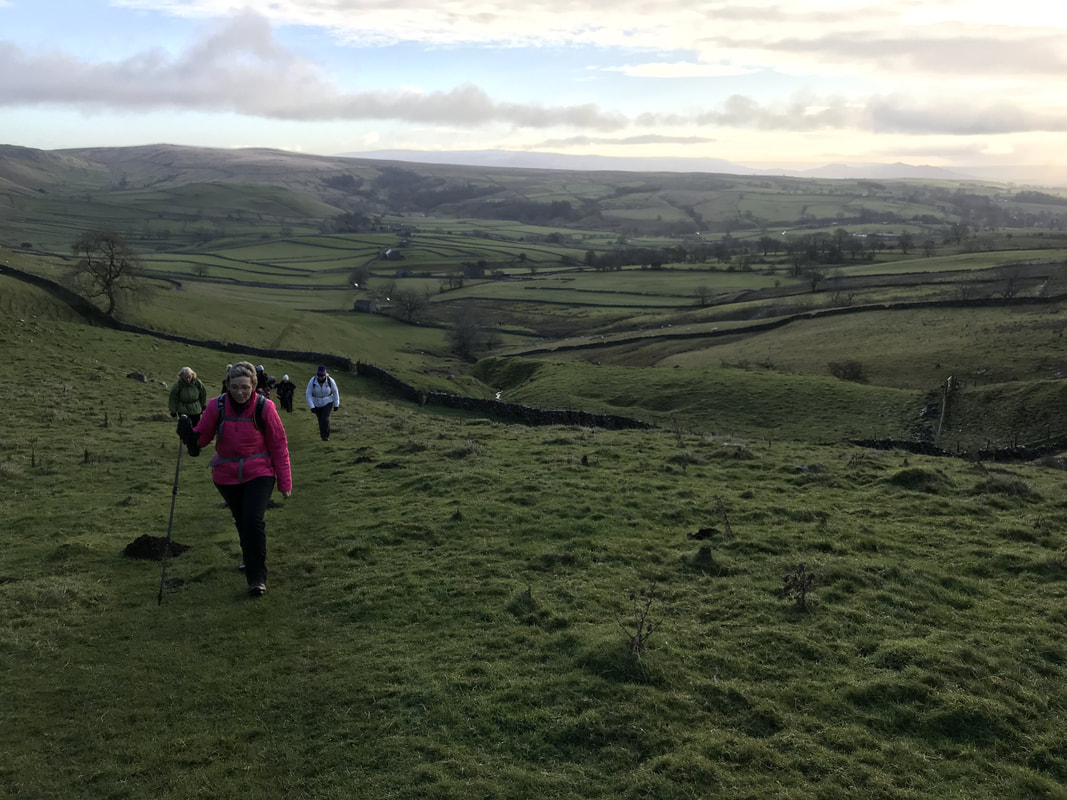
 Sometimes you need to walk in a group. Sometimes you just need to escape and spend time with your thoughts. That's where I was recently. I had four days off and wanted somewhere I could walk safely but entirely alone, that wouldn't be crowded, would have a few hills, somewhere for me to stay and was easy for me to get to from York. I considered to stretches of the Cleveland Way, but it can be tricky finding accommodation on the route and public transport options aren't great depending on where you start and finish. Then I remembered the Esk Valley Walk, something I'd been wanting to do for a while. As described by the North Yorkshire Moors website: The 37-mile (60km) walk follows the River Esk from its source high on the North York Moors to the coast at Whitby. It’s marked by a special waymark with a leaping salmon – yellow arrows mean a footpath and blue denotes a bridleway. The best thing about the walk is that it is served by the Esk Valley Railway line, which means you can leave your car at one end and be able to get back to it at the end. Unlike the suggested itinerary, I did it in reverse and actually decided to abandon the last part of the walk in favour of some self-navigation. Here's what I did: Day 1: Whitby to Grosmont - 8 miles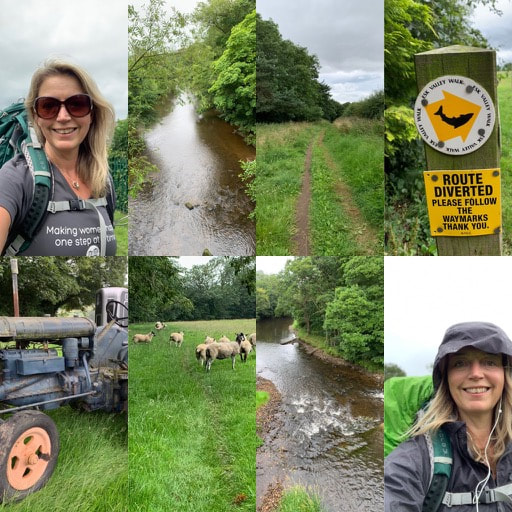 This is an easy, short day which is good for day 1 as it gives you time to get to the start. I parked at the Long Stay carpark in Whitby down by the marina. It's not cheap at £9.40 a day, but it meant I could top up my daily parking from the Ringo app every day and it felt safe. What's more, the carpark is literally the start of the walk. I plotted my route in advance using the OS Map app, which I would highly recommend you get. Worth every penny. While the walk is signposted with little leaping salmon symbols, they are not posted at every point where you might need a sign. I found myself referring to my map quite often. The walk follows the River Esk reasonably closely and on day 1 you will find yourself zig zagging across the river and the railway line repeatedly. There are plenty of bridges to appreciate pretty river views and a number of places you have to cross the railway tracks directly, keeping an eye and ear out for trains. But they're not all that frequent! If you're lucky, you will get to see and hear the steam trains chugging along the North Yorkshire Moors Railway. There are enough little hills to make you work up a sweat, particularly if you're carrying a backpack. But in general it is an easy, pretty walk to ease you into the rhythm of walking. Expect fields, sheep, rivers, bridges and railway lines. I got to Grosmont faster than expected and had a room booked at the gorgeous Grosmont House B&B. it was bliss to be able to lie on my comfy bed, with the rain coming down outside, reading a book and just enjoying putting my feet up. Dinner at the Station Tavern next door was good and filling. I had wanted to go to the Steam Cafe for one of their pizzas which are apparently very good, but they only serve those on the weekends. 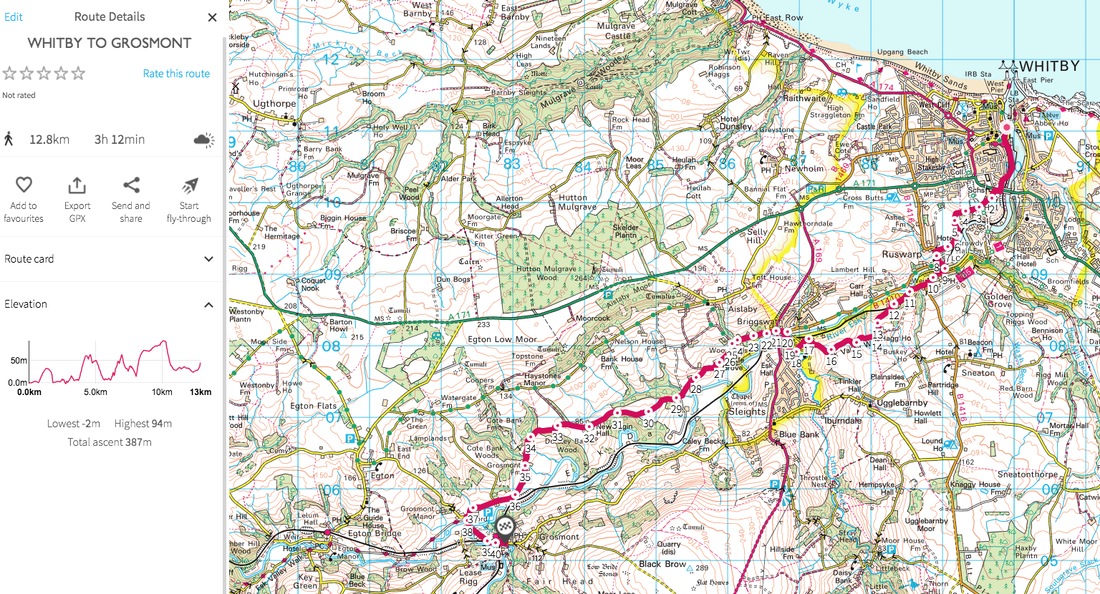 click the image to get taken to the route click the image to get taken to the route Day 2: Grosmont to Danby - 13 miles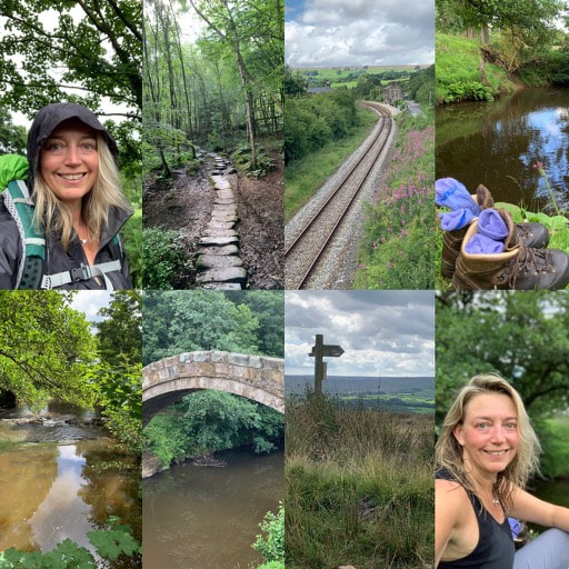 After a lovely breakfast at the B&B, I headed off into the rain. The first part of the walk is flat and easy, along a broad track which still criss crosses the river and railway, but it's gentle and serene start to the day. Egton Bridge is ridiculously pretty and you can wave hello to the Alpacas (or Llamas - I can never tell the difference) at Egton Manor. Once you've gone through Egton Manor there is a short sharp climb up to East Arncliffe Wood, but the woods are magical. Take your time here and simply enjoy the mossy rocks, tree canopy and the mulchy smell of old wood giving life to new plants. You pop out at Glaisdale. Be sure to take a quick peek at Beggar's Bridge near the railway line before continuing on through more woods and fields. You could stop for a snack or lunch at the Arncliffe Arms in Glaisdale, but I opted for a picnic next to the river closer to Leaholm. There are public toilets right on the path at Leaholm (top tips for all of you like me who like to know where to go!) You then climb steeply up and out of Leaholm, up and across Leaholm Moor to Danby Beacon, where you get fabulous views out towards the sea in one direction and across moorland and valleys in the other. Once you've had your fill, you can wind your way down, eventually passing the Moors National Park centre and into Danby. I stayed at the Duke of Wellington Pub. It's a great pub but be warned, the rooms are not very sound proof so if you have a room at the front like I did, you will be able to hear everyone enjoying their drinks until closing time. No problem if you're joining them, more of a problem if you want to sleep. 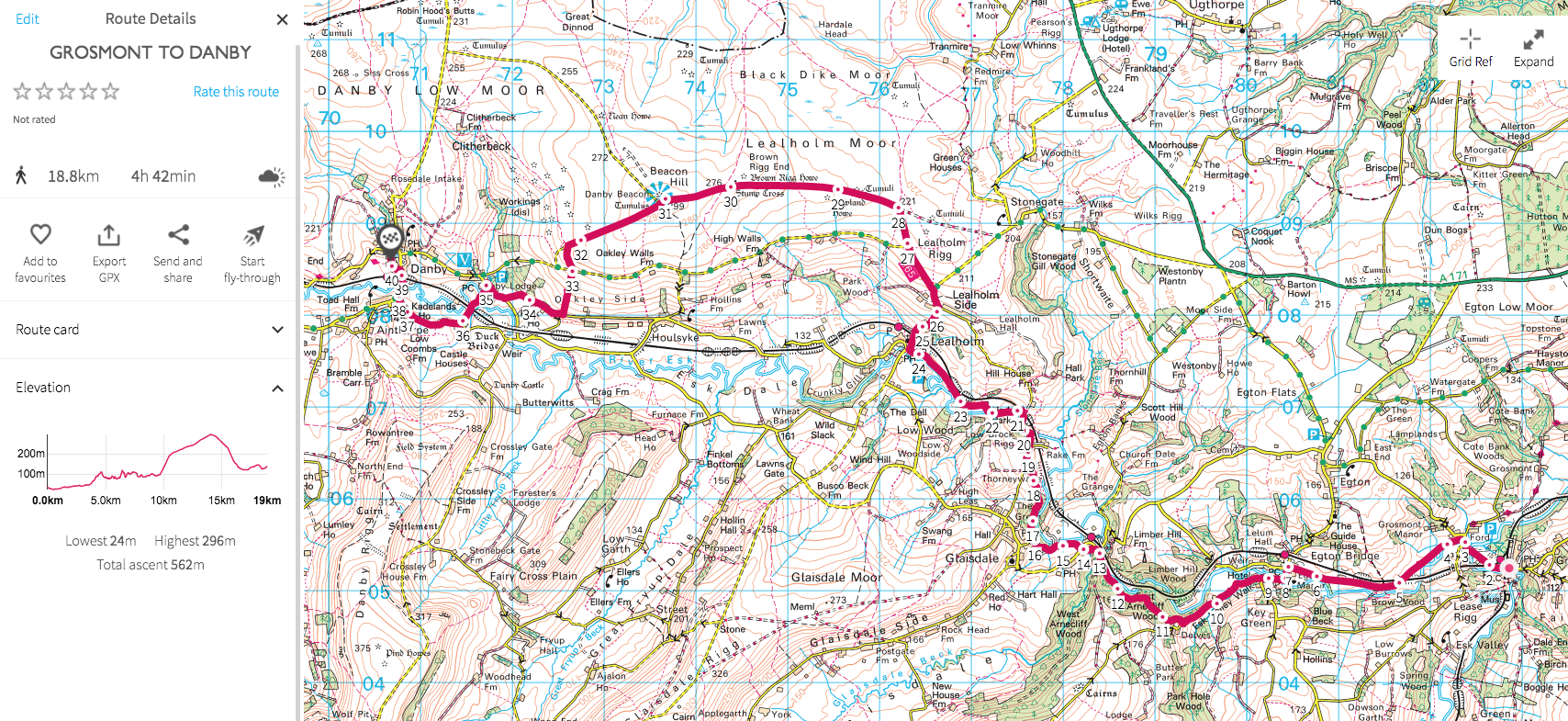 click the link to get taken to the route Day 3 - Danby to Blakey - 12 miles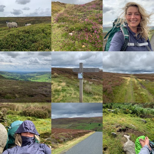 After two days of rivers, railways and valleys, the wildness of the moors was calling. A brief woodland walk through Danby Park, a final railway crossing at Castleton and then the start of the climb up the moors. I somehow managed to lose my way three times early on - possibly because there weren't many leaping salmon fish signs and possibly because I wasn't concentrating. However I soon got on track. It felt like the moors were teasing me a bit. There'd be a climb, some heather, the sense that the moors were just there, and then the moorland path would turn into a farm track and down we'd go again. At one point I managed to walk right through someone's garden before I realised the error of my ways. Luckily a lovely young chap whose garden it was pointed me in the right direction. My path was still tracking along the river although it gradually fell away as I gained height. But the path became seriously boggy, overgrown and hard to navigate. So much so that I eventually decided it was time for a rest. Lying down in the sunshine listening to the noise of the birds, water trickling from somewhere and insects buzzing was lovely. Just me and nature and not another soul. I eventually roused myself and carried on the climb. The path cleared and finally, a track took me to the top of Farndale Moor. The wind was blowing and the expanse of open moorland with no-one else there was jaw-dropping. I let all the emotional stuff I'd been carrying in side me out, free to blow on the wind. It was the best therapy ever. After taking my time to enjoy the view over Farndale, I followed the broad track to the famous Lion Inn at Blakey. Anyone who has done the Coast to Coast will be familiar with this spot - an oasis after miles of desolation. It's where I spent my night. Food portions are huge and tasty. The rooms are always too hot. But I still slept like a log. 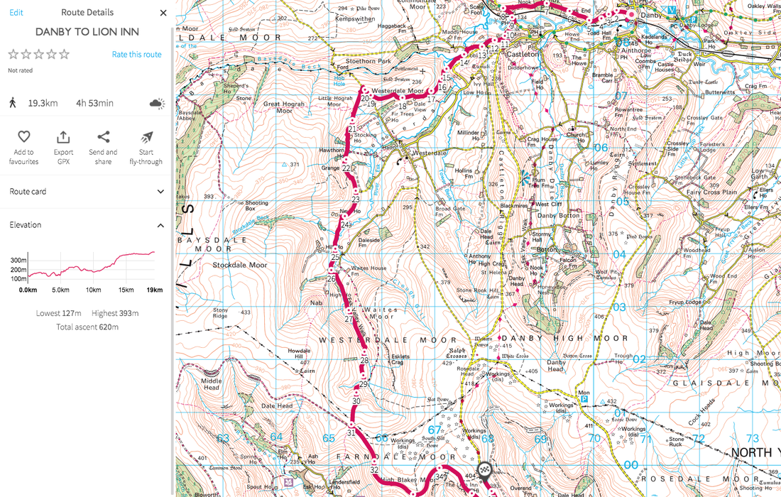 Click the image to be taken to the route Day 4 - Blakey to Glaisdale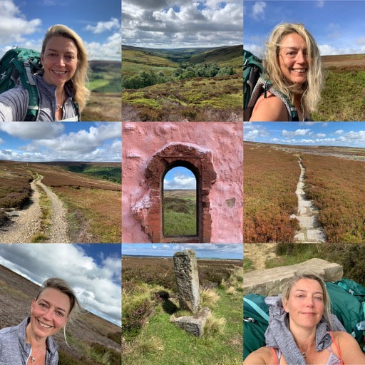 Now if you want to complete the Esk Valley Walk, you follow the route in the image below (click it to get the route). 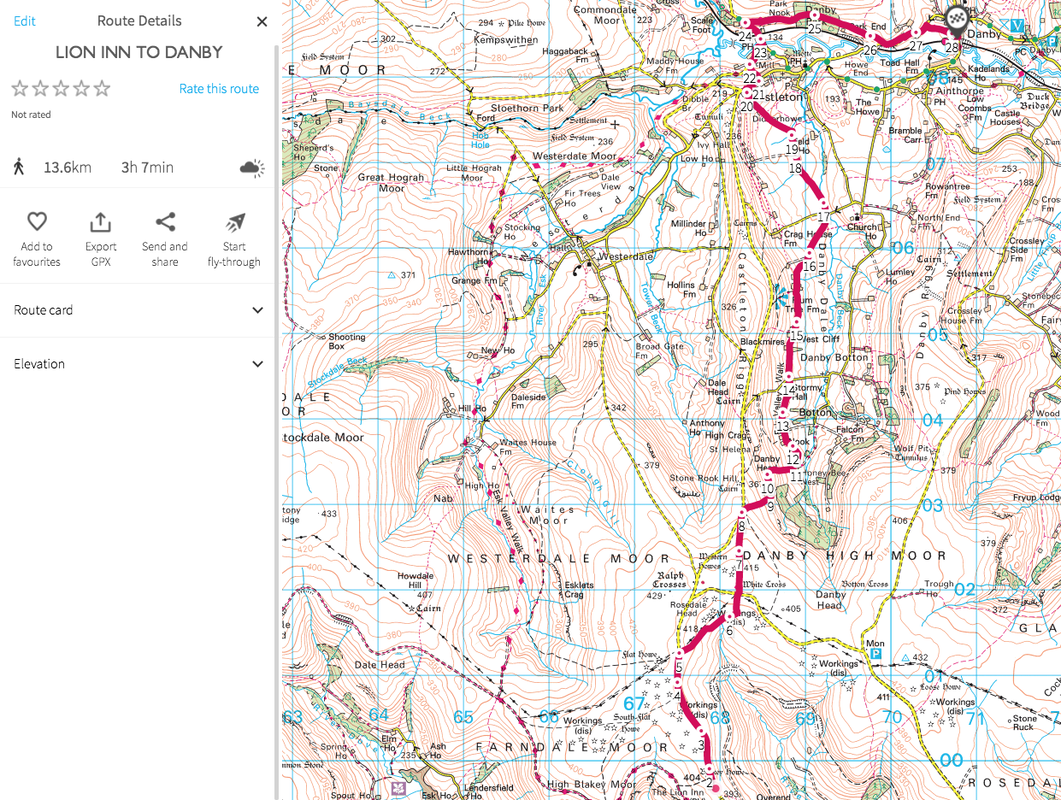 I, however, decided I wanted more moorland and wanted to test my ability to plot a route and navigate it. I plotted a route the went from Blakey to Glaisdale via Rosedale - the plan was to go down into Rosedale Valley and up the other side. But in the morning I didn't feel like adding in a big fat hill for the sake of it, so I didn't quite follow my own route. Instead I followed the old mining railway line around the top of Rosedale and then at the junction where you could turn downhill and go to Rosedale Head Farm, I followed a path up to the top of Rosedale Moor. Here I discovered that the path that was shown on the map obviously wasn't very well used and there was no path. I had to make my way across boggy bits and heather for quite a while, constantly checking the OS Map app to ensure I was going in the right direction. At last I came to a road, crossed that and could then follow the George Gap Causeway across the top of Rosedale Moor. It was beautiful, wild and remote and a bit of the moors I'd never been to. As the path curves, you lose sight of where you've been and the sea opens up ahead in the distance. You follow a broad, rough path with lovely views over Great Fryup Dale for a while. Then a bit of road walking, before I picked up the Glaisdale Rigg path which gradually headed downhill to Glaisdale. I was easily done by early afternoon despite having stopped for another rest to just enjoy the scenery. The Esk Valley Railway train service wasn't due for some time, so I called a taxi from Whitby and got a much faster ride back to my car. It was a briliiant four days of solo walking, a tiny micro-adventure. You could easily compress it into 3 days if time is short. Definitely one to add to your list. 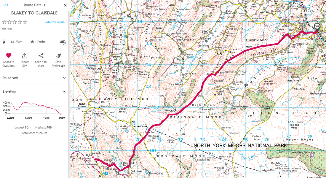 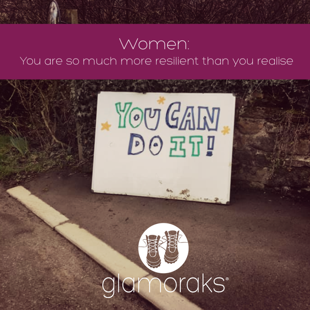 I've just returned from a lovely 7.5 mile walk starting at Cod Beck Reservoir, tracking through Osmotherley and along a stretch of the Cleveland Way in the North Yorkshire Moors. I haven't been on many walks recently. My personal life has been somewhat fraught/busy/overwhelming for the last few months, so walking had to take a back seat. But today I had a free day. No kids. No commitments. And yes there were household jobs to do - when aren't there? - but I decided to prioritise time for me. Luckily, a Glamoraks member had planned a walk for today. That's how Glamoraks works. Someone decides that they want to do a walk and they choose a route. They share it in the group and/or the Facebook page and other people can decide to join them. You can search for members or walks near you too (and we have members all over the world.) For many people, coming on one of these walks is daunting. They don't know anyone and as with any new situation, meeting new people and trying new things can feel scary. But as the ladies on the walk today can testify, there is absolutely no reason for nerves. We are women with completely different stories and backgrounds. Yet we all love the same thing - getting outside in the fresh air and having a good long stomp. Now had this walk not been set up today, I would have gone on my own (although it would have been easier to cry off and binge watch Game of Thrones), but for many others, they would prefer not to be alone out on a remote path. Many don't feel brave enough to be the walk organiser, but once they've been on one, realise that actually it's not that scary either. No-one expects you to be a qualified walker. It's ok if we get lost. Or it's muddy. Or we want to change course. Or stop for tea. We're just grateful that someone has encouraged us to get out there.
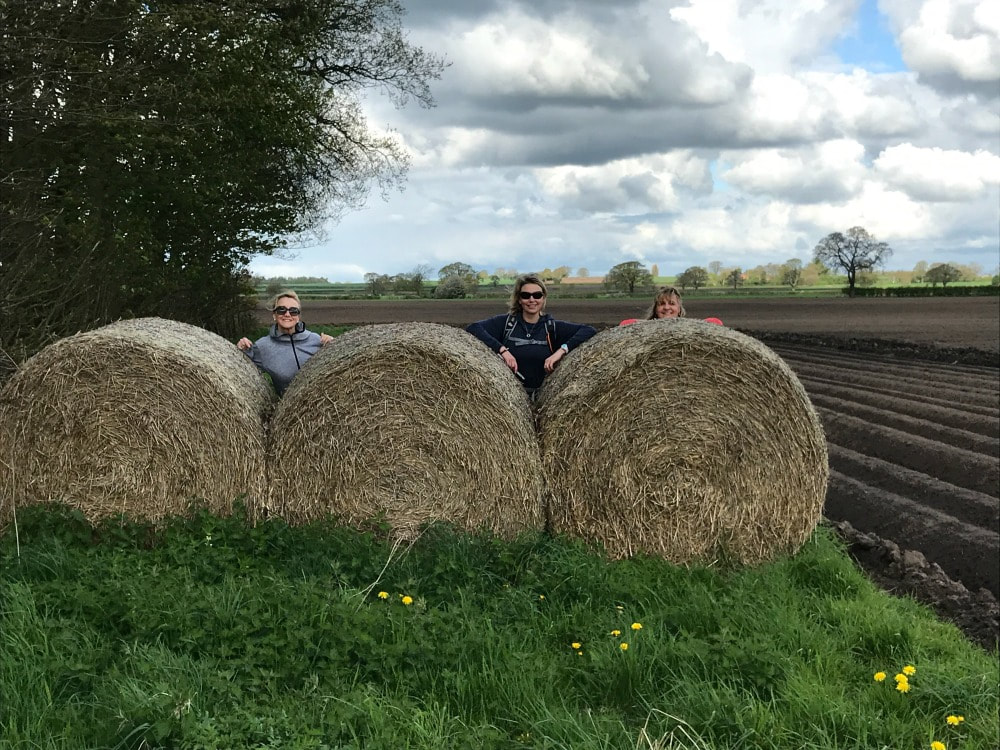
Besides the normal chat about parenting, food, jobs, holidays, we had quite a bit of chat today about doing things that push you out of your comfort zone, saying yes more. My take on this is that the fears you may have because you've never done something will always be there - it's your body's natural instinct to keep you safe. But as soon as you do it, you realise that the worries you had were often far worse than reality. And it's not just walking that this applies to. Anything that you may be facing - getting a divorce, moving house, starting a new job or leaving a job, tackling an illness, have kids leave home, dealing with a family crisis, or taking on the bucket list thing you've always wanted to do but don't feel brave enough - you can do it. Please believe me: YOU. CAN. DO. IT. No matter what it is, how huge or scary, just tackle it one step at time. And you will find yourself doing it. And you're ok. And in many cases, so much better than you were before. So in the words of that famous shoe brand: Just do it. 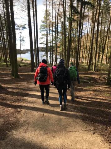 How do I know that you'll be ok? Because on every Glamoraks walk, I hear different women's stories and it always amazes me at just how resilient women are. No matter what they've been through, it turns out ok. Hearing these stories from people outside your normal friendship group opens up your mind and deepens your compassion for what others face. It also inspires you to try some of the things they've done or get ideas on what to do next. Sometimes the world and our own personal lives can feel a bit overwhelming or negative. But just one walk with a group of women, I guarantee, will put a smile of your face, a glow in your cheeks and a sparkle in your eyes - see the evidence below. And hopefully, it will also give you that little confidence boost to know that you can do it, whatever 'it' is. (Incidentally, we passed the sign in the picture above on our walk today ....)  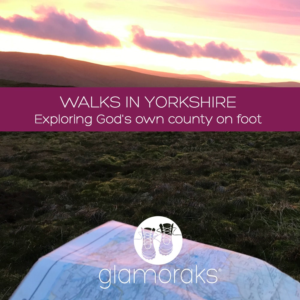 1 August is Yorkshire Day. To celebrate the splendour of God's own county, here is a round up of some of the walks I'd recommend you do in Yorkshire. We are absolutely spoilt for choice with so many exceptional places to walk that this list is by no means conclusive. It doesn't include some of the more famous routes like the Cleveland Way, Dales Way, Wolds Way, the Pennine Way, Lady Anne's Way, the Ribble Way or the Herriot Way. Frankly, there are so many splendid walks to choose from, your biggest challenge is going to be finding the time to do them all. So whether you're looking for a city walk, an urban stroll, a multi-day hike, a coastal caper or a good long stomp in the wilds of the moors or dales or Northern Peak, you are sorted. RIVERSIDE WALKS1. Beningbrough to York Close to York yet completely rural in feel, this is either a short 3-miler along the river, doing a circuit around Beningbrough Hall. Or make it longer and walk 8 miles from Beningbrough all the way along the river Ouse into York City Centre. Details here. 2. York Minster to Sheriff Hutton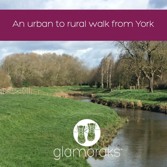 This is the first part of the centenary way, a multi-day walk running from York to Filey. But it's a great way to explore the surrounding York countryside starting right in the heart of town. Follow the river Foss out and either stop in Strensall or continue on to Sheriff Hutton. Details here. 3. Stamford Bridge circular Stamford Bridge is a village in the East Riding of Yorkshire. With a pretty centre and plenty of history, this is a flat, circular walk that takes in the river Derwent. Details here. 4. Kirkham Priory to Howsham Mill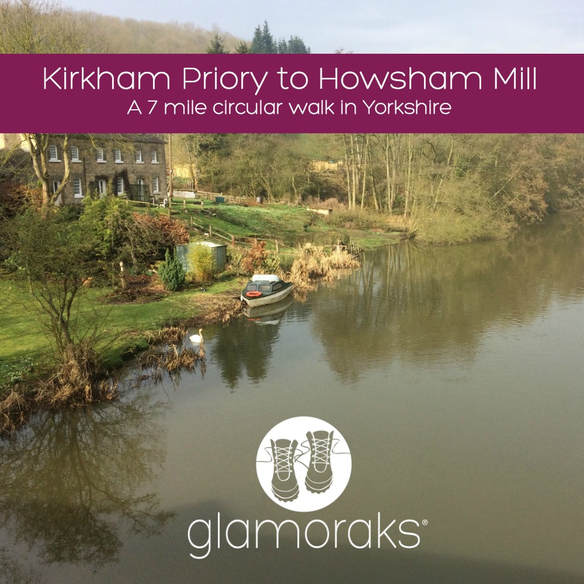 Another walk along the Derwent, this is a pretty circular walk that takes in the ruins of Kirkham Priory and the delightful Howsham Mill. Details here. COASTAL WALKS1. Whitby heading South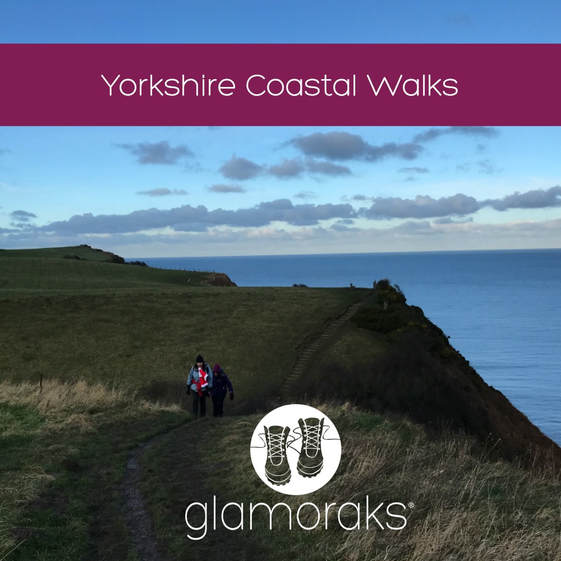 From Saltburn to Bridlington, the Yorkshire coast is a gem for walkers. One of the most popular stretches if you fancy making a weekend of it is to head from Whitby to Robin Hood's Bay and back again. It's roughly 6 or 7 miles each way, depending on where you start. But you can also start further north from Sandsend and end at Boggle Hole, just after Robin Hood's Bay, spend the night and head home the next day. Or try starting at Whitby, walk to Ravenscar, return and stay at Boggle Hole or Robin Hood's Bay and return the next day. Details of these walks can be found here and here. 2. Scarborough to Filey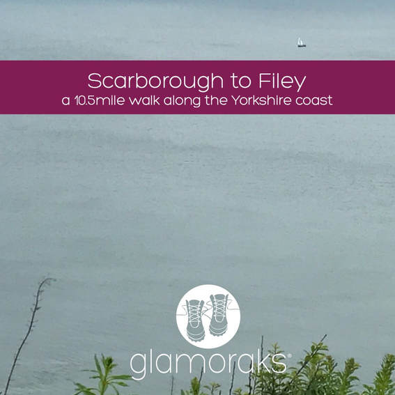 Walk the final stage of the Cleveland Way as you leave the bustle of Scarborough behind, hugging the coast until you reach Filey Brigg. It's roughly 10 miles of gorgeous walking. Details here. 3. Bridlington to Bempton If you're a bird watcher, this is the walk for you. It takes in the incredible Flamborough Head, many beaches and RSPB bird watching platforms to get up to close to the myriad of sea birds that nest along this stretch of coast. Details here. 4. A wild camp on a coastal path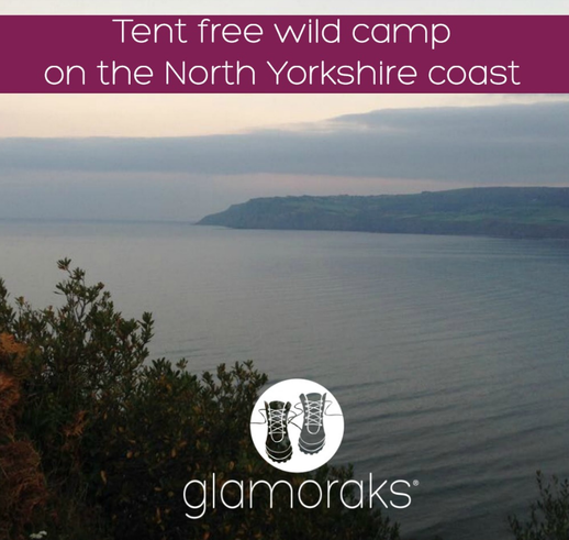 This is just a short walk of no more than a couple of miles, depending where you choose to stop, but if you fancy a bit of an adventure, try heading out from Robin Hood's Bay and sleeping under the stars along the coastal path. Just be sure to leave no trace and don't sleep too close to the cliff edge. Details here. NORTH YORKSHIRE MOORS1. Rosedale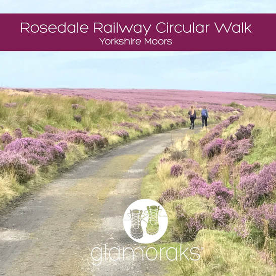 A gorgeous valley and open moorland that can be done in a circuit of different lengths depending on your stamina. They take in the old mine buildings that dot the path. Details here. 2. The Hole of Horcum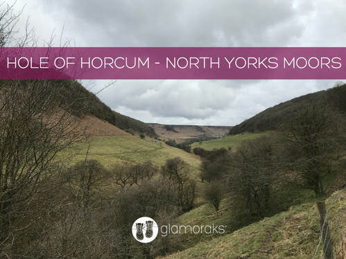 This is a stunning 7 mile walk in one of the North Yorkshire Moors most famous viewing spots. The Hole of Horcum is a giant punchbowl that includes walking along the moorland tops and in the valley, with a lovely pub midway. Details here. 3. Upper Riccal Dale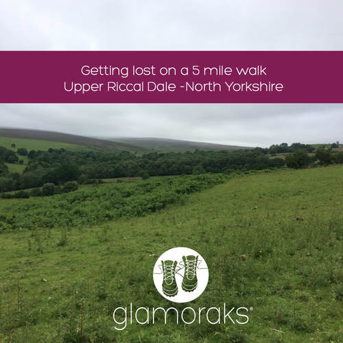 This a short 5 mile walk just north of Helmsley, that takes in the gentle agricultural side of the moors, but with some great views from the top of the ridge. Details here. 4. Helmsley to Rievaulx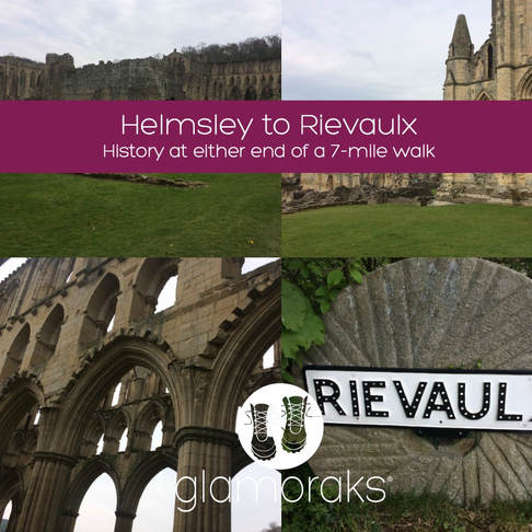 This is a glorious 7-mile walk from Helmsley to Rievaulx and back again. It is actually stage 1 of the Cleveland way and is bookended with Helmsley castle and the ruins of Rievaulx Abbey. Plenty of lovely tea shops to choose from too. Details here. 5. Wild camping in the North Yorkshire Moors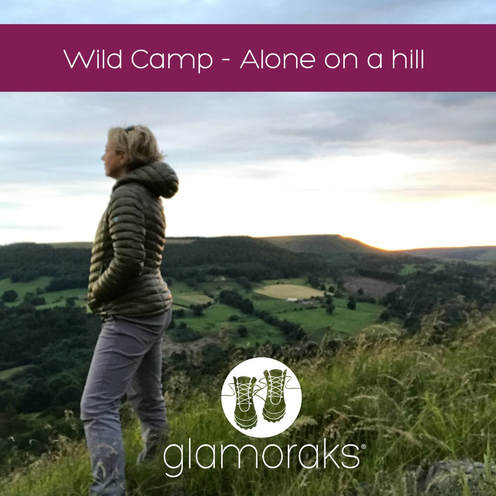 While not strictly allowed, if you are sensible, leave no trace and don't start fires, a wild camp on the moors is a lovely way to experience the peace and splendour they afford. Here are two wild camps (locations not revealed) to give a flavour of it. How far you want to walk to reach your camp spot is up to you. Wild camp 1 Wild camp 2 THE YORKSHIRE BITS OF THE COAST TO COAST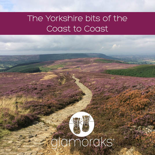 The coast to coast is a 192-mile path running from St Bees in Cumbria through to Robin Hood's Bay in Yorkshire. The Yorkshire section starts once you cross the Pennines after leaving Kirkby Stephen and takes in some magnificent stretches of the Yorkshire Dales, North Yorks Moors and the Yorkshire Coast. You don't have to do the whole thing - just pick one or two of these stretches for a day or two of gorgeous walking. Note: the bit from Richmond to Danby Wiske and Danby Wiske to Ingleby Arncliff are probably the least exciting. I've included them in case you'd like to do the full Yorkshire stretch but I wouldn't pick them for a day walk. Kirkby Stephen to Keld Keld to Reeth Reeth to Richmond Richmond to Danby Wiske Danby Wiske to Ingley Arncliff Ingleby Arncliff to Blakey Ridge Blakey Ridge to Grosmont Grosmont to Robin Hood's Bay YORKSHIRE DALES1. Malham Malham is a jaw-droppingly beautiful bit of the Yorkshire Dales with a number of walks you can do regardless of your fitness. A gentle stroll to see Gordale Scar and Janet's Foss; something a bit more taxing as you climb to the top of Malham Cove to see the stone pavement of clints and grikes; or even further up to Malham Tarn. Details here. 2. The Yorkshire Three Peaks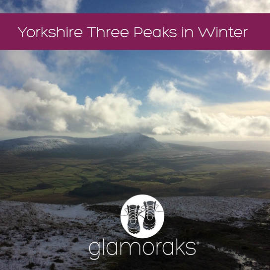 Many people take on the famous Yorkshire Three Peaks of Pen y Ghent, Whernside and Ingleborough as a 12 hour challenge. But you don't have to charge your way around. You can pick them off one at a time or two them over two days. This is the scenery that will take your breath away. Details here. YORKSHIRE BIT OF THE PEAK DISTRICT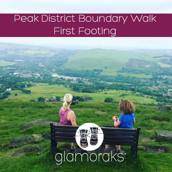 A new boundary walk that takes runs the whole way around the Peak District opened in 2017. The northerly bit of the Peak is in Yorkshire and includes more spectacular moorland walking. This section runs from Greenfield to Marsden. And there's a very welcome pub at the end. Details here. As I said, there are so many walks to be done in Yorkshire. I know that this is just a tiny sample - but they are ones which I have personally walked and written up. I'd love to hear about yours, so please do share any Yorkshire walks you've written about in the comments below.
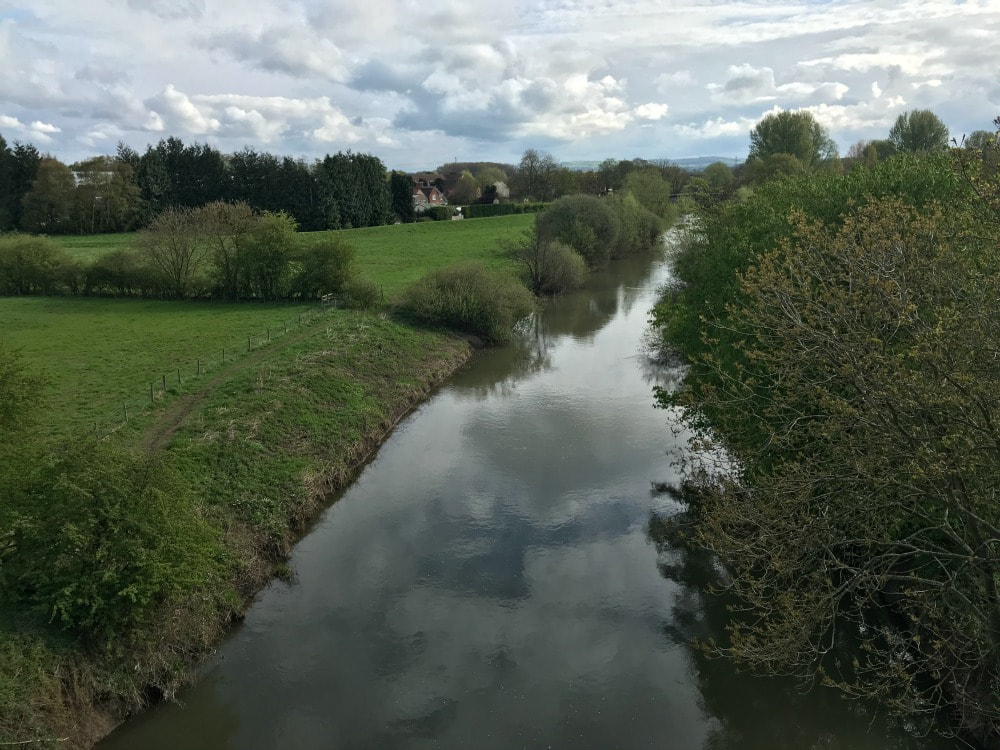
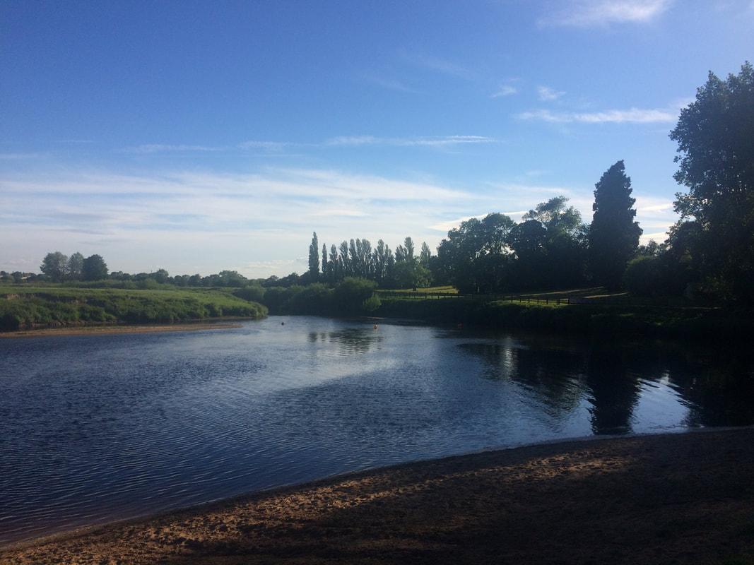
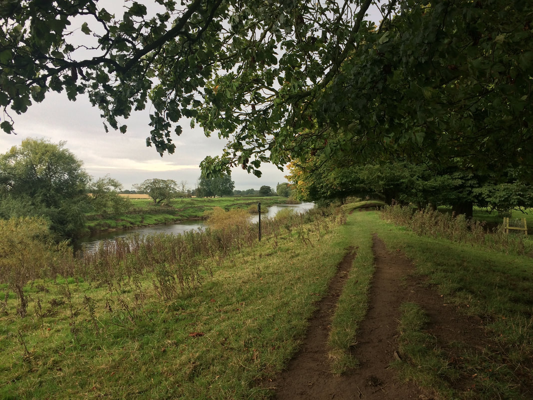
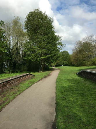
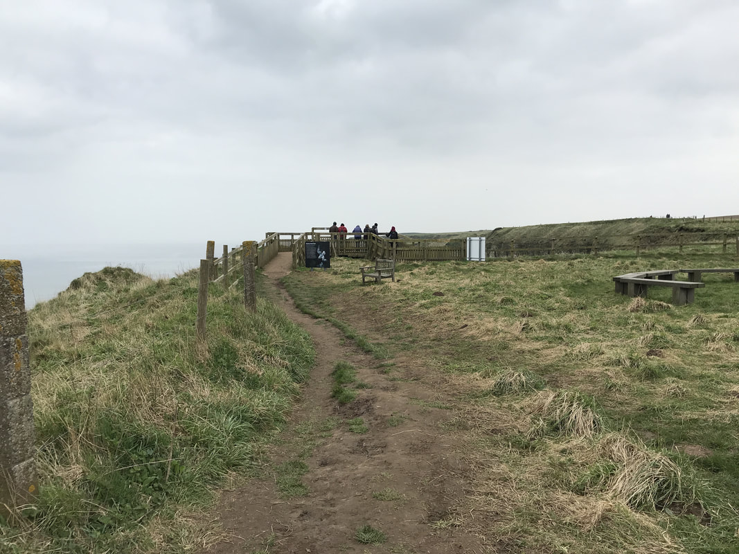
If you are a woman who loves to walk, please join Glamoraks, an online community that helps women find other women to go walking and adventuring with together. You can also join the Facebook group here. Both are free. 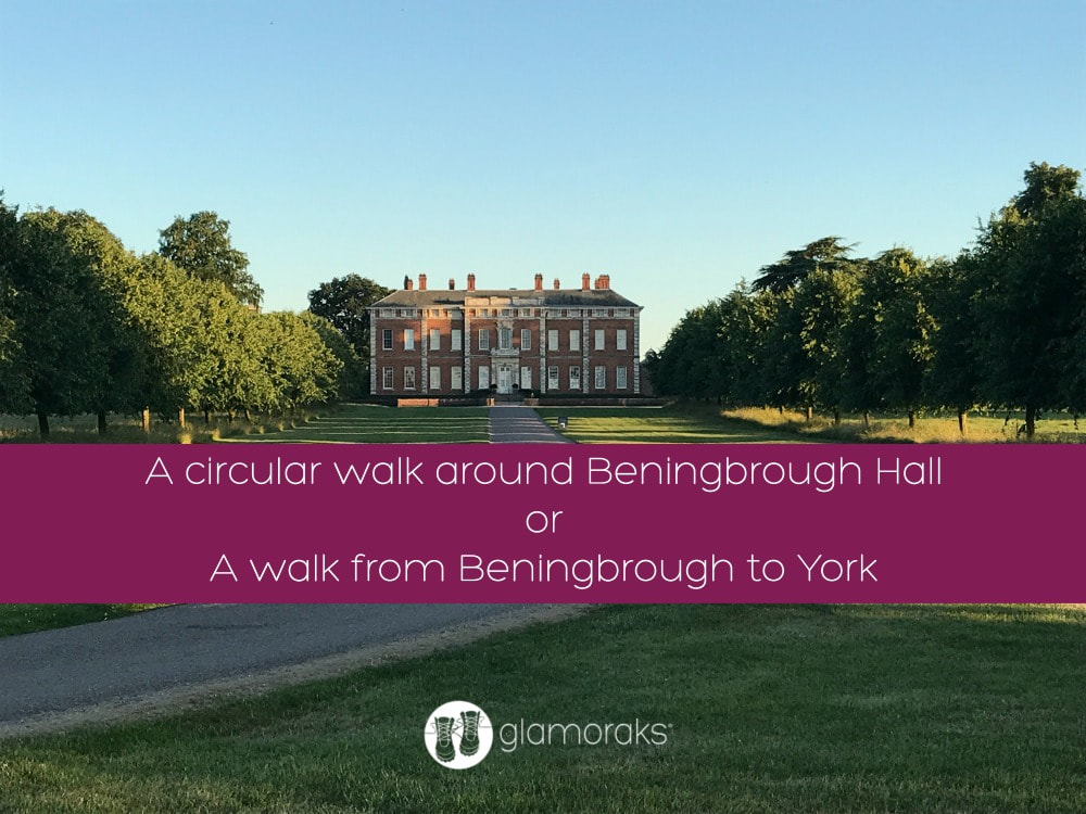 Start point: YO30 1DB Distance: 3 miles circular or 8 miles linear (ending in York) Terrain: Paths, some overgrown in summer, very muddy in winter Last week I had the privilege of taking a Sunday Telegraph journalist and photographer for a walk around Beningbrough Hall. It always amazes me how many people in York aren't aware of what a gem we have right on our doorstep. Beningbrough Hall is a National Trust property. Surrounding the hall is a stunning 3-mile loop walk and as it's outside the grounds of the Hall itself, you don't need to pay to walk it. You can park in Newton-on-Ouse and follow the footpath signs as you head toward the river. Or you can park at the opposite entrance at a small carpark that asks for a donation to the Air Ambulance. Option three is to park outside Home Farm, a lovely farm shop and cafe, as long as you return as a customer after your walk (an excellent idea by the way as it have fabulous cakes.) Simply follow the path along the river, getting glimpses of the Hall as you go. Roughly half-way along the loop you will find a secret beach and wild swimming spot. On hot sunny days, it is an idyllic setting. You can even catch a ferry on the weekends over to Nun Monkton, where after a short stroll, you will find a pub - The Alice Hawthorn. You continue the loop, depending where you started from and then follow the track around the back of the estate, through woods for a section before ending up back where you started. You can't really get lost and you can vary the loop direction. There is also a pub - The Dawnay Arms - in Newton-on-Ouse if you started out there and want to have a drink in a beer garden that goes down to the river.
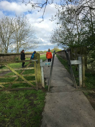
But if you're after a slightly longer walk, you can walk directly from the centre of York to Beningbrough or vice versa. A group of Glamoraks recently did exactly this. We started at Beningbrough (you will need to be dropped off as it's a one-way walk unless you fancy doing 16 miles there and back). Start at the little carpark outside the entrance (not the Newton on Ouse side) as indicated in the image below: 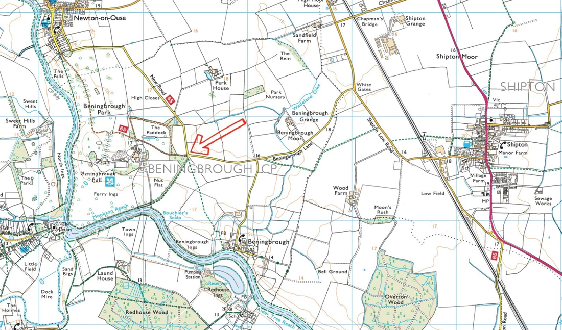 The route: 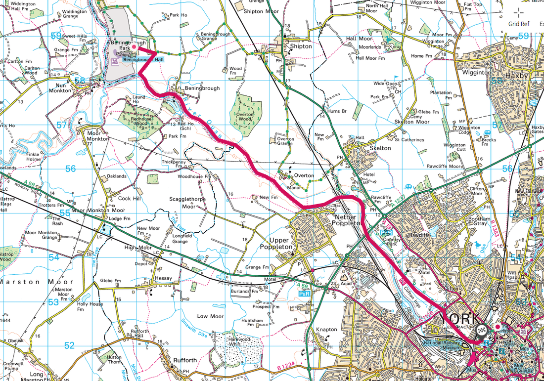 Follow the footpath that runs alongside the woods, heading towards the river. When you reach a gate, go through it and instead of following the path ahead (the loop walk mentioned above), turn to your left. There will be an indistinct footpath that leads to a raised path alongside the river. Now you simply follow that, keeping the river on your right all the way. You will go past a row of houses at the village of Beningbrough and a few more as you near Overton. Poppleton will start to be seen on the opposite bank. As you go underneath the railway bridge, you will have a bit of an overgrown path to navigate before crossing a small footbridge. Just after the bridge, your path will intercept the cycle path (route 65). Turn right onto the cycle path and follow it.
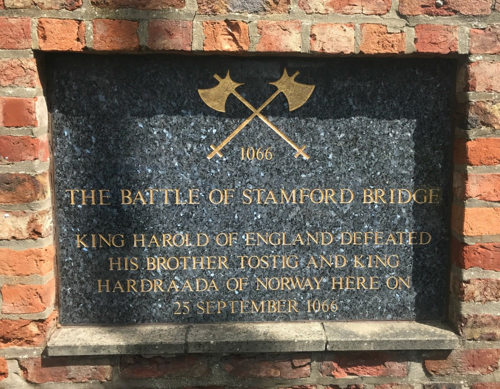
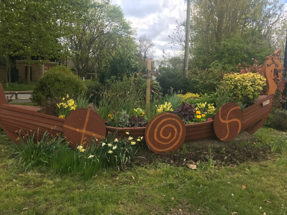
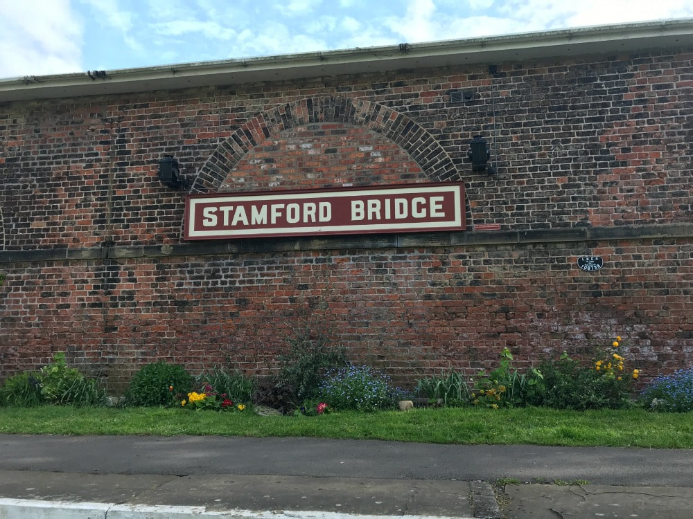
It will curve away from the river along a row of pretty houses. Just after the houses, turn right still sticking to the cycle path. If you go straight you will hit the A19 (you don't want to do that). Keep following the path underneath the A1237 and keep going. You will pass the York Ings (flood plains) and eventually will start to get into the built up city centre. The path ends at Museum Gardens, where you will be spoilt for choice with places to get a cold drink. The Star Inn the City has a lovely outdoor terrace overlooking the river, for a cold pint of something reviving after a hot summer's walk. There are no places to stop for a drink or food on the way so do take water and snacks with you. I also recommend long trousers in summer as the path can be overgrown with nettles in places. Alternatively, walk the other way going York to Beningbrough - just as simple. The only place you could go wrong is to miss the path that goes off to the left of the cycle route. You'll spot it as there is a bench on the side of the path at that point When you get to Beningbrough, enjoy a fine lunch or afternoon tea at Home Farm. This is one my regular walks and it's a great one. Just be careful of the Giant's Hogweed that grows in some parts along the route. You don't want to touch it. It causes dark painful blisters that form within 48 hours, and result in scars that can last anywhere from a few months to six years. Touching giant hogweed can also cause long-term sunlight sensitivity, and blindness if sap gets into a person's eye. It looks like this: 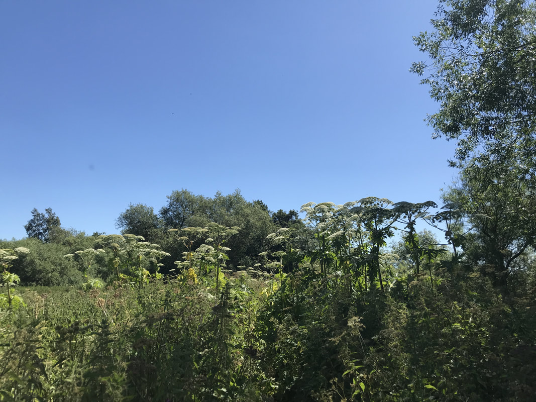 Here's the piece that the Sunday Telegraph did on the walk: 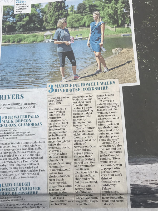 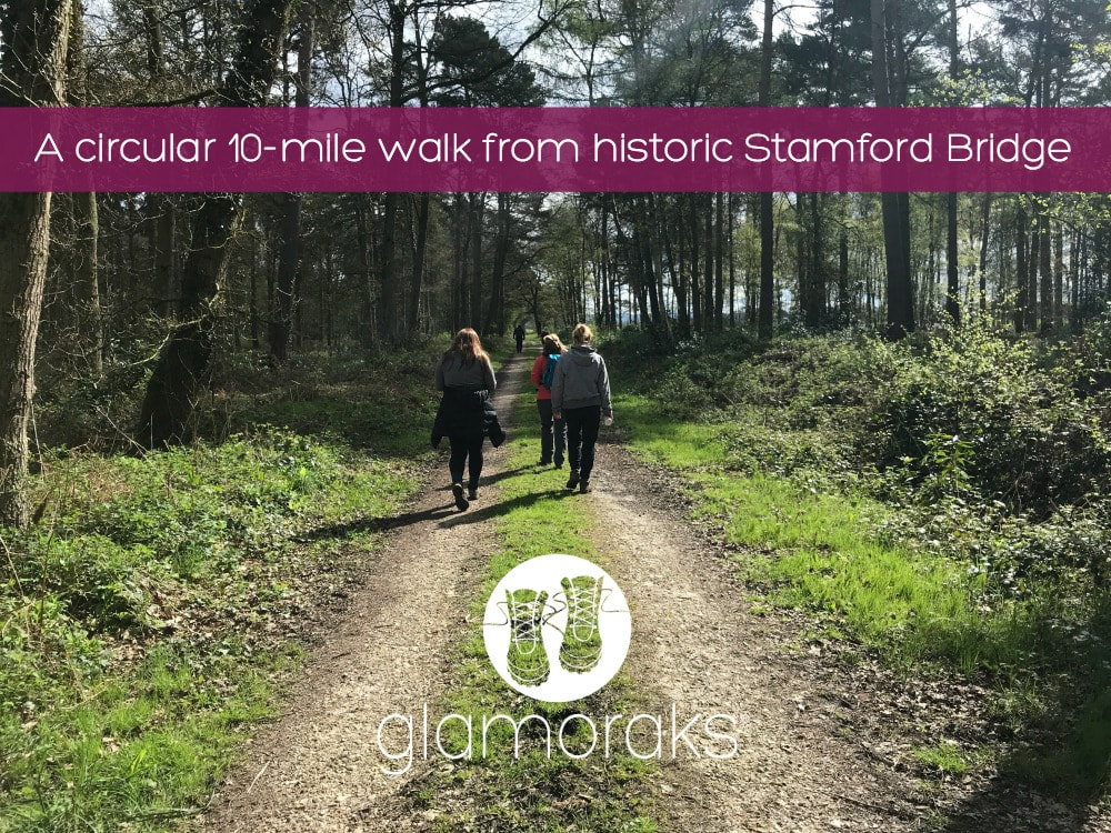 Distance: 9-10 miles Difficulty: Easy to moderate (it's all flat but if you aren't used to walking 10 miles, may find it tiring!) Type of terrain: dirt paths, grassy paths, pavement, some mud Starting point: Stamford Bridge public car park, Viking Road, YO41 1AG Before I get onto the walk, I want to give you a short history lesson. Stick with me. It really is interesting. If I said the words: Stamford Bridge to the average English person, they would automatically assume I was referring to the Chelsea Football Club Stadium. But another Stamford Bridge played a far greater role in the future of Britain (and it involves slightly fewer overpaid prima donnas - but only just). Stamford Bridge is a village five miles to the East of York, in the East Riding of Yorkshire. But this small village was the site of a battle that genuinely changed the entire future of England. Yes really. I'm not a historian but here's my understanding of what happened back in September 1066. King Harold Godwinson had taken over the throne after Edward the Confessor died but there was a bit of a family argument about whether that was the right choice. His brother Tostig felt he should have got the job. Harold was having none of it, took away Tostig's title of Earl of Northumbria and had him exiled. That annoyed Tostig so he teemed up with the King of Norway, Harald Hardrada, who felt he too had a right to wear the English crown. When Harold (the English, not Harald the Norwegian) heard about this, he marched his army up from the South. 185 miles in just 4 days. Now anyone who has done a multi-day hike knows that is pretty impressive. I did the Coast to Coast which is 192 miles, in two weeks! And my feet hurt doing that! Anyway, Harold and his foot-sore troops arrived at the place that is now Stamford Bridge. King Harold himself went over to Tostig and Harald and said that he was willing to give Tostig his title back. When he was asked what he'd give to the Norwegian king, Harold suggested "Seven feet of English ground, as he is taller than other men." That didn't go down too well. And so the fighting kicked off. By all accounts a single Norse giant impeded the path of the oncoming English soldiers, waving a scary looking Dane axe around. But then some plucky English chap got in a barrel and drifted under a bridge and poked a spear up into the Norseman (one can only guess where) which ended his axe wielding career and indeed life. The Englishmen went on to win the battle. Just when Harold thought he could haul out the compeed plasters, and have a nice pork pie and a pint, he heard that some upstart French chap called William was heading over from Normandy. So poor Harold and his jolly tired soldiers had to walk all the way back down to Hastings in East Sussex and face another battle, averaging about 27 miles a day. They probably didn't have fancy walking shoes either. Frankly, despite picking up some reinforcements en route, they had had quite enough walking and fighting - understandably. And they lost that battle. William got the middle name The and last name Conqueror, and he went on to change the future of British history, with the year 1066 forever etched in school children's collective psyches. So that is how a little village in Yorkshire came to play such a big part in English history. You're welcome.
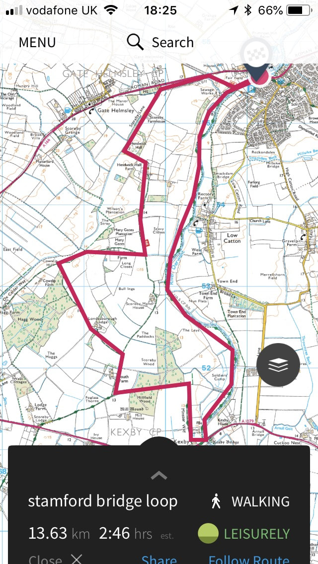
Today you can enjoy a lovely 10-mile circular walk from Stamford Bridge without fear of being attacked by a viking. The walk starts in the free village car park just over the stone road bridge. There are many different routes you can take but I will describe the walk we did.
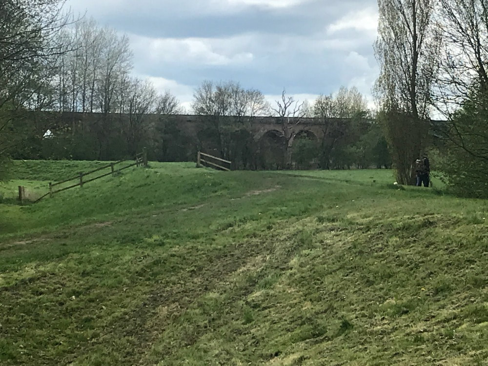
 The view from the top of the Viaduct Leave the car park and turn right into a housing estate. Turn right again and follow the road through the estate to a T-junction. Turn right again and in about 100m you come to the old railway station on your right hand side. Turn right onto a resurfaced track-bed, passing between the platforms and the old station. This is the old railway line that goes over a viaduct. It is now route 66 of the National Cycle Network. You walk along the top of the viaduct and then simply follow the cycle path. Besides a few short, noisy stretches that run alongside the busy A166, you soon find yourself walking through woodland and farmland, past a number of idyllic farm houses. This is a smooth and easy path, suitable for buggies (but not all of the walk is.)
 When you reach a junction that says turn right to follow the cycle path or go straight, you can do either. If you go straight, you will cut about a mile off your walk. If you want that extra mile, follow the cycle path behind a farm house, through fields off rape until you get to another junction. Where the cycle path veers off to the right, you take the left hand path running alongside Hagg Wood. When you reach a farm house with a clear farm track that looks like the obvious path to take, don't take it. Instead follow the public footpath sign towards a small copse of trees, skirting the edge of the farm house, before getting back onto a farm road. You will come to another junction with a track that joins the road you're on from the left. Keep walking straight along your track (that other path is the short cut you could have taken earlier). At the corner of Millfield Wood, turn left and walk through a beautiful sun-dappled forest for a short time, before taking a right hand footpath towards Kexby. Once you reach the busy A1079 in Kexby, turn left, follow the road until just before the bridge goes over the river. Look for a slightly hidden footpath sign to your left and drop down to the riverbank. Now simply follow the river across many fields all the way back to Stamford Bridge. When you get to the village, there are a couple of pubs, delis and coffee shops to revive yourself. An alternate route is to cross over the bridge in Kexby until you reach a footpath on the left but on the opposite side of the river. Follow that, then the road to Low Catton, which has a very good pub for lunch (by all accounts). From there you follow a footpath along the river back to Stamford Bridge again. This is a great circular walk that has free parking, a good array of refreshment stops at the beginning or end (or in Low Catton if you do that walk) and a fabulous hit of history. If you want to find other women to go walking with, join the Glamoraks community.
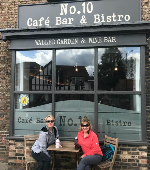 Because every walk needs a frothy coffee and a bacon buttie or cake.
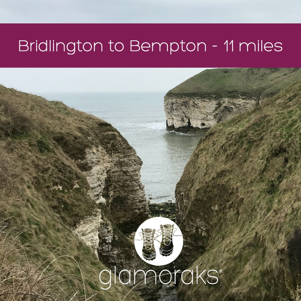 Start: Bridlington (parking at long stay car park near the train station) End: Bempton (catch the train back to Bridlington) Terrain: Cliff top coastal path - muddy in places depending on time of year. Lots of ups and downs Good for: Bird watching Refreshments: Plenty of places on the way. Distance: Roughly 11 miles
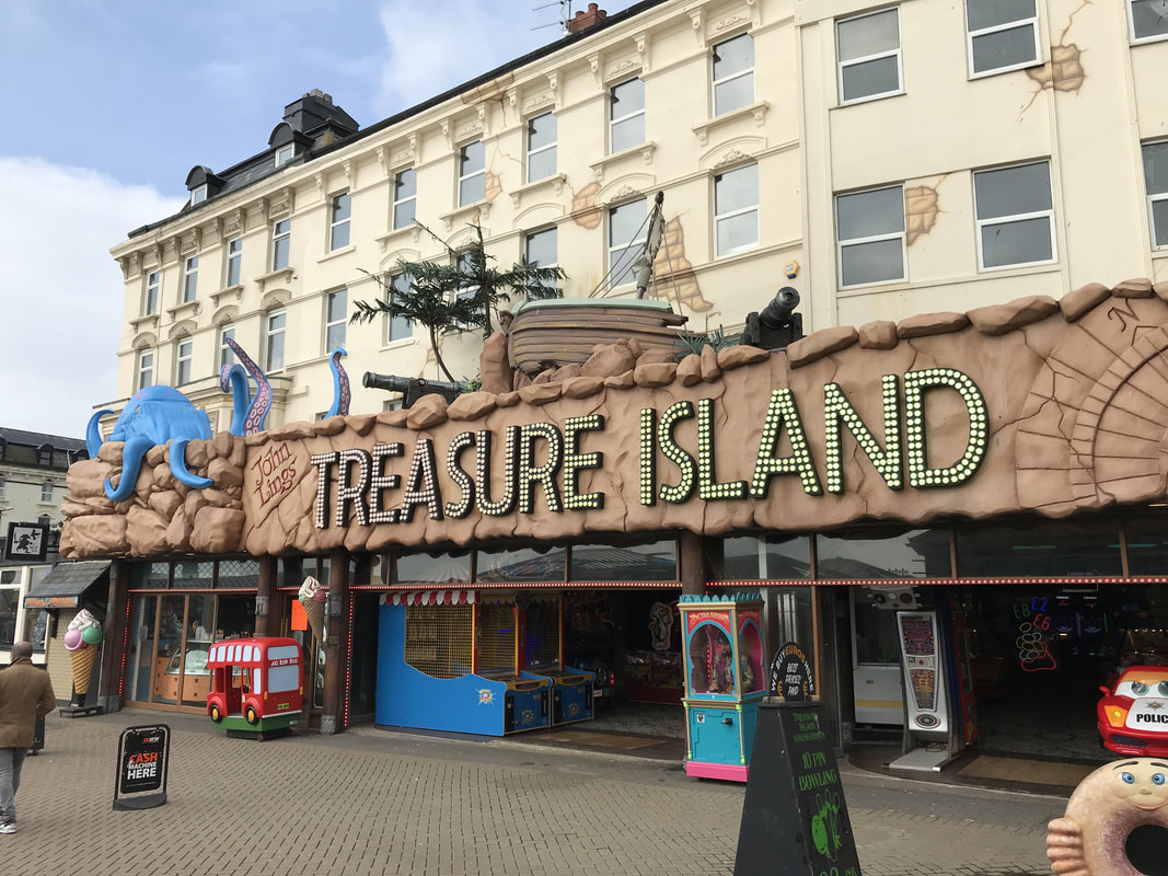
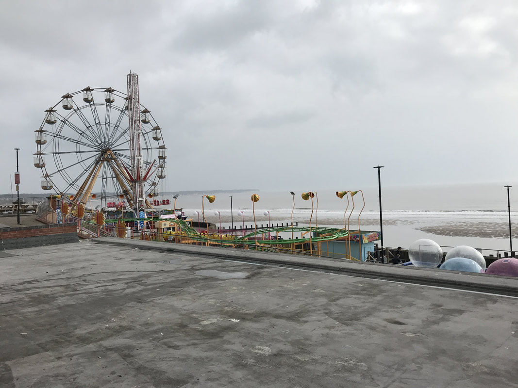
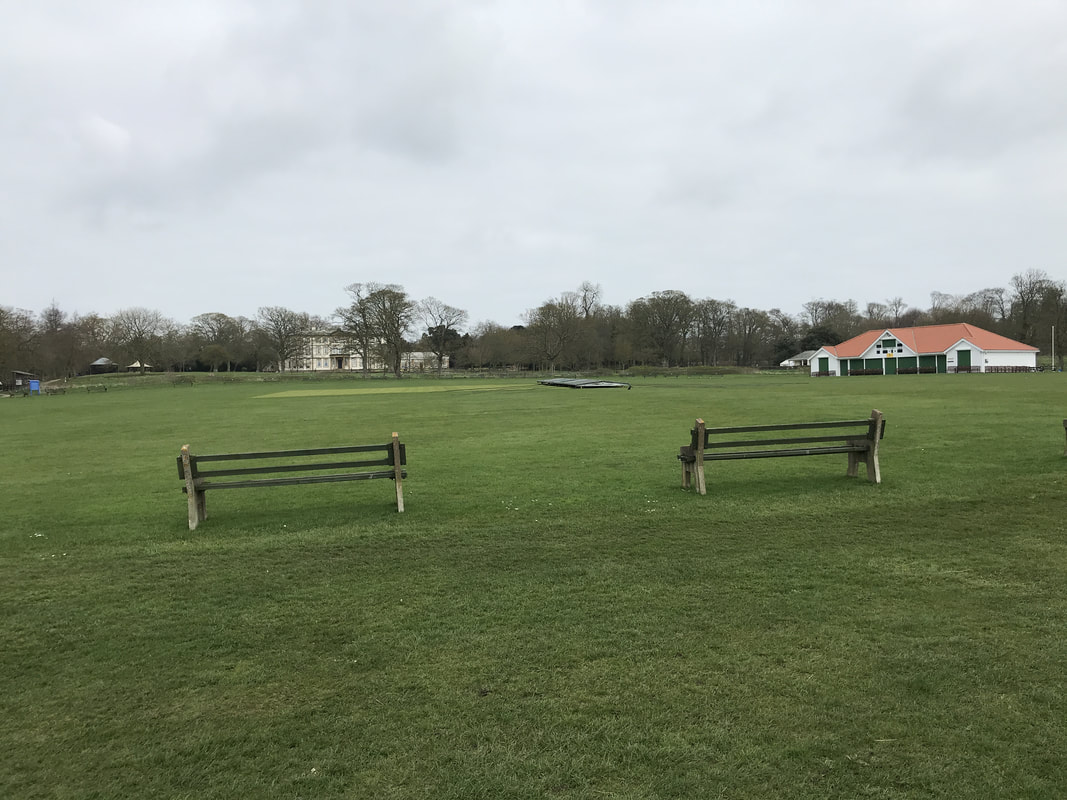
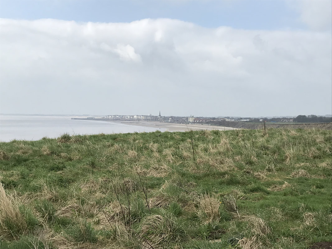
You start this walk in Bridlington. From the long stay car park near the station, head to the seaside, past the amusement arcades and funfair rides. This is a quintessential English seaside town, with an air of faded glory and the feeling that just a bit more love, attention and sunshine could restore it into something lovely. But on the day I did this walk, it was a blustery, overcast April day with a hint of summer on offer. I wanted headspace, so was keen to get away from the people strolling along the beachside promenade. I followed the track that runs alongside the little landtrain, ferrying passengers from Sewerby Hall to the beach. A row of memory benches lines the other side of the path. I couldn't help but imagine that the people in whose memories those benches were left must have been the sociable type as they were packed in one after the other with plenty of seats to be had should you need one at this early stage. Just past Sewerby Hall you pass a cricket club that has got to have the most spectacular setting of all cricket clubs in England. Hit a six and you could well send your ball over the cliff top and onto the beach below.
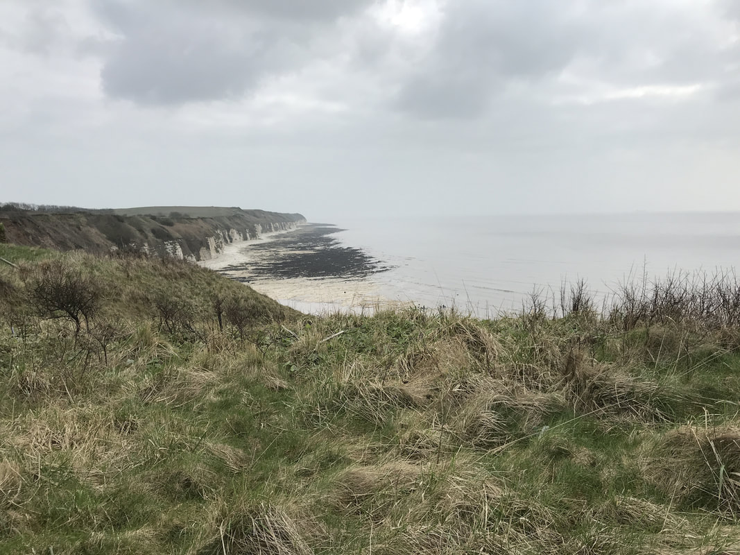
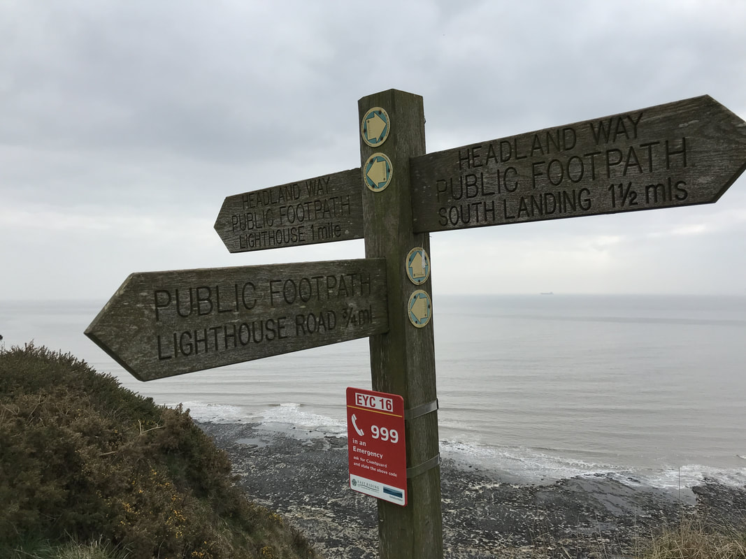
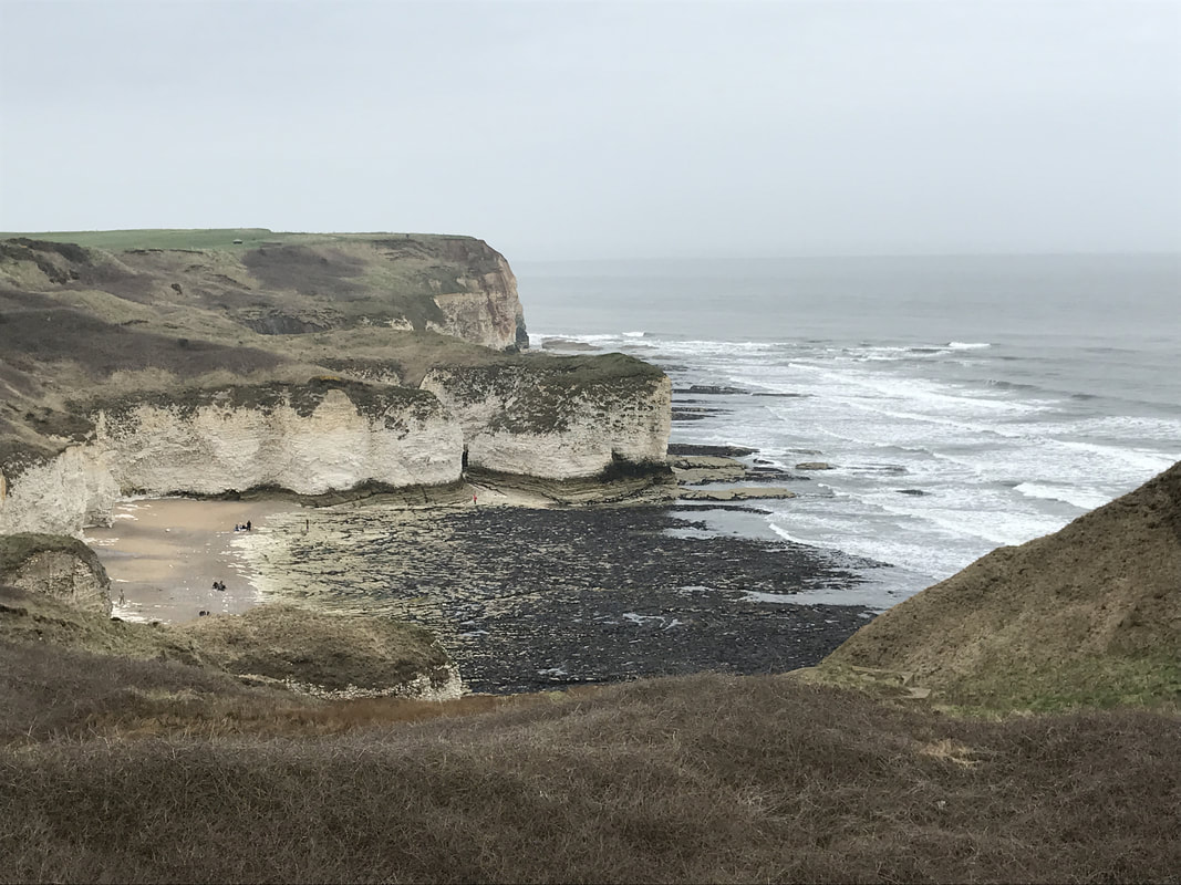
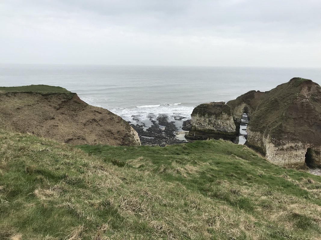
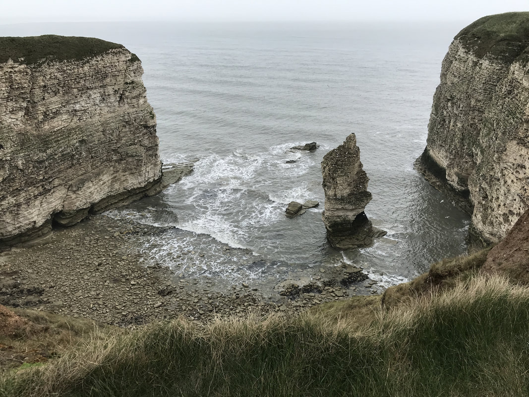
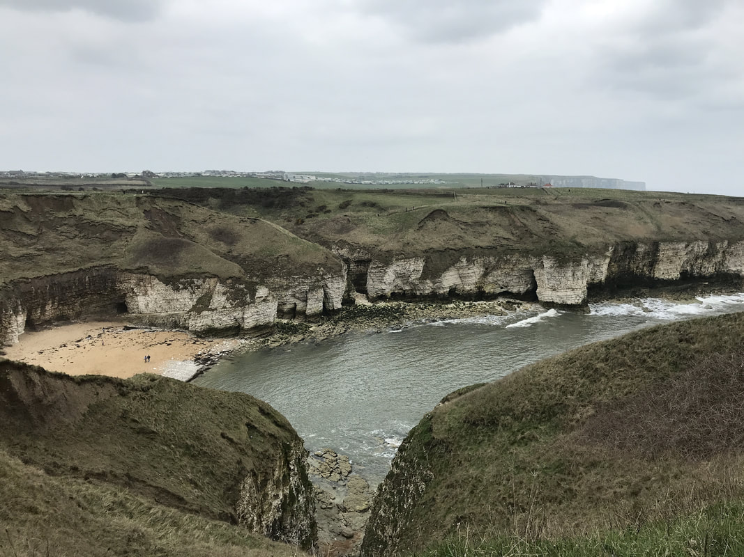
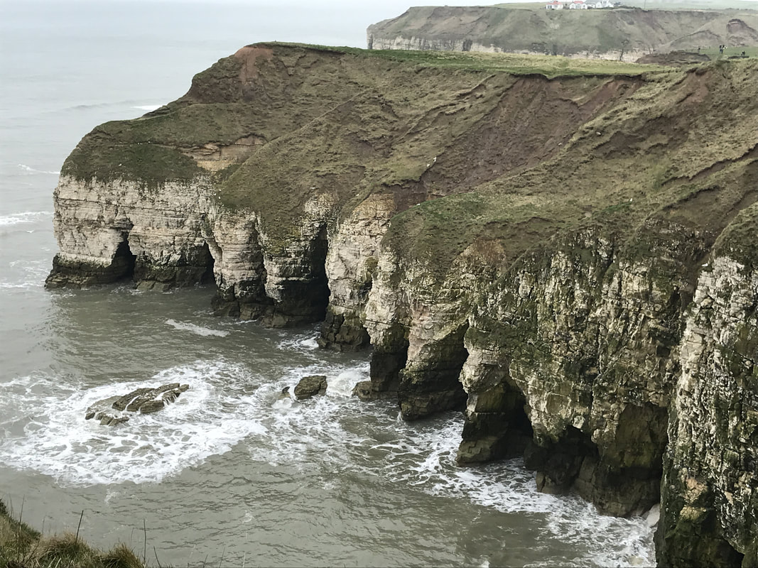
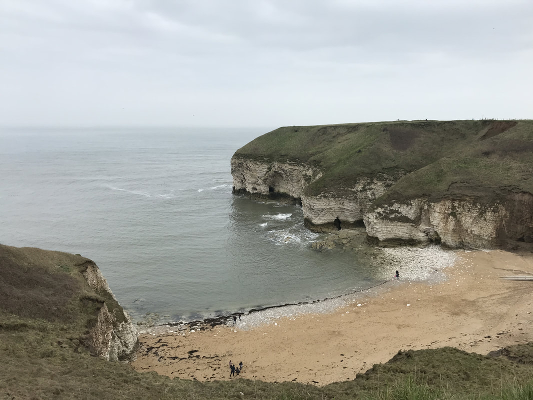
Leaving the cricket club and crowds behind, I at last had the path to myself. The sea to my right lay grey and brooding under a heavy sky while the chalk cliffs marched onwards to the north. I love the feeling of being alone on a cliff with just the circling seabirds and the occasional sheep for company. The path dipped down to Danes Dyke, a pretty little nature reserve that at one point drops down to the sea. You can access the beach here and be free from the busier Bridlington beaches. Danes Dyke actually runs for 4km across the whole of Flamborough Head and is thought to be some kind of defensive structure from the Dark Ages or Roman period. Climb up the steps on the other side and make your way towards South Landing of Flamborough Head. As you follow the path, you will start to see the rock formations formed by coastal erosion at Flamborough Head, which is made of sheer chalk cliffs that have gradually had bites taken out of them by the sea. Take your time here and enjoy the waves crashing in and around the rock formations.
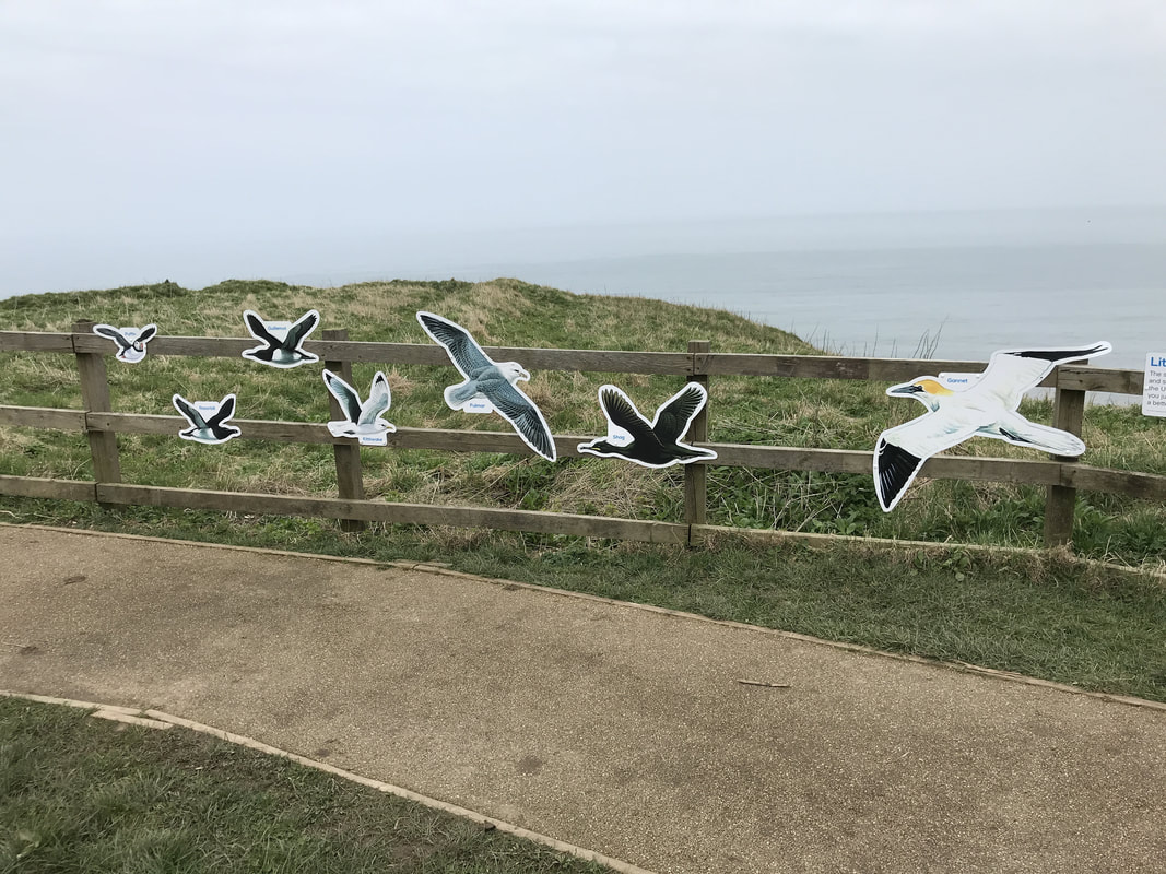
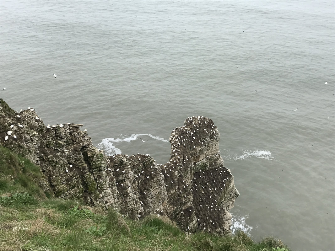
Head up past the Flamborough head lighthouse. If you need refreshments, there is a cafe near the carpark too. Keep following the path until you reach the north landing, where once again you can get refreshments and a public toilet and not far beyond that, is Thornwick Bay, where you can access the beach depending on the tide. There are old smugglers caves and the famed Thornick Nab (a rock arch) to be explored if the tide is out. And yet another cafe is on offer if you want a nice cup of tea. Ignoring the busy holiday park to your left, keep following the path, looking out and back over the rock formations. Depending on the time of year, keep your eyes peeled for seabirds. All along this stretch of coast, the RSPB has built little bird watching landings from which to view Puffins, Gannets, Kittwakes, Guillemots, Herring Gulls, Razorbills and Shags. I passed a young chap who was packing up a long range lens camera. I asked him what he'd been doing. He explained that he was counting puffins for the RSPB. Apparently they have just two days in which the puffins sit on the sea, feeding, before they head off to lay their eggs. So time is of the essence. I noticed many more people all doing the same as I walked along the path. I did wonder how on earth they count a bunch of tiny black dots bobbing about on the sea! I took plenty of time looking at the birds from the various platforms before heading inland. There is a RSPB centre at Bempton with another cafe (seriously, no need to take a lunch with you for this walk). I then walked the mile from there into the middle of Bempton to catch the train back to Bridlington. A lovely walk with plenty of wildlife, geology and beaches. If you are a woman who loves to walk, join Glamoraks for free. It's a way to find other women to walk with, get inspiration and rediscover your sense of adventure.
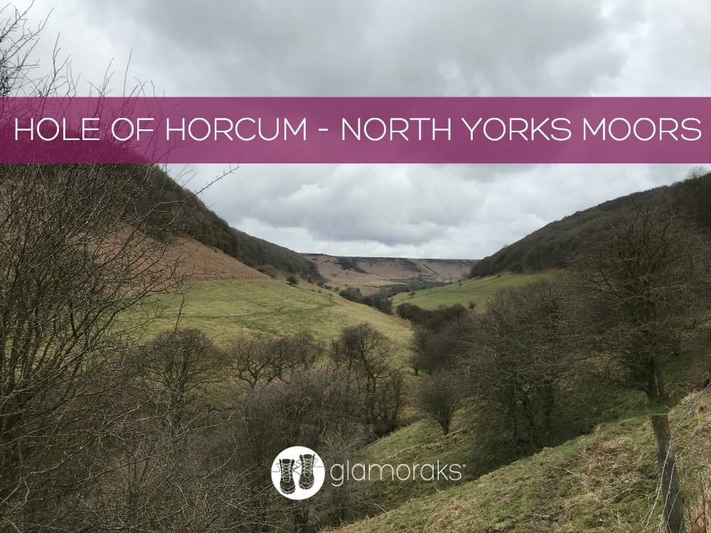 Start and end point: Hole of Horcum carpark off A169 postcode YO18 7NR Terrain: Muddy paths, moorland Hills: A steep climb in and out but otherwise reasonably flat Refreshments: The Horseshoe Pub in Levisham Distance: Approx 7 miles The Hole of Horcum is a section of the valley of Levisham Beck and is part of the Tabular Hills walk in the North York Moors National Park, in Northern England. The 'hole' is 400 feet deep and is approximately 3⁄4 mile (1.2 km) across. Local legend has it that the punchbowl feature was created when Wade the Giant scooped up a handful of earth to throw as his wife during an argument. (Perhaps his wife had suggested that she was heading out for another weekend of walking....) According to Wikipedia: The Hole was actually created by a process called spring-sapping, where water welling up from the hillside gradually undermined the slopes above, eating the rocks away grain by grain. Over thousands of years, a once narrow valley widened and deepened into an enormous cauldron – and the process still continues today. The walk is lovely - roughly 7 miles. It's a circular walk and I've walked it both ways. You can start either at the car park off the A169 (Saltergate - postcode YO18 7NR) or in the village of Levisham. But I personally prefer to park in the carpark because it means you can stop half-way round for a pint of something cold at The Horseshoe Inn. You can walk it clockwise or anticlockwise. CLOCKWISE ROUTE The view are probably best if you walk counter clockwise from the carpark. But as I most recently walked it clockwise and my images are of those views, I am going to write it as the clockwise route. Cross the A169 with care, then follow the waymarked path. Where the path splits to go left and down into the punchbowl or right and along the moors, go left and downhill. Follow the path down and just keep walking. 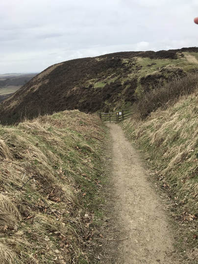 Once at the bottom, keep walking along the base of the punchbowl following the clear path. You will go over a stile and will eventually get to a bit where an old farm building sits. At this point, turn back and look at the majestic view.
Keep following the path, sticking to the low path. If you find that your path starts to lead up a hill, you are going wrong and will end up in Lockton - not where you want to be. Stick to the low path that is closer to the stream. Follow the increasingly muddy track, along some wooden boards, getting closer and closer to the stream until eventually you cross it by a little bridge. Shortly thereafter as you start to climb, you will find a sign post pointing you in various directions. Take the one going straight ahead to Levisham. If you want a shorter walk, you can take the sign to the right to Dundale Pond and return back along the moors, skipping out Levisham.
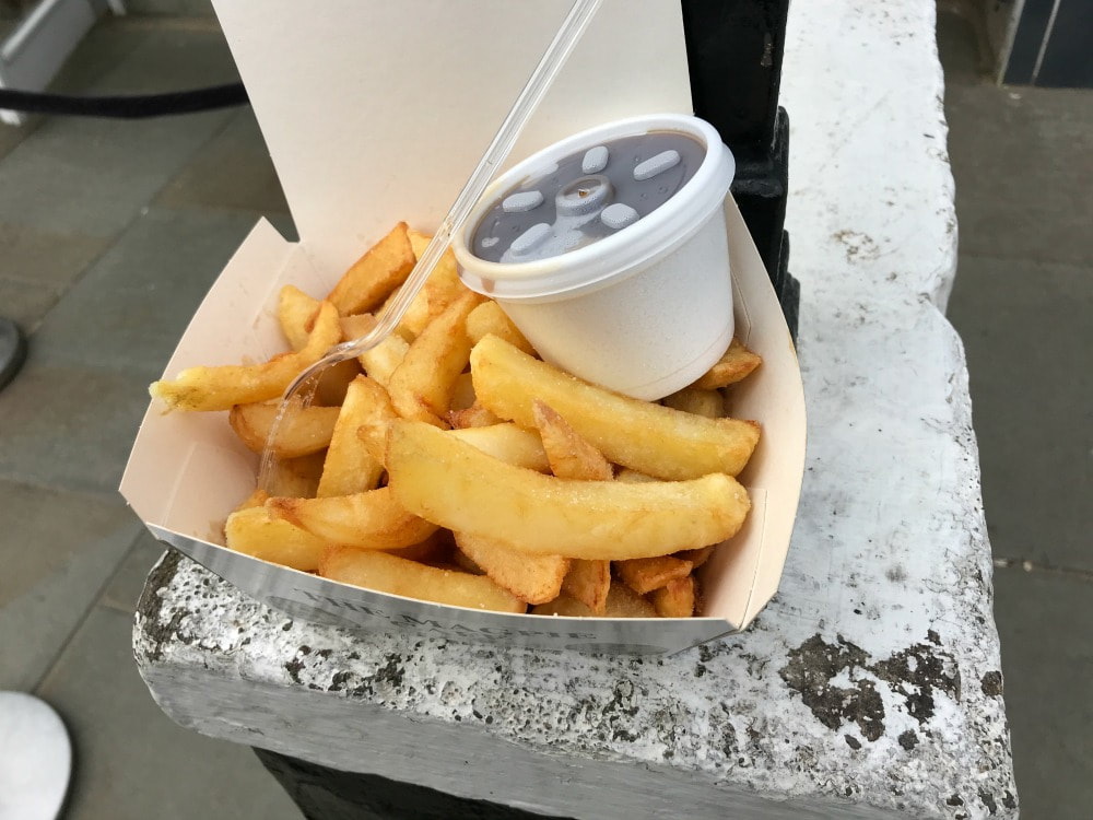
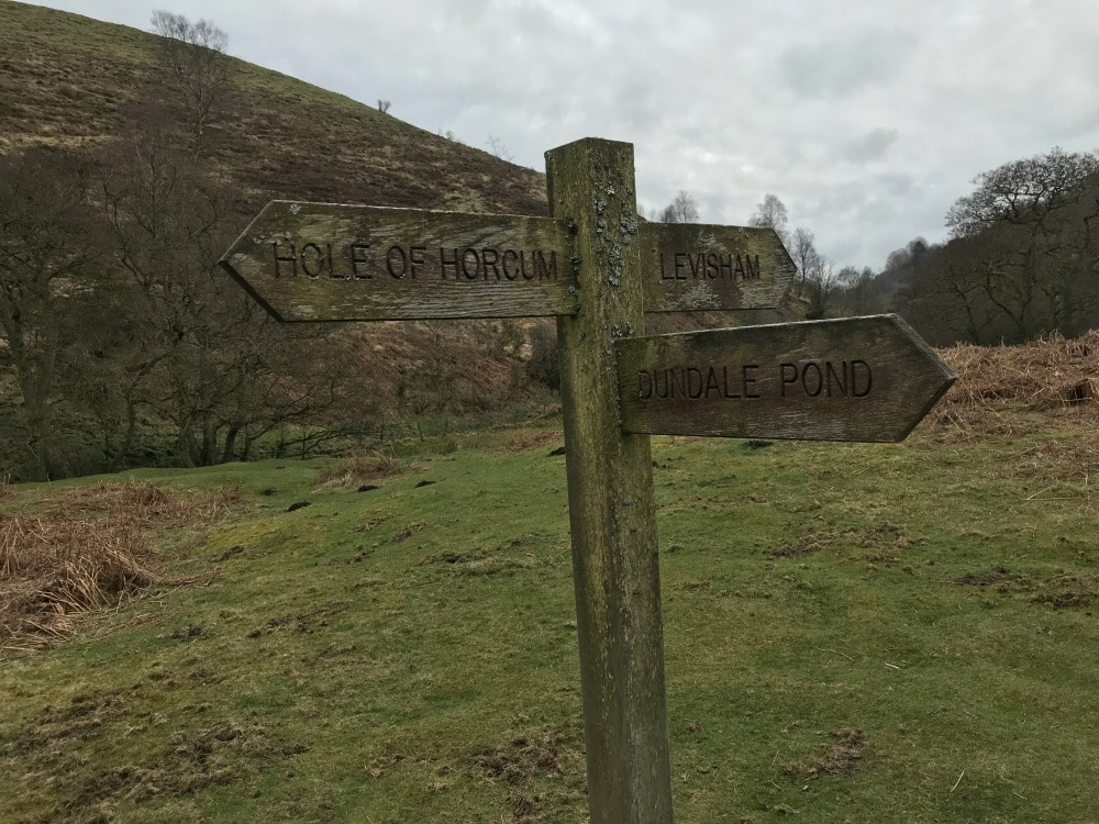 You follow a increasingly narrow path as you make your way up the hill and through woods until you reach the road at Levisham village. You'll see this waymarker sign and a bench.  Turn right up the road and you'll see the Horseshoe pub. I can recommend the chips! Once you're revived, keep walking in the same direction past the right hand side of the pub. Follow the farm track until you go through a gate. This takes you onto the moorland path. Just keep following it back in the direction of carpark. You will at one point arrive at a 4-way junction signpost - keep going straight on without turning left or right. This is where the early path sign-posted to Dundale Pond would bring you to. The walk is straight-forward now across the moors, with the carpark coming into view. After a final stile, you climb the hill back to the carpark and you're done! Be sure to look back across the punchbowl for a final view.
 This is a relatively easy walk with some hills. It's a good one to do with older kids. If you do it with a dog, be aware that there are sheep grazing so they will need to be kept on a lead.
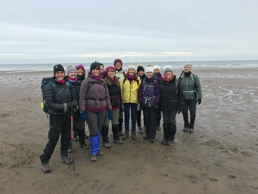
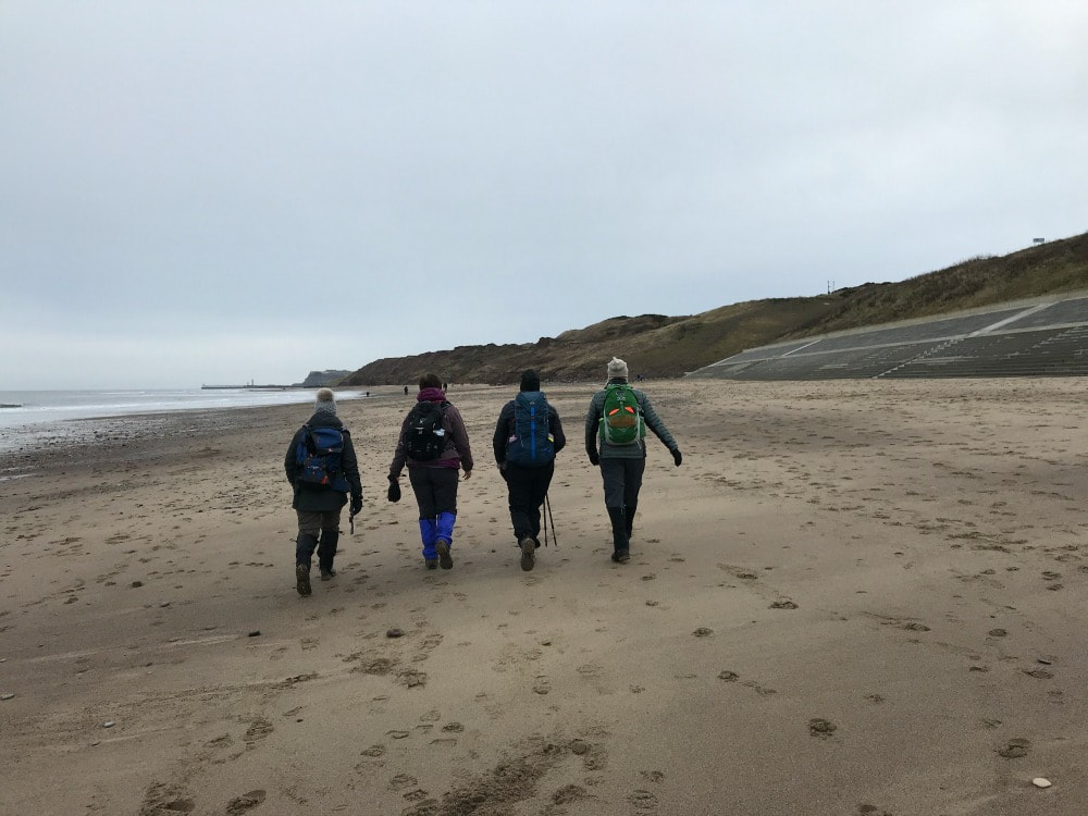
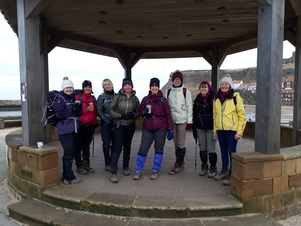
If you'd like to find other women to go walking with, join Glamoraks. It's free. 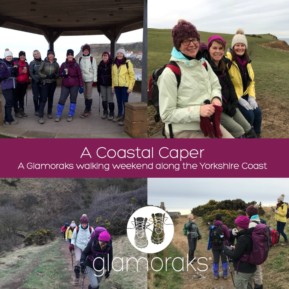 It was a chilly morning when 14 ladies gathered in the carpark at Sandsend in mid-January. Some had come alone, others with a friend. All were ready to have a good, long stomp to blow away the January blues and to walk off any lingering Christmas calories. After adding layers, checking backpacks and having final cups of tea from the nearby cafe, we set off. We walked the two miles along the beach towards Whitby, leaping over streams - some broader than others - as the tide rushed out. Walking along beach sand is remarkably tiring and soon layers were being stripped off and cheeks were pink from the cold and exertion.
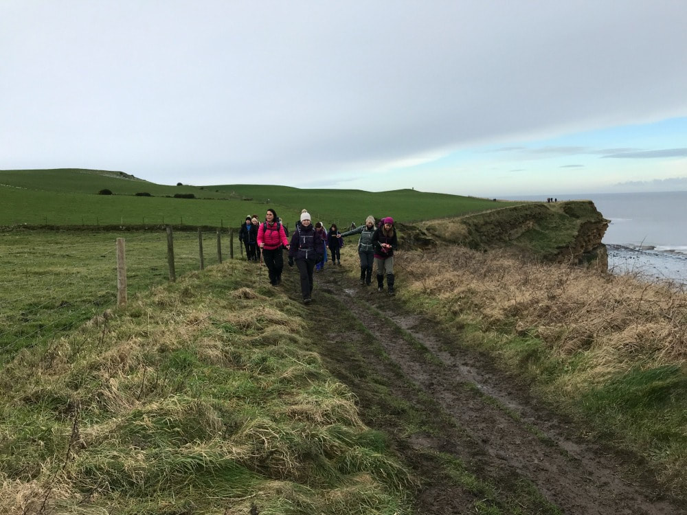
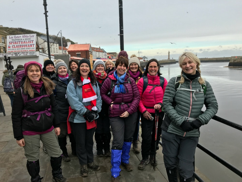 In Whitby harbour 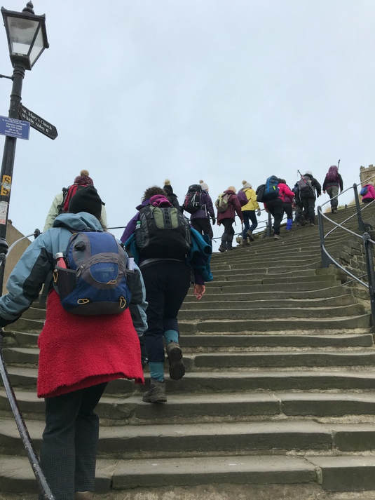 Glamoraks take on the 199 Whitby steps Too early for fish and chips, we ignored the waft of vinegar and made our way through the old fishing town to the famous 199 steps that lead up to the ruins of Whitby Abbey. If we weren't warm before, we certainly were by the top of the stairs. We bid farewell to two of our group who were off to do their own shorter walk, while we headed for the clifftop path. Layers of ice made the path through a campsite slippery but soon we were on the muddy path, taking in the stunning coastal views. This route is part of the Cleveland Way, a long distance walking path that starts in Helmsley and ends in Filey, with exceptional North Yorkshire scenery for all of it. It's easy to break the walk up into stages and do them anytime you have a free day or weekend. We chatted and learnt more about each other as we slipped about in the mud. On several occasions we narrowly missed having a muddy landing and in one, case, did!
 which resulted in some soggy bottoms
We stopped for a picnic lunch in a field with an impressive view. The day had brightened up and the sun eventually popped out as we continued on our way. I have personally done this stretch several times, the first time kickstarted my love of walking. It also forms part of the Coast to Coast route, either being the first or last day of the multi-day hike depending on which way you are going. My cousin Lynda - who did the Coast to Coast with me - had flown from Sweden to join me for this Glamoraks weekend, so we had a moment of nostalgia as we found the C2C sign. With the sun starting to dip in the sky, we made our way down the steep hill into Robin Hoods Bay, a fishing village made up of tiny houses stacked higgledy piggledy on top of one another. Half our party headed to the pub in search of a restorative ale or port, the other half found the last open tea shop and tucked into slices of cake, scones and pots of tea.
Suitably revived, we headed off towards Boggle Hole, just 20 minutes away. The sun was setting, creating a beautiful scene with the snow on the moors ahead of us. We got to the hostel just as it got dark. If you've not been to Boggle Hole hostel before, you are missing a trick. It is festooned in bunting and nautical paraphernalia, with plenty of hidden objects for children to find. And it's situated right on the beach. You can hear the waves crashing as you lie in bed. After finding our shared rooms, we reconvened in the cosy dining room with a roaring log fire. Glasses of wine, a hearty chicken curry followed by apple pudding and we all felt ready for bed. We had, after all, done 11.5 miles of fairly tiring walking across sand and slipping on mud! Another reason for the early bed time was Sunday's weather forecast of strong winds and snow arriving mid afternoon, which meant we needed an early start. While we all had the right kit to keep warm, none of us fancied trying to drive back home over the North Yorkshire Moors in a blizzard. We got the chef up bright and early to cook us a hearty breakfast, while taking in the magnificent sunrise. We bid farewell to four of the ladies who wanted a shorter day and a nosey around the quaint shops of Robin Hood's Bay, before getting the bus back to Sandsend. The rest of us retraced our steps along the path the way we'd come as the tide was still too high to do the beach walk. We were treated to even more spectacular views of the sunrise and we all agreed that it was moments like this that made us face the sub-zero temperatures and get outdoors. After making our way back up the steep hill in Robin Hood's Bay, we opted for the Cinder Track, a route that runs roughly parallel to the coastal path only it's slightly more solid with less slippy mud. However, what it lacked in mud, it made up for in slippy ice. We still managed to make better time and soon rejoined the coastal path again. Thanks to the very low overnight temperatures, all the mud had frozen solid, making it much easier to walk back.
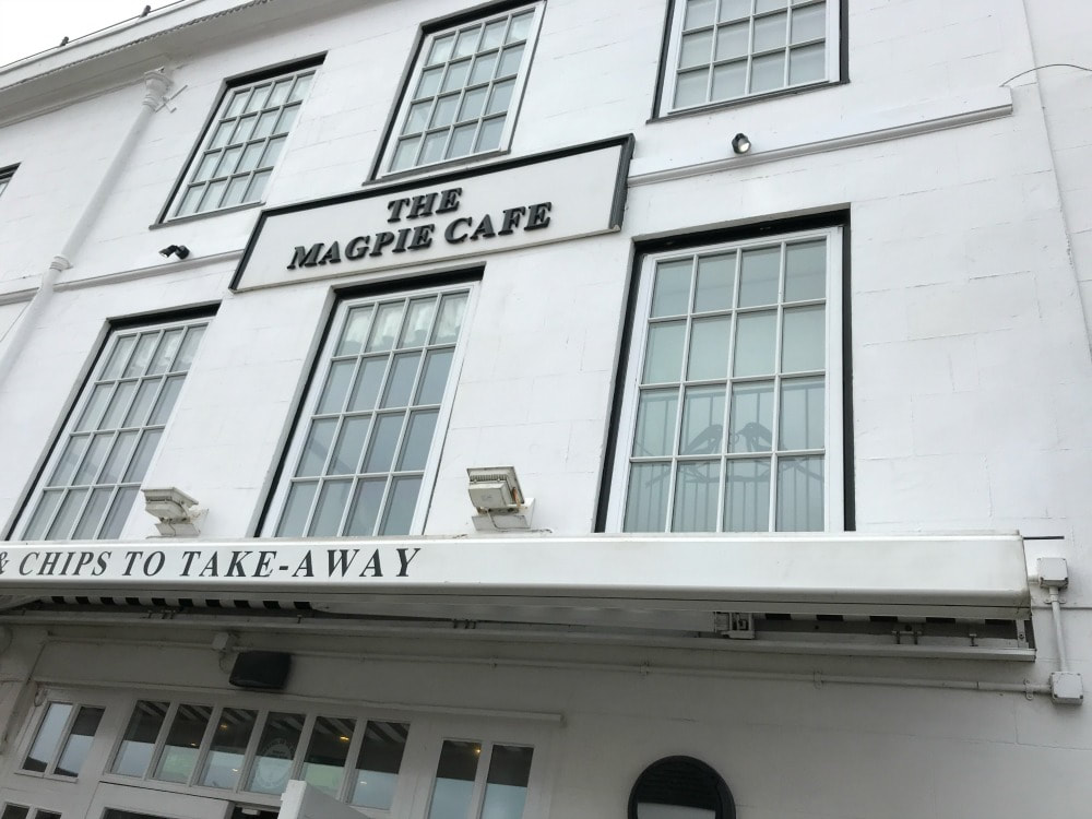
We managed to get to Whitby in time for lunch. General agreement was to ditch the packed lunch we'd been given in favour of fish and chips from the famous Magpie. What a treat to tuck into warm chips and gravy on an icy cold day (with the added bonus of trying to fend off dive bombing seagulls). We could see the weather setting in so we headed back up the beach to Sandsend for our final two miles. As we reached the carpark, the snow arrived, flying in sideways on the wind. A quick cup of tea at the Wits End Cafe, and we dashed to our cars. We drove in convoy up and over the moors in a blizzard, with deep snow on the road sides. Had the driving conditions not been quite so scary, it would have been beautiful, like a scene out of a Christmas card.
We all made it home with rosy cheeks and tired legs. A total of 23 miles walks, washed down with cake, fish and chips, wine, curry, good chat and the chance to forget about day to day life. The perfect Glamoraks weekend really! If you would like to meet other women for fabulous weekends like this, join the Glamoraks community. 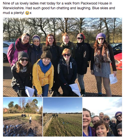 Or these:  If you'd like to do this walk, park at the Sandsend carpark (free of charge over winter), postcode YO21 3TD. Walk along the beach to Whitby (or the signposted path if the tide is in). Head over the bridge in Whitby and follow signs for the Abbey ruins. Climb the 199 steps, walk through the car park and turn left onto the coastal path. Follow this through a caravan site and then simply follow it all the way to Robin Hood's Bay. When you enter Robin Hood's Bay, turn left onto the main road heading down towards the sea. Just after Smugglers pub, turn right and follow the coastal path signs again until you reach Boggle Hole. You simply retrace your steps the next day. Or, take the sign post for the Cinder Track just outside Robin Hood's Bay (where the Coastal Path starts again). Turn right off the track when you reach a road that leads to Northcliffe holiday park. Walk through the park and you'll reconnect with the coastal path. Turn left and follow it back to Whitby and then on to Sandsend. roughly 11.5 miles each way.
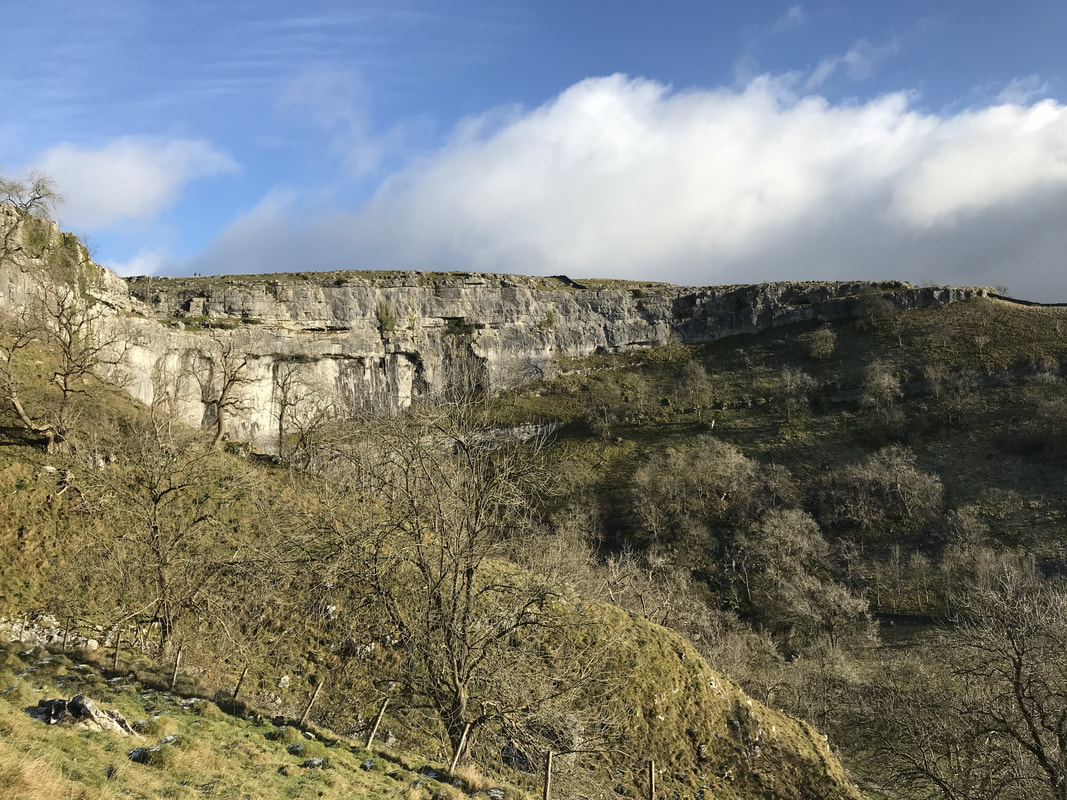
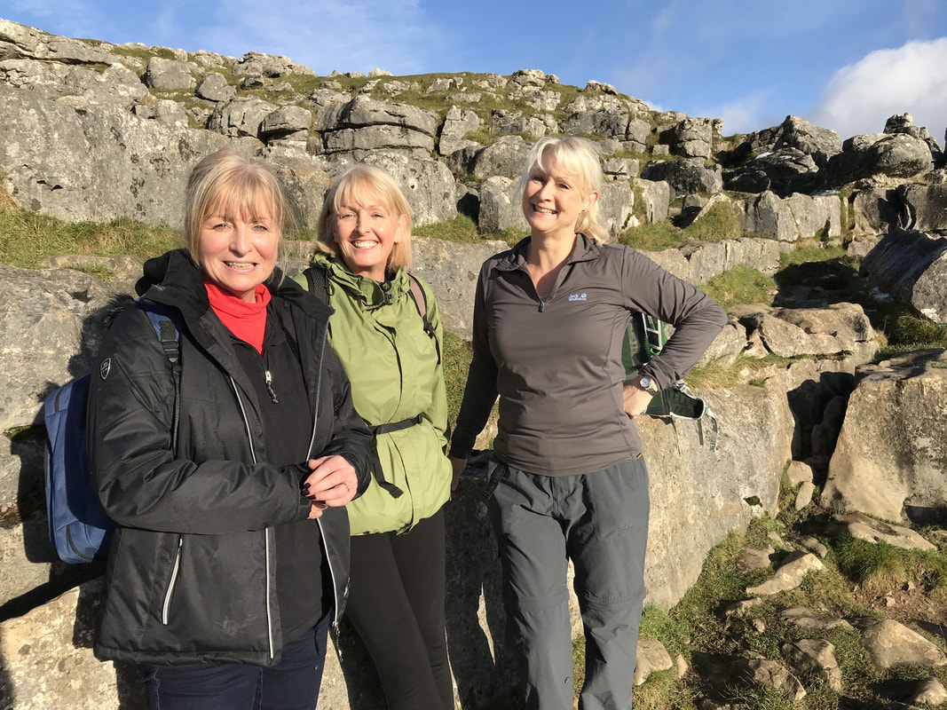
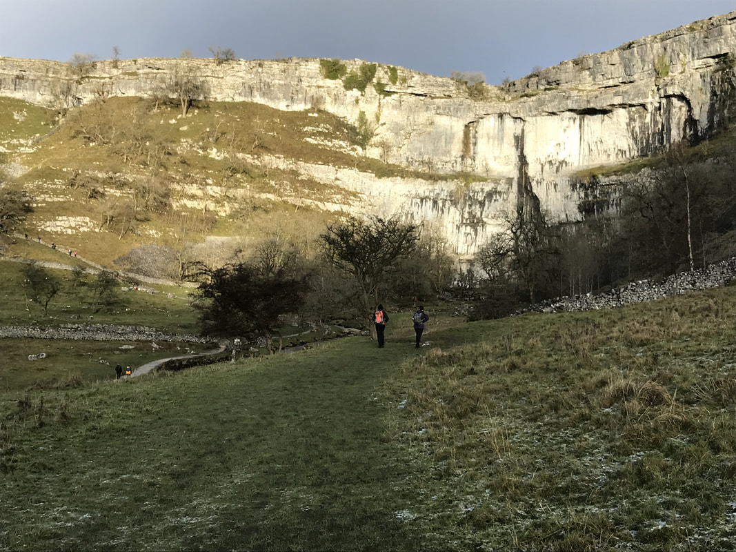
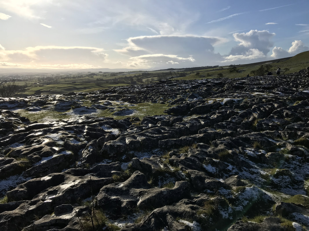
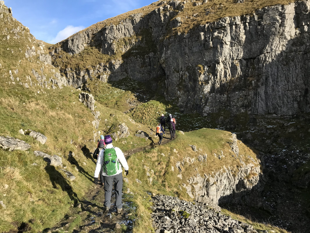
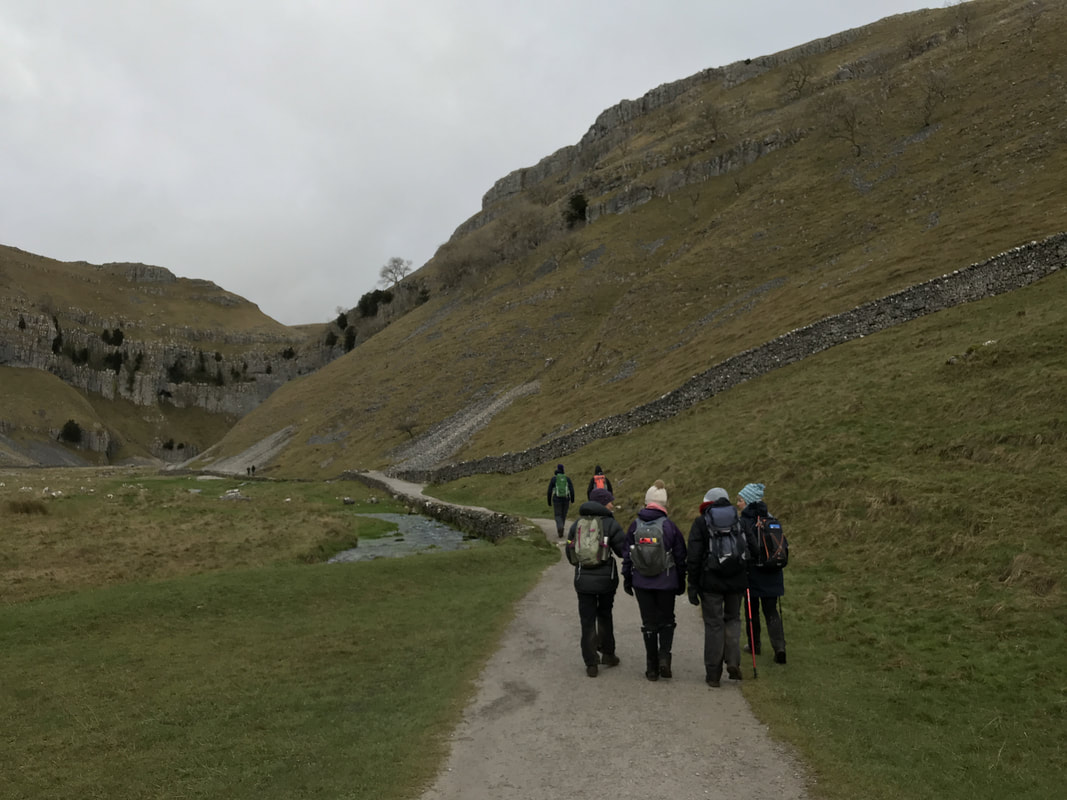
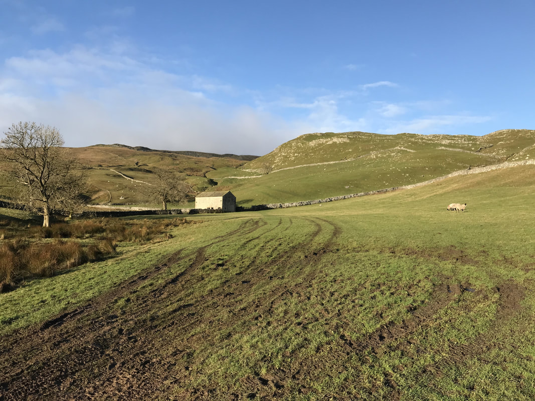
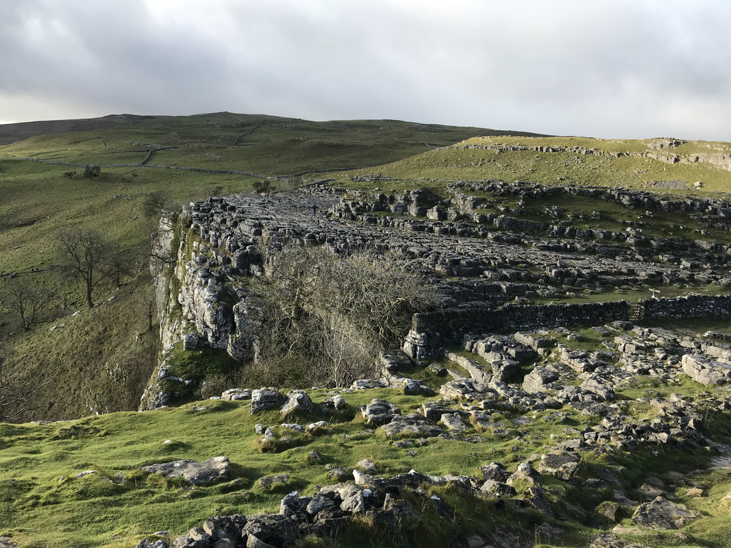
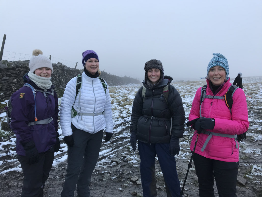
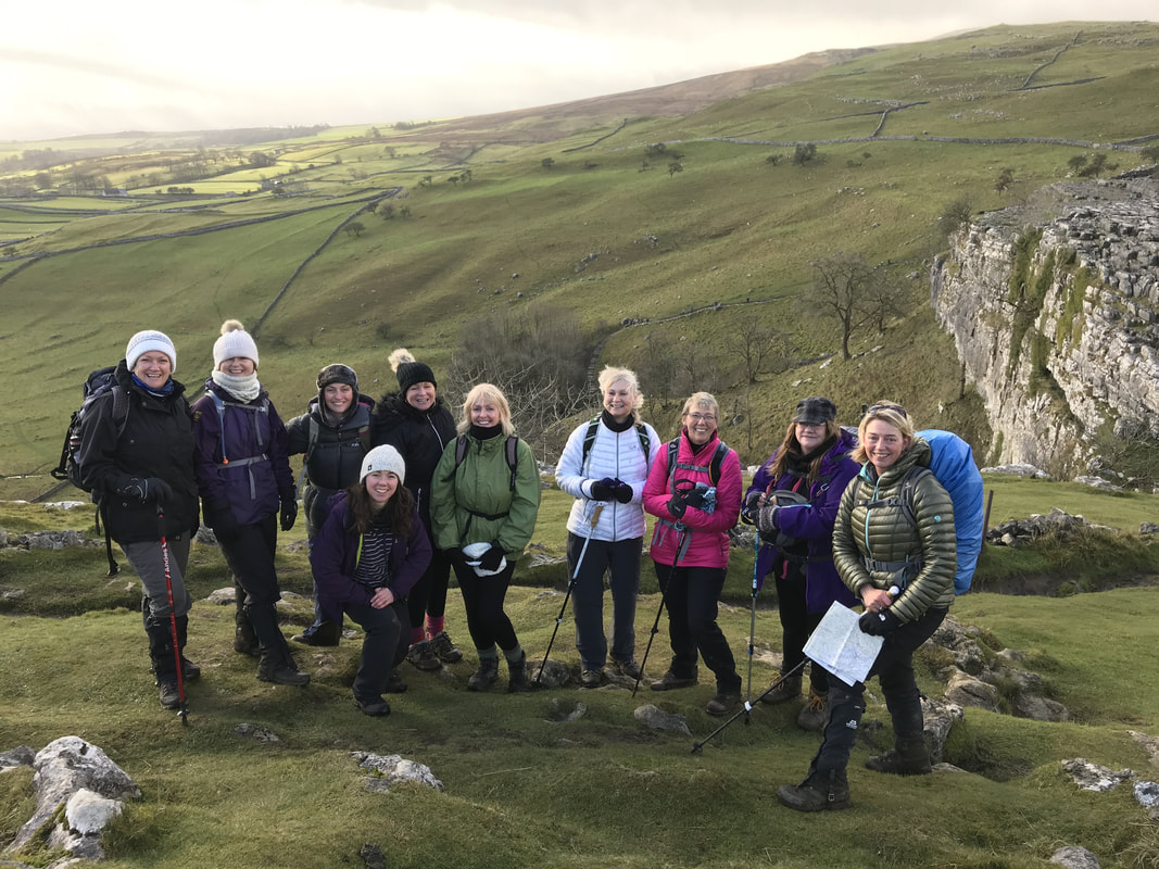
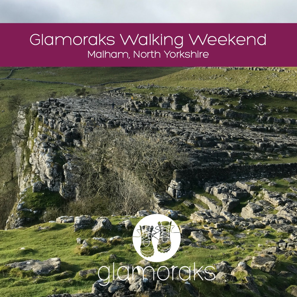 The first ever Glamoraks Walking Weekend was held on 24 - 26 November. And it was fab! Fourteen ladies made their way to Malham Youth Hostel. Most people didn't know each other so there was a certain amount of trepidation, but an evening in the cosy Lister Arms pubs with several glasses of warming red wine, and any anxieties were laid to rest. The hooting of the resident owl sent us off to sleep ready to tackle a day of walking. Once the rest of the group arrived on Saturday morning, we set off. Using the footpath that runs directly alongside the hostel we made our way up to the base of Malham Cove. It's a stunning setting and gave us a taste of the scenery to come. Crossing a stone bridge over a stream we made our way up the steep steps the carve around the edge of the cove. From the top, the views over the Yorkshire Dales were incredible. After a warming cup of tea, we gingerly made our way across the limestone pavement - famed for having a Harry Potter scene set on it. The slippery stones made it slow going. On the far side we decided to split into two groups - those who wanted a more gentle walk of 4.5 miles to Gordale Scar, Janet's Foss and back to the hostel; and those who wanted a longer walk up to Malham Tarn and Malham Raikes before picking up the path to the Scar and Foss.
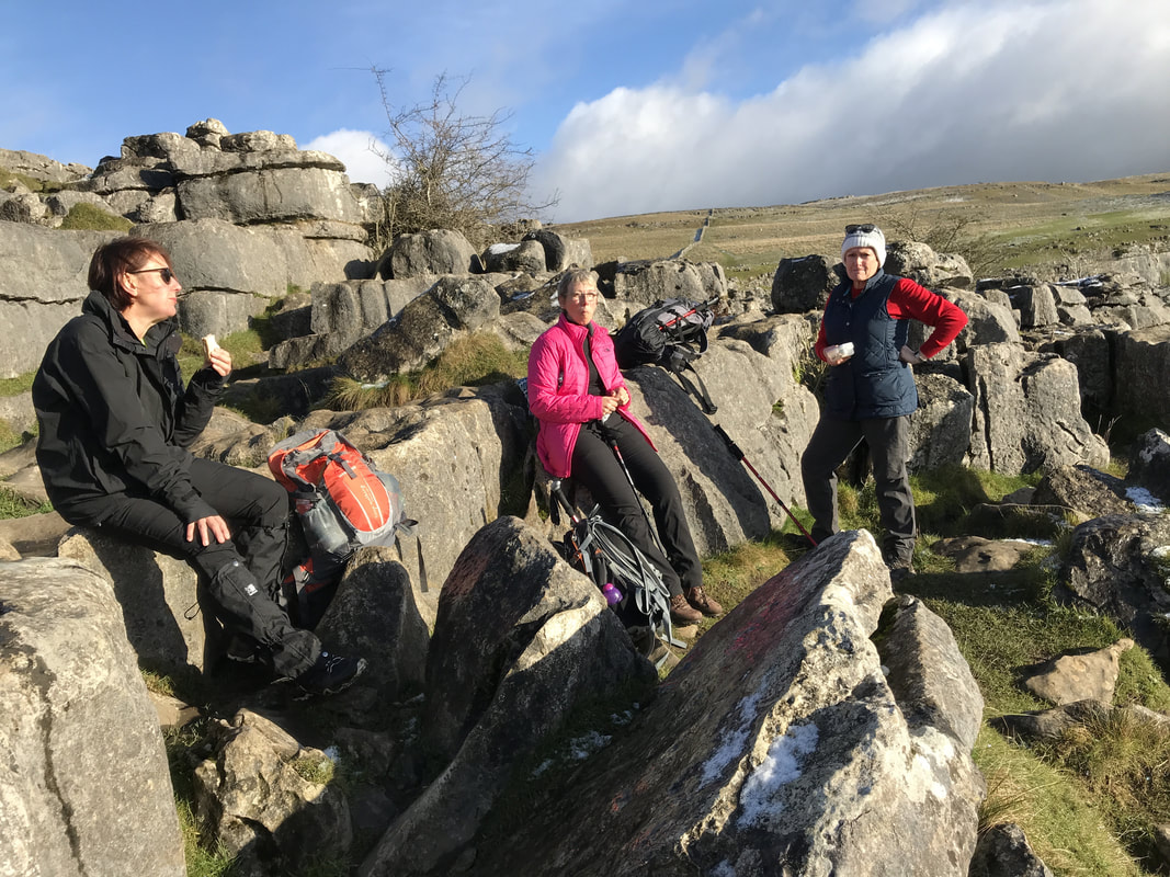
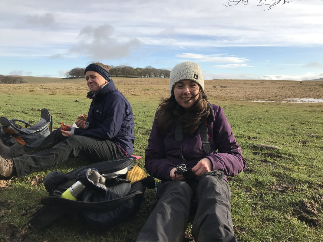
While the sun was glorious during our walk up the Ing Scar, at the Tarn it was bitterly cold, so we found a wall to shelter behind to enjoy our picnic lunch. Suitably revived, we headed for Malham Raikes and got stuck in icy bogs en route. After squelching through those for a while, we were pleased to hit a drier path and finally reached Gordale Scar. Just as we were heading for home, the heavens opened and our faces were whipped with sleep and rain. A final stretch in woodland passed Janet's Foss and we made it back to the hostel before the sunset. Thanks to Janet for the ingenious idea to create hot port, we feasted on cake and hot toddies and soon thawed out. A team dinner of chilli, rice, salad and garlic bread, washed down with wine, and soon we were solving all the problems of the world. It wasn't a late night for anyone!
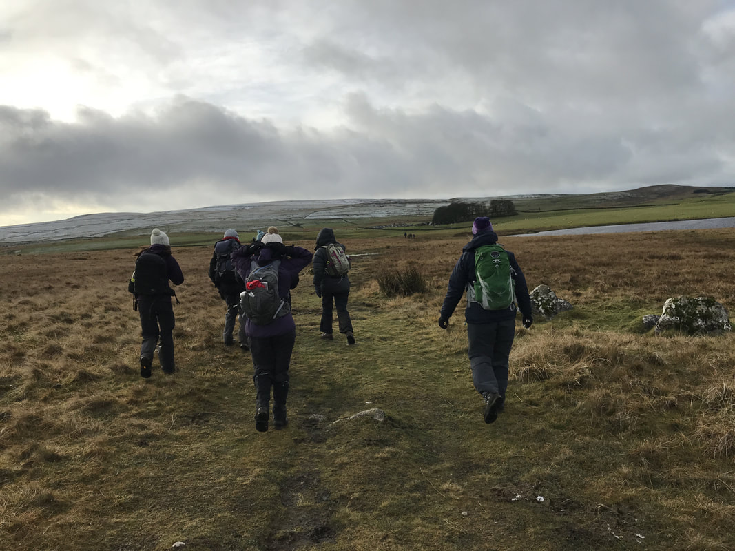
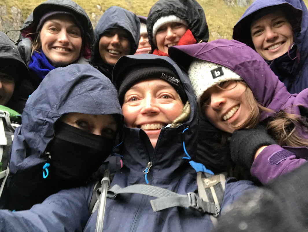
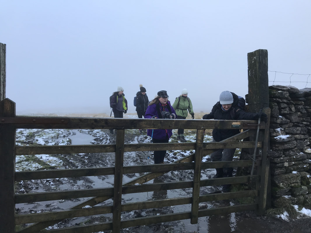
We had an early wake up call as the fire alarm went off at 4.30am for absolutely no reason whatsoever. After catching a few more hours sleep and a hearty breakfast, the group once again split into two. The smaller group had to get back in time to catch trains to London and elsewhere, so they headed off to Kirkby Malham where they timed their arrival just as the Sunday service ended. They received a warm welcome from the Parishioners. The larger group decided to tackle Pikedaw Hill. This is a reasonably feisty climb that started in stunning winter sunshine but ended in murky fog at the top, where a layer of snow still lay on the ground. But before the fog set in, we were rewarded with more spectacular views. We crossed the top and headed by to Ing Scar where we picnicked for lunch, before making our way home, a total of about 7.5 miles. All too soon it was over. But we left with pink cheeks and smiles on our faces. The best thing about walking with other women - even if you don't know them - is that you very quickly get past the superficial layer of conversation and dive straight into the good stuff. Thank you so much to all the lovely ladies who joined me and for giving me a snapshot into your lives. Let's do it again! If you want to meet other likeminded women to go walking with, join the Glamoraks community.
|
Categories
All
Archives
July 2024
|


 RSS Feed
Get social. Follow us.
|
Don't get left out.
Add your email to be alerted about any Glamorak events, walks, get togethers, challenges or news.
Success! Now check your email to confirm your subscription.