|
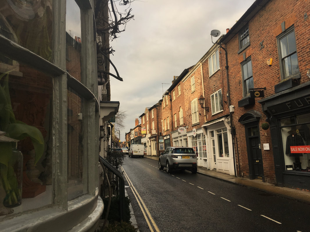
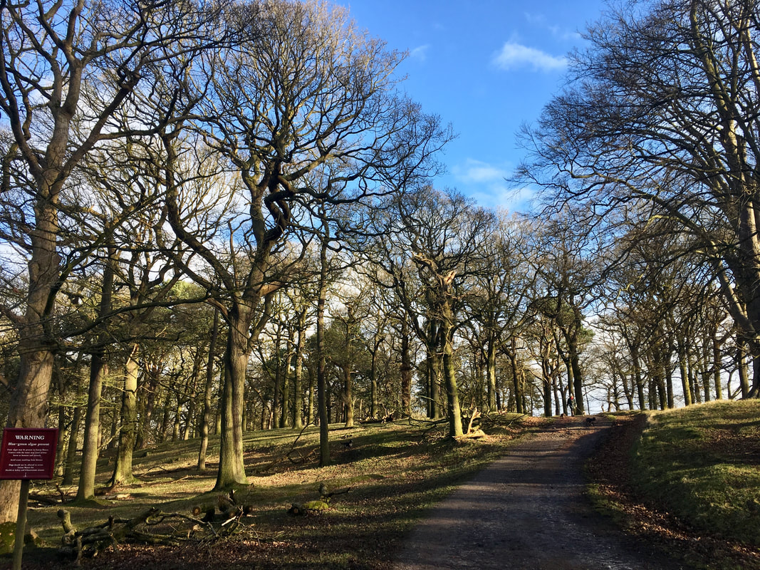
Distance: 4 miles or 6 miles Difficulty: Easy Type of terrain: grassland, paths, road Starting point: Knutsford town centre Resources: 100 walks in Cheshire Knutsford, a picturesque Cheshire town, known for its staggering choice of restaurants and cafes, is the perfect setting to top and tail a gentle Glamoraks walk. Just a few minutes drive from junction 19 on the M6 or by train direct from Manchester Piccadilly, it’s very easy to find this attractive historic town. It’s also great for celeb spotting. One of Take That recently helped someone back into a parking space and it’s not uncommon to see a Coronation Street star walking down the street. Park up in the town centre car park, opposite the art deco Belle Époque restaurant, once the setting for ITV's Brideshead Revisited, and then head up King Street. This street is one way so walk in the same direction as the traffic to reach Tatton Park. It would be a shame to start your walk with an empty stomach so pop into Piccolinos, an Italian eatery for their popular brunch. They have a great choice from traditional English breakfast to healthy options like porridge & fruit. After brunch continue up King Street until you see the impressive stone arch that straddles the entrance to the park. As you pass through the pedestrian gates either side of the cattle grid, you have three choices, left through the wooded area, straight on along the road and or to the right, down beside the lake, known locally as the Mere. All routes eventually lead you to Tatton hall, and even on the road you can get very close to the deer that nonchalantly roam the grassland. The park is popular with joggers, dog walkers & cyclists and one frosty morning, I saw a brave cyclist working up a sweat on a penny-farthing. This is not unusual given that we have the Penny Farthing museum in the town, home to over thirty Penny Farthings as well as what is believed to be the oldest bike in the UK. Worth a visit at the start or end of your walk as they also serve tea & cakes. At the end of the lake, known as the Mere, you automatically come back to the main road, which leads up to the Hall. You can stay on the road for ease or it’s not difficult to spot grassy pathways leading in a similar direction, which is softer underfoot. Once you reach Tatton Hall, which is about 1.5 miles from the main entrance, you can visit the mansion, the housekeepers shop as well as the gardens. In the summer months you can get lost in the copper beech maze, relax in the Japanese shrubbery or explore the walled kitchen garden. You can also buy fresh produce at the garden shop in the courtyard. You can head back on a slightly indirect route by heading left, towards the Rostherne Exit, then bearing right across the parkland, where on a clear day you can see the peak district. We are also in Manchester airport’s flight path and heads always strain upwards, when the impressively huge Emirates Airbus flies majestically overhead. You will hear it before you see it, so deceptively close you think you can touch it. As you head back towards Knutsford centre you can follow the edge of the lake the way you came in or head to the opposite side and get back to the town via Dogwood. Nothing to do with dogs, although it’s popular with dog walkers, it’s just the name of the wooded area with a well-surfaced path. Back in Knutsford there are plenty of food options before you head back to your car, a little taste of French cuisine at Brasserie Blanc or Spanish tapas in Evuna. Suffice to say there’s plenty to lure you back for another visit. If you would like to meet other women who love to walk and get walk idea inspiration, join Glamoraks. About the Author - Vanessa Williams
I am a 52 year old TV Producer & Director, still working in television on programmes like A Place in the Sun. I live in Knutsford, Cheshire, where I am lucky enough to have Tatton Park right on my doorstep which makes me feel like the lady of the manor with my own private estate.
2 Comments
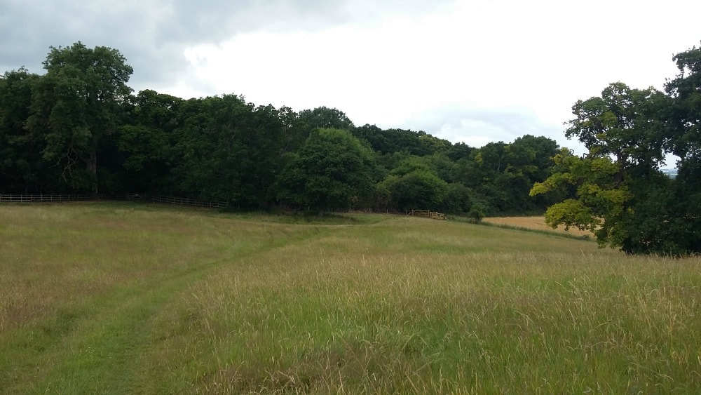
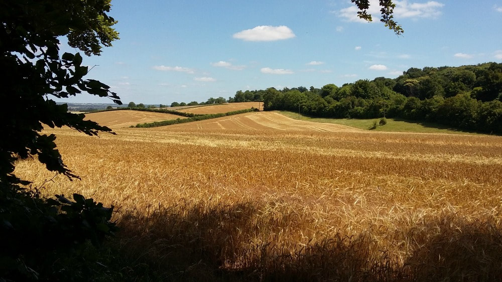
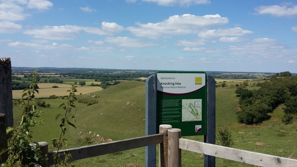
A choice of two short walks on the Hertfordshire and Bedfordshire border, with an abundance of nature regardless of the season. Distance: 3 miles extending to 4 and more. Terrain: easy with some moderately steep climbs. Fields and a bridleway. Height: up to 450 feet. Starting Point: Motte & Bailey Pub, Pirton, nr Hitchin, SG5 3QD You’re getting two walks for the price of one here. Both routes are on the edge of the Chilterns and around 3 miles long. The first is circular, done clockwise or anti-clockwise. The second is straight up the hill to the edge of Knocking Hoe Nature Reserve and back. If you want to extend your walk, you can follow the way marks from this point and go further into Bedfordshire, although an OS map would help! Part of the route is on the Icknield Way, which extends from Dorset to Norfolk and has the claim of being 'the oldest road in Britain' as it is made up of prehistoric pathways. Both walks start in Pirton, a small village forty miles north of London, on the border of Hertfordshire and Bedfordshire. Just thirty minutes by train from Kings Cross, it makes an easy escape from the city and the chance to breathe in some fresh air. Plus you'll get to see a traditional Doomsday village complete with old cottages, two pubs, a duck pond and Highdown House, an old Jacobean mansion with an interesting history. Although this walk is popular with families on Boxing Day, any other time of year you won't typically pass more than a couple of dog walkers making it a good option to escape the hustle and bustle of city life. There are a couple of steep hills peaking at around 450 feet. In summer you can get by with almost any type of shoes, but if it’s been raining you need boots because part of the lane gets muddy. I’ve ended up on my bottom more than once, but thankfully no one saw me. In early autumn there are plenty of blackberries, so take a container or eat as you walk. What’s nicer than a warm, juicy blackberry, straight from the hedge? I walk from my front door as I work mainly from my home in Pirton, but if you're travelling in, park outside the Motte and Bailey pub. If you have caught a train from London, get off at Hitchin Station and get a taxi to the pub in Pirton (it's about a 5 mile trip and will cost approximately £8). From the pub, walk left to the main road to Hitchin, passing a wooden Pirton sign with hands holding straw on your left. In case you're wondering about the straw sign, this walk is part of the Straw Plaiters walk. In the 19th century, Pirton’s women and children collected the straw, from wheat growing on the chalk soil, for the hat making industry in nearby Luton. Cross the road and go straight ahead to Wood Lane, with a large house on your right. You can walk up the shady lane which has a canopy of trees or, for better views, walk along the edge of the field running parallel, where an ‘unofficial’ path has been worn. After a quarter of a mile or so there is a path to your left across the open field (waymarks are here.) Turn left if you want to walk clockwise. Carry straight on for an anticlockwise route, turning sharp left at a wooden seat. Go straight on up the hill for the second walk to Knocking Hoe Nature Reserve. These directions are for the clockwise route. Follow the path over the field and keep right to a kissing gate. Go through the kissing gate and climb the steep hill. Highdown House, a Jacobean mansion once a Cavalier stronghold, is on your left. There is supposedly a ghost in it and a headless horseman who rides across the field on 15 June. As you walk, keep your eyes open for wildlife: free range guinea fowl belonging to the house, muntjac, pheasants, buzzards and roe deer. At the top of the hill pause and look across the fields. You can see for miles and there are usually buzzards circling overhead. This is a great spot for a picnic – a couple of massive old oaks and soft grass. Don’t go to the end of this field, but bear right down the hill to another kissing gate. In spring there are masses of bluebells in the wood to your left - Tingley Wood. (You can’t go in- it’s private – but you can stand at the gate and admire the view.) At the bottom of the hill there’s a wooden seat – a favourite picnic spot for walkers. You’d complete the circuit by turning right. For the second walk, turn left at the seat and continue up the hill. At the top of the hill, bear right towards a wood. Very soon you will see the sign for Knocking Hoe Nature Reserve opposite a seat with a wood behind. There is public access into Knocking Hoe, but the footpath to further routes continues outside the reserve, down the hill, where there are some way markers. These can take you to the B655 road which you cross to access other walks. In the Nature Reserve in summer you will find lots of butterflies and wild flowers, some of them rare. The views are lovely, it’s usually quiet and you can easily find a sheltered spot to eat or drink. Definitely worth the climb to get there!
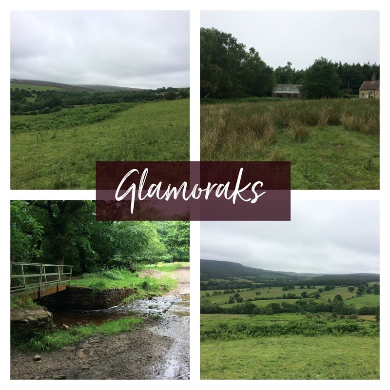
Distance: 5 miles (more if you get lost) Difficulty: Moderate (some hills to climb and map reading required) Type: Farmland, forest Start point postcode: YO62 5HH - Cowhouse Bank Carpark, North Yorkshire, UK After days of being trapped indoors due to a combination of work and utterly foul weather, I decided to head off on an easy 5 mile walk on the edge of the North York Moors. I have a little book called Short Walks in the North York Moors, by Collins. Now this book has given me plenty of really good walk suggestions and the instructions are typically easy to follow and as each walk includes a map, there is no need to take an additional big map with you. The walk I chose was one called Upper Riccal Dale, that starts from a Forestry Commission carpark called Cowhouse Bank. To find it, head out of Helmsley, through a tiny hamlet called Carlton and shortly thereafter you find the exceptionally quiet carpark. There is bench with lovely views over Bransdale from the carpark. I parked up, the only car there and got that lovely sense that I was the only person in the world. You start out by crossing the road you've just driven in on and heading off down a forest track. Through gaps in the trees you get glimpses of the views over the dale below, dotted with sheep. The path was exceptionally boggy underfoot on account of the three days of torrential rain we'd just had but I didn't care. It was peaceful and quiet. If it's been raining, wear gaiters! The path went back on itself down the side of the hill until reaching a farm track. It was here that my first navigation issue arose. According to the book, 'Go right on the farm road. Cross the bridge and climb through two fields away from the stream towards Howl Wood Farm.' But at the entrance to that farm road were two big signs saying PRIVATE - NO ENTRY. That's never a welcoming sign. I couldn't see any right of way signs or footpath signs but everything else seemed to indicate that this was the way I should go. So I went in. Although there was a stream (very pretty) and a bridge, there were no fields to climb through. Just a track that made it's way up to the farm buildings. I figured it must be right, so I kept walking. The book said, 'Go left through the farmyard and left through a gate beyond the farm tip to follow a faint track ahead.' I really, really don't like walking through farms. Firstly, it feels as though I am trespassing on someone's property - and the big PRIVATE - NO ENTRY signs certainly reinforced that. Secondly, there are always old, empty barns creaking in the wind, with rusty hooks and other dangerous looking pieces of equipment lying around. I always expect a scary bloke to come out carrying a bloodied meat cleaver while spitting out chewing tobacco, telling me to either 'Get orf my land' or 'To come in for a visit....' (I have an over active imagination.) Add to that, there is invariably at least one (in this case four) farm yard dogs that aren't known for their friendliness. They started barking furiously, while a gaggle of geese hissed at me as I passed them. Then the cows (luckily behind a wall) started to add to the cacophony, lowing their discontent at my presence. Luckily there was a single footpath arrow on one of the gates, so I headed at pace for that and made it through the other side breathing hard. I am very rarely scared walking on my own but on remote farms, my heart does race a little. After that excitement, the next set of instructions was simply, 'Cross the stream by the footbridge'. I was still following the 'faint track' as described by the book but eventually I reached the end of the wall line and my path was blocked. I had obviously missed a path down to the stream where the footbridge was, but there really hadn't been a path anywhere! I retraced my steps, found no path but eventually followed sheep tracks down to where I could hear the stream flowing. Reaching the stream, there was no footbridge. So I bashed my way along the stream edge until at last I found the footbridge. Somehow I had obviously missed the path down. My advice if you're doing this walk, is when the 'faint track' starts to bend slightly north, head down the hill to your west. Crossing the bridge, I headed up through two fields until I found a rough bit of grazing land and the Forest Chapel that the book mentioned. Like something out of Hansel and Gretel, the chapel was very sweet tucked into the forest (picture top right above). But here again, the instructions were light to say the least. 'Cut across an area of rough grazing and walk towards the road, aiming to the left of the forest chapel. Cross the metalled road and go onto a forest road.' I stood in an overgrown field with no signs of a road. Beginning to despair of my navigation skills, I saw the first - and only - person I encountered all day. A cyclist, or rather a cyclist's head, whizzed past. That must be the road! I found a gate that led to a very overgrown track to meet the road. Should you be doing this walk, don't worry about the fact that you can't see the road or a gate or a sign of any kind. Just keep walking towards the fence line and it shall reveal itself to you. After that, it was a simple case of following the forest track back up a steep bank to get more lovely views over Bransdale. Even though I thought I was home and dry at this point, I made one final mistake. The book said, 'At the open field, turn left away from the road on a path between forest and the field's upper boundary.' I found the open field and turned left, but the word I missed was UPPER boundary. I turned left to soon and ended up back on the road. By which point, I thought 'Sod it' and walked back up the road to find my car where I'd left it. The moral of the story: When going on a walk, take your time to read the instructions VERY carefully and look VERY closely at the map. Tiny signs like contour gradients, side paths and streams all give clues if the instructions aren't very detailed. I couldn't even blame my getting lost on chatting too much - which is normally the reason I go wrong. Despite getting lost, what made this walk lovely was the remoteness of it and the fact that I didn't see another soul (other than the cyclist). If you want to escape the world for a bit, get expansive views and see plenty of wildlife, this is a great walk. Besides all the farm animals, I saw plenty of birds, hares, bunnies and a gorgeous roe deer. And now that I've found out that you can walk through the farm despite the no entry signs, you can do so with the confidence I lacked. Below is a little video of my experience..... If you are a woman who likes walking - either on your own or with others - please join Glamoraks community where you can share your walking experiences, get inspiration or find people to walk with. Also sign up for the Glamoraks newsletter to get details of any events we have planned. |
Categories
All
Archives
July 2024
|
Get social. Follow us.
|
Don't get left out.
Add your email to be alerted about any Glamorak events, walks, get togethers, challenges or news.
Success! Now check your email to confirm your subscription.


 RSS Feed