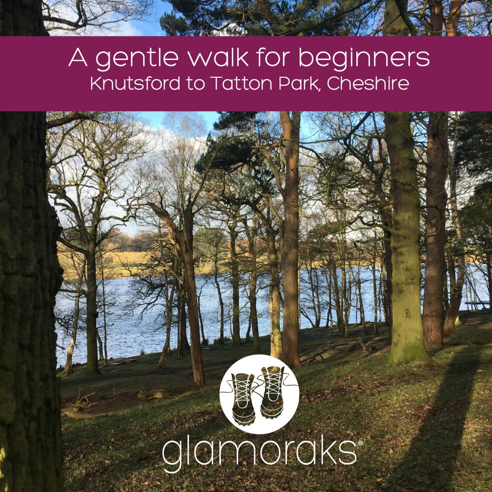
 Distance: 4 miles or 6 miles Difficulty: Easy Type of terrain: grassland, paths, road Starting point: Knutsford town centre Resources: 100 walks in Cheshire Knutsford, a picturesque Cheshire town, known for its staggering choice of restaurants and cafes, is the perfect setting to top and tail a gentle Glamoraks walk. Just a few minutes drive from junction 19 on the M6 or by train direct from Manchester Piccadilly, it’s very easy to find this attractive historic town. It’s also great for celeb spotting. One of Take That recently helped someone back into a parking space and it’s not uncommon to see a Coronation Street star walking down the street. Park up in the town centre car park, opposite the art deco Belle Époque restaurant, once the setting for ITV's Brideshead Revisited, and then head up King Street. This street is one way so walk in the same direction as the traffic to reach Tatton Park. It would be a shame to start your walk with an empty stomach so pop into Piccolinos, an Italian eatery for their popular brunch. They have a great choice from traditional English breakfast to healthy options like porridge & fruit. After brunch continue up King Street until you see the impressive stone arch that straddles the entrance to the park. 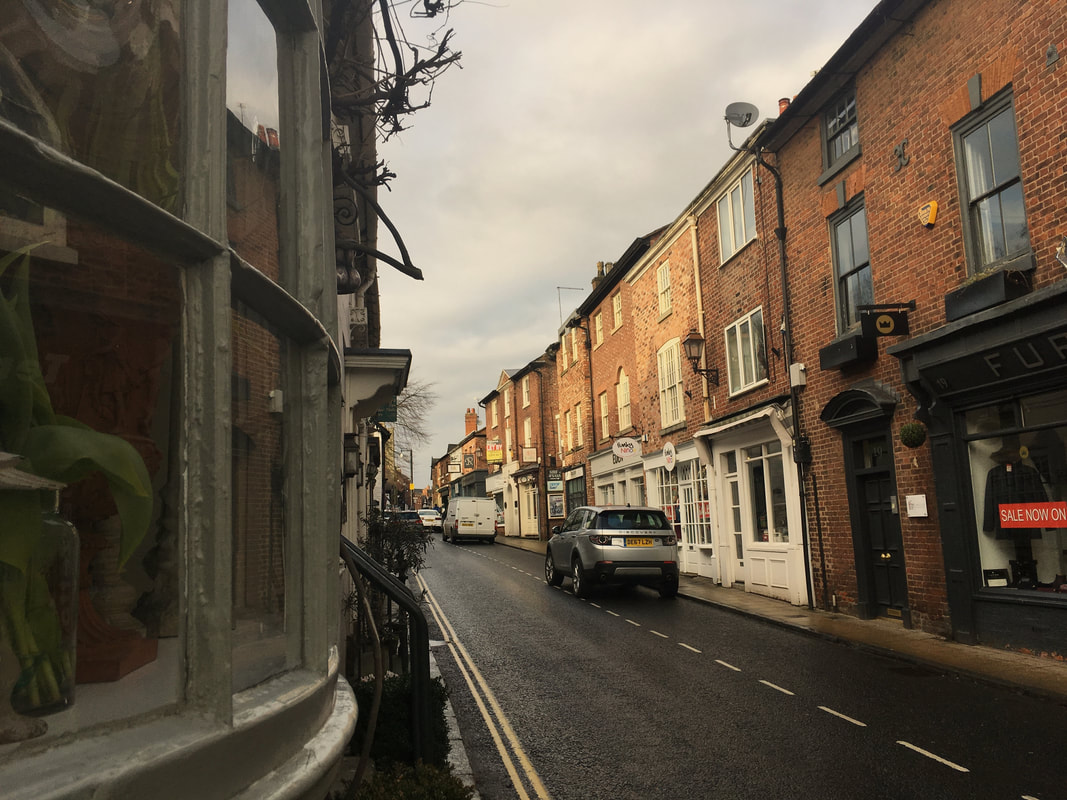 As you pass through the pedestrian gates either side of the cattle grid, you have three choices, left through the wooded area, straight on along the road and or to the right, down beside the lake, known locally as the Mere. All routes eventually lead you to Tatton hall, and even on the road you can get very close to the deer that nonchalantly roam the grassland. The park is popular with joggers, dog walkers & cyclists and one frosty morning, I saw a brave cyclist working up a sweat on a penny-farthing. This is not unusual given that we have the Penny Farthing museum in the town, home to over thirty Penny Farthings as well as what is believed to be the oldest bike in the UK. Worth a visit at the start or end of your walk as they also serve tea & cakes. At the end of the lake, known as the Mere, you automatically come back to the main road, which leads up to the Hall. You can stay on the road for ease or it’s not difficult to spot grassy pathways leading in a similar direction, which is softer underfoot. 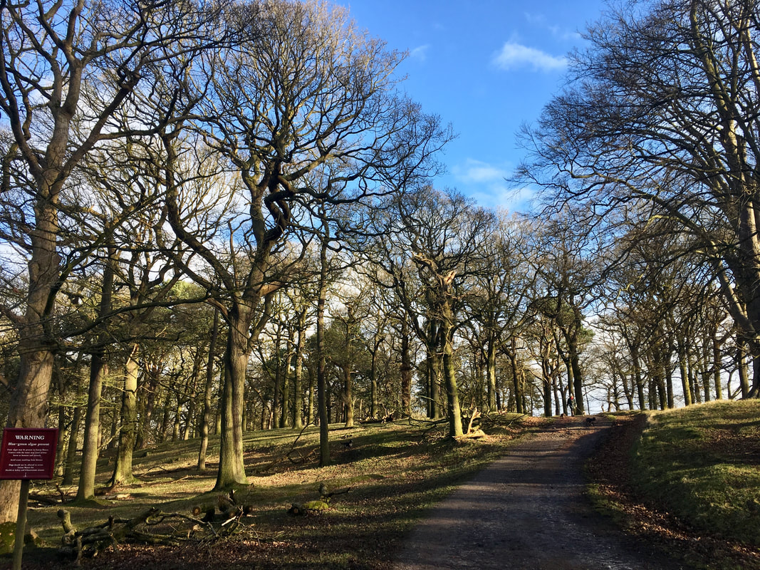 Once you reach Tatton Hall, which is about 1.5 miles from the main entrance, you can visit the mansion, the housekeepers shop as well as the gardens. In the summer months you can get lost in the copper beech maze, relax in the Japanese shrubbery or explore the walled kitchen garden. You can also buy fresh produce at the garden shop in the courtyard. You can head back on a slightly indirect route by heading left, towards the Rostherne Exit, then bearing right across the parkland, where on a clear day you can see the peak district. We are also in Manchester airport’s flight path and heads always strain upwards, when the impressively huge Emirates Airbus flies majestically overhead. You will hear it before you see it, so deceptively close you think you can touch it. As you head back towards Knutsford centre you can follow the edge of the lake the way you came in or head to the opposite side and get back to the town via Dogwood. Nothing to do with dogs, although it’s popular with dog walkers, it’s just the name of the wooded area with a well-surfaced path. Back in Knutsford there are plenty of food options before you head back to your car, a little taste of French cuisine at Brasserie Blanc or Spanish tapas in Evuna. Suffice to say there’s plenty to lure you back for another visit. If you would like to meet other women who love to walk and get walk idea inspiration, join Glamoraks. 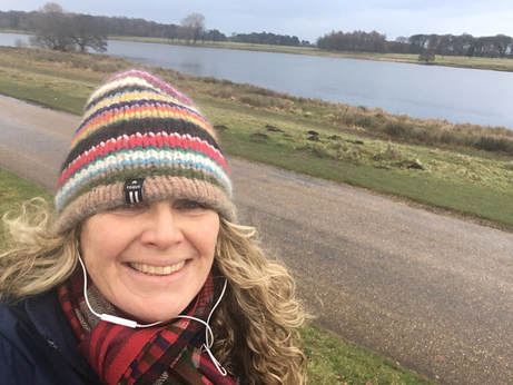 About the Author - Vanessa Williams
I am a 52 year old TV Producer & Director, still working in television on programmes like A Place in the Sun. I live in Knutsford, Cheshire, where I am lucky enough to have Tatton Park right on my doorstep which makes me feel like the lady of the manor with my own private estate.
2 Comments
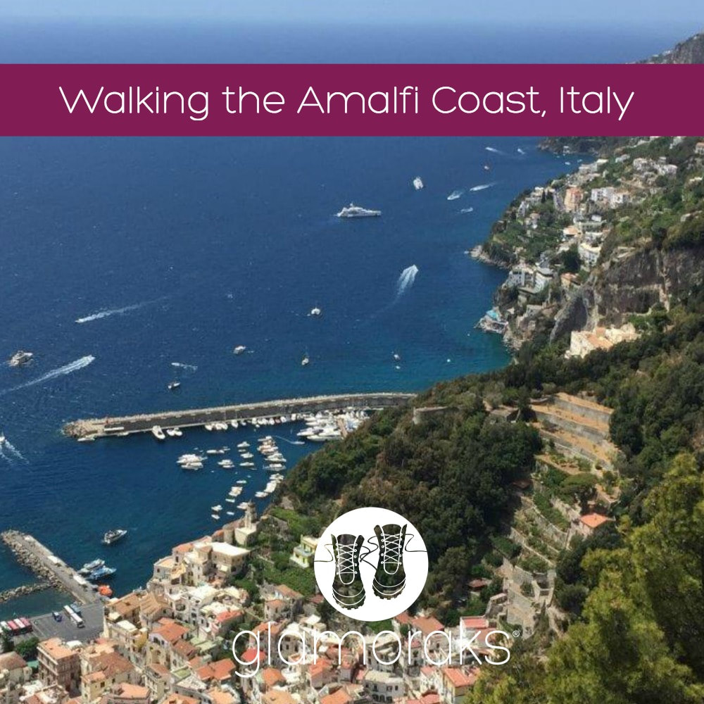 Lynda Gouveia, a South African now living in Sweden, chose to explore the Amalfi Coast on foot with her husband and three teenagers in the height of summer. She shares four of the day walks they undertook. Perhaps they'll whet your appetite to explore this gorgeous region. Distance: Each walk was between 10 – 14km’s - over four days Difficulty: Moderately difficult – loads of stair climbing and steep descents Type of terrain: Mountainside villages, forests, roads, paved paths and stairs Starting point: All of these walks start from Amalfi, either by taking the local bus to a nearby village high on the hilltop, or the route starts in Amalfi Approaching the area of Amalfi on the Italian coast just south of Naples, the mountain pass twists and turns far up the side of the mountain before starting to make its descent. The roads are barely wide enough for two cars and a sheer drop awaits on the other side of the barrier. As we descended into the town of Amalfi, nestled next to Atrani, I really began to wonder how we were possibly going to walk here. You certainly couldn't walk on the main mountain roads - you would take your life in your hands! Needless to say, I had nothing to worry about - this area is geared for walkers! We booked through Country Walks who provided excellent detailed maps and directions, as well as a contour map which was rather complicated. The local tourist office also has maps, and there are a number of books available online on walking in Amalfi. The routes are generally well signposted and some are colour coded red and white (CAI Club Alpino Italiano). Having read the maps and instructions we'd received, we opted for four walks with both moderate and easy options. There are loads to choose from though. Travelling with my husband and three teenagers, I wasn't sure what they'd be able to manage. The reviews had warned about stairs and knee problems and my husband's creaky knees were about to get the workout of a lifetime. They were not joking! Also as a result of our differing ability levels, we opted to stay in Amalfi in a lovely 4-star hotel and use that as our base. This was a really good call as we didn't have the stress of moving bags and when my teenage girls opted for a day on the beach instead of walking, it was not an issue. We found all the walks were about 3km’s longer than the distance guides gave, but I suppose that depends on your exact starting point and any wrong turns! If you’re planning on walking in Amalfi in summer (we were there for the last week in July), be prepared for heat and carry lots of water. We were lucky the week we were there as the temperatures hovered at around 26C, with a few thunderstorms forecast. The week after we left, the temperatures were all forecast to be in the mid 30’s! My apprehension about the kids not managing was unfounded. They coped really well and enjoyed it as much as we did. All in all, a fabulous family holiday. 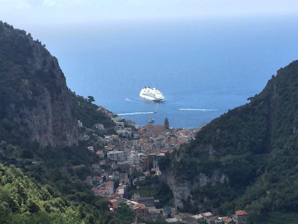 Day 1: Amalfi and Vallee dei Mulini with the additional part to Torre dello Ziro and returning via Atrani The walk on day 1 started with exploring the village of Amalfi and then climbing up through the terraces of lemon groves. I’ve never seen such large lemons! This is a steep start with stairs, but mostly paved. At the top of the hill when you’re in need to refreshments, there is the little town of Pontone, which has a shop and a toilet. From there we did a detour to the Torre dello Ziro, a tower which dates back to the 13th century, and climbed to the top to enjoy the most magnificent views over Amalfi and Atrani, before retracing our steps to the main path. The descent was long and steep with many stairs but this brought us into the winding tunnels and passages of Atrani and down to a delightful village square. From there the return to Amalfi has two options – a pedestrian walkway through a tunnel into Amalfi, or another climb through a tunnel and narrow passages to a high paved path between the two villages that again held beautiful sweeping views across the coast. This was a fantastic walk that we all loved. It gave a good overview of the area and had a little of everything. 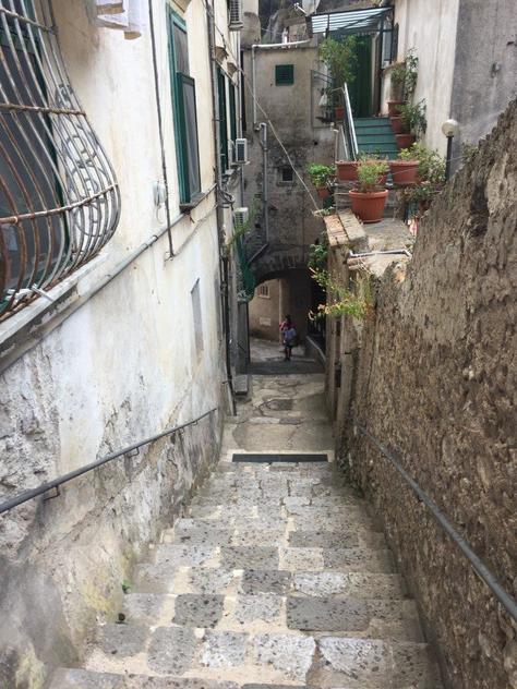 Day 2: Ravello & Scala This walk starts in Ravello so you need to catch the local bus from the Piazzo Flavio Gioia in Amalfi. Tickets are available to the tobacconist across the road from the square and when we were there in mid summer, the buses left every 30 minutes. We were cautioned to be early as the busses get very full and you don’t want to be standing as the bus winds its way up the treacherous roads. Note that the bus stops at Scala first, before going on to Ravello. After visiting the famous town of Ravello, the path leads along the contour of the hill to Scala. There are toilets near the main square in Scala but are very well hidden, so you’ll need to ask. From there, the path follows the road until Minuta and Pontone, both little villages perched on the top of the hill. Thereafter it is a steep, but easy to follow downhill walk on terraced paths between the lemon groves with hundreds of stairs. The route ends in the village of Amalfi. The kids were less keen on this walk – it wasn’t as varied as the day before and none of it was off road. 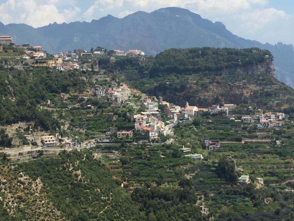 Day 3: Valle del Ferreire This walk starts in Scala, so again you need to take the Ravello/Scala bus and then walk on to Minuta. From there, you climb about 450 stairs onto a mountainside path that follows the contours of the mountain. We overshot the intersecting pathway and continued to follow the stairs way beyond where we should have, but were lucky to meet other walkers who redirected us. This walk is probably the most challenging and a couple of kilometres longer than the others we did, but is not difficult to follow. The high level path follows the contour of the mountain from one side of the mountain and around the valley, past a waterfall and on to the other side of the mountain. Probably the best aspects of walking in Amalfi, but this walk in particular, is that you can see at all times where you’ve walked from so you have a real sense of achievement – imagine walking semi-circles along the sides of a mountain from one peninsula to another. At points, this walk can be scary for those fearful of heights though. It is narrow and rocky in places, requiring some climbing, and has no railing. There is however vegetation on the narrowest, steepest part of the route which gives you a false sense of security. Walking poles were a real help in all the walks, but this one in particular. The valley walk ends in the little hilltop town of Pongerola where there is a toilet at the bar/café. The café also serves the best lemon granite I’ve ever tasted! From there, the descent wound through houses and apartments on a steep paved path with, again, lots of stairs until emerging above the sea in Amalfi. A bus from Pongerola to Amalfi is an option too. A stunning walk! 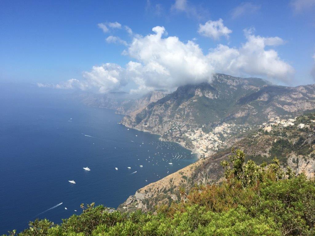 Day 4: Positano and the Path of the Gods
The well known Path of the Gods or Sentiero degli Dei starts in the neighbouring town of Bomerano (you need to take the Agerola/Bomerano bus). The walk starts from the town square a block or two away from the bus stop. This was definitely the busiest walk – a walk done not only by serious walkers but people in swimming costumes and sandals. This walk was relatively easy, with the exception of the gruelling descent into Positano. The path winds its way along the side of the mountain towards Nocelle, Montefaruso and then Positano and on a clear day, you can apparently see all the way to Capri. After passing through the delightful little village of Nocelle, you reach Montefaruso high above Positano, where you can decide whether to walk down or catch a bus. There are toilets at the bus stop. We split up and two of the children and I walked down approximately 1300 steps to reach Positano, a bustlingly busy tourist destination. Apparently standing in the bus on the way down the hill was less than comfortable, so I think the walk was the better choice. We returned to Amalfi by boat which gives you the perfect opportunity to see where you’ve walked from. About the Author: Lynda Gouveia I am South African, but my family and I moved to Stockholm, Sweden 6 months ago and we are really enjoying being close to Europe and all it has to offer. I have three teenagers – identical twin girls and a son who is one year younger, and I’ve been married for 18 years. I am self-employed and work as a business and executive coach and people development consultant. In between, I make time for my passions which are walking, preferably long distance, photography and painting. I grab any opportunity to walk with both hands, and if I can take a few photos along the way, all the better. If you want to explore more of the world and find other women to walk with, join Glamoraks.  A choice of two short walks on the Hertfordshire and Bedfordshire border, with an abundance of nature regardless of the season. Distance: 3 miles extending to 4 and more. Terrain: easy with some moderately steep climbs. Fields and a bridleway. Height: up to 450 feet. Starting Point: Motte & Bailey Pub, Pirton, nr Hitchin, SG5 3QD You’re getting two walks for the price of one here. Both routes are on the edge of the Chilterns and around 3 miles long. The first is circular, done clockwise or anti-clockwise. The second is straight up the hill to the edge of Knocking Hoe Nature Reserve and back. If you want to extend your walk, you can follow the way marks from this point and go further into Bedfordshire, although an OS map would help! Part of the route is on the Icknield Way, which extends from Dorset to Norfolk and has the claim of being 'the oldest road in Britain' as it is made up of prehistoric pathways. Both walks start in Pirton, a small village forty miles north of London, on the border of Hertfordshire and Bedfordshire. Just thirty minutes by train from Kings Cross, it makes an easy escape from the city and the chance to breathe in some fresh air. Plus you'll get to see a traditional Doomsday village complete with old cottages, two pubs, a duck pond and Highdown House, an old Jacobean mansion with an interesting history. Although this walk is popular with families on Boxing Day, any other time of year you won't typically pass more than a couple of dog walkers making it a good option to escape the hustle and bustle of city life. There are a couple of steep hills peaking at around 450 feet. In summer you can get by with almost any type of shoes, but if it’s been raining you need boots because part of the lane gets muddy. I’ve ended up on my bottom more than once, but thankfully no one saw me. In early autumn there are plenty of blackberries, so take a container or eat as you walk. What’s nicer than a warm, juicy blackberry, straight from the hedge? I walk from my front door as I work mainly from my home in Pirton, but if you're travelling in, park outside the Motte and Bailey pub. If you have caught a train from London, get off at Hitchin Station and get a taxi to the pub in Pirton (it's about a 5 mile trip and will cost approximately £8). From the pub, walk left to the main road to Hitchin, passing a wooden Pirton sign with hands holding straw on your left. In case you're wondering about the straw sign, this walk is part of the Straw Plaiters walk. In the 19th century, Pirton’s women and children collected the straw, from wheat growing on the chalk soil, for the hat making industry in nearby Luton. Cross the road and go straight ahead to Wood Lane, with a large house on your right. You can walk up the shady lane which has a canopy of trees or, for better views, walk along the edge of the field running parallel, where an ‘unofficial’ path has been worn. After a quarter of a mile or so there is a path to your left across the open field (waymarks are here.) Turn left if you want to walk clockwise. Carry straight on for an anticlockwise route, turning sharp left at a wooden seat. Go straight on up the hill for the second walk to Knocking Hoe Nature Reserve. These directions are for the clockwise route. Follow the path over the field and keep right to a kissing gate. Go through the kissing gate and climb the steep hill. Highdown House, a Jacobean mansion once a Cavalier stronghold, is on your left. There is supposedly a ghost in it and a headless horseman who rides across the field on 15 June. As you walk, keep your eyes open for wildlife: free range guinea fowl belonging to the house, muntjac, pheasants, buzzards and roe deer. At the top of the hill pause and look across the fields. You can see for miles and there are usually buzzards circling overhead. This is a great spot for a picnic – a couple of massive old oaks and soft grass. Don’t go to the end of this field, but bear right down the hill to another kissing gate. In spring there are masses of bluebells in the wood to your left - Tingley Wood. (You can’t go in- it’s private – but you can stand at the gate and admire the view.) At the bottom of the hill there’s a wooden seat – a favourite picnic spot for walkers. You’d complete the circuit by turning right. For the second walk, turn left at the seat and continue up the hill. At the top of the hill, bear right towards a wood. Very soon you will see the sign for Knocking Hoe Nature Reserve opposite a seat with a wood behind. There is public access into Knocking Hoe, but the footpath to further routes continues outside the reserve, down the hill, where there are some way markers. These can take you to the B655 road which you cross to access other walks. In the Nature Reserve in summer you will find lots of butterflies and wild flowers, some of them rare. The views are lovely, it’s usually quiet and you can easily find a sheltered spot to eat or drink. Definitely worth the climb to get there! 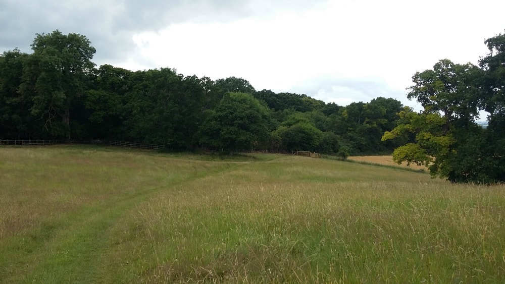 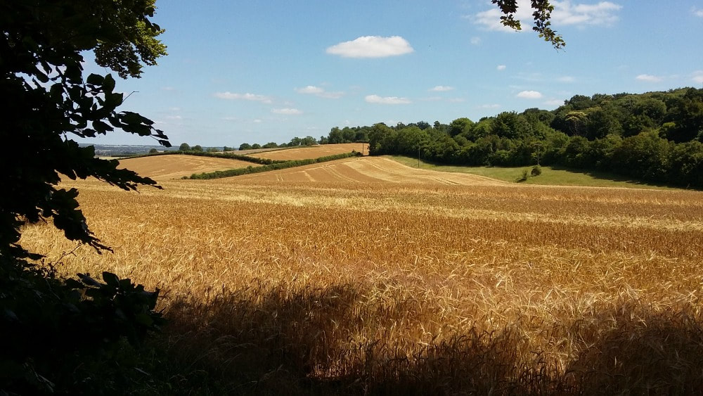 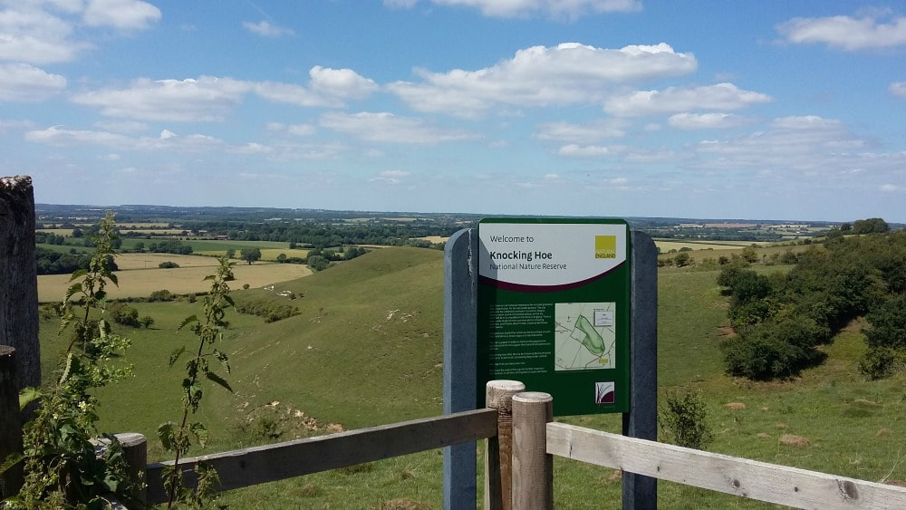
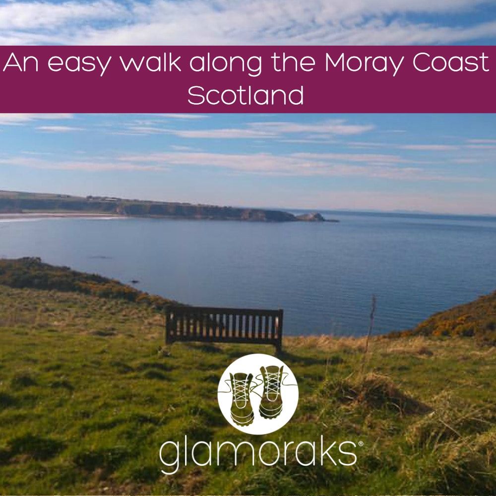 Moray coastal walk (North East of Scotland) Cullen to Findochty Distance: 12km (7.5 miles) Difficulty: easy Type of terrain: beach, cycle path, village streets Start point postcode: Cullen - village square. A98 post code for sat nav would be AB56 Resources: OS Map 425 Everyone needs that one place where they go and all their troubles melt away, a place to think, plan and breathe. Cullen is that place for me and this walk is my go to walk when I just want to chill out. There’s something about the air on the Moray coast. It’s cleaner, fresher and just altogether better. This is an easy walk with no need for any special walking gear. It is along a section of the moray coastal trail of around 12 kilometres taking around 3 hours to complete. The path is on a well-established cycle route and via village streets. I walk a section over the beach, but this can be missed out if you’re not the sand between your toes type. The village of Cullen is where I start this walk. It’s famous as the birth place of the famous Cullen skink soup, which is a delicious creamy fish soup. If you have time for a bowl I would highly recommend it. The village has a few cafes and antique shops to browse. You can park in the village square. Parking here is free and there are public toilets. This is on the A98 post code for sat nav would be AB56. I would walk back up the hill as if heading back out of the village and follow the signs for the caravan park. Once at the caravan park there is a path which leads along the cliffs and towards a view point known as Nelsons Seat. This is a great spot to gaze over the Moray Firth and if you’re lucky perhaps spot a dolphin. From here continue on the path down toward a small rocky beach which on a sunny day is perfect sun trap and has few visitors. Be warned if you fancy a paddle here it’s very rocky and not the safest without some sort of water going footwear. 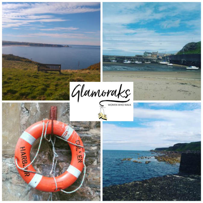 At this point you would have 2 choices you could follow the path on the right which takes you along the cliff side and on to Sunnyside beach and Findlater castle. I have never been able to take this path as I have a fear of heights and find it too much to pass over the narrow path. I therefore take the path round to the left and if you follow this you will head back to Cullen. Just before you re-enter the village you pass a small pet cemetery. I find this quite a touching place to have a look around and a reminder of how special our animal friends can be. Once back in the village I follow the street past the harbour and head towards the beach. You will see the rock formations known as the Three Kings and then walk along the beach. There is a path just off the beach which heads through the golf course that connects to the main cycle route. Then follow the cycle path to the village of Portknockie and onwards to Findochty. Once in Portknockie you head off the cycle path. The next part of the cycle path is signed posted, follow these through the village and admire the lovely village homes before picking up the cycle path again to Findochty. This section is quite exposed to in parts and can be cold on a windy day but has amazing sea views. The path continues on past Findochty to Buckie and Spey Bay and beyond. My last visit to this route was early spring and I left it a little late to continue along the path, on reaching Findochty I took the same route back to Cullen and ended the day with a lovely coffee and brownie in the Rockpool café. Want to meet other women who love to walk? Join Glamoraks.  This post was contributed by Glamorak Linda Chessor
I’m 43 years old. I live in the north east of Scotland. I do mainly coastal or forest walks. I'm not the best at hills, but do attempt them now and again. My sister is lucky enough to live in the Cairngorms so she does occasionally get me up a hill. I'm a nurse and work 12 hour shifts, so walking for me is the best way to unwind from work and gives me four days most week to get out and about weather permitting. I occasionally walk with my www.borrowmydoggy.co.uk friends Bix and Hunter. 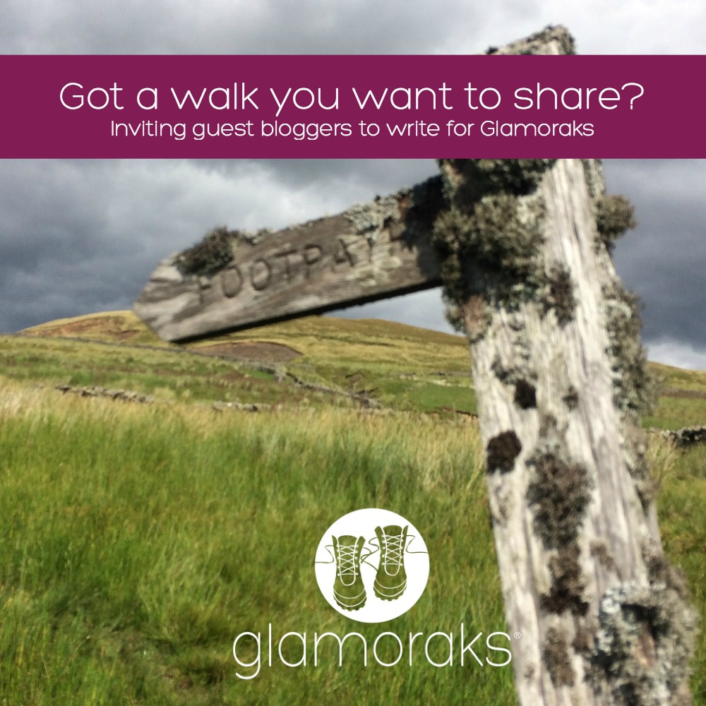 If you are a woman who loves to walk and write, I want to hear from you. Glamoraks is a group for women around the world who love to walk. I want to be able to share walks, thoughts and inspiration from likeminded women no matter where in the world they are. And to do that, I need guest bloggers from every corner of the globe.
Wouldn't it be great to see walks in Croatia or Japan or Argentina or USA or Botswana or anywhere? If you're in the UK, what about walks in areas you've not visited or even new walks on your doorstep? It doesn't matter which country you live in or visit, if you have done a great walk there, I want to know about it. They can be short walks, day walks, multi-day walks or adventures/expeditions involving walks. So please share this far and wide. This is your chance to be part of a global voice of women who are heading outdoors in search of themselves. If you want to know more about what a Glamorak is, you can read about it here. I welcome guest bloggers. Here's what I need from you to have your story published on this site:
Please send your blog post or post idea with one image to [email protected] - if I can use it, I will ask for further images (if you have them). Become part of a global voice of women who love to walk! Your post will be shared on this public blog PLUS in the Glamoraks online community. Terms and conditions for guest bloggers: By submitting a blog post to Glamoraks, you acknowledge that you understand and comply with the following:
|
Categories
All
Archives
July 2024
|

 RSS Feed
Get social. Follow us.
|
Don't get left out.
Add your email to be alerted about any Glamorak events, walks, get togethers, challenges or news.
Success! Now check your email to confirm your subscription.