|
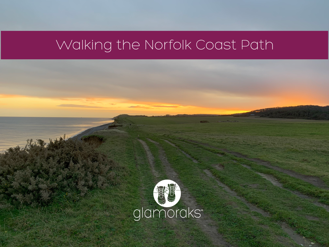
Just about every plan that I made in 2020 was foiled due to Covid. So when I had a long weekend just before Christmas, I cast about looking for somewhere I could go that was also a Tier 2 zone at that time, wasn't the other end of the country and was a multi-day walk that I could return to a base everyday to reduce Covid risks as opposed to staying in multiple places. Oh, and it had to be somewhere I wanted to go. Norfolk was the answer - the Norfolk Coast Path to be precise. At the time, it was tier 2 like York, and ticked every other box. I didn't have the time to do all of it as it's 84 miles running from Hunstanton to Hopton-on-Sea, but I did a good chunk. Using the Coasthopper bus, you can pick a base somewhere along the route and always make your way back again. Two points on the bus:
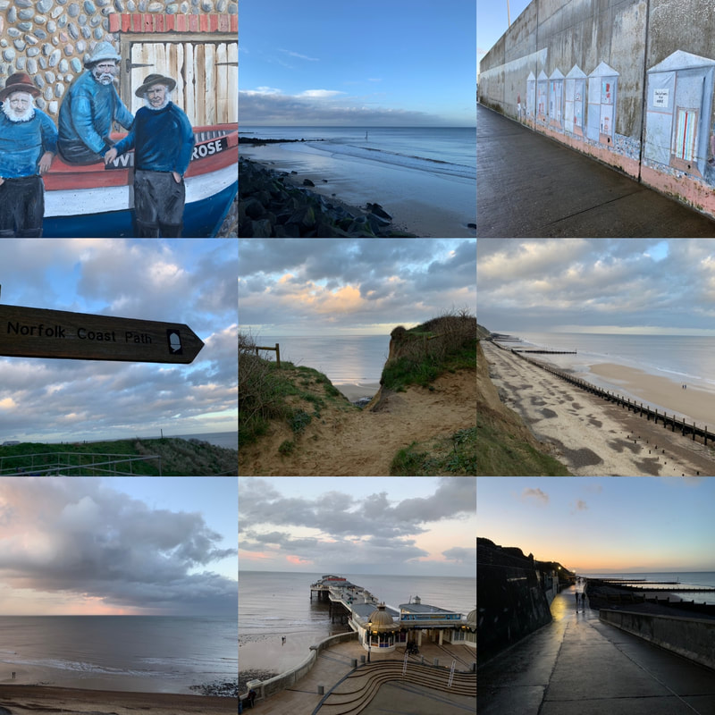
Day 1: Sheringham to Cromer (4.5 miles)I arrived after lunch so couldn't go for a long walk before it got dark, so as I was based in Sheringham, I did the short 4.5 mile walk along the coast to Cromer. Sheringham has a lovely promenade decorated with an art trail. Seaside scenes are painted along the length of the promenade, creating an outdoor art gallery on one side and beautiful views along the beach and out to sea on the other. The sandy beaches in Norfolk are broken up with groynes (wooden fences that stop beach sand being washed away by long shore drift - I only know this because I once had to help my 10 year old do a geography project and I've always wanted to share that valuable knowledge again). Anyway, besides row after row of groynes and idyllic views out to sea, with wind farms far offshore, there isn't much of note on this short walk other than Beeston Bump. And here I will quote directly from wikipedia or similar: 'Beeston Bump is a part of Cromer Ridge, a range of low hills left behind when the glaciers retreated at the end of the last Ice Age between 15,000 and 10,000 years ago. The hill was used as the location for a top secret ‘Y’ listening station during World War II and the concrete remains of this can be seen on top of the hill.' So there you go. You'll also walk past quite a few not very pretty caravan parks and an area of scientific interest where the fossils of an extinct elephant, twice the size of current African elephants, was found. Who knew?! Cromer itself is a bustling town with a pier, pretty church and plenty of places to get something to eat or drink. However, I caught the bus and returned back to my base as it was getting dark. I had hoped to retrace my steps but I didn't fancy walking through semi-populated caravan parks alone and as much of the path was along a steep cliff edge, that didn't seem sensible to tackle in the dark either. Oh well, I'd make up for mileage on day 2.
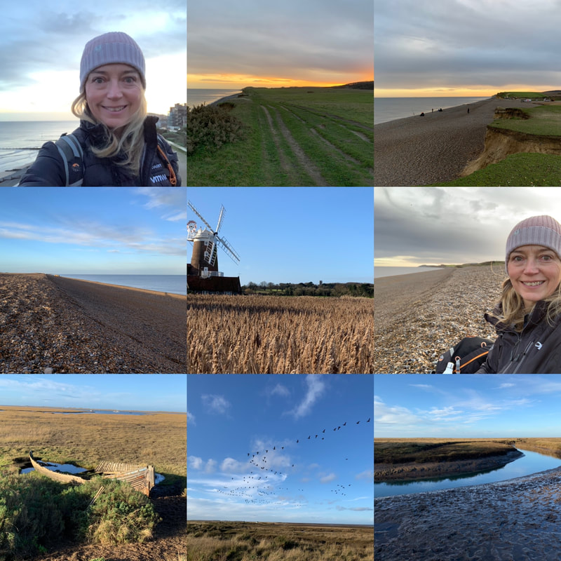
Day 2: Sheringham to Stiffkey (16 miles)Not wanting to get caught out by the lack of light again, i set off early. 7.30am just as the sun was rising - glorious. The early morning walk gave beautiful views once again along a cliff top. The path then drops down onto a pebbly beach and despite having the beach to myself - bar some anglers early on - it was tough going. Walking on pebbles kills the ankles but the serenity made it worth while. I sat on the beach having a coffee and watched a seal frolic in the sea in front of me - magic! Slightly less magic was the series of military buildings that run above the beach with large guns pointing out to sea and a weird beeping noise coming from somewhere..... I left that behind and made my way along the beach, with military buildings being replaced by marshland, a bird watcher's paradise. And indeed I saw many of those. I felt rather out of place not wearing green camo and without a long lens camera to hand. But the twitchers were having a fine morning admiring the birds. I made my way to Cley-next-the-sea that has a rather marvellous windmill and an even more marvellous coffee shop that sold giant scones and very good cappuccinos. Having refuelled, I set off again following the river Glaven out to sea before the path wove itself in and around marshland until Blakeney. From there, more marshland which at times looked like a boat cemetery teaming with birds. A handy sign saying Coasthopper showed me where to head up towards Stiffkey (pronounced Stookey just to fool people). I had really wanted to continue onto to Wells-next-the-Sea and I had daylight, just. But I no longer had phone battery and didn't want to get lost out on the marshes without it. So I headed into Stiffkey and passed the time waiting for the bus in the Stiffkey stores, which are definitely worth a visit. Lovely gift shop and I could have bought myself many Christmas presents had I had a bigger backpack. They also sell coffee! The bus stop is right outside the store, making it easy to get home.
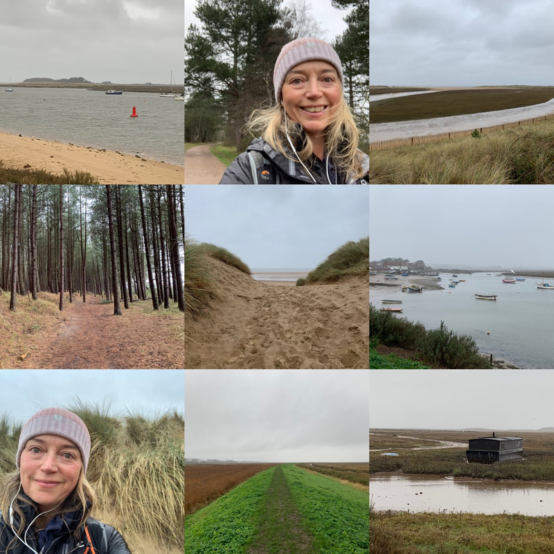
Day 3: Wells-next-the-Sea to Burnham Deepdale (12 miles)This was a very, very wet day. Torrential rain and wind that blew it sideways into my face - but that's the kind of walking that makes you feel alive. While I really wanted to walk that missing gap between Stiffkey and Wells, as the buses require a change at Wells, I decided it would have to be missed. I drove to Wells instead, parked on the quay side, got a coffee to stave off the cold and headed off. From the quayside, there is a long walk along a causeway down to the sea. When you get there, instead of heading onto the beach, you follow a woodland path that runs behind the sand dunes. It's pretty and peaceful but I wanted to see the sea. At last, you pop out at Holkham Gap (incidentlly there is a visitor centre here and loo.....because you know, the coffee you started out with.) And here you at last walk along the beach with views out to sea. You can also walk along more forest, just as pretty but I wanted to feel the wild sea wind blowing my face off. You track this section for what feels like a long time, with the scenery changing again, this time grass covered dunes. I was entirely alone in amongst them and felt like I was the last person on the planet. No pandemic or risk of infection - just me. Alone. After stopping for a little rest on the beach, I trekked along a raised dyke across marshland, with plenty of birds to look at as I went. I arrived at Burnham Overy Staithe and was tempted to call it a day due to just how wet it was. My waterproofing had given up and was now causing seepage. But I hadn't travelled to Norfolk to give up because I was damp. I soldiered on. I almost immediately regretted that decision. The bit from Burnham Overy Staithe to Burnham Deepdale is a long, long, long trek across marshland where there is very little to see in any direction. In fact I'd go so far as to say it felt a bit scary being quite so stuck out in the marshes miles from everyone. I know in reality it wasn't that far away, but it felt it. What made it worse was the mud. Every step taken forward meant a half step slide back or sideways. It was an epic work out, particularly when I realised that I had just 40 minutes to make the next bus or have to wait in the rain a full hour for the next. So I attempted to run. You try running in heavy boots on slippery mud.... Anyway, I made it with five minutes to spare looking like a drowned rat. I caught the bus back to Wells, got my car and got back to my base to heat through. I had hoped to walk from Burnham Deepdale to Hunstanton, the last bit of 10 miles, but I had to get back and be a mother. I did however drive the route and a lot of it looked similar to the marshlands of the day prior, so I felt I'd seen enough of that for a while. In short, it was a lovely mini multi-day walk with scenery that really does change every few milies. Who knew there were so many different types of shore lines? I do now. If you would like to do a walk like this but want company, join the Glamoraks App or Facebook group (it's free) and find like-minded women to walk with.
1 Comment
|
Categories
All
Archives
July 2024
|
||||||||||||||||||
Get social. Follow us.
|
Don't get left out.
Add your email to be alerted about any Glamorak events, walks, get togethers, challenges or news.
Success! Now check your email to confirm your subscription.


 RSS Feed