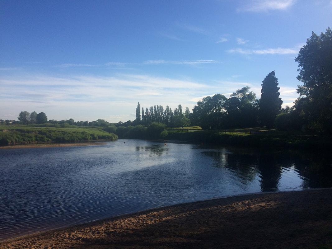
 Start point: YO30 1DB Distance: 3 miles circular or 8 miles linear (ending in York) Terrain: Paths, some overgrown in summer, very muddy in winter Last week I had the privilege of taking a Sunday Telegraph journalist and photographer for a walk around Beningbrough Hall. It always amazes me how many people in York aren't aware of what a gem we have right on our doorstep. Beningbrough Hall is a National Trust property. Surrounding the hall is a stunning 3-mile loop walk and as it's outside the grounds of the Hall itself, you don't need to pay to walk it. You can park in Newton-on-Ouse and follow the footpath signs as you head toward the river. Or you can park at the opposite entrance at a small carpark that asks for a donation to the Air Ambulance. Option three is to park outside Home Farm, a lovely farm shop and cafe, as long as you return as a customer after your walk (an excellent idea by the way as it have fabulous cakes.) Simply follow the path along the river, getting glimpses of the Hall as you go. Roughly half-way along the loop you will find a secret beach and wild swimming spot. On hot sunny days, it is an idyllic setting. You can even catch a ferry on the weekends over to Nun Monkton, where after a short stroll, you will find a pub - The Alice Hawthorn. You continue the loop, depending where you started from and then follow the track around the back of the estate, through woods for a section before ending up back where you started. You can't really get lost and you can vary the loop direction. There is also a pub - The Dawnay Arms - in Newton-on-Ouse if you started out there and want to have a drink in a beer garden that goes down to the river.
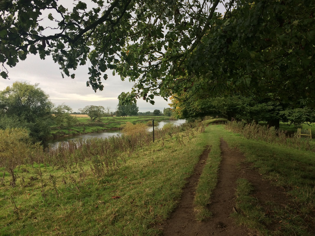
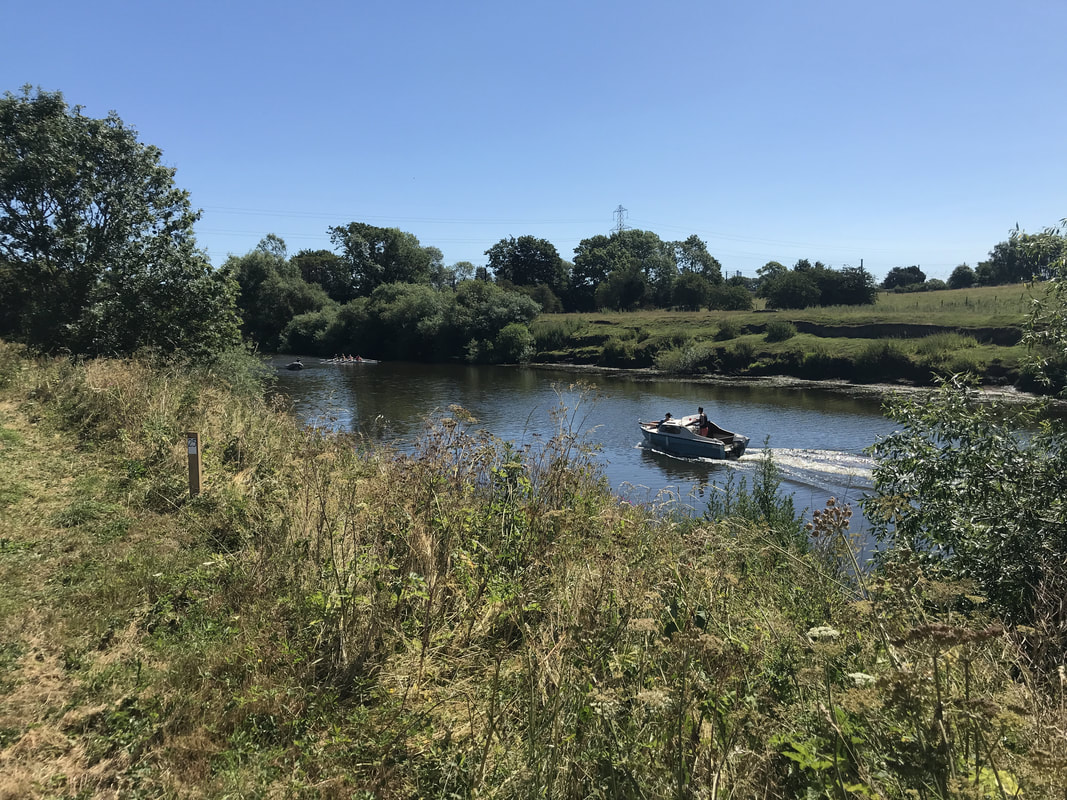
But if you're after a slightly longer walk, you can walk directly from the centre of York to Beningbrough or vice versa. A group of Glamoraks recently did exactly this. We started at Beningbrough (you will need to be dropped off as it's a one-way walk unless you fancy doing 16 miles there and back). Start at the little carpark outside the entrance (not the Newton on Ouse side) as indicated in the image below: 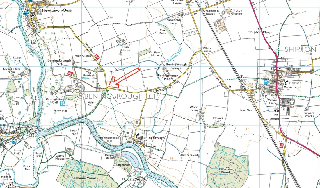 The route: 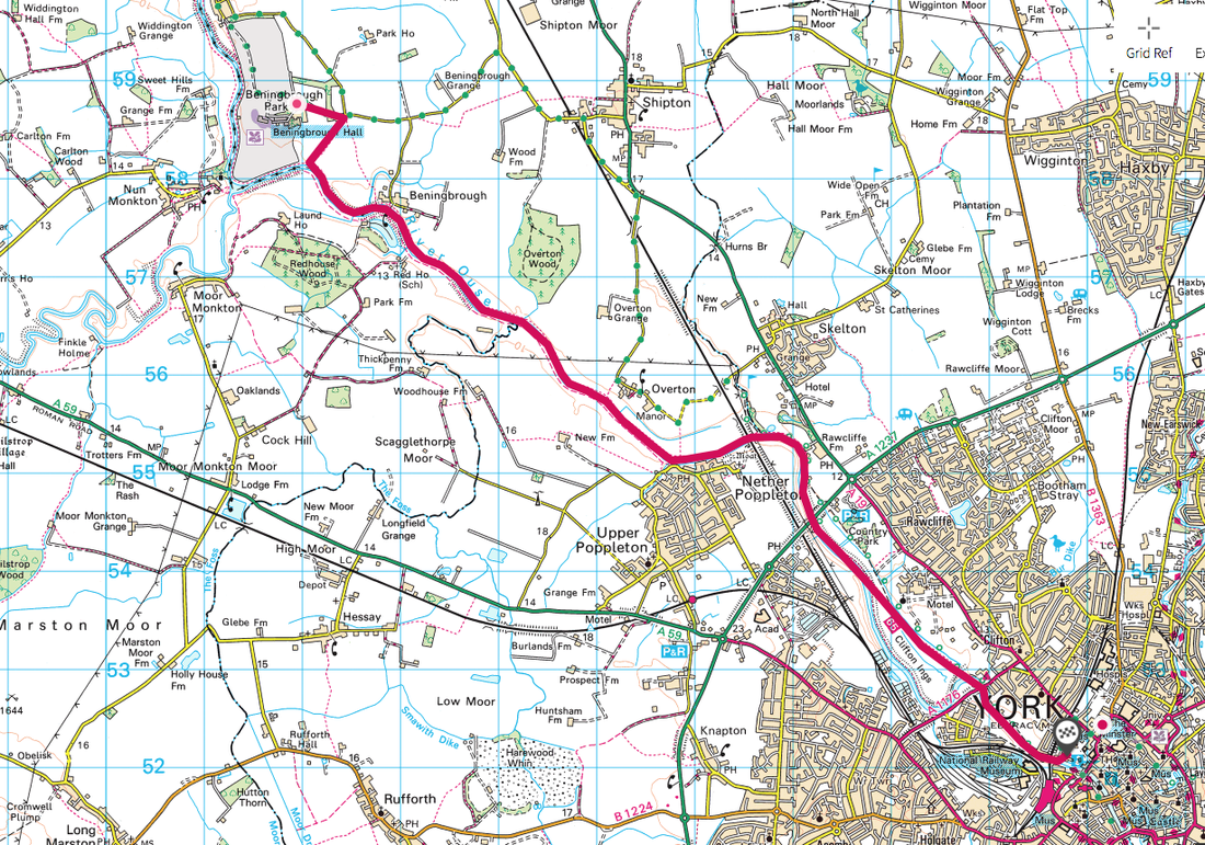 Follow the footpath that runs alongside the woods, heading towards the river. When you reach a gate, go through it and instead of following the path ahead (the loop walk mentioned above), turn to your left. There will be an indistinct footpath that leads to a raised path alongside the river. Now you simply follow that, keeping the river on your right all the way. You will go past a row of houses at the village of Beningbrough and a few more as you near Overton. Poppleton will start to be seen on the opposite bank. As you go underneath the railway bridge, you will have a bit of an overgrown path to navigate before crossing a small footbridge. Just after the bridge, your path will intercept the cycle path (route 65). Turn right onto the cycle path and follow it.
It will curve away from the river along a row of pretty houses. Just after the houses, turn right still sticking to the cycle path. If you go straight you will hit the A19 (you don't want to do that). Keep following the path underneath the A1237 and keep going. You will pass the York Ings (flood plains) and eventually will start to get into the built up city centre. The path ends at Museum Gardens, where you will be spoilt for choice with places to get a cold drink. The Star Inn the City has a lovely outdoor terrace overlooking the river, for a cold pint of something reviving after a hot summer's walk. There are no places to stop for a drink or food on the way so do take water and snacks with you. I also recommend long trousers in summer as the path can be overgrown with nettles in places. Alternatively, walk the other way going York to Beningbrough - just as simple. The only place you could go wrong is to miss the path that goes off to the left of the cycle route. You'll spot it as there is a bench on the side of the path at that point When you get to Beningbrough, enjoy a fine lunch or afternoon tea at Home Farm. This is one my regular walks and it's a great one. Just be careful of the Giant's Hogweed that grows in some parts along the route. You don't want to touch it. It causes dark painful blisters that form within 48 hours, and result in scars that can last anywhere from a few months to six years. Touching giant hogweed can also cause long-term sunlight sensitivity, and blindness if sap gets into a person's eye. It looks like this: 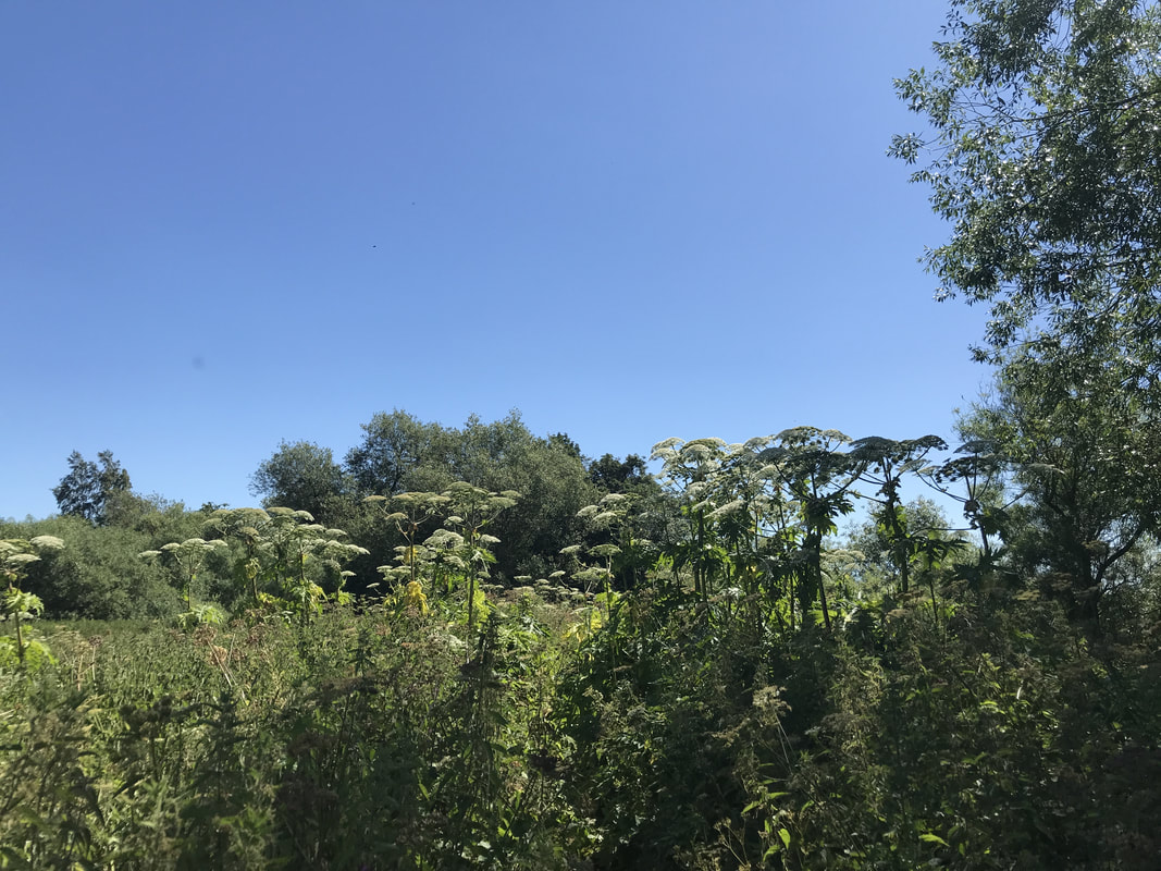 Here's the piece that the Sunday Telegraph did on the walk: 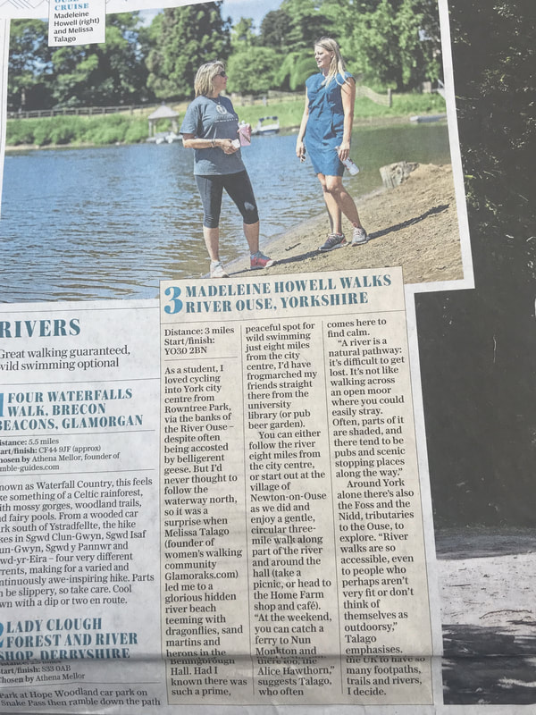
0 Comments
June - what a fabulous month. If you're in the Northern Hemisphere, that means it is summer which is already a great reason to get out walking. But here are seven other slightly quirky reasons to get your boots on this month:  1. It's National Fish & Chips Day on 1 June There is truly nothing better than going for a long coastal walk and ending it with some delicious fish and chips. If ever you needed an incentive to get outdoors and feel fully justified in having this less than healthy treat, this is it. Walking burns calories. Tuck in with impunity. One of my favourites are the chips from Magpie Cafe in Whitby (as pictured above) after walking a stretch of the North Yorkshire coast. Where is your favourite walk with fish and chip stop?  2. Go on a butterfly safari The 2nd of June is Butterfly Education and Awareness Day. Which in my book is just a good excuse to head out for a walk and see how many different butterflies you can spot. This Guardian article gives some good ideas of which butterflies you can see where. But frankly, just head out and see what you can see. It's also a great way to get younger kids outdoors - tell them they're going on a butterfly safari and they won't realise they're walking. 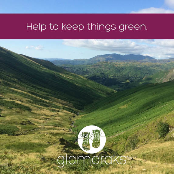 3. Help protect the environment 5 June is World Environment Day. As walkers, we thrive on the beauty of the countryside, but all too often people leave their litter lying around. Why not head out on a walk and pick some litter up as you go? Plogging (jogging and picking up litter) is all the rage, so why not extend it to your next walk and do your bit for the environment. You'll get the fresh air and exercise with a side order of feel good for doing something great for the countryside. Another way you can help ensure we can all enjoy the great outdoors is by cutting back on plastic. Instead of taking a single use plastic water bottle with you on your walk, replace it with a reusable bottle. #BanPlasticPollution. 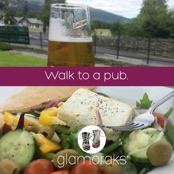 4. Enjoy a pint at a pub after a good long hike Ah - an ice cold pint of beer in a sunny beer garden after a long, hot walk is sheer bliss. And 15 June is the perfect day to do it because it's Beer Day Britain. Whoop! And it's a Friday. Here's the idea. Plan a day off walk. Grab a group of friends (or find some Glamoraks in our online community of women who walk) and head out for a walk and a pint. You will feel like you've had a mini holiday just by doing this one simple thing. 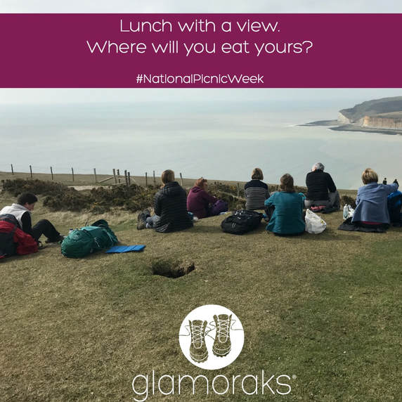 5. Have a picnic If you prefer your lunch with a view, June is the perfect time to do that as it's National Picnic Week from 15 - 24 June. You can make your picnic as fancy as you like, or just grab a couple of sarnies, a cold drink and a favourite chocolate bar - then head off with some friends. Choose your perfect viewing spot just as your feet are starting to ache. Get those boots off and wriggle your toes around while you tuck into your feast. Lie back and enjoy the sun on your face. Life doesn't have to be complicated to be pretty darn perfect. (This picture was taken during a Glamoraks walking weekend - our picnic spot had a view of the Seven Sisters. Stunning.) 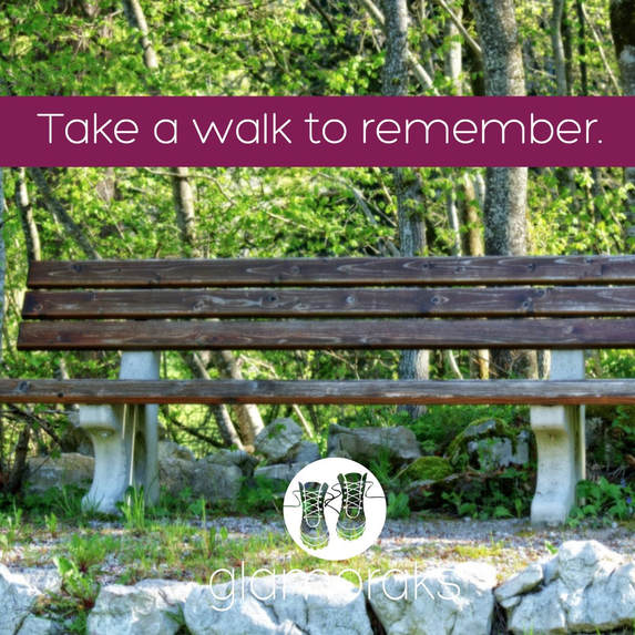 6. Remember your dad It's Father's Day on 17 June, the perfect time for a family walk. But if your dad is no longer around and you don't have family to go walking with, why not head out on a walk on your own - or with a friend if you're not confident (try the Glamoraks community) and enjoy a peaceful walk in a place he would have loved. Take time out to remember him and return home feeling calm, peaceful and ok with things just as they are. 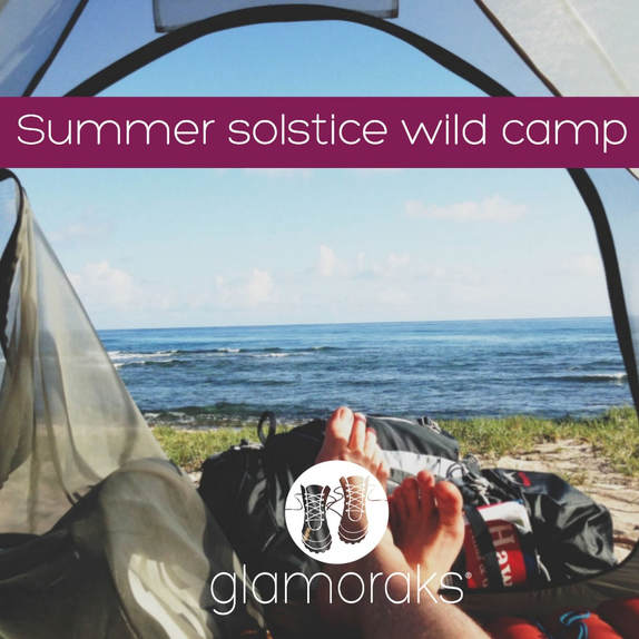 7. Celebrate the Solstice with a wild camp
On 21 June we celebrate the longest day of the year. It's the perfect day to go on an adventure so why not plan a wild camp? After work, head out to a hill or a stretch of coast. Grab a bit of dinner at a pub on the way or take a meal with you. As the sun only sets around 10pm, you have plenty of time to walk and find a spot. As with all wild camping, you should ideally get the land owner's permission but if you can't, be sure to set up camp late and leave early. Not brave enough to go on your own? Head over to Glamoraks and ask in the community. With enough notice, you will hopefully find a fellow adventurer. If the forecast is to be rain free, don't even bother with a tent. Just take a bivvy bag and a sleeping bag and sleep under the stars. You will feel as though you've conquered Everest afterwards and you may just become addicted to the wild camping life. If you are a woman who loves to walk or go on adventures, join Glamoraks, an online community that helps you find other women near you. For your life to get a whole lot happier, all it takes is one small step into new adventures. Join us! 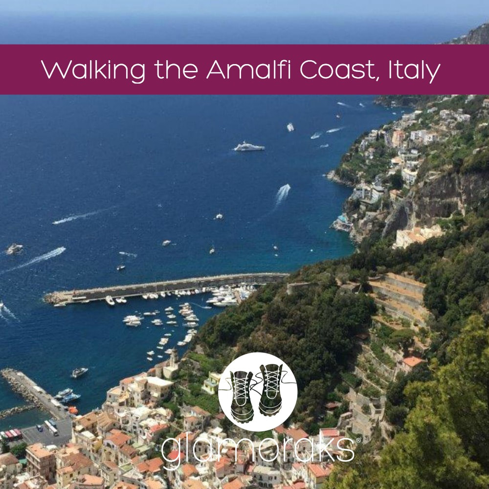 Lynda Gouveia, a South African now living in Sweden, chose to explore the Amalfi Coast on foot with her husband and three teenagers in the height of summer. She shares four of the day walks they undertook. Perhaps they'll whet your appetite to explore this gorgeous region. Distance: Each walk was between 10 – 14km’s - over four days Difficulty: Moderately difficult – loads of stair climbing and steep descents Type of terrain: Mountainside villages, forests, roads, paved paths and stairs Starting point: All of these walks start from Amalfi, either by taking the local bus to a nearby village high on the hilltop, or the route starts in Amalfi Approaching the area of Amalfi on the Italian coast just south of Naples, the mountain pass twists and turns far up the side of the mountain before starting to make its descent. The roads are barely wide enough for two cars and a sheer drop awaits on the other side of the barrier. As we descended into the town of Amalfi, nestled next to Atrani, I really began to wonder how we were possibly going to walk here. You certainly couldn't walk on the main mountain roads - you would take your life in your hands! Needless to say, I had nothing to worry about - this area is geared for walkers! We booked through Country Walks who provided excellent detailed maps and directions, as well as a contour map which was rather complicated. The local tourist office also has maps, and there are a number of books available online on walking in Amalfi. The routes are generally well signposted and some are colour coded red and white (CAI Club Alpino Italiano). Having read the maps and instructions we'd received, we opted for four walks with both moderate and easy options. There are loads to choose from though. Travelling with my husband and three teenagers, I wasn't sure what they'd be able to manage. The reviews had warned about stairs and knee problems and my husband's creaky knees were about to get the workout of a lifetime. They were not joking! Also as a result of our differing ability levels, we opted to stay in Amalfi in a lovely 4-star hotel and use that as our base. This was a really good call as we didn't have the stress of moving bags and when my teenage girls opted for a day on the beach instead of walking, it was not an issue. We found all the walks were about 3km’s longer than the distance guides gave, but I suppose that depends on your exact starting point and any wrong turns! If you’re planning on walking in Amalfi in summer (we were there for the last week in July), be prepared for heat and carry lots of water. We were lucky the week we were there as the temperatures hovered at around 26C, with a few thunderstorms forecast. The week after we left, the temperatures were all forecast to be in the mid 30’s! My apprehension about the kids not managing was unfounded. They coped really well and enjoyed it as much as we did. All in all, a fabulous family holiday. 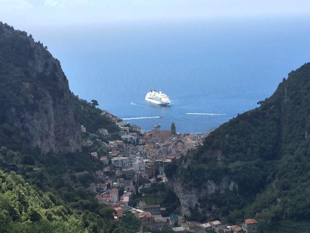 Day 1: Amalfi and Vallee dei Mulini with the additional part to Torre dello Ziro and returning via Atrani The walk on day 1 started with exploring the village of Amalfi and then climbing up through the terraces of lemon groves. I’ve never seen such large lemons! This is a steep start with stairs, but mostly paved. At the top of the hill when you’re in need to refreshments, there is the little town of Pontone, which has a shop and a toilet. From there we did a detour to the Torre dello Ziro, a tower which dates back to the 13th century, and climbed to the top to enjoy the most magnificent views over Amalfi and Atrani, before retracing our steps to the main path. The descent was long and steep with many stairs but this brought us into the winding tunnels and passages of Atrani and down to a delightful village square. From there the return to Amalfi has two options – a pedestrian walkway through a tunnel into Amalfi, or another climb through a tunnel and narrow passages to a high paved path between the two villages that again held beautiful sweeping views across the coast. This was a fantastic walk that we all loved. It gave a good overview of the area and had a little of everything. 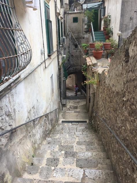 Day 2: Ravello & Scala This walk starts in Ravello so you need to catch the local bus from the Piazzo Flavio Gioia in Amalfi. Tickets are available to the tobacconist across the road from the square and when we were there in mid summer, the buses left every 30 minutes. We were cautioned to be early as the busses get very full and you don’t want to be standing as the bus winds its way up the treacherous roads. Note that the bus stops at Scala first, before going on to Ravello. After visiting the famous town of Ravello, the path leads along the contour of the hill to Scala. There are toilets near the main square in Scala but are very well hidden, so you’ll need to ask. From there, the path follows the road until Minuta and Pontone, both little villages perched on the top of the hill. Thereafter it is a steep, but easy to follow downhill walk on terraced paths between the lemon groves with hundreds of stairs. The route ends in the village of Amalfi. The kids were less keen on this walk – it wasn’t as varied as the day before and none of it was off road. 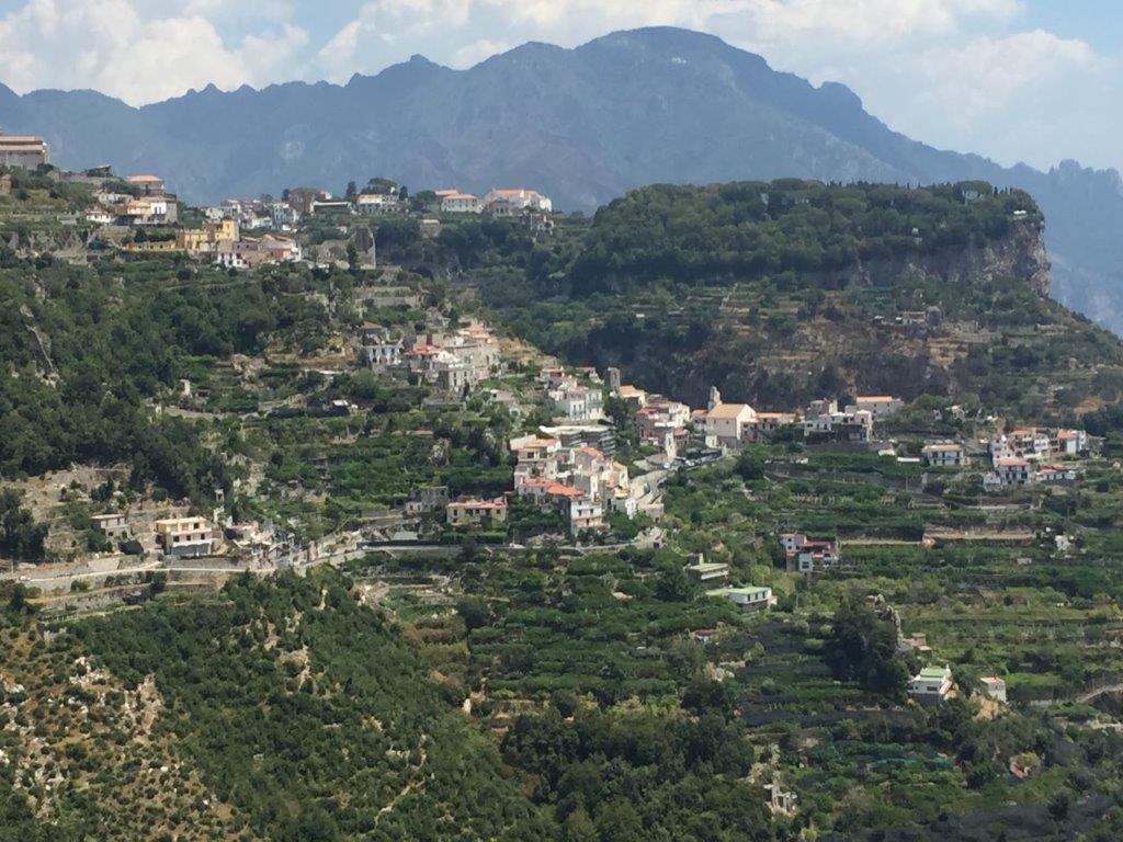 Day 3: Valle del Ferreire This walk starts in Scala, so again you need to take the Ravello/Scala bus and then walk on to Minuta. From there, you climb about 450 stairs onto a mountainside path that follows the contours of the mountain. We overshot the intersecting pathway and continued to follow the stairs way beyond where we should have, but were lucky to meet other walkers who redirected us. This walk is probably the most challenging and a couple of kilometres longer than the others we did, but is not difficult to follow. The high level path follows the contour of the mountain from one side of the mountain and around the valley, past a waterfall and on to the other side of the mountain. Probably the best aspects of walking in Amalfi, but this walk in particular, is that you can see at all times where you’ve walked from so you have a real sense of achievement – imagine walking semi-circles along the sides of a mountain from one peninsula to another. At points, this walk can be scary for those fearful of heights though. It is narrow and rocky in places, requiring some climbing, and has no railing. There is however vegetation on the narrowest, steepest part of the route which gives you a false sense of security. Walking poles were a real help in all the walks, but this one in particular. The valley walk ends in the little hilltop town of Pongerola where there is a toilet at the bar/café. The café also serves the best lemon granite I’ve ever tasted! From there, the descent wound through houses and apartments on a steep paved path with, again, lots of stairs until emerging above the sea in Amalfi. A bus from Pongerola to Amalfi is an option too. A stunning walk! 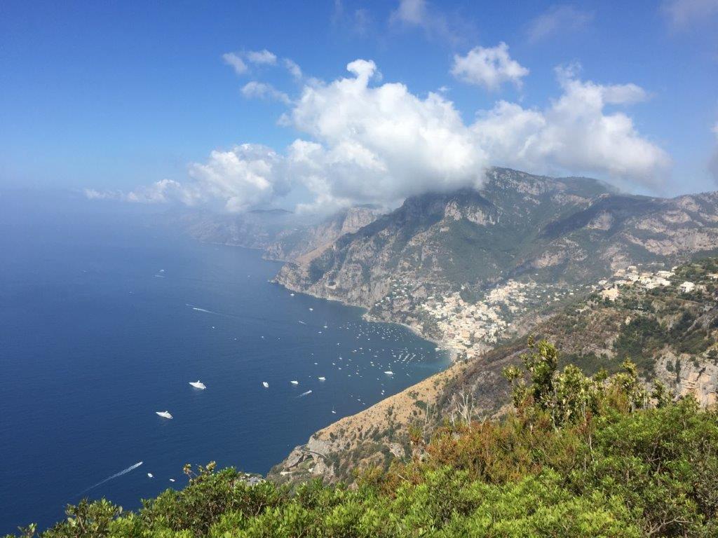 Day 4: Positano and the Path of the Gods
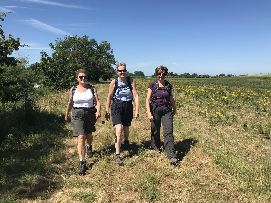
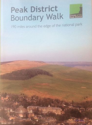
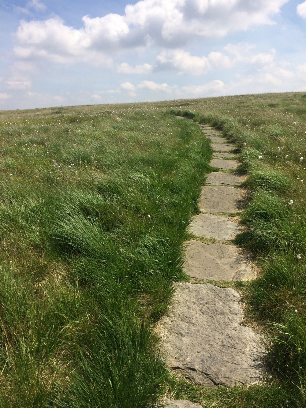
The well known Path of the Gods or Sentiero degli Dei starts in the neighbouring town of Bomerano (you need to take the Agerola/Bomerano bus). The walk starts from the town square a block or two away from the bus stop. This was definitely the busiest walk – a walk done not only by serious walkers but people in swimming costumes and sandals. This walk was relatively easy, with the exception of the gruelling descent into Positano. The path winds its way along the side of the mountain towards Nocelle, Montefaruso and then Positano and on a clear day, you can apparently see all the way to Capri. After passing through the delightful little village of Nocelle, you reach Montefaruso high above Positano, where you can decide whether to walk down or catch a bus. There are toilets at the bus stop. We split up and two of the children and I walked down approximately 1300 steps to reach Positano, a bustlingly busy tourist destination. Apparently standing in the bus on the way down the hill was less than comfortable, so I think the walk was the better choice. We returned to Amalfi by boat which gives you the perfect opportunity to see where you’ve walked from. About the Author: Lynda Gouveia I am South African, but my family and I moved to Stockholm, Sweden 6 months ago and we are really enjoying being close to Europe and all it has to offer. I have three teenagers – identical twin girls and a son who is one year younger, and I’ve been married for 18 years. I am self-employed and work as a business and executive coach and people development consultant. In between, I make time for my passions which are walking, preferably long distance, photography and painting. I grab any opportunity to walk with both hands, and if I can take a few photos along the way, all the better. If you want to explore more of the world and find other women to walk with, join Glamoraks. 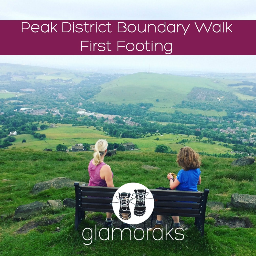 Distance: 10.6 miles Ascent: 597 metres Type: Rural, farmland, moors Terrain: Tracks (some overgrown), dirt tracks, stone slabs On 17 June 2017, a brand new long distance UK trail opened. Called The Boundary Walk, it is 190 miles long running around the edge of the Peak District National Park. A few Glamoraks and I headed off to have a first footing of the path. We decided on the Greenfield to Marsden leg (stage 5) mainly because it had a train station at the start and end of the stage. It also looked - on paper - as though it would cover some wild moorland and had a good amount of hills in it. Catching a train from York at 8.30, we were in Greenfield for 9.40 and were kindly picked up by the walk organiser's friend who took us to the start at Dovestone Reservoir (although you could walk from the station and simply pick up the path from Hollins Lane). Despite looking around for others who were meant to be walking the same leg, we couldn't find anyone, so at the allotted start time of 10am, we set off. We did ask around at the car park but whenever we mentioned we were walking to Marsden, we were greeted with open mouthed disbelief or teeth sucking as though we were out of our minds for walking such a long way (it really isn't that far!) We used the newly published guide book (pic below). Almost immediately we were slightly puzzled by where we should be going. The words and the map in the book didn't quite correlate. Switching on google maps on our phones, we finally figured out where we should be heading and got started. (Top tip: if you're doing this leg, when you get to the Dovestone Reservoir carpark and you're at the public toilets, you walk away from the sailing club and out of the carpark along the road you would have driven in on, until you hit the main busy road ahead. The instructions in the book make sense from there).
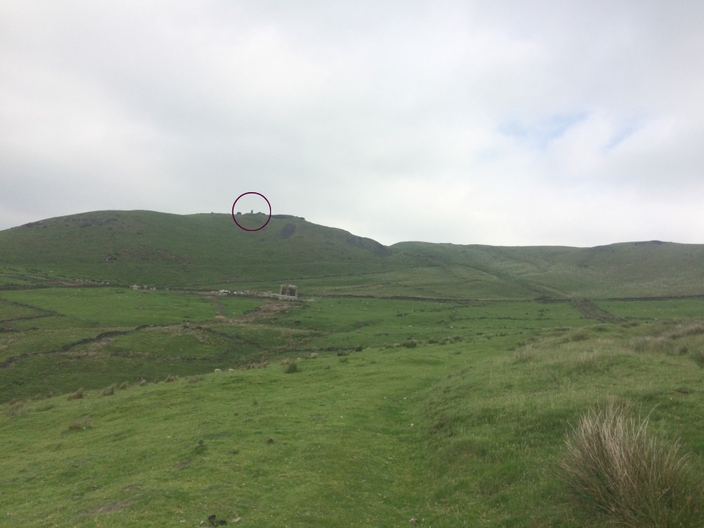
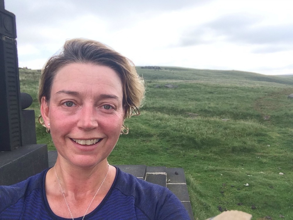
Almost immediately, the 597 metres of ascent made itself felt as we began a long, hot climb to the top of a hill where an impressive obelisk awaited. We caught our breath and had a snack while we admired the expansive views from the hill top.
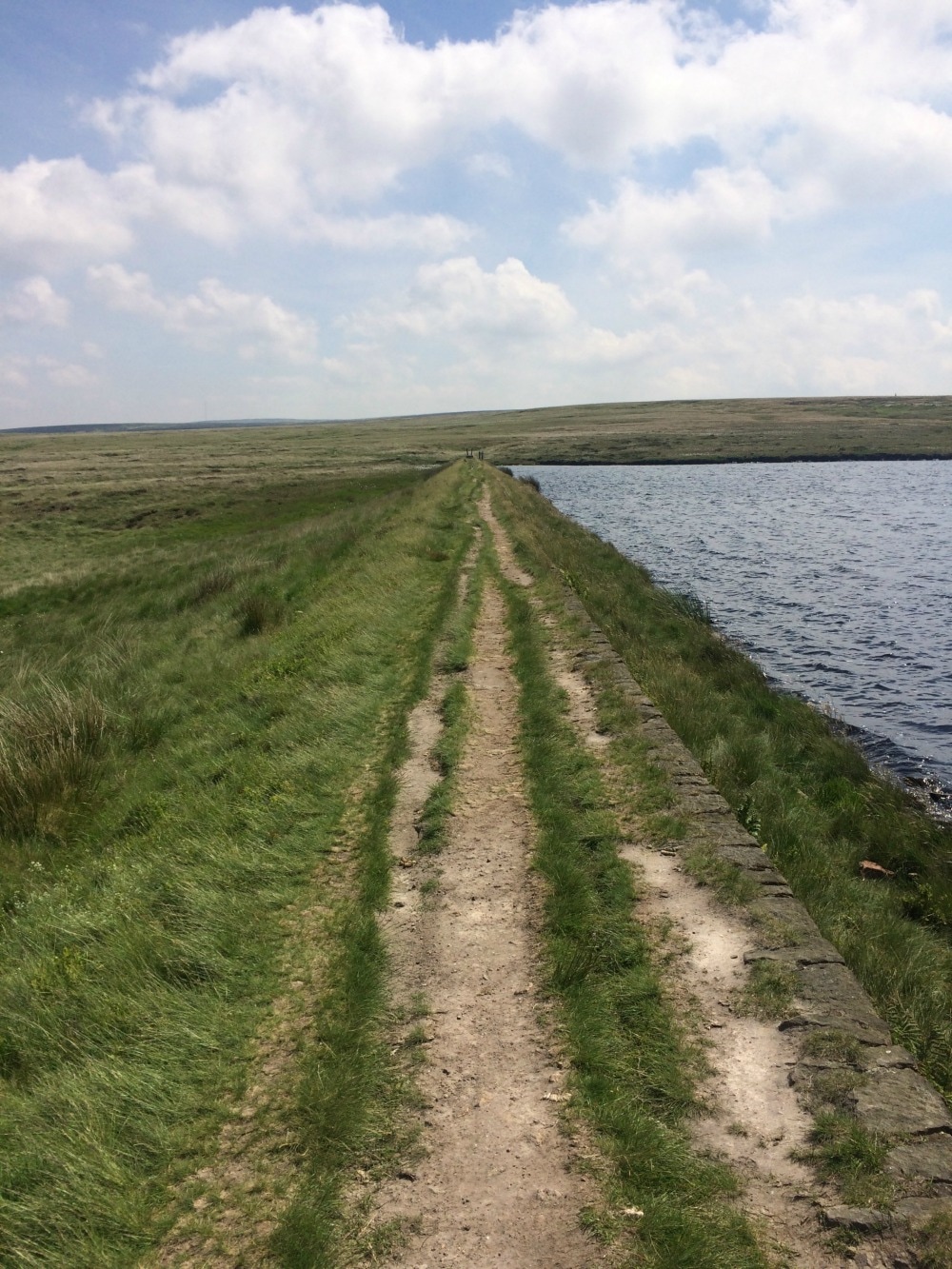
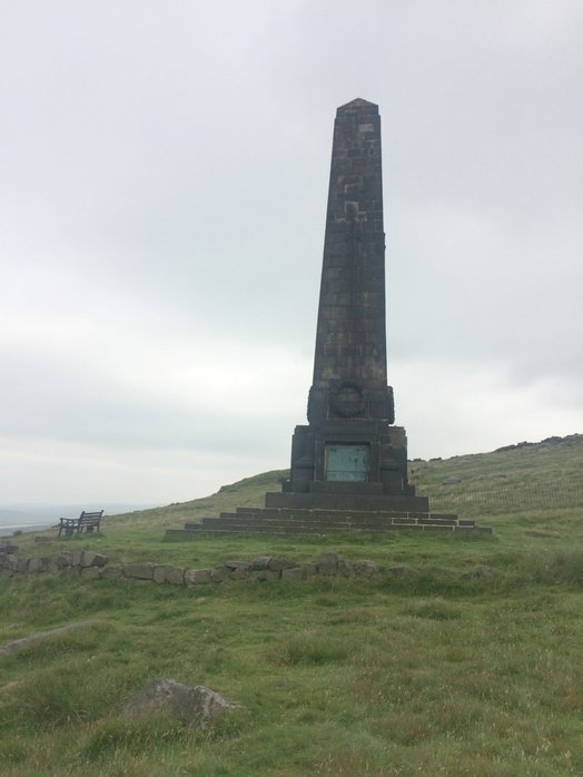 The obelisk 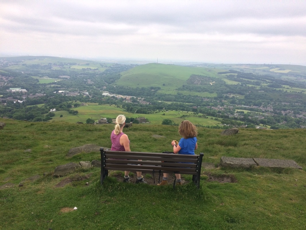 The lovely views from the top We set off again along the edge of Saddleworth Moor, with stunning scenery off to our right. Just as we were getting into our stride, we had to descend again down to a small village called Pobgreen. It had an inviting looking pub and we were ready for our lunch by this point, but we had to soldier on as we had a return train to catch. Just a note here: as you head down the lane to Pobgreen you will get to a point where you can keep following the lane or take a stile and footpath sign directly in front of you. Stay with the lane. Leaving Pobgreen behind us, we climbed another hill before descending again to another little hamlet. It was here that the guidebook left us feeling a little confused once again. The book said: Follow the lane downhill and once rounding a slight bend, you should see the public footpath fingerpost on the right hand side of the lane, at the edge of a property. Continue past the property and along a narrow fenced-in path. We had no idea whether that meant we had to take the footpath or walk past the house and take the next footpath. We walked back and forth a few times before deciding to take the very narrow path behind the house as indicated by the fingerpoint sign. And it was the right choice. We soldiered on through fields of sheep, before crossing a bridge, and heading up another hill with the sound of a shooting range echoing around us. At last we got to the Brun Clough Reservoir, where we had a brief picnic lunch and aired our hot feet. Until this point, the sun had stayed hidden behind clouds but it was super humid. 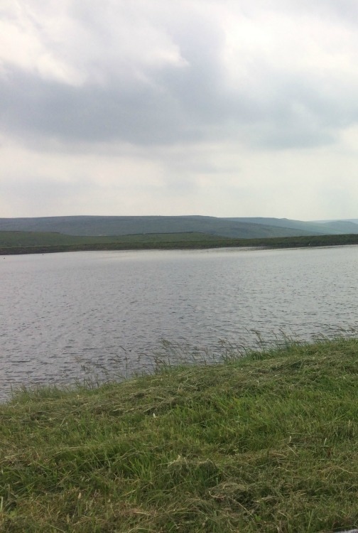 The view from our picnic spot After lunch we joined the Pennine Way and made our way across the gorgeously wild and remote moorland, passing several reservoirs as we went. The sun was now blazing and the brown peaty water looked very tempting for a dip. At one of the reservoirs (Black Moss) there was even a tiny beach, which would make an idyllic wild camping spot. 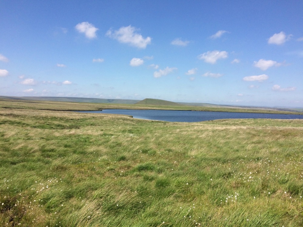
We didn't have a swim but carried on as the temperature rose. The book said that we should look out for a stone platform and little mast, which we found. But - a note of caution for anyone following the book - at this point you need to turn the page and read the next set of instructions, rather than blindly following the path (as we did). As a result, we missed a steep path that ran down the side of the hill that we should have taken. Luckily, the path we took eventually reconnected with the path we should have been on, and we got to avoid a knee killing downhill plus we got to see a pretty waterfall. So I'm not sure why the route we took isn't the actual route, but there you are. By this point the temperature was in the high twenties, not a cloud in sight. We had a choice. Continue with the route as per the book, which would have meant a longer, much steeper climb up to the ridge line. Or follow a path alongside the reservoirs and get into Marsden to catch the train on time. We chose the latter! This last stretch was baking. I'm sure the views from the ridge line would have been more spectacular, so if you're doing the walk on a cooler day, I'd suggest you do it! At last we got into Marsden where crowds spilled out of the Riverhead Brewery Tap, ice cold pints in hand. They looked thoroughly tempting and should you be doing this walk, this would be a good place to stop for a refreshing drink. Sadly we had to rush on to get to the station, where we ran into a hilarious group of young men on a stag party, stopping at each station on their way to Leeds for a pint. They were only three stops in and things were starting to get messy. We bid them farewell and got back in York by 5pm having walked just under 11 miles. I'd got to see parts of the Peak District I'd never seen before that were stunning, wild and good for the soul. And we'd done a good amount of hill climbing. I got through 3 litres of water! If you go on a hot day, take a lot of water with you. Then it was time for a quick shower and transformation into evening wear for a ball. And that's what it means to be a Glamorak! Squeeze a bit of the outdoors into the everyday. Don't forget to join the Glamoraks community. That's where you find out about walks like these and get to meet up with people you don't know, make new friends and see new places. And subscribe to the Glamoraks newsletter here.
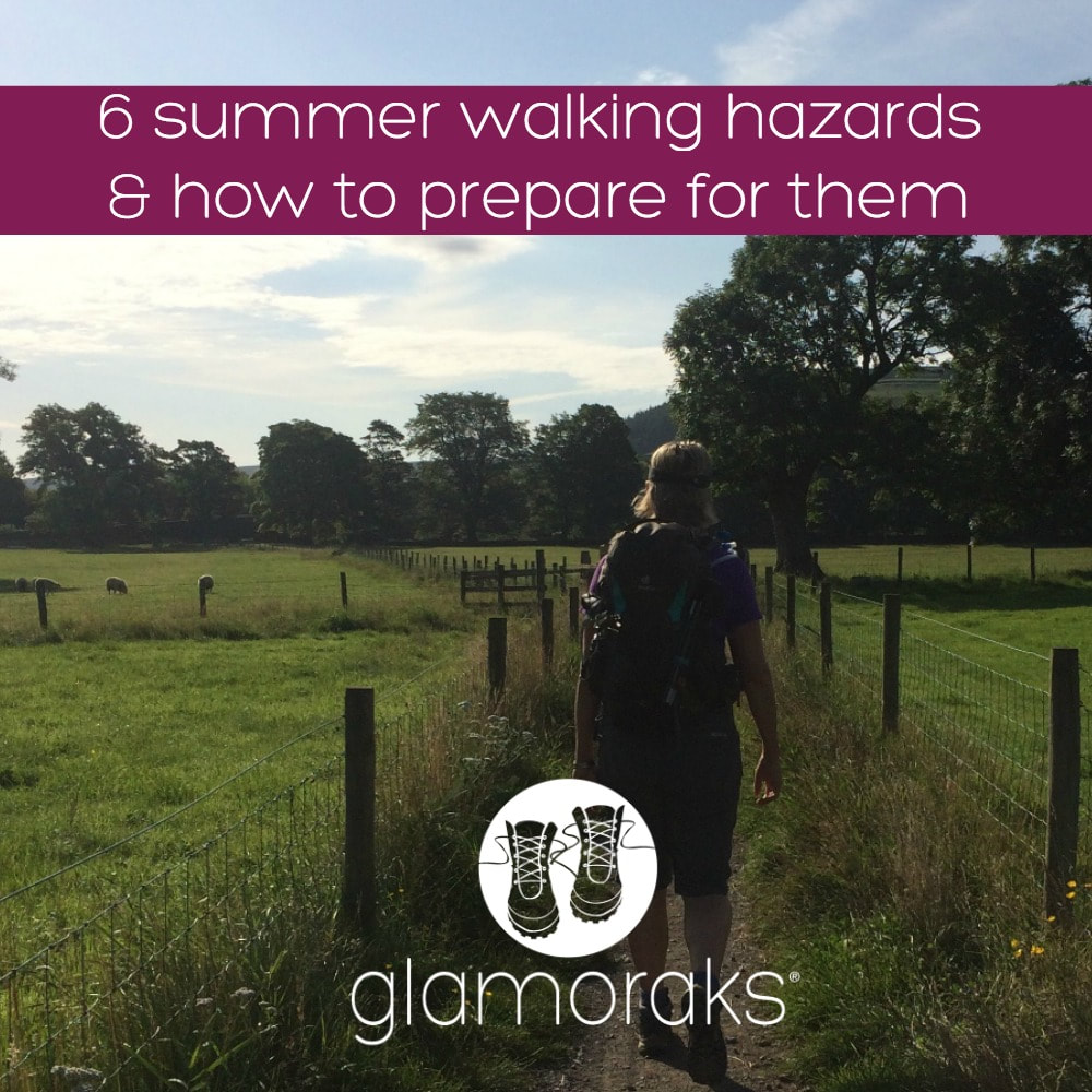 You'd think that walking in summer would be the easiest of all the seasons. Right? Glorious sunshine on your back and not having to contend with blizzards or deluges or biting winds. But walking in summer can actually be a bit of a challenge. Here are my top six summer walking hazards and how to deal with them. 1. Heat In the UK at least, it rarely feels hot enough to worry about overheating. But a long march across a shade free field in blazing sunshine can get very hot and it's easy to get sunburnt. And if you're in a hotter country, it's easy to get heatstroke if you're not used to walking long distances in high temperatures. Always apply sunblock, take a sunhat and drink plenty of water. And I mean a lot of water. Drink little and often to stay hydrated as you go. I just carry a water bottle for a short walk, but for a longer hike, I'll fill my 2 or 3 litre hydration system to ensure I don't run out. If you are hiking long distances, make sure your backpack is well ventilated, with space between your back and the pack, to allow air to flow through. You stay much cooler and less sweaty that way. I use this one, which works great. 2. Nasty plants One of the joys of winter walking is that you don't get nettles. Well not many. As soon as summer comes round, many of the footpaths become massively overgrown and nettles threaten to sting your legs as you brush past them. They're particularly prevalent at styles and kissing gates, where you have to squeeze past while the nettles prickle menacingly through the gaps. Wear lightweight long trousers (I swear by these Craghoppers), rather than shorts. This will give your legs some protection. Also, find a Nettle Stick* or use a walking pole. (*A large stick to hold nettles and other overzealous plants back as you squeeze along a track - they're free. Look on the ground!) This stick will come in handy for hazards 3 & 4 too. If you do get a nettle sting, look for a dock leave and rub the leaf on the sting. It helps relieve it (a bit). Another poisonous plant to look out for is Giant Hogweed. This can grow up to 5 metres tall, and is normally found along footpaths and riverbanks. If its sap gets in contact with your skin, it can cause really nasty burns, which are made worse by sunlight. 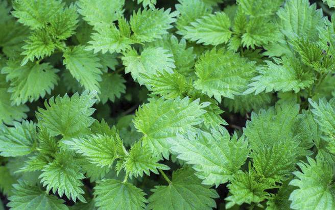 Nettles! 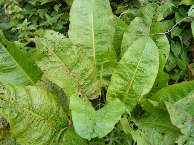 Dock leaf 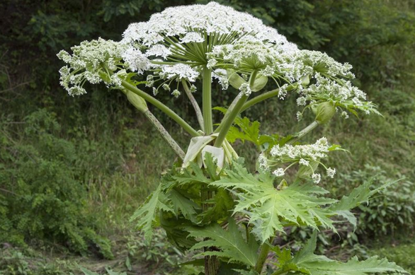 Giant Hogweed. Avoid! 3. Overgrowth It's not just poisonous plants that can cause problems. All the vegetation suddenly springs up and unless the keepers of the footpath or farmers are on the case, you can find yourself walking along paths with plants that are neck height. Not fun. Firstly, you can lose track of where you are as the paths are more difficult to follow. Secondly, it's much easier to go over on your ankle as you bash your way through. Thirdly, your trousers get soaked from the dew or condensation on the plants. Use your stick as a walking aid and as a weed thrasher. Even though it's hotter wearing walking boots, you may find they give better ankle support on uneven, overgrown ground. And wearing gaiters can help keep the bottom of your trouser legs dry as you bash your way through. 4. Cows Cows and their calves (and often the big bulls) are out in force at this time of year. Cows can be dangerous and very protective of their young. I use my nettle stick as a form of comfort when I have to walk through a field of cows. Knowing that I have a large stick makes me feel slightly braver (even if it wouldn't really do much against a charging bull!) With cows, I tend to walk as close to a fence or wall as possible so that should I need to escape a field in a hurry, I can. Walk quietly but with purpose, around the herd if possible - they will typically get out of your way but do assess them before you head into a field. I was once held up for about 40 minutes by a field of young bullocks who were simply curious more than anything else, but it didn't feel safe going into their field. In situations like that, try to find an alternate path. Be even more careful if you have a dog with you. 5. Bugs The warm weather brings out bugs of all kinds, but midges, mosquitoes and horseflies are the most painful. Carry insect repellant on you and if you're going somewhere super midgey you may want to get a face protector too. It ain't sexy - but then again, neither is a face full of bug bites. Bitey bugs also don't like the smell or taste of garlic or vitamin B, so grab a handful of wild garlic you'll find growing in early summer and carry it with you. Or eat marmite sandwiches. Seriously. Apparently midges fall into the Marmite Hate It camp. Who knew! 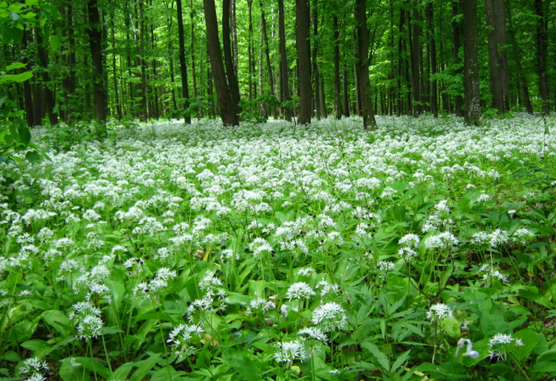 Wild Garlic - a possible bug repellent if you forget yours 6. Snakes In the UK there is only one venomous snake - the adder. It has a dark brown, reddish or black zig zag from head to tail with spots on its sides. Some (rare) are entirely black. They typically have their babies in late summer and will mostly be seen basking in sunny spots, in heathland, bogs, moorland, woodland edges or rough grassland. They are shy and will only bite when cornered, alarmed or picked up. I have never seen one in the UK (unlike in my native South Africa where I had a puff adder sidle under my sun lounger one day!) If you see discarded snake skin or winding trails in dirt tracks, be aware there may be snakes about. To scare off snakes, stomp your feet as you walk. Snakes pick up on vibrations through the ground and will disappear. They're more afraid of you than you are of them. Again, walking through long grass means gaiters, long trousers and sturdy boots gives you more protection should you stand on a snake (highly unlikely!)  Adders Although snakes, poisonous plants and grumpy cows may seem alarming, walking in the UK really is pretty safe. These few hazards are simply worth being aware of and preparing for. If you are walking elsewhere in the world - particularly in a country you're less familiar with - take a moment to look up any local plants, animals or pests that could pose a danger. Better to be safe than sorry.
Now head out and enjoy that sunshine! And remember, one of the best things about walking in the summer is the longer days and evening, meaning you can still fit in a good length walk after work and enjoy watching the sunset. Got any other summer walking tips? Share them below. Join the Glamoraks community to meet other women who also like to walk. |
Categories
All
Archives
July 2024
|

 RSS Feed
Get social. Follow us.
|
Don't get left out.
Add your email to be alerted about any Glamorak events, walks, get togethers, challenges or news.
Success! Now check your email to confirm your subscription.