|
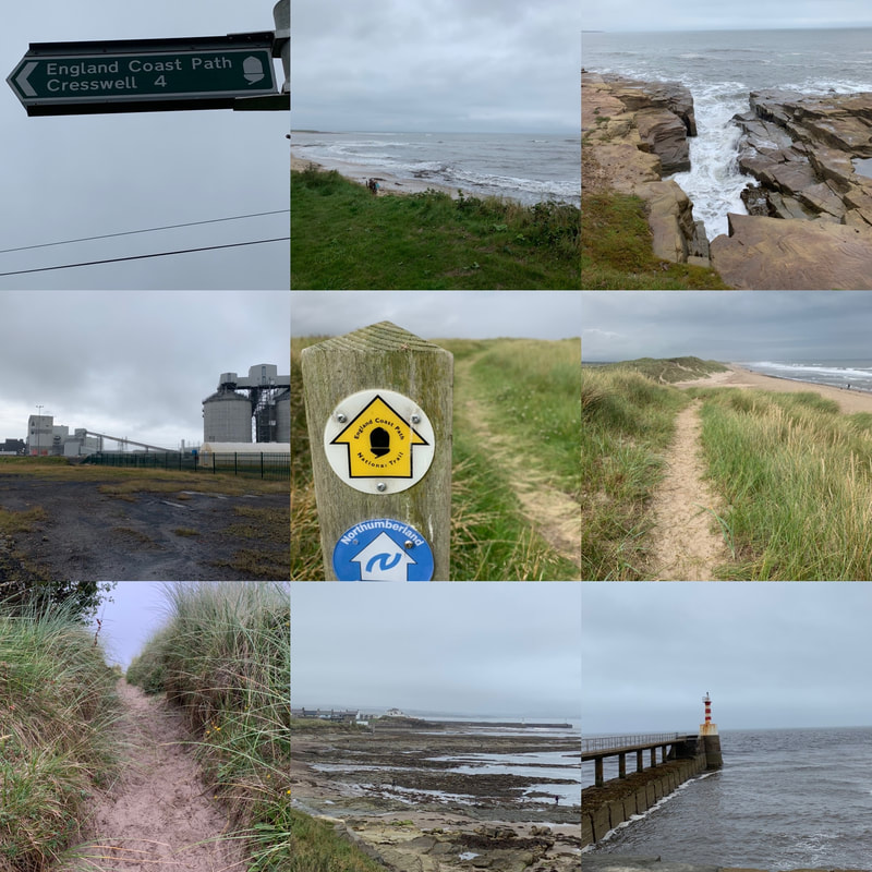
In late August/early September 2020 I was meant to do the Tour du Mont Blanc. But the global pandemic had other plans. With time off work and in need of an adventure, I decided to walk the Northumberland Coast Path solo, carrying what I needed on my back. I didn't fancy camping and lugging all that kit with me, opting for any available accommodation. This proved tricky as accommodation was in very short supply and so I couldn't follow the itinerary suggested by the official route. The Northumberland Coastal path runs from Cresswell in the south up to Berwick-on-Tweed in the north, a total of 62 miles or 100km of coastal walking, littered with castles and history. If you've never been to Northumberland. then you need to add it to your list of places to go. It is jaw-droppingly beautiful with plenty of little coastal villages to explore or take refuge in when in need of tea/cake/chips/wine. And given some of the weather I faced, refuge was certainly needed at times. I decided to tag a bit onto the beginning, by starting at Newbiggin-on-Sea to enjoy the newly created stretch of the England Coast Path route. Getting there: The East Coast Main line runs up and down from London to Edinburgh. The closest train stop to Cresswell or Newbiggin is Morpeth. From there I took a taxi to Newbiggin, which meant I started walking at about 11am. You can catch a return train home from Berwick-on-Tweed. Day 1: Newbiggin-on-Sea to Amble (14 miles)Frankly I'm not sure why I decided to add the extra miles on as Newbiggin-on-Sea isn't going to win any prizes in a beauty contest. It was a grey day and a bit of a plod to start along an urban seafront and past a not very attractive power plant. But the path was clearly signposted with new England Coast path signs and I was pleased to be walking a stretch of this newly created route. Once I reached Cresswell and officially picked up the Northumberland Coast path, the scenery improve massively. The path stretched for miles along stunning Druridge Bay, with gorgeous sand dunes and a nature reserve just inland. Approaching Amble, you will see Coquet Island out to sea, an RSPB nature reserve, housing a monastic cell and medieval tower. I like little bits of history along the way. I arrived at Amble with sore feet unused to walking 14 miles, a lot of which was on sand. Amble has a busy quay with little shops and spots to get something to eat. Sadly, the only place available for me to stay - the Amble Inn - was another mile out of town. I was very pleased to have my comfy bed and tasty food when I got there.
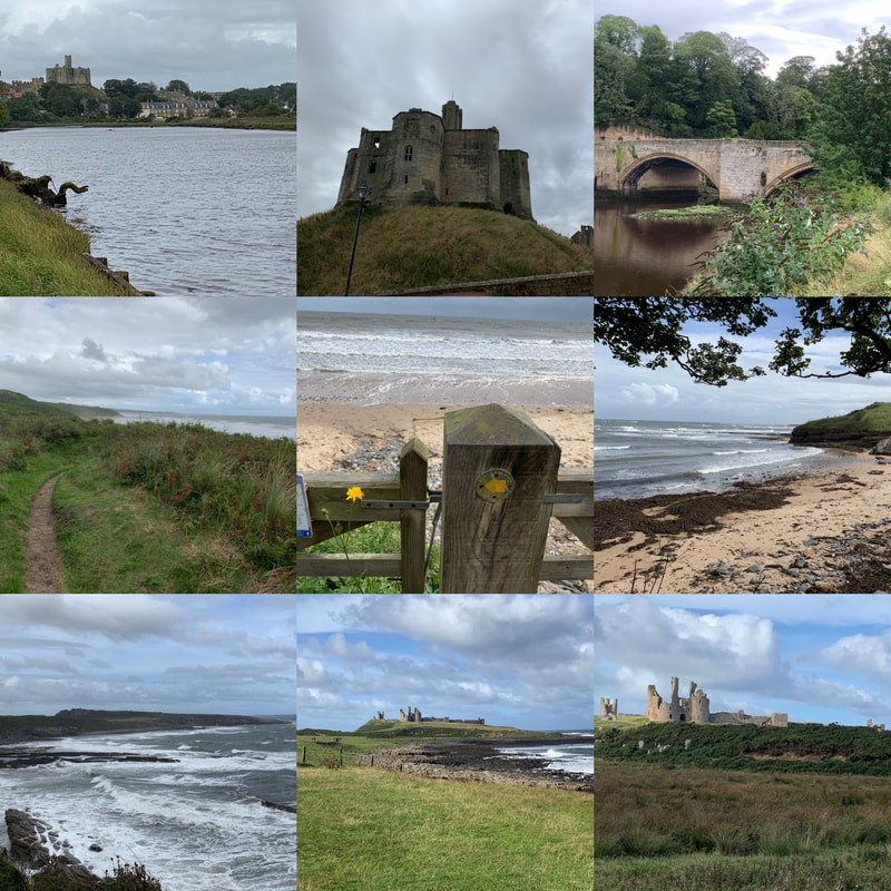
Day 2: Amble to Embleton (18.5miles)I had a lot of miles to cover this day and the forecast was WINDY! But it promised two spectacular castles and stunning scenery so I was up for the challenge. After a hearty breakfast, I headed back into the heart of Amble and out the other side, walking alongside Warkworth harbour before climbing the hill into Warkworth. Atop the hill sits Warkworth castle, one of the few Northumbrian castles I hadn't previously visited. I didn't have time to go in but gave it a wave before walking through the very pretty village of Warkworth with its even prettier bridge, which spans River Coquet. From there it was miles of gorgeous sand dunes (the path itself running behind the dunes so wasn't heavy going underfoot). I had to play dodgems with flying golf balls as links courses dot the path. There are handy bells to ring to let golfers know that you're passing through. I then reached the River Aln and the lovely village of Almouth. I stopped for a bite of lunch at the Alnmouth Village Golf Club (the oldest links golf club in England) where I was the youngest person by about 50 years. But they did a good sandwich and they had a loo and everyone wanted to know where I was walking to. From there I had to climb a hill above the golf course, and kept following the coastal path until it dropped down to the sea. The walking got tough for a while as it was a pebbly beach, which hurts the ankles but the scenery made up for it. The wind picked up as I headed along a long cycle path towards Boulmer and then even windier as I walked along the path overlooking wild seas crashing on rocks as I headed for Craster, famous for its smoked kippers. By the time I reached the Jolly Fisherman Pub, I was very ready to rest my feet. By chance I bumped into friends there so had a welcome catch up in the sun before tackling the last 4 miles. The walk from Craster to Dunstanburgh Castle is one of my absolute favourites and if you're ever after a short day walk, add this one to your list. I however, had to walk past the castle, making sure I took in the backwards facing views and did my final push to Embleton. I stayed at The Dunstanburgh Castle Hotel, but frankly I could have been staying under a hedge. I simply wanted to put my feet up after a very long, windy but utterly gorgeous 18 odd miles.
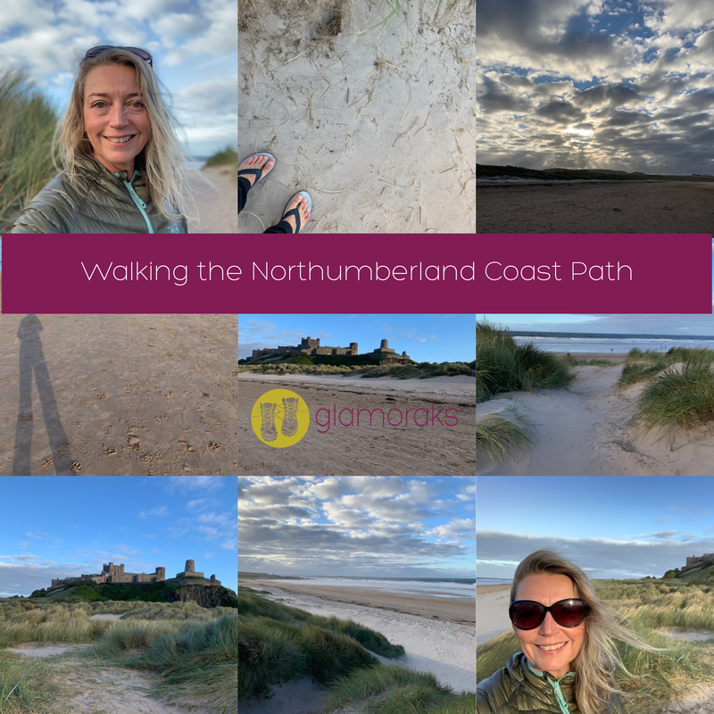
Day 3: Embleton to Bamburgh (11.6 miles)While a significantly shorter day, this day was still quite hard going for two reasons. 1) The weather 2) a long stretch of roadside plodding. It starts with some of the most stunning scenery of the entire walk along Embleton Bay, with views back over Dunstanburgh Castle. Little seaside cottages dot the dunes and I would very much like to have one of those. The route then followed another links golf course running next to Beadnell Bay. The wind had again picked up at this point and by the time I hit Beadnell, the rain arrived. Sadly, the stretch from Beadnell to Seahouses is a long tarmac plod alongside a busy road. I was sorely tempted to stick out my thumb and ask for a lift. I didn't and instead fought my way against the gale and face-on rain until I arrived in Seahouses, where I collapsed in a seaside pub and watched the rain beat against the windows. After psyching myself up, I did the last push from Seahouses to Bamburgh, which veers away from the sea and crosses fields, which included a field of bullocks. Sigh. The adrenalin got me across that field and views of Bamburgh Castle gave me my point of reference to work towards. I could have walked along the beach if I'd wanted to - and you could do this although it is not technically the coast path route. I didn't because walking on sand is very tiring and the wind was so fierce, the sand would have taken the top layer of skin off my face, and I was looking haggard enough. Anyway, after reviving myself at the Victoria Hotel, I headed out in flip flops to air my feet and strolled around the beach near the castle. If you've never visited Bamburgh Castle, add it to your list. It looks exactly like a castle from story books and you couldn't get a better setting. Once my feet were frozen lumps of ice, i headed back and had a large glass or two of wine.
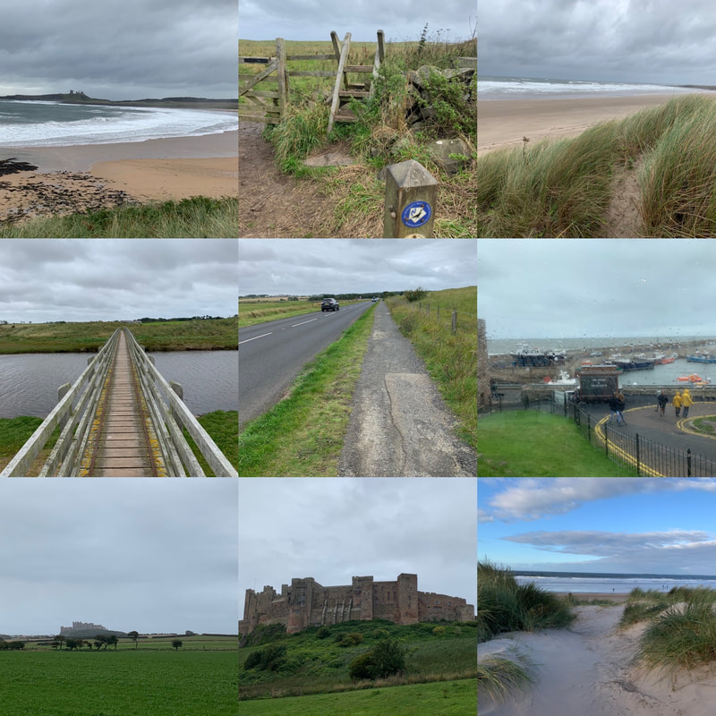
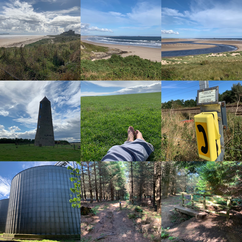
Day 4: Bamburgh to West Mains (14 miles)If I'm completely honest, you could probably just do those first three days to get the highlights of the Northumberland Coast Path as day 4 was a bit 'meh'. Technically I should have gone all the way to Holy Island to see Lindisfarne castle but the way the available accommodation worked out, it wasn't an option for me. Plus, if you go to Lindisfarne, you have to time it right to ensure you can walk across the causeway before the tide rolls in, otherwise you will find yourself having a swim instead of a walk. I didn't have to worry about that, I simply had to walk 14 miles. The wind and rain of the last two days had been replaced with blazing sunshine. Glorious. Except today was a hilly day, inland, not much shade....did I mention the wine from the night before? It starts off beautifully with views back towards Bamburgh Castle before taking in the stunning Budle Bay. Lovely. And then after climbing a hill, do a bit of road walking, pick up St Oswald;s way, you arrive at an intercity railway line that you have to cross. That's exciting! There's a telephone you have to use to call the signalman. He'll want to know how many are in your party and how long you estimate it will take you to cross the line. He then lets you know how long you've got before the next train comes barrelling along at 100 miles an hour. Despite having five minutes to make a 30 second journey, it still makes your heart thump. Luckily I'd had a little rest in a grassy field just before this, watching the butterflies flutter about while I aired my feet and rehydrated my body. After the railway line excitement, you walk past weird, slightly spooky silos before reaching the village of Belford. Here I stocked up on a nutritious lunch of a scotch egg and can of soda from the Coop, before continuing on. After the beauty of the coastline, this all felt a big dull until getting to some woods, which were both pretty and cool respite from the sun. Out the other side of the woods is a tiny village called Fenwick, which had I been going to Lindisfarne, i would have passed through, crossed the A1 and headed off on my pilgrimage like so many other pilgrims before me. But alas, the only accommodation I could find was in West Mains, which meant a trudge along a tarmac road, another interesting crossing (this time the busy A1) and then at last found my accommodation at the Lindisfarne Inn. This was definitely my least favourite day on the walk.
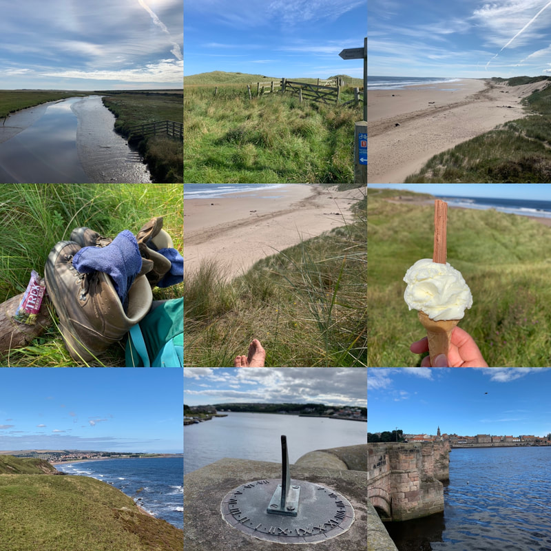
Day 5: West Mains to Berwick-on-Tweed (11.6 miles)Another gloriously sunny day and I was up and out early. Despite tired legs and feet, I was ready to take on the last day of this walk. From West Mains, I dropped down to the coast line, picking up the coast path again at Beal Point, looking out over the causeway to Holy Island. From there it is a straight forward, relatively flat, easy walking stretch of beautiful coastline. I even managed to get an ice cream from a van along the way. Perfection! I arrived into Berwick-on-Tweed way too early for my departing train, so I stopped on the promenade for some obligatory chips. Sitting with my boots off, my feet in the sea breeze, eating hot chips and smelling the sea air, I mentally high-fived myself for doing the 70 miles. What a lovely, leisurely (at times tiring) but beautiful walk. There is something about coastal walking that just releases tension, letting all your worries blow out to sea. I reluctantly put my boots on, headed across the old bridge into the town, taking in the views from the old Elizabethan walls that prevented the Scots from invading the town, a nice extra bit of history before finally catching my train back to York. In contrast to some of the more remote and hilly long distance paths, the Northumberland Coast Path is relatively easy. That said, 70 miles is still 70 miles and lots of it is on sand, some pebbles and some roadside, so don't underestimate it. But the incredible beaches and fairytale castles will keep you going. I highly recommend it! And if you're looking for company to do it with, join the Glamoraks app or Glamoraks Facebook group and find like-minded women to go walking with.
0 Comments
|
Categories
All
Archives
July 2024
|
||||||||||||||||||||||||||||||
Get social. Follow us.
|
Don't get left out.
Add your email to be alerted about any Glamorak events, walks, get togethers, challenges or news.
Success! Now check your email to confirm your subscription.

 RSS Feed