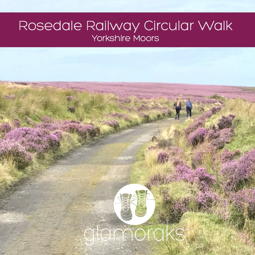
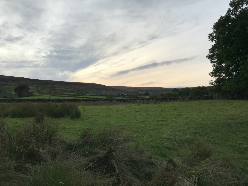
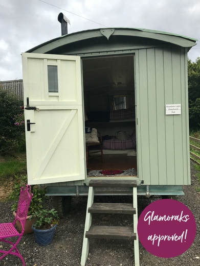
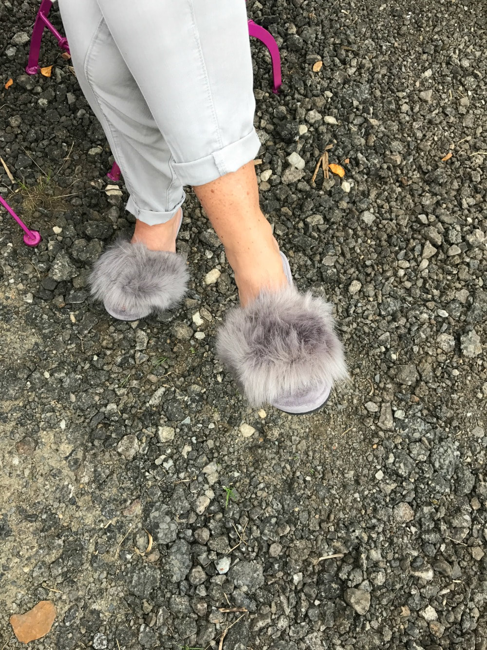
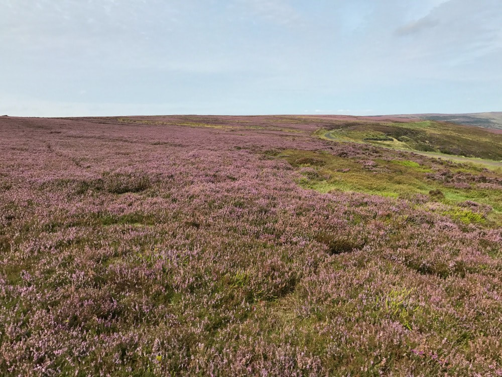
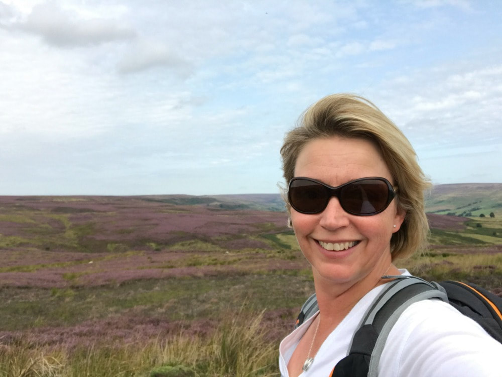
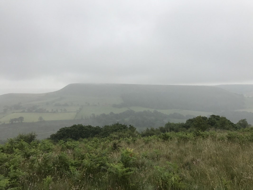
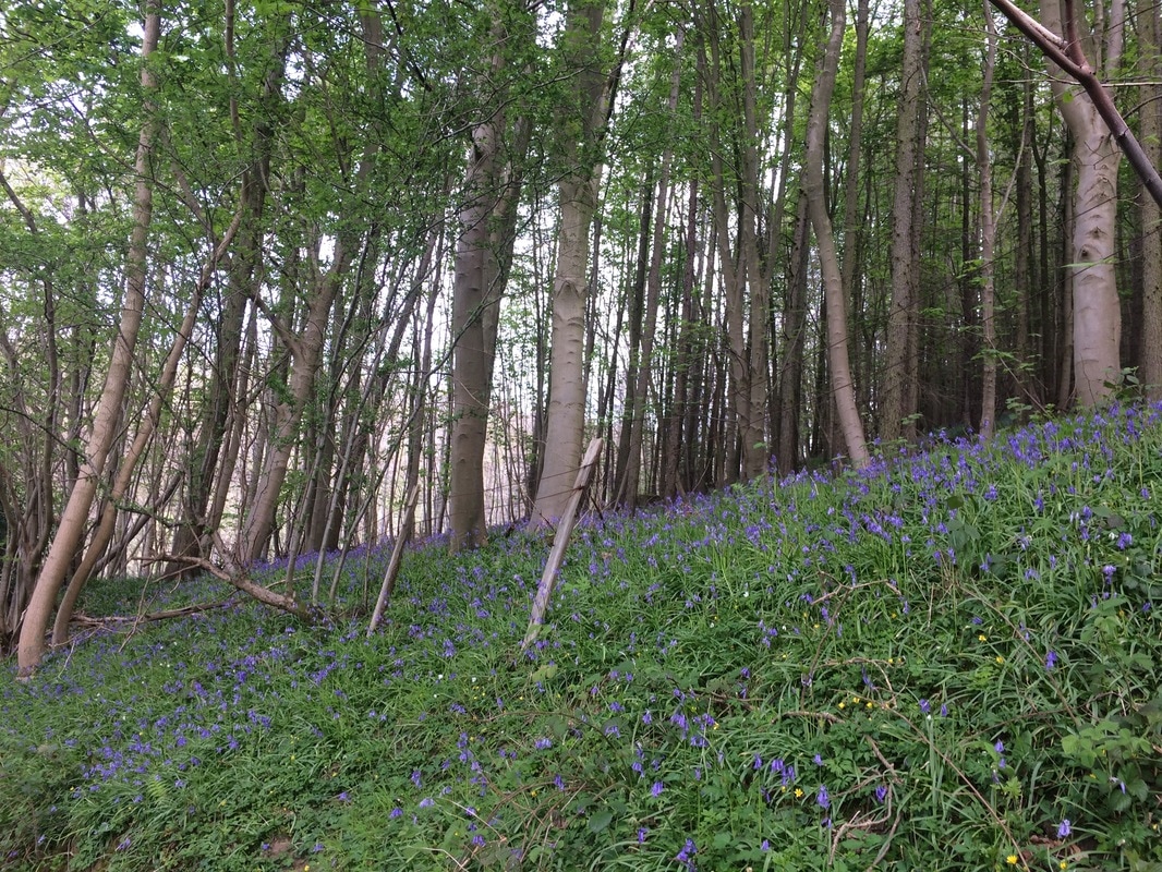
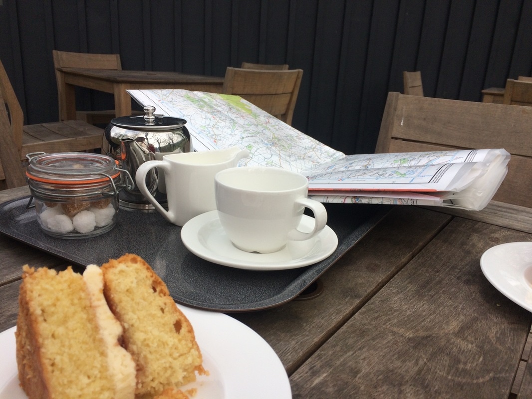
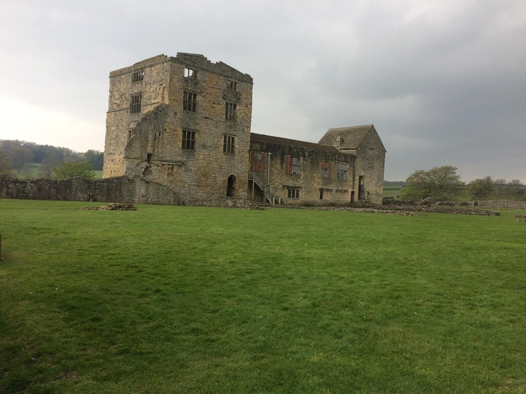
 Distance: Variable - from 5 miles to 12 miles Terrain: Mostly easy walking on flat, broad paths - but expect steep climbs up and down when you go into and out of the valley Refreshments: The Lion Inn, Blakey Ridge, Dale Head Farm Tearoom (plus Shepherd Hut if you fancy spending a night somewhere remote), plus plenty of pubs and tea shops in Rosedale Abbey 'Would a rose by any other name smell as sweet'. That is the Shakespearian line that played on repeat in my mind as I walked along the ridge line overlooking Rosedale in the North Yorkshire Moors. There wasn't a rose in sight, just miles of heather, breathtaking in its purple splendour. I was gobsmacked that I'd never been to this part of the moors before, which incidentally isn't named after roses, but possibly after the viking word 'rhos' for moor. As it turns out, I had actually skirted Rosedale when I did the coast to coast, but didn't realise where I was at the time (I was a little preoccupied with the blisters on my feet having just walked 25 miles in a single day). But the best finds are often completely unexpected, so let me rewind. A friend had called to say that she was spending a night in a shepherd's hut somewhere remote. I invited myself along. Armed with just a postcode and a couple of bottles of champagne, I drove from York, to Pickering, then across to Hutton-le-Hole. As I climbed across Spaunton Moor out of Hutton-le-Hole, I was greeted to a breathtaking sight of heather as far as the eye could see. Daft sheep kept wondering across the narrow road, which meant I had to drive slowly giving me ample time to take in the vista. I was listening to Cold Play's A Sky Full of Stars as I drove, and the combination of uplifting music and stunning scenery plastered a smile of my face while simultaneously moving me to tears. It was simply jaw dropping. Bracing myself for a perilously steep drive down Chimney Bank (there is a carpark there where you can take in the view - post code YO18 8SE), I noticed old stone structures on the side of the hill and wondered what they were. I found out the next day.... I made my way through the ridiculously pretty town of Rosedale Abbey and still the road continued. Eventually I could drive no further as the path petered out. Stopping the car I climbed out and found my friend, wearing fluffy slippers, sitting in the sun outside the shepherd's hut, located at the aptly named Dale Head farm. It was indeed at the head of the Dale and you could travel no further by car. We enjoyed home baked cake and tea in the pretty tea room and garden. When all the other walkers had disappeared, we were left to enjoy our champagne, a BBQ and a good long chat outside our hut, while we watched the sun set and the stars come out. After a slightly tipsy stroll that evening, we decided that a walk was in order the following day.
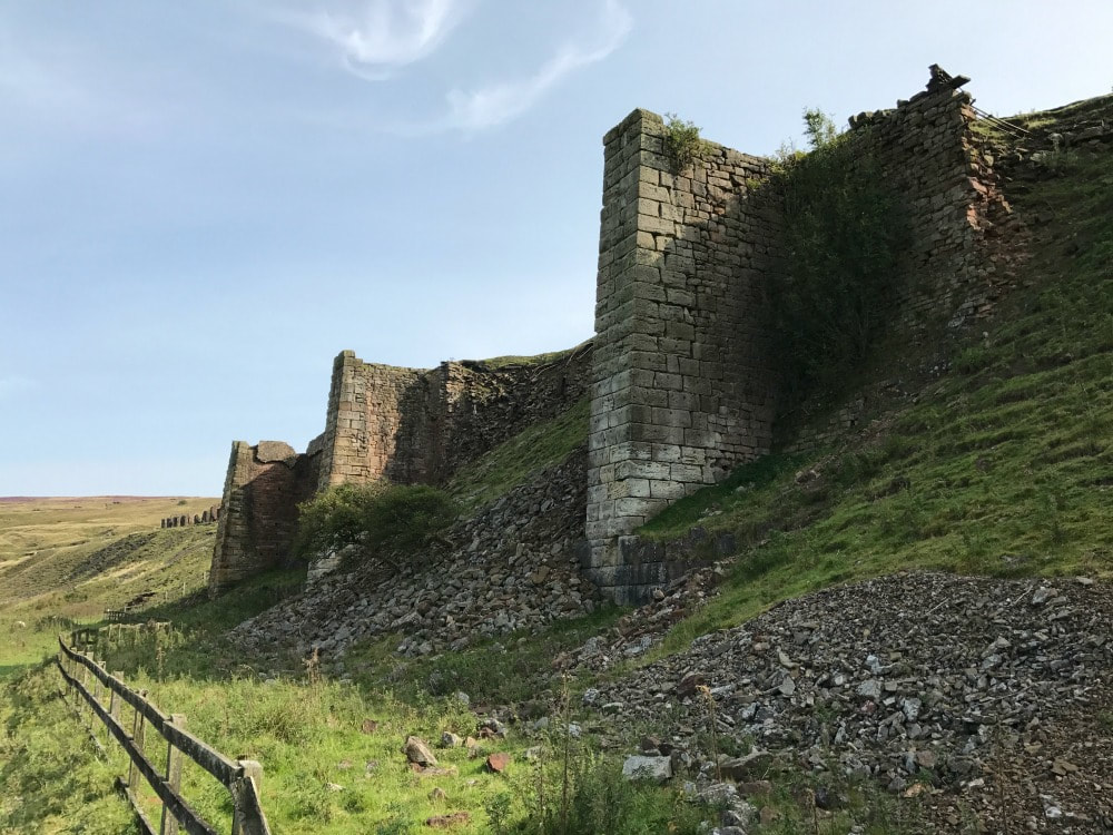
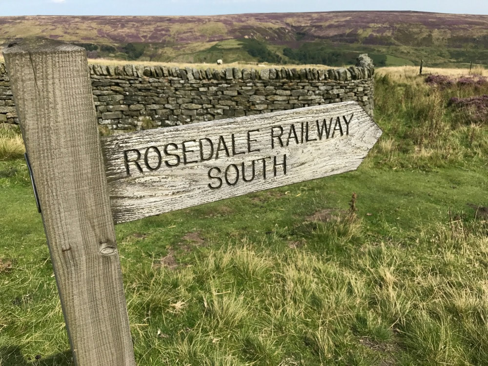
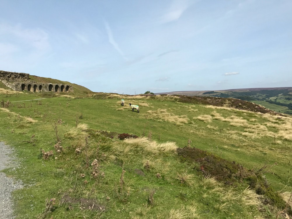
 Our view The full Yorkshire breakfast nearly put paid to that idea, but we huffed our way up the forest line to the old railway track that runs midway along the ridge. It used to cart trains filled with ironstone ore off to Teeside. We turned right and walked to the old calcining kiln remnants where the ore was blasted to remove impurities, making it lighter to ship. Despite being industrial relics, the ruins were beautiful and ghostly. These were like the buildings I'd seen the previous day and I learned that the entire area was dotted with old mines and kilns. We could - from Dale Head Farm - have climbed up to the same abandoned railway line track and turned left, following a three mile path around the head of the Dale, until reaching the Lion Inn at Blakey, where you can enjoy a meal or pint, before walking another two miles back down into the valley to the farm. For a day trip, that would make a lovely 5 mile walk, very do-able with children. 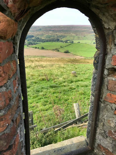 Old mine buildings and workers houses dot the landscape and frame the heathery views
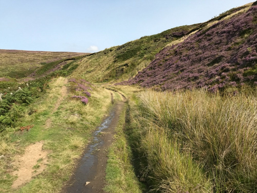
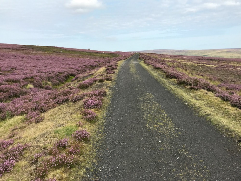
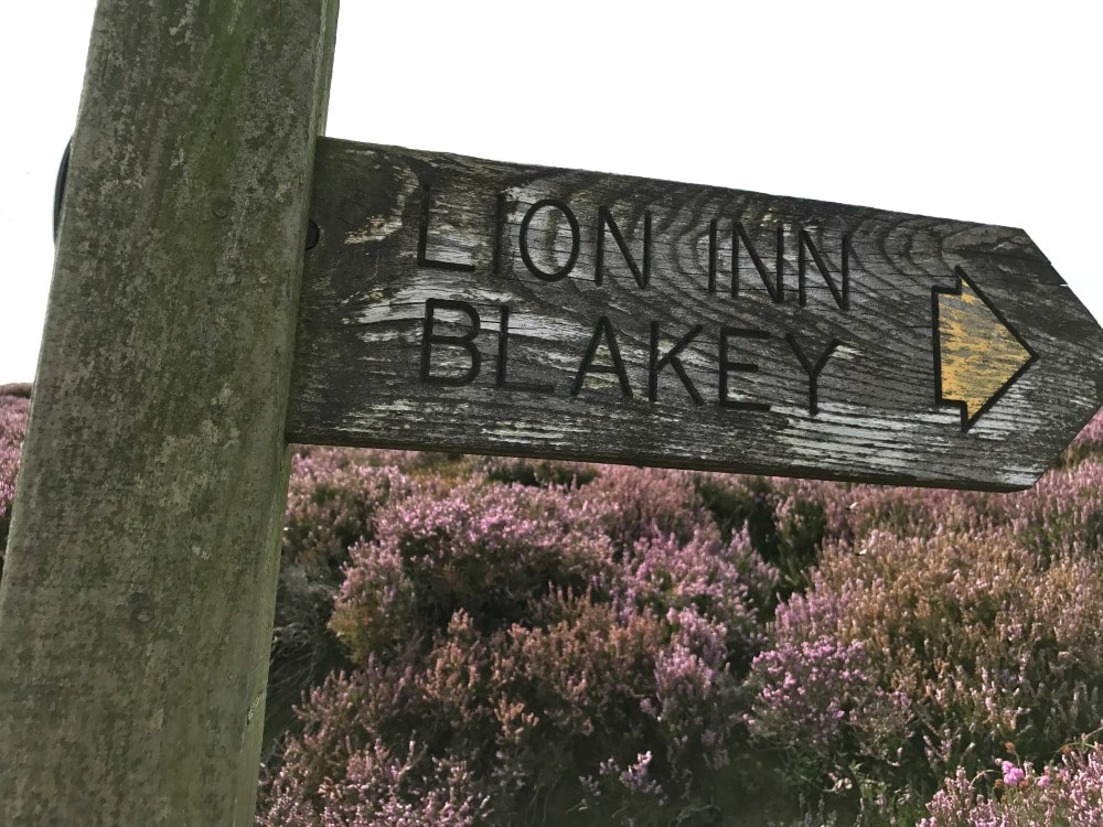
However, having waved goodbye to my friend and driving back to Chimney Bank (where I'd seen the old stone kilns and mining buildings the day before), I spotted an inviting path heading north west in the direction of the Lion Inn. Carpe Diem! I ignored the fact that it was Monday and that I should be working, put my boots on and followed the path. This too was an old railway line, the tracks long since gone, but the flat path makes easy walking. Heather lined both sides of the route while sweeping views across the valley below were wonderful. By my estimation it's roughly 5 miles from the Chimney Bank car park to the famous Lion Inn pub at Blakey Ridge, situated at the highest point in the North Yorkshire Moors. This pub is a haven for walkers, being on the Esk River Valley route, the Coast to Coast and the Samaritan Way. It is also the only place to eat and rest for miles. I decided that I'd walk to the pub, get a cold drink and then walk back again. And then I realised that I'd left my wallet in the car.....But I used the pub to refill my water bottle and luckily had a few snacks in my pack to make an impromptu lunch, which I had sitting on a stone taking in the views. During my walk, I stopped to chat to a man who had been in the fire service for years and who had now retired. He spends every Monday walking somewhere beautiful - lucky him. He had started his walk at the Lion Inn and was walking to Chimney Bank, down into Rosedale Abbey, through the village, up the other bank and along the track I'd walked that morning, continuing all the way around the top of the dale, before returning to the Lion Inn. I have tried to map that out (see below) and I believe it will be about 11 or 12 miles - but it may be a bit more. There will be one very steep downhill and another steep uphill during the walk if walking anti clockwise. But it got me thinking that it would make a fine one-day walk. You could stop for lunch in Rosedale Abbey. If you felt the need, you could stop again at Dale Head farm with its tea garden (although you will be adding in another climb for yourself). And then you could return to the pub for a well deserved pint! Alternatively, you could go for a weekend, and start in Rosedale, break the walk by staying at the Lion Inn and then completing it the next day. There are many different ways to tackle this particular part of North Yorkshire Moors - but whichever way you do it, I can highly recommend you go. August is when you'll see the heather in all its glory. February is when you'll see the wild daffodils (although Farndale - the dale on the other side of Blakey Ridge - is where the best daffodils are on display). In winter, dress for extreme cold and don't attempt driving Chimney Bank in icy conditions. The walking - while on the old railway line - is mostly flat. The views - assuming you have a clear day - are spectacular. Here's a taste of what it looks like like, although no pictures can do it justice.
Here's a rough map plotting out of the entire circular loop taking in both the east and west sides of Rosedale. But the best bet is to get an OS map (number OL26) and have fun plotting out your own route, depending on how far you want to go! 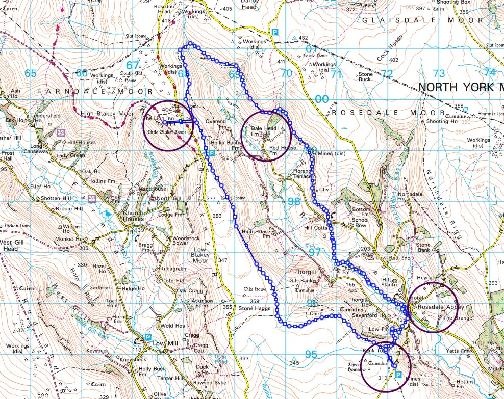 Highlighted are: Top Left: The Lion Inn at Blakey Top Right: Dale Head Farm with tea garden and shepherd hut Bottom left: Chimney Bank carpark Bottom right: village of Rosedale Abbey Join Glamoraks, an online community of women who walk. Find women just like you who love some company while exploring walks around the world.
0 Comments
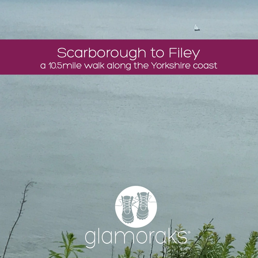 Distance: 10.5 miles (depending on where you start in Scarborough) Terrain: Mostly flat walking on good paths but with several steep hills. Stretches of woodland plus cliff edges most of the way Starting point: Scarborough train station or anywhere along the Scarborough seafront. Parking available at Scarborough train station (pay at meter) This is the last leg of the Cleveland Way, a 108-mile national trail that crosses the North Yorkshire Moors and a long stretch of the North Yorkshire coast. I've walked most legs of the Cleveland Way as day walks or two- day stretches, but I'd yet to do the final leg that runs from Scarborough to Filey. You can either catch a train to Scarborough station or drive there and park next to the station (making it easy to get home on your return). But you can start from any point along the Scarborough seafront. You can even have a dabble on the penny slot machines before you kick off if you like! If you start in North Bay, before the hill with Scarborough castle on it, you will be walking for about an hour before you really start the walk route. Leaving the sandy beaches and promenade behind you, you will climb up a hill where you can admire the views as you catch your breath. Be sure to look behind you to see the bulk of Scarborough Castle looking impressive on the opposite hill. For a stretch of the path, you'll walk alongside a golf course to your right. The sea will remain on your left and in sight for most of the walk. Having waved goodbye to the golfers, you will follow a headland, then go down some steps to a ravine until eventually you have to turn right along a track that takes you past some holiday houses. This bit of the walk isn't particularly lovely. You skirt the holiday homes before connecting with a suburban road. Turn left and follow the road until you see a National Trust sign for Cayton Bay. You follow the steep steps down through woodland then turn right onto a path that leads out of the woods and along a cliff overlooking Cayton Bay, a great spot for surfing. After climbing a hill you reach the road that takes you down to Cayton Bay itself. Here you can pop down to the Beach Shop for snacks if you didn't pack a lunch, or simply use one of the two handily placed benches for a lunch break. Lovely views and a good chance to rest after quite a few unexpected hills. 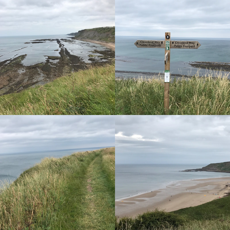 From here you simply follow the cliff top path. Some of the edges are pretty sheer and if you're not a fan of heights (I'm not) simply walk as far from the edge as you can. I really don't like heights but I managed it fine. The views are magnificent the whole way, with thousands of nesting birds swooping and calling. The only thing that detracts from the view are the numerous caravan parks that run along your right hand side. It makes the walk feel less remote and the people traffic also increases near each of the sites. That said, once you've left the last of the caravan sites behind you, the views continue with the white cliffs of Flamborough Head appearing in the distance. There is something about looking at the outline of the English coast that makes me feel inordinately fond of this little island country. It stands so resolute against the sea, despite the waves taking constant bites out of its cliffs. The rooftops of Filey will come into view and eventually you'll reach the sign marking the end of the Cleveland Way. But if you still have energy left, it's worth walking to the end of Filey Brigg, a headland jutting out into the sea. Carr Naze, the landward end of the peninsula had flint tools discovered on it dating back 3 to 4000 years. The Romans also used the headland as a signal station to warn against invaders. You can see why as the headlands to the north and south of it as clearly visible. 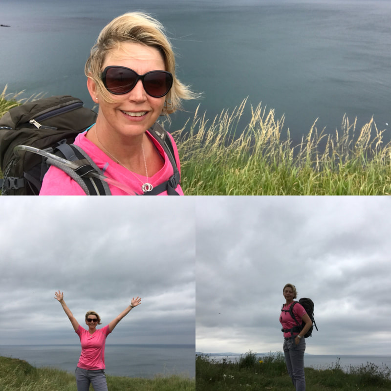 Once you've had your fill of sea air, head back inland and follow the signs for the town centre until you reach the bus station. Catch the 120 or x20 buses back to Scarborough - they run every 15 to 20 minutes - and will drop you outside the Scarborough train station, ready to catch a train back home or a short walk to your car. A lovely seaside walk with stunning views. Definitely one to add to your list. See the video below for a sense of what it's like. If you would like to meet likeminded women who walk, get walk ideas, advice and inspiration, be sure to join the Glamoraks community. Or sign up to the newsletter.
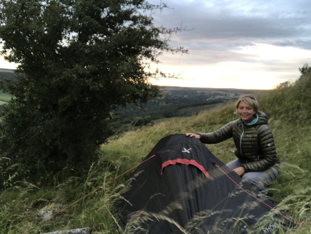
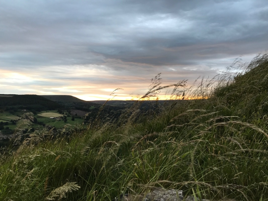
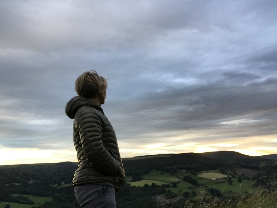
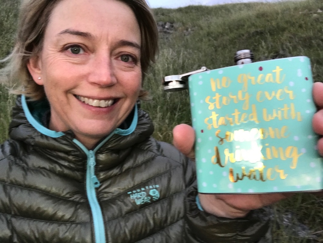
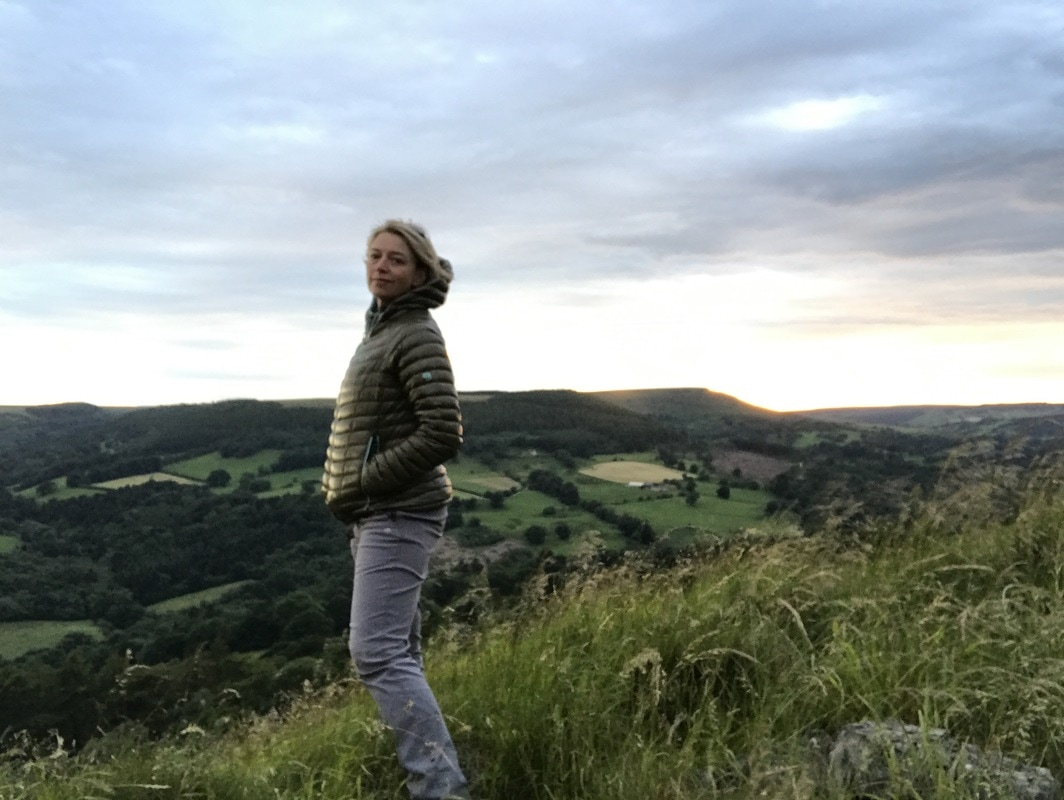
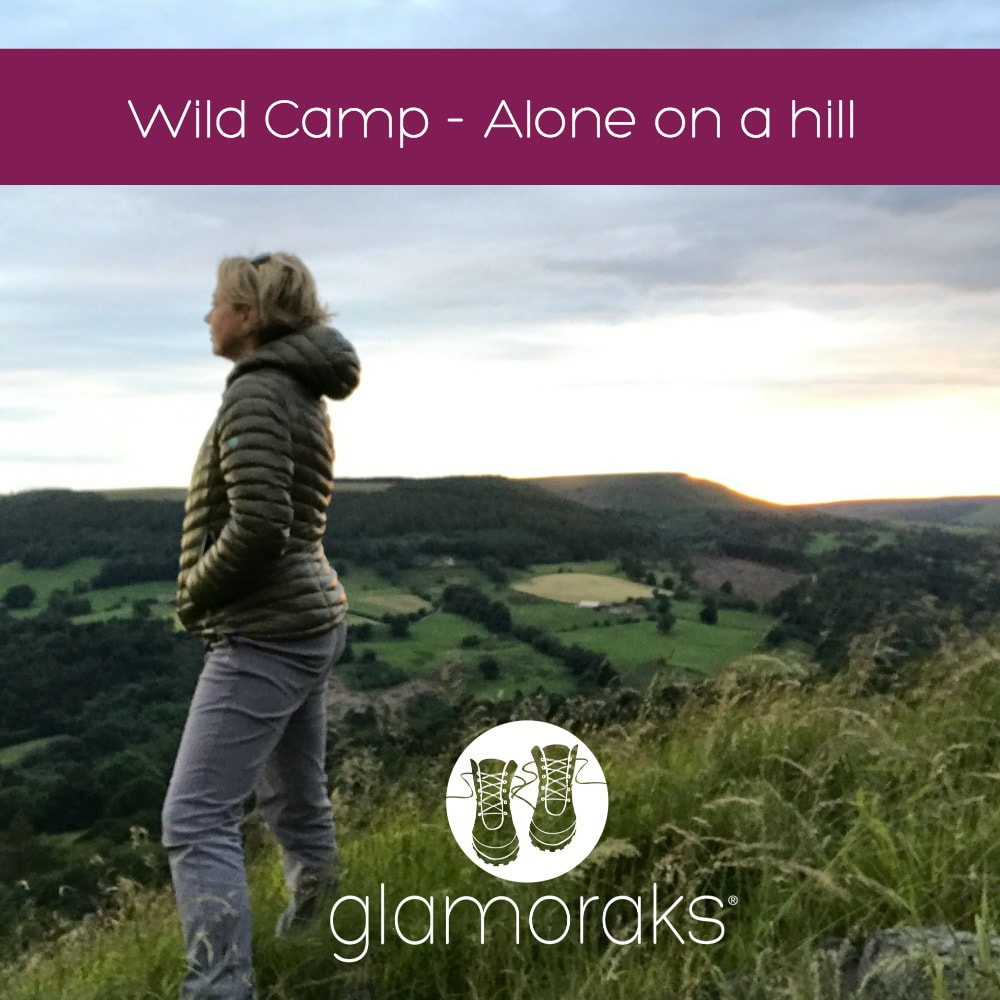 Five years ago a man called Alastair Humphreys gave the speech day address at my children's school. He was on a mission to get people to have microadventures - a mini adventure that you can fit into every day life. It should challenge you and push you out of your comfort zone but still be achievable. That speech inspired me and soon afterwards I started walking, having my first microadventure when I set off walking 14 miles on my own and staying in a hostel. Since then I've gone on to have plenty of adventures, but I had yet to wild camp. So when I saw that Alastair was running his Summer Solstice Microadventure challenge, I knew it was time to push my comfort zone a little bit further. My plan had been to go wild camping on the summer solstice (21 June) but despite having arranged childcare and having my bag fully packed, the Met Office put out a yellow warning for thunder, lightning, gales and very heavy rain showers with the potential for localised flooding. That didn't sound particularly sensible to be camping in, particularly on the top of a hill. I had to put my plans on hold and wait for better weather. Last night that weather arrived. Once again I packed and this time headed off, leaving my husband and children at home, all three thinking I was daft in the head. My microadventure would see me do three things I'd never done before: 1. Carry all the kit I needed on my back for an overnight stay 2. Wild camp 3. Camp on my own My comfort zone was going to be well and truly pushed. But too many women - particularly mothers and those whose 20s and early 30s are well behind them - spend their lives observing life through their kids or doing things for others instead of experiencing life first hand. I'm on a mission to change that and I can't tell others to do it if I don't do it myself. But first things first..... Where to wild camp?My biggest challenge with wild camping was trying to find somewhere to go. In England, legally you are not allowed to camp anywhere you like. You're supposed to get the land owner's permission. But that can be very tricky to do and it spoils the spontaneity of it. The advice is to find somewhere tucked away, out of view, don't make fires and don't leave anything behind. Arrive late, leave early and no-one will be any the wiser. I spent a good amount of time trying to find a suitable spot by looking at maps. I wanted somewhere remote, but not so remote that if anything happened I'd be in tricky spot. I didn't want to run the chance of bumping into people. I wanted views and it had to be not too far from my home in York. After doing some research, I found the very spot in a secret location on the North Yorkshire Moors. It was 50 minutes drive away, was a short walk from a pub/civilisation, but was remote enough to not be found. And it had stunning views. Next challenge..... What to take wild camping?Here's what I took. You could get away with less:
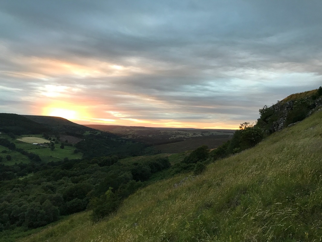
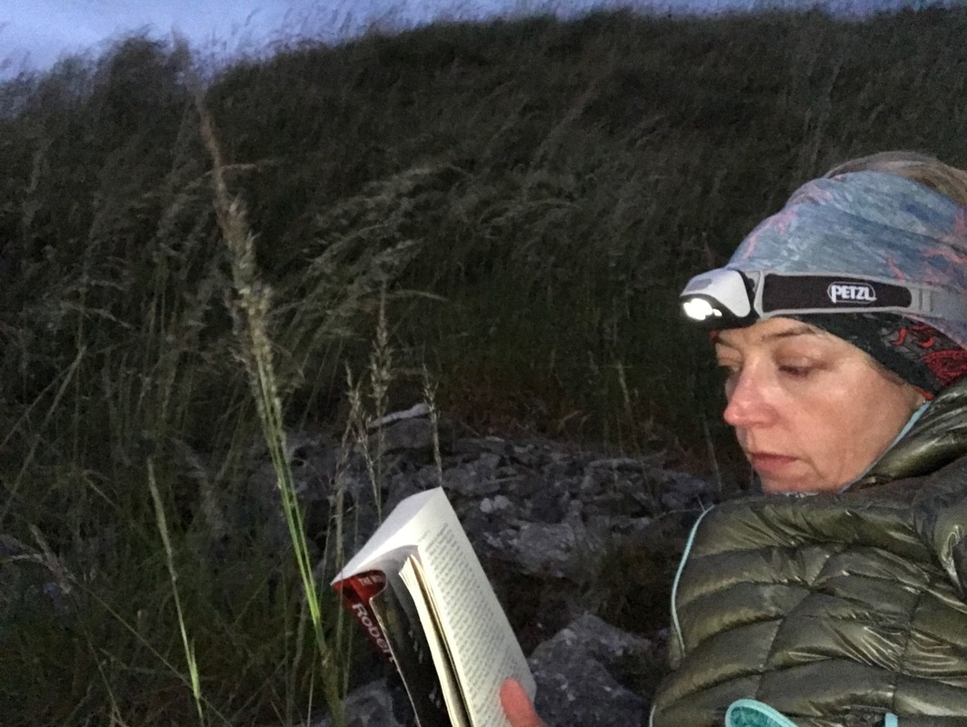
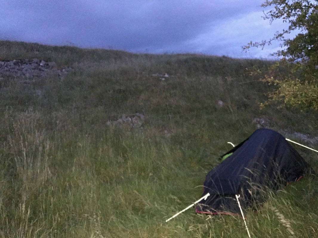
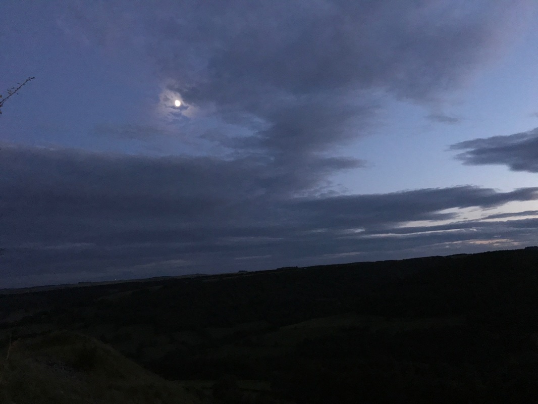
My MicroadventureI set off from York at 6.20pm on a Sunday evening and drove north, towards the moors before arriving 50 minutes later in the exceptionally quaint hamlet, closest to my chosen destination. I knew it had an Inn, but I hadn't realised it also had a tiny tearoom and shop, which amazingly was open at 7.15pm on a Sunday evening. I popped in for my crisps and chocolate bar and asked for directions. She pointed out the general direction to me and said I could park my car behind the village hall. That was handy to know as there is nowhere else suitable to leave your car overnight. I tucked mine out of sight behind the hall and set off up the hill. I began my short brutal walk - only about 15 minutes but straight up - before I was on the top of the hill with magnificent views on all sides. I followed the path along the ridge line, looking for somewhere to make camp. I reach the cairn on the hill summit and noticed several dips off to the left hand side just before the cairn. They would be out of sight of anyone on the path and out of sight of anyone below. They were also slightly less exposed to the wind than on the very top. Because the thing about hills is that they're high up and therefore windy! I chose a little dip that had a tiny tree for a bit more shelter and attempted to pitch my tent. This proved a challenge as the ground had a layer of soft spongy moss to lie on, but a layer of solid rock just beneath it, making it impossible to get the pegs to grip. But I finally managed it and rewarded myself with my glass of red wine and an exceptional sunset. It truly was magnificent. The bright daylight had transformed into an array of purples, pinks, corals and golds. Every five minutes it would change, each more stunning than the last. It hit me that the sun setting really is an artistic masterpiece that is available for free every day to every person - you just have to step away from your screens and head outdoors. I watched the wind blow through the grass, saw birds swooping for a late supper of bugs and heard their night time calls, while sheep far below were baaing to their lambs. It was truly magical. Unlike an inside space, the great outdoors is always moving, whether it's clouds scudding past or long grass waving, there is a sense of perpetual movement. As the night sky darkened, it seemed as though the stars themselves were racing across the sky, but it was just a trick played by the clouds rushing along. I tried to read my book, taking nips of cherry liqueur as it grew colder, but my attention kept getting distracted by the view.
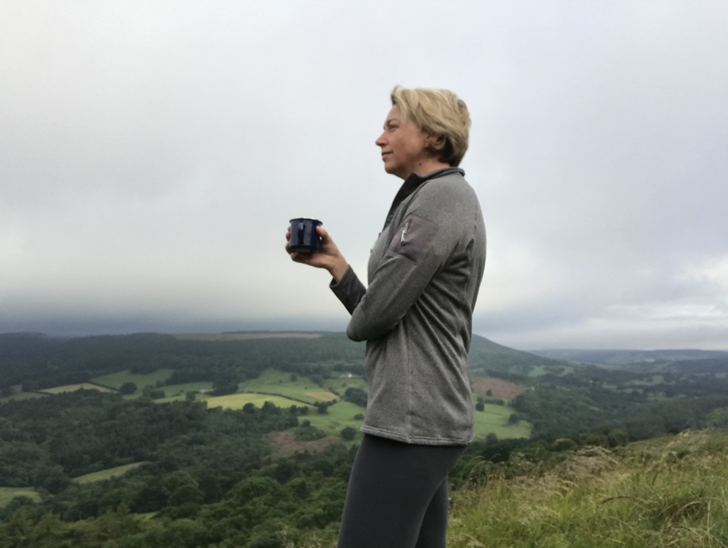
 Just after 11pm I decided to retire. It was a battle between my closing eyelids and my desire to wait until it got truly dark. But my eyelids won and I slunk into my tent and fell asleep instantly. I'm not sure what time it was, but possibly 1am I woke to the sound of wind howling around the tent. Having pitched next to a tree for shelter, the wind sounded even louder as it funnelled its way through the branches. I lay listening to it a while, wondering if my tent would take off, with its poorly secured pegs. I must have drifted off again as I had a really odd dream about an adventurer (a real life one who I know) who was shaking me awake. In my dream I sat up and said, 'Oh, I thought I was dreaming but here you are.' We had a good long chat. It seemed so real that when I eventually did wake up in the morning, I was surprised that he was no longer there. About 4am the rain started to come down but the sound was soporific and I went back to sleep until 6am. I woke to a very wet morning. A brief respite in the rain meant I could make a cup of coffee, have my sandwich and pack up before it started again. I just managed to get everything put away when the heavens opened. I bid a hasty farewell to my campsite, making sure I'd left nothing behind. The only trace that I had been there was a slightly flattened bit of grass. I headed back the way I'd come the day before. Any plans for a longer walk home were binned as the water poured down the back of my neck. I'd failed to pack waterproofs! It was a brilliantly refreshing start to the day. Instead of chivvying kids into uniforms or sitting in traffic, I got rain pelting my face, sheep to yell good morning to and views of rolling green hills.
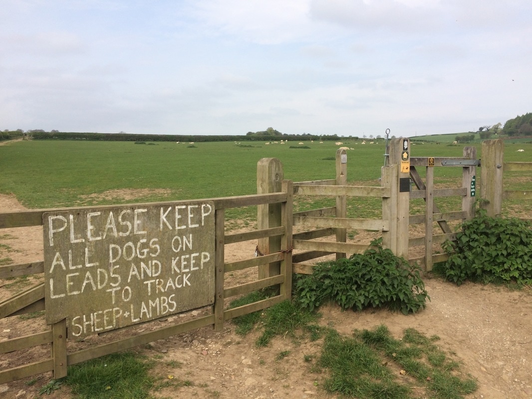
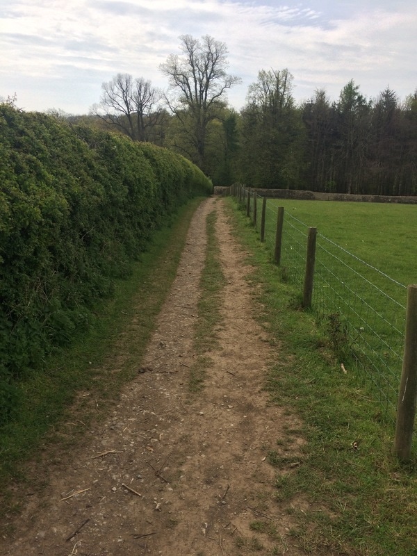
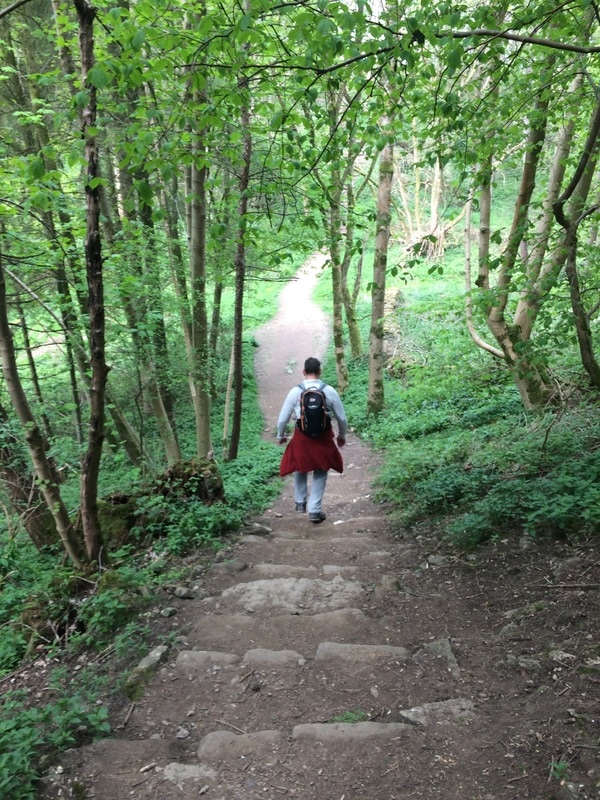
So would I recommend it?Hell yes. It seems much more scary in the planning than it actually is to do it. I loved going on my own as there is something beautiful about solitude. But I can imagine that going with a friend would have a completely different feel and would be a lot of fun. If you want to feel alive and come home grinning from ear to ear, go wild camping. It doesn't matter how old your are or that you're a woman (it's not just for blokes!). Go have a microadventure. You'll be so glad you did. Watch the video below for a taste of what it was like. And if you'd like to meet other likeminded ladies who love to walk and adventures, join the Glamoraks community. 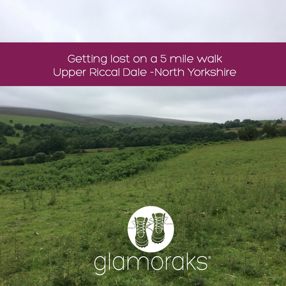 Distance: 5 miles (more if you get lost) Difficulty: Moderate (some hills to climb and map reading required) Type: Farmland, forest Start point postcode: YO62 5HH - Cowhouse Bank Carpark, North Yorkshire, UK After days of being trapped indoors due to a combination of work and utterly foul weather, I decided to head off on an easy 5 mile walk on the edge of the North York Moors. I have a little book called Short Walks in the North York Moors, by Collins. Now this book has given me plenty of really good walk suggestions and the instructions are typically easy to follow and as each walk includes a map, there is no need to take an additional big map with you. The walk I chose was one called Upper Riccal Dale, that starts from a Forestry Commission carpark called Cowhouse Bank. To find it, head out of Helmsley, through a tiny hamlet called Carlton and shortly thereafter you find the exceptionally quiet carpark. There is bench with lovely views over Bransdale from the carpark. I parked up, the only car there and got that lovely sense that I was the only person in the world. You start out by crossing the road you've just driven in on and heading off down a forest track. Through gaps in the trees you get glimpses of the views over the dale below, dotted with sheep. The path was exceptionally boggy underfoot on account of the three days of torrential rain we'd just had but I didn't care. It was peaceful and quiet. If it's been raining, wear gaiters! The path went back on itself down the side of the hill until reaching a farm track. It was here that my first navigation issue arose. According to the book, 'Go right on the farm road. Cross the bridge and climb through two fields away from the stream towards Howl Wood Farm.' But at the entrance to that farm road were two big signs saying PRIVATE - NO ENTRY. That's never a welcoming sign. I couldn't see any right of way signs or footpath signs but everything else seemed to indicate that this was the way I should go. So I went in. Although there was a stream (very pretty) and a bridge, there were no fields to climb through. Just a track that made it's way up to the farm buildings. I figured it must be right, so I kept walking. The book said, 'Go left through the farmyard and left through a gate beyond the farm tip to follow a faint track ahead.' I really, really don't like walking through farms. Firstly, it feels as though I am trespassing on someone's property - and the big PRIVATE - NO ENTRY signs certainly reinforced that. Secondly, there are always old, empty barns creaking in the wind, with rusty hooks and other dangerous looking pieces of equipment lying around. I always expect a scary bloke to come out carrying a bloodied meat cleaver while spitting out chewing tobacco, telling me to either 'Get orf my land' or 'To come in for a visit....' (I have an over active imagination.) Add to that, there is invariably at least one (in this case four) farm yard dogs that aren't known for their friendliness. They started barking furiously, while a gaggle of geese hissed at me as I passed them. Then the cows (luckily behind a wall) started to add to the cacophony, lowing their discontent at my presence. Luckily there was a single footpath arrow on one of the gates, so I headed at pace for that and made it through the other side breathing hard. I am very rarely scared walking on my own but on remote farms, my heart does race a little. After that excitement, the next set of instructions was simply, 'Cross the stream by the footbridge'. I was still following the 'faint track' as described by the book but eventually I reached the end of the wall line and my path was blocked. I had obviously missed a path down to the stream where the footbridge was, but there really hadn't been a path anywhere! I retraced my steps, found no path but eventually followed sheep tracks down to where I could hear the stream flowing. Reaching the stream, there was no footbridge. So I bashed my way along the stream edge until at last I found the footbridge. Somehow I had obviously missed the path down. My advice if you're doing this walk, is when the 'faint track' starts to bend slightly north, head down the hill to your west. 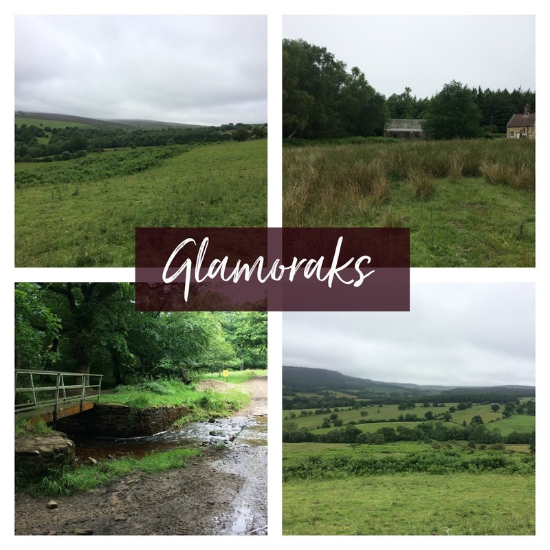 Crossing the bridge, I headed up through two fields until I found a rough bit of grazing land and the Forest Chapel that the book mentioned. Like something out of Hansel and Gretel, the chapel was very sweet tucked into the forest (picture top right above). But here again, the instructions were light to say the least. 'Cut across an area of rough grazing and walk towards the road, aiming to the left of the forest chapel. Cross the metalled road and go onto a forest road.' I stood in an overgrown field with no signs of a road. Beginning to despair of my navigation skills, I saw the first - and only - person I encountered all day. A cyclist, or rather a cyclist's head, whizzed past. That must be the road! I found a gate that led to a very overgrown track to meet the road. Should you be doing this walk, don't worry about the fact that you can't see the road or a gate or a sign of any kind. Just keep walking towards the fence line and it shall reveal itself to you. After that, it was a simple case of following the forest track back up a steep bank to get more lovely views over Bransdale. Even though I thought I was home and dry at this point, I made one final mistake. The book said, 'At the open field, turn left away from the road on a path between forest and the field's upper boundary.' I found the open field and turned left, but the word I missed was UPPER boundary. I turned left to soon and ended up back on the road. By which point, I thought 'Sod it' and walked back up the road to find my car where I'd left it. The moral of the story: When going on a walk, take your time to read the instructions VERY carefully and look VERY closely at the map. Tiny signs like contour gradients, side paths and streams all give clues if the instructions aren't very detailed. I couldn't even blame my getting lost on chatting too much - which is normally the reason I go wrong. Despite getting lost, what made this walk lovely was the remoteness of it and the fact that I didn't see another soul (other than the cyclist). If you want to escape the world for a bit, get expansive views and see plenty of wildlife, this is a great walk. Besides all the farm animals, I saw plenty of birds, hares, bunnies and a gorgeous roe deer. And now that I've found out that you can walk through the farm despite the no entry signs, you can do so with the confidence I lacked. Below is a little video of my experience..... If you are a woman who likes walking - either on your own or with others - please join Glamoraks community where you can share your walking experiences, get inspiration or find people to walk with. Also sign up for the Glamoraks newsletter to get details of any events we have planned. 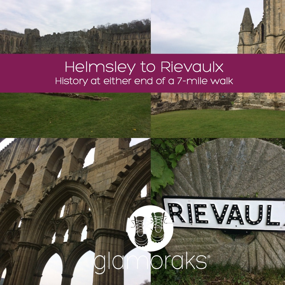 Start point: Helmsley Long stay carpark. Postcode: YO62 5AT Distance: Roughly 7 miles but could be extended by another 2 miles with an additional loop Sights: Rievaulx Abbey & Helmsley Castle Terrain: Easy walking on paths, a few hills with some steps that aren't particularly challenging Facilities: Toilets in Helmsley carpark and at Rievaulx Abbey carpark. Tea room at Rievaulx and plenty of restaurant options in Helmsley If you like to break up your walking with a little bit of history, then this is the perfect route, particularly if you're looking for somewhere not too far from York. It starts at a long stay carpark in Helmsley, which has the helpful bonus of loos. Whoop! This is the official start of the Cleveland Way, a 109-mile national trail that runs across the North Yorkshire Moors and along the coast. As such, it's clearly signposted. Although the sign says 2.5 miles to Rievaulx, which should be a 5 mile walk there and back, my walk tracker definitely registered it more like 7 to 8 miles, but that will depend on how much walking around the Abbey you do! 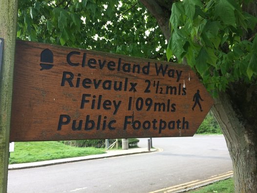 After leaving the car park, there's a brief climb up a hill until you level out at fields. If you look back over your shoulder, you will see Helmsley Castle behind you. More on that later. Simply follow the path alongside fields and through woodland. There is one section with a set of steps going down and then steeply up on the other side. But other than that, it is fairly level walking, with plenty of wild garlic, bluebells and primroses as a backdrop (well in May anyway!)
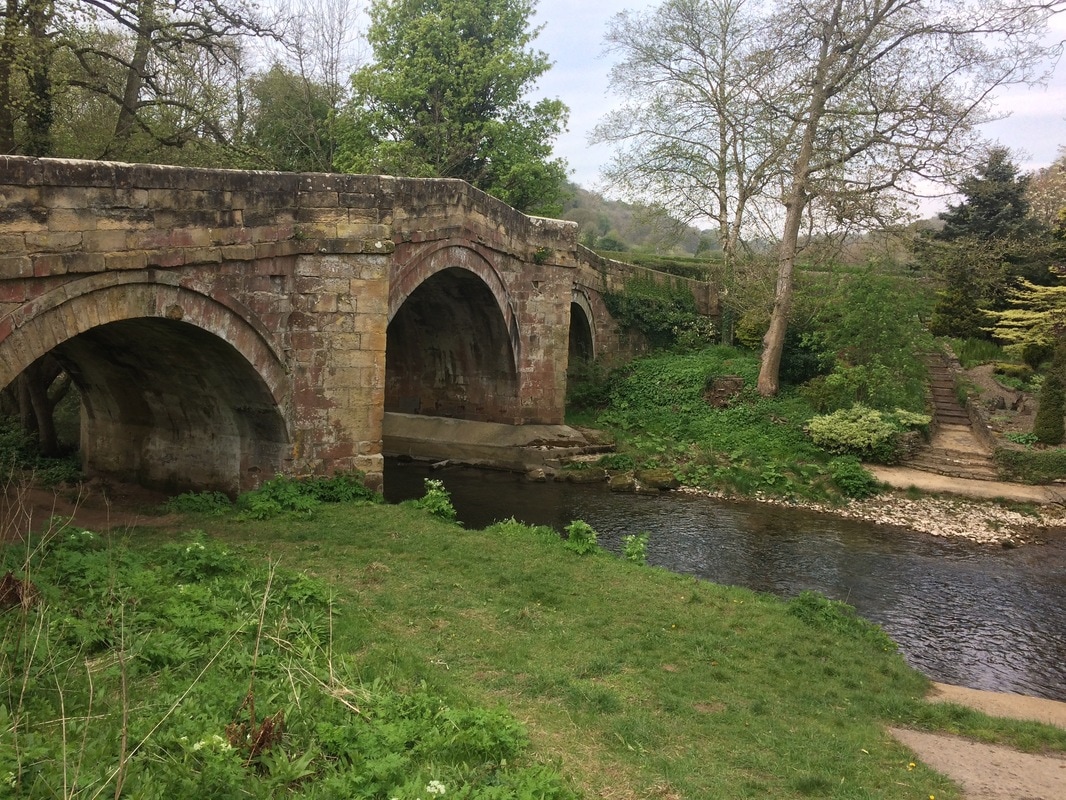
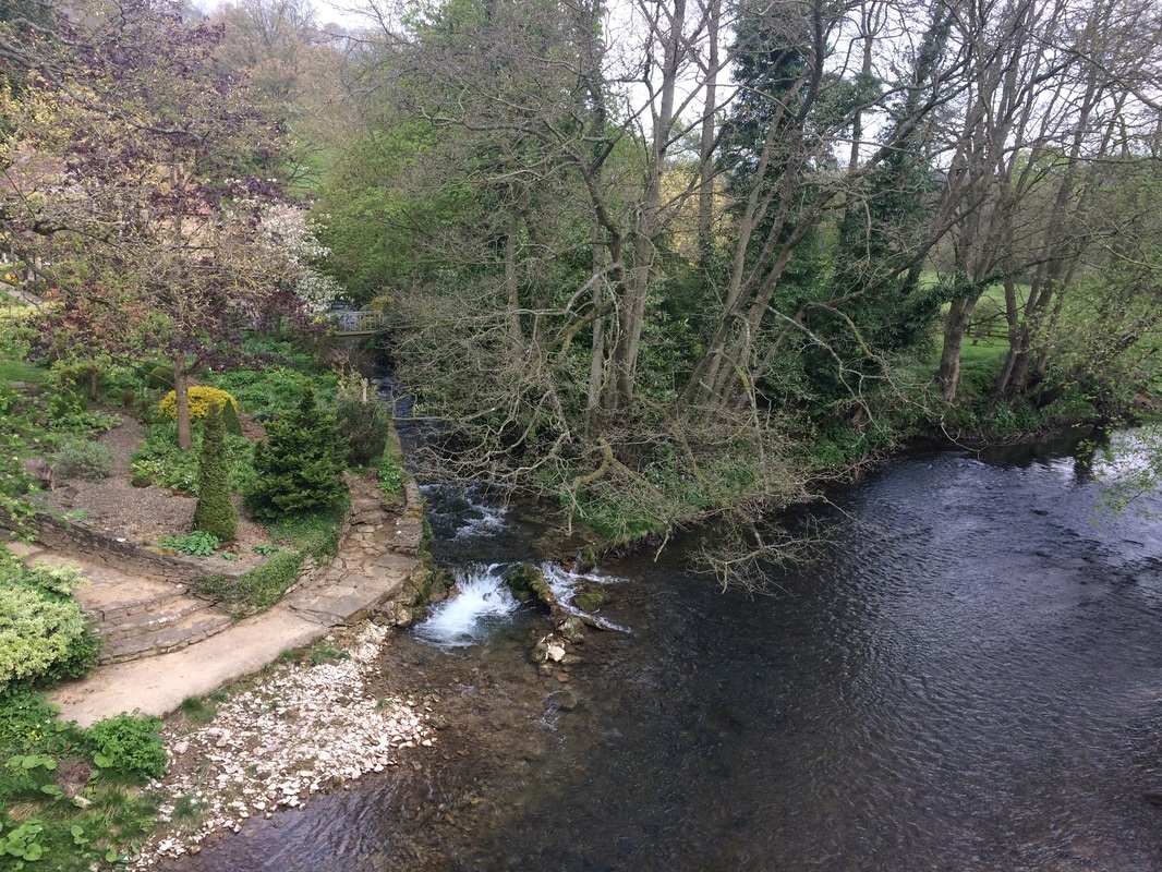
On the far side of the woods, you reach a road which leads to a pretty little stone bridge over a stream. Turn right just before the bridge and follow the road to the Abbey, which you will see looming in the distance.
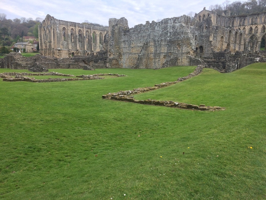
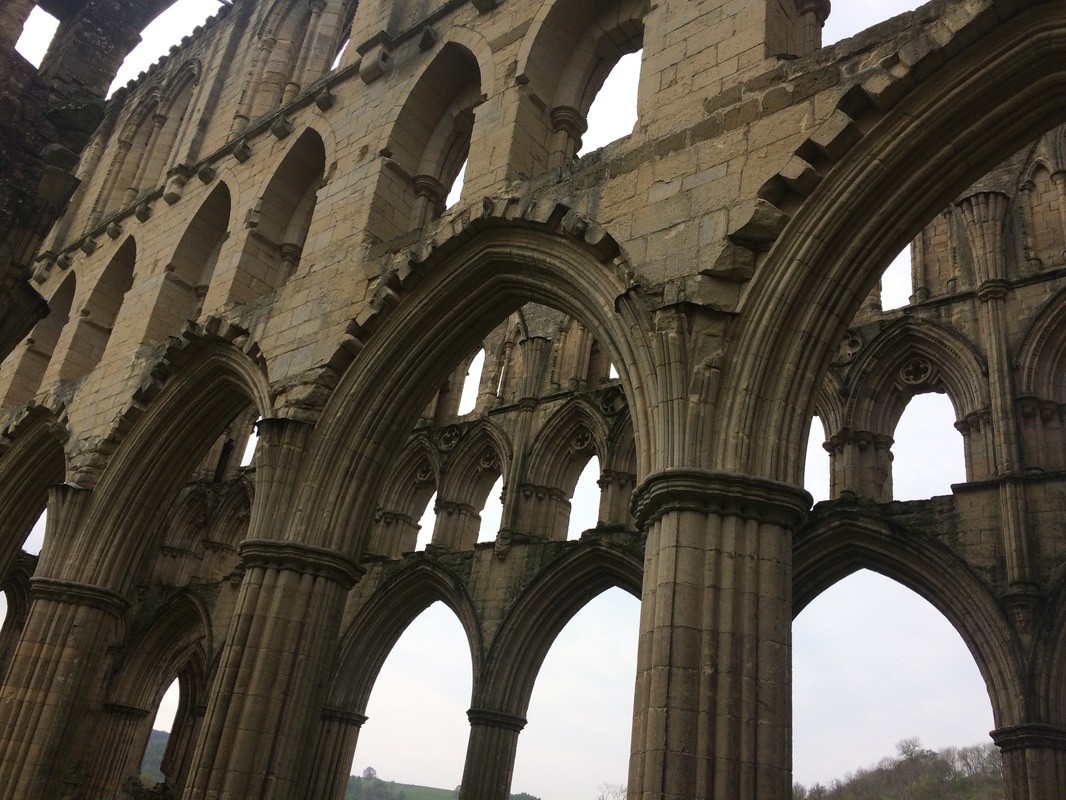
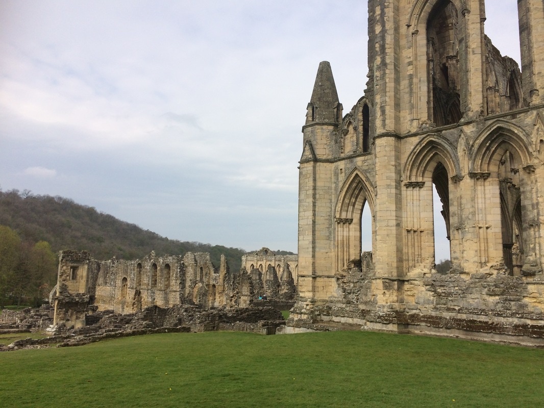
If you are an English Heritage member, it's free to get in (£8.50 for an adult, £5.10 for kids if you're not - I would strongly advise getting English Heritage membership if you're keen on visiting historic place as it works out much cheaper in the long run). Rievaulx Abbey was one of England's most impressive Cistercian monasteries. It's situated in a tranquil valley and the sheer scale of the ruins are impressive. It now has a new visitor centre and there are free audio tours you can take. Best of all, there is a lovely tea room with indoor and outdoor seating. And an excellent choice of cakes!
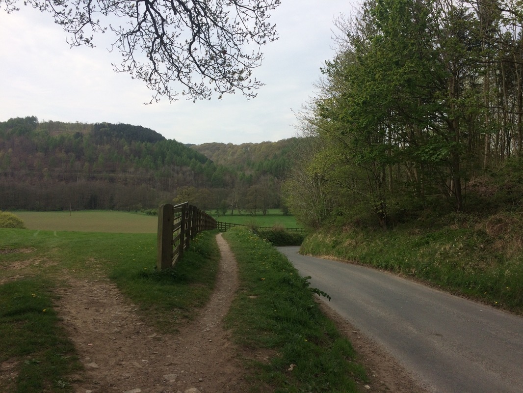
Once you've had your fill, you can either retrace your steps to Helmsley the way you came, or add an additional couple of miles to your walk by turning right out of the Abbey. Follow the road for a short while until you get to a gate on the left by a footpath with a sign to Bow Bridge. You'll pass a paddock and fields, briefly joining the River Rye, before bearing right through a gate of the meadow. You'll turn left over a gravel track, cross Bow Bridge and carry on to a right hand bend. Go through a gate to the left signposted to Ashberry. You follow the base of a hill before climbing it where you get views across to the opposite bank and glimpses of the Abbey again. The path eventually goes down, depositing you back at the bridge you came across earlier. Then retrace your steps back to Helmsley. If you want another history fix, visit Helmsley Castle, is just a short walk from the carpark. Another English Heritage property (free for members, £6.20 for adults, £3.70 for kids), it is well worth a visit. Again you get a free audio tour and you can learn all about the fascinating 900 year history of the place. You get lovely views over Duncombe Park from the castle too.
After all of that, you'll be ready for a hearty lunch, afternoon tea or pint in a pub, all of which you can get in abundance in Helmsley. So add this walk to your list!
If you are a woman who likes walking, remember to join the Glamoraks community. Get inspiration, advice, meet other walkers for find walks. Access it here. 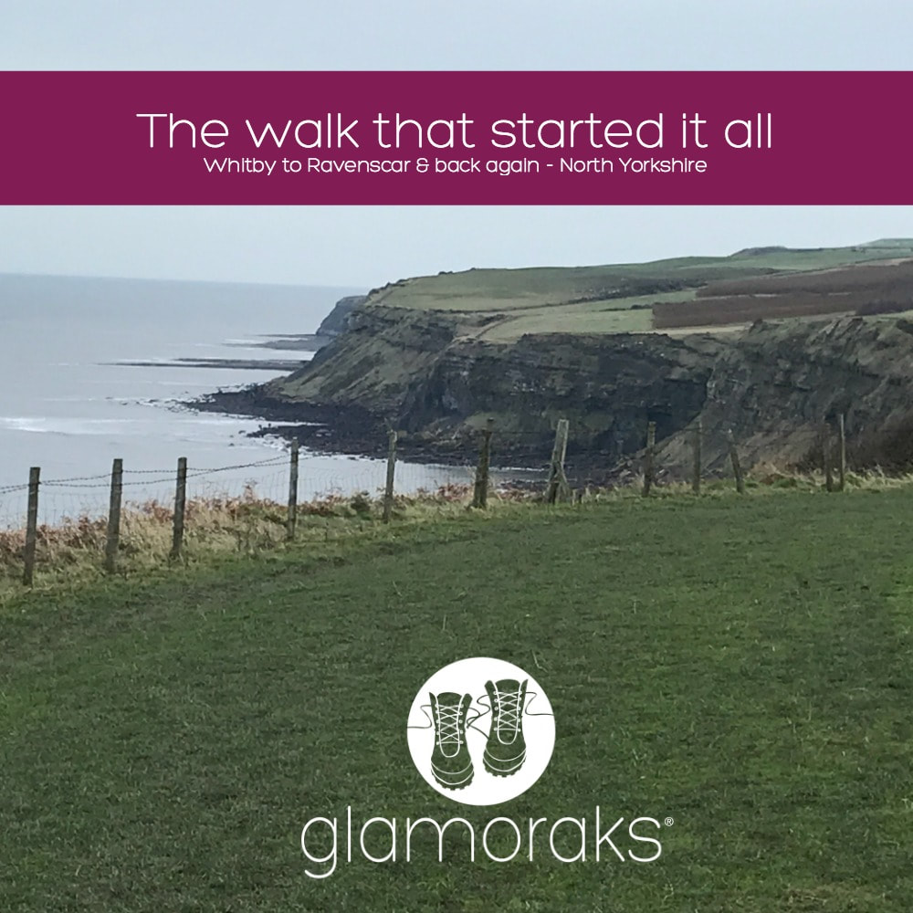 I first wrote this blog post in May 2014 on a now defunct blog. But thanks to the wonders of the internet, I could find it. So here it is - the walk that started my love of walking: Dont get me wrong, I like other people. But occasionally I do like to head out on a little adventure all by myself. It makes it slightly more scary, slightly more liberating and it gives me plenty of time to think. Or sing aloud with no-one listening. As I have no children this week (I know, how did I wangle that one?) I decided to buy some hiking boots and a small backpack and attempt a bit of the Cleveland Way. If you did the Cleveland Way in its entirety, you'd have to walk 110 miles. I didn't have the time to do that and did I mention I had new boots? So my grand plan was to catch a train from York to Scarborough (somehow going on a train always makes any trip seem that much more of an adventure), then walk from Scarborough to Boggle Hole Youth Hostel just before Robin Hoods Bay. And then after a night in the hostel, walk to Whitby, where I'd catch a bus and go home. Except on the morning of my trip, the Met Office gave a yellow warning for rain all along the Yorkshire coast, with not insignificant winds just to add to the mix. Given the walk is a clifftop coastal walk, which does get very muddy and you walk quite close to the edge at times, I started to have second thoughts. After much deliberation while the heavens poured down outside, I decided to drive to Whitby, walk to Boggle Hole and then retrace my steps. That would make a shorter walk and if the weather really got too vile, I could simply turn around and drive home. The weather was pretty vile. But I wish I'd stuck with my original plan because it was manageable. And there is something utterly liberating about walking in the rain. If you have good shoes on, your feet stay dry. This is important. If you wear natty waterproof trousers as I did, your bottom half stays dry (even though you will look like a telly tubby). If you wear a really not very good supposedly waterproof jacket, you will get wet. But once you're wet, you're wet. And who bloody cares when you get to see this: 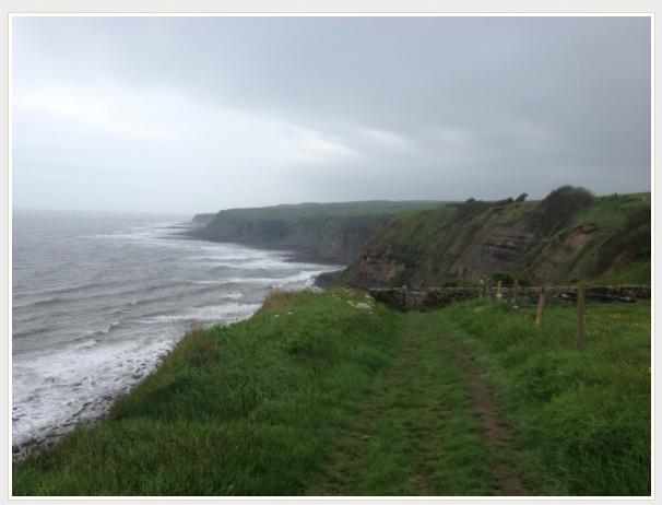 I walked for a good hour that morning before I saw a single other person. It was just me and the cows and the sheep and the seabirds and fields of buttercups dancing in the wind. And because no-one was there, I could sing out loud (Sound of Music was my preference) and talk to myself (yes, I know its the first sign of madness but it helps to talk out loud when you're trying to build a plot for a book). It didn't matter that my clothes were filthy, that my hair was in knots, that my face was make up free and rather sweaty. I could just be me. It was lovely. When you stand on a clifftop, with the wind pelting rain at your face, looking out at the vast curving expanse of sea in front of you, you get a real sense of the earth's size, shape and beauty. While pretty huge, it makes you realise just how tiny it is in relation to the rest of the universe and how tinier still we are. And that puts any problems you might have into perspective, which is why you end up singing like a loon to a field of cows in the rain. Because why not? If you like me sometimes yearn for head space and clean air to just revel in nature, I can highly recommend doing this walk (or one similar near you). Here's how to do it: I found this website very useful, with lots of info on the trail depending on where you want to start and how much of it you want to do. It also has plenty of other trails to try out. I started in Whitby. To find the start, just walk up the steps to the Abbey, walk through the gates as though you are going to the Abbey, but then follow the road to the left and you'll see a sign showing you where to go: 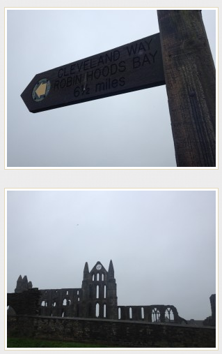 The path is clearly signposted. You will walk through a caravan park (less lovely) but once you're through that, it's just miles of gorgeous coastline to enjoy. 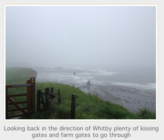 You will pass an old fog horn, which mercifully wasn't blaring out because it was foggy but the thing would deafen you! That is swiftly followed by a lighthouse. 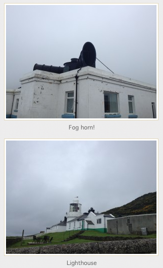 Besides those two landmarks, really the route is just a series of undulating hills. There are one or two places to stop for a snack at caravan park cafes, which thankfully are off the path so you can avoid them entirely should you not need food. Large bits of the walk are flat, but you do get steep inclines and declines, with plenty of little streams to cross some by bridge, others by stepping stones. You do occasionally have to walk through fields with cows (something I am not a fan of) but mostly you simply walk past the sheep and cows grazing on their side of the fence. In places the path does get very close to the edge of the cliff. I made sure I walked as far from the edge as possible due to the wet conditions and the erosion that is visible the entire length of the coast. It really does feel like the sea is taking big bites out of Britain and one day there will simply be no land left! 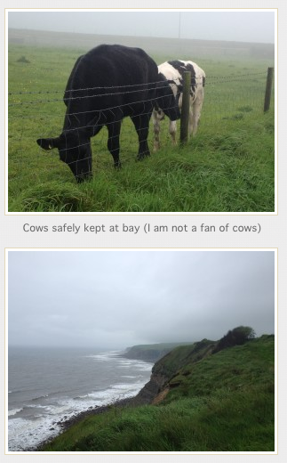 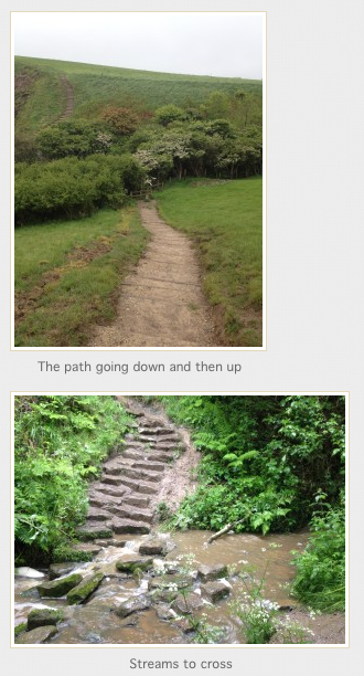 Walking into Robin Hoods Bay, you head down a very steep hill. If you've never been to Robin Hoods Bay, it is an old fishing village with houses stacked on top of each other, clinging to a steep hill as though they are afraid they might topple into the sea. I stopped for a cup of tea and scone with jam and cream at the bottom of the hill just what was needed on a very wet day. 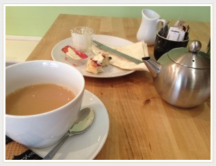 I got to Boggle Hole (about a 1/2 mile after Robin Hoods Bay) but I felt I hadn't walked enough (I'd only done about 7 miles) so I kept going to Ravenscar. I passed the Peak Alum ruins, saw deer in fields and climbed up a steep hill through beautiful woods to get to Ravenscar. Sadly, when I got there, the fog had set in so thick that I could see nothing so had to turn around and head back to Boggle Hole. 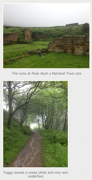 I have stayed at Boggle Hole Youth Hostel before. This time I had to stay in a shared dorm, not something I have done since I was about 21. But it was fine the showers were hot, the beds not too uncomfy for bunkbeds and frankly all I wanted to do was sleep after eating a meal and having a small bottle of wine. After wolfing down my full English (£4.99 from YHA) this morning, I set off retracing my steps. This was the view that greeted me this morning: 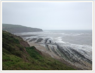 I was amazed that I had no blisters given I had new boots, but my feet were fine, if a little stiff. Like the rest of me. Who knew walking up and down hills in slippery mud could tire you out so much? After almost reaching the end, and after stopping for a moment on a bench to admire the view and complete solitude, I begrudgingly got up and did the last slog back to Whitby. Slog, because my feet were tired by then and I had to see other people. Didn't they get the memo that the Yorkshire Coast was mine, and mine alone? 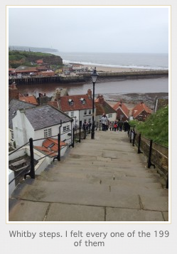 And then I rewarded myself with a proper Yorkshire lunch of chips n gravy.  And that was it. By my reckoning, about 23miles in total walked. I now have the walking bug (not to mention the boots and backpack) so will be doing a whole bunch more of it. Coast to coast perhaps?  Since I wrote this back in 2014, I have gone on to walk the Coast to Coast, the West Highland Way, climbed Snowden, walked the circumference of the Isle of Wight and have climbed Kilimanjaro - plus heaps of other walks in between. All because on that rainy weekend, I decided to put my boots on and go have an adventure. Why don't you try it? You may just find yourself in the process.
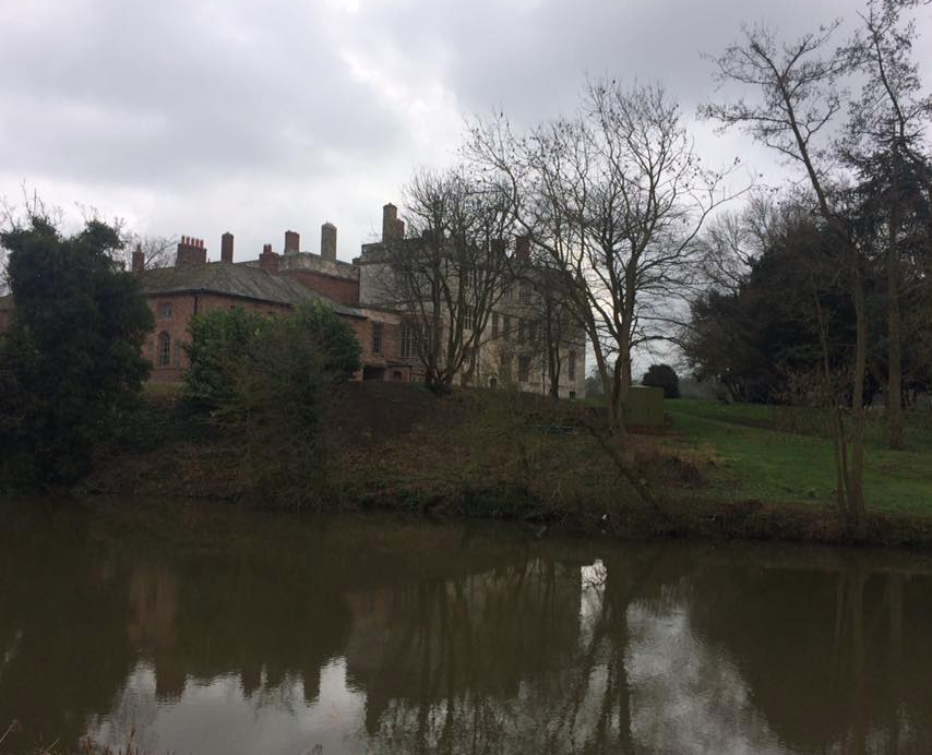
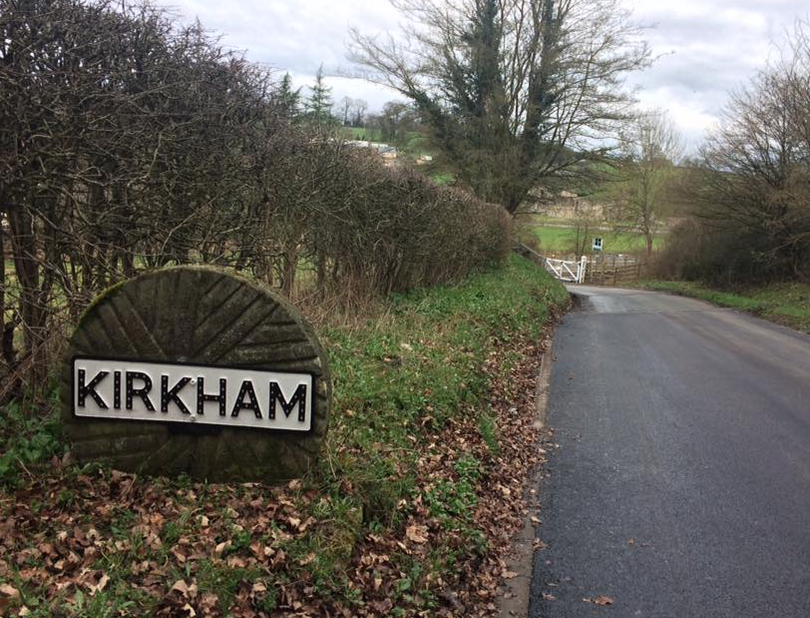
If you are a woman who loves to walk, join Glamoraks, a global online community of women who love to walk. Find new walks, meet new people and get out there more often. And sign up to be on my mailing list so I can keep you informed of any news. 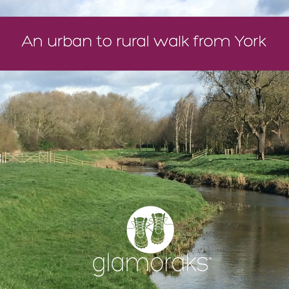 Distance: 11.8 miles (although I missed the last 0.8 as a friend picked me up for a coffee...) Type: Urban to rural Terrain: Riverside path, fields, some roads and some muddy bits I am lucky enough to live just outside the York City Walls. The downside about living in the city though, is that I typically have to get in my car to drive to some countryside for my walks. But I recently discovered that the Centenary Way starts right outside the York Minster, a mere five minutes walk from my house. The Centenary Way was created to celebrate the 100th anniversary of the York County Council and was opened in 1989. It runs from York to Filey on the North Yorkshire coast, spanning 83 miles. Besides the Minster and Sheriff Hutton Castle, both of which are in this first part of the walk, it also includes the Howardian Hills and Yorkshire Wolds, letting you see Castle Howard and the abandoned medieval village of Wharram Percy. It links up the Foss Way, Yorkshire Wolds Way and Cleveland Way. I confess that I was unsure of what to expect. Some of York's residential areas aren't exactly uplifting for the soul. I didn't really fancy an urban walk, but I headed out from the Minster after being pelted by a snow storm. The forecast was strong winds and they weren't wrong. The walk around the Minster is one I know well, starting from the Southern transept, heading down Chapter House Street and the haunted Treasurers House, before going along Ogleforth (so named as Vikings found owls living along a river there - I've been told - ogle meaning owl.) You pass beneath Monk Bar, one of the ancient city gates, cross busy Lord Mayor's Walk and then head down a little lane past a not very attractive car park. This is what I feared. But that experience was short lived. I quickly found myself walking through the Groves, a residential area with a pretty snickelway running through it. Before long I popped out on Huntingdon road and got to walk along the Foss River. I am amazed at how quickly you felt as though you weren't in a city anymore. Yes there were houses lining each side of the path, the Foss can be a bit grotty in places and the Nestle Factory is hardly a rural idyll (although the chocolate fragrance wafting overhead was lovely), but it was a peaceful, tree-lined river walk. All the way from New Earswick to the outer ring road, the river was lined with houses that were lucky enough to have gardens with water frontage. Again, I wasn't aware that all these properties existed. There was so much green space and I was still in the city! After walking along the river for a good distance, I finally ducked under the outer ring road where it immediately felt more rural despite walking past Earswick, another suburban village. The wild weather kept coming - intense sun one minute, rain, sleet and bitter winds the next. I eventually diverted from the river briefly to head through Haxby and along Towthorpe Road. This was probably the least fun bit as it meant walking on the grass verge alongside the road, with cars rushing by. But it didn't last long and I headed off across fields once again in the direction of Strensall. I picked up the river again until at last I reached Strensall bridge. This would be a good place to stop if you didn't want too long a walk (about 8 or 9 miles). And there is a pub - The Ship Inn - in Strensall should you need some lunch. And there is a bus that runs back into York right past the pub. However, I kept on going, following the river for another good long stretch. It's here you can tell that it used to be a canal and according to the guide, also has some Roman remains somewhere along the way. I was too busy dodging the mud to notice, as the path had suddenly turned into a bog. As I reached an old metal footbridge, I had to veer away from the river, through a wood, across and field and past a farm. By now my feet were starting to hurt. I headed into the pretty village of West Illing and saw that there was just 3/4 of a mile left to Sheriff Hutton. However, I'd arranged for a friend to meet me for a coffee so she scooped me up and we drove that last bit. When a latte and chocolate brownie call, walks end abruptly! There is a lovely coffee shop in Sheriff Hutton, so it's worth walking there for a spot of lunch or afternoon tea. There is a bus that runs from the village back to York, but it's infrequent so you may need to get a friend to pick you up or call a taxi. All in all it was a lovely, a very surprising walk that took me from a busy city centre to peaceful, rural countryside, right from my doorstep. If you haven't explored it yet, give it a try. You can download the entire Centenary Way route for free here Why not join the Glamoraks community and meet other women to go walking with? 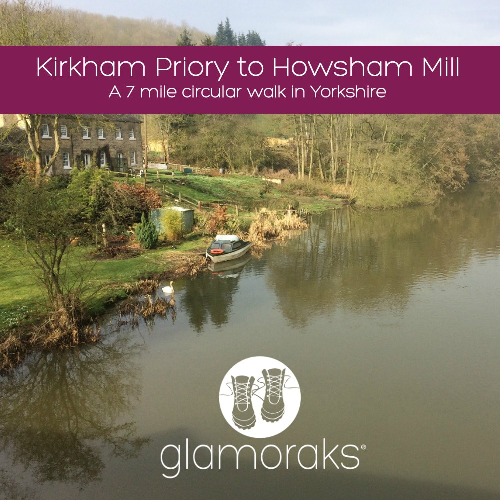 Yesterday morning I was a bit cross. That is a euphemism for how much of a rage I was actually in. I grabbed my boots, filled my water pouch, shoved a waterproof jacket into my backpack and headed out. I needed miles of space to help me simmer down. But it had to be somewhere not too far from York and I wasn’t in the mood for my normal stomps. I recalled having cycled past Kirkham Priory once, which is set along the banks of the Derwent River. A quick Google search showed a circular walk from the priory. ‘Right, that’ll do,’ I muttered and drove off. Fifteen minutes later I found myself in the peaceful sanctuary of Kirkham. Getting out of the car, I turned to Google to check the route, only to discover that there was no internet signal. Ah. Well the good thing about the UK is that you don’t have to walk far before you stumble upon a public footpath sign. So that’s what I did. Leaving my car at Kirkham Priory carpark, I walked back over the bridge and found a footpath sign pointing left along the riverbank. I vaguely recalled the walk being along the river, so I set off. 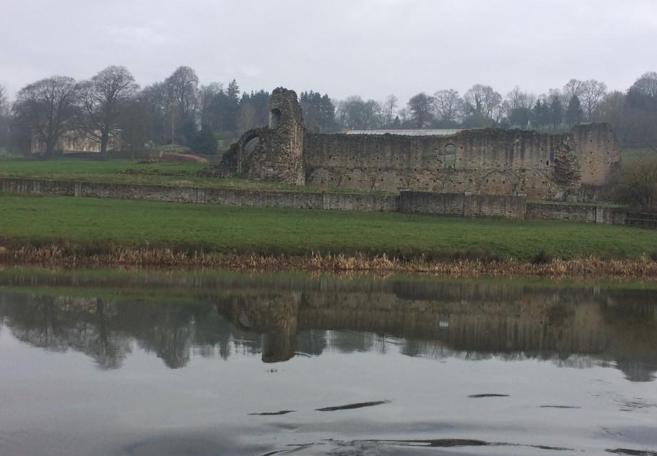 Kirkham Priory ruins
It was a pretty setting with the fast flowing river tumbling over a weir and the ruins of the priory brooding in the mist. I followed the path, which quickly resembled a bog. Cursing the fact that I hadn’t bothered with gaiters, I soldiered on still too cross to care how muddy I got. After about 20 minutes I passed a fisherman relaxing in the perfect spot. He gave a cheerful greeting and told me that one of the bridges further along was down but that I should be fine. I kept walking. It was hard work, the slippery mud making each step a good deal more difficult than it should be. I was feeling less angry but still hadn’t found my happy place. I kept walking. After about an hour I began to wonder if I was indeed on the route I’d read about because it seemed to just go in a straight line along the river, whereas the route I’d seen online mentioned all sorts of diversions and was only 5 miles long. I checked my phone and there was just enough of a 3G signal to show me that I was indeed going in the entirely opposite direction to the one I was meant to be heading in. Excellent navigational skills by me then. I looked on Google maps and saw that the path would intersect a road eventually and that I could walk back to Kirkham along that road, which would be significantly easier than stumbling in the mud. Shortly thereafter I came upon two lovely fishermen. Reet proper Yorkshiremen, who confirmed that there was a road up ahead, ‘just by t’bridge and t’mill.’ I asked them about the imposing building on the opposite bank and was informed it was Howsham Hall, a private residence. Not a bad pad really. After a bit more of a chat, I carried on with a cheery, ‘Av a good day luv,’ ringing out behind me. My rage from the morning had dissipated. I began to feel a smile creep on my face.
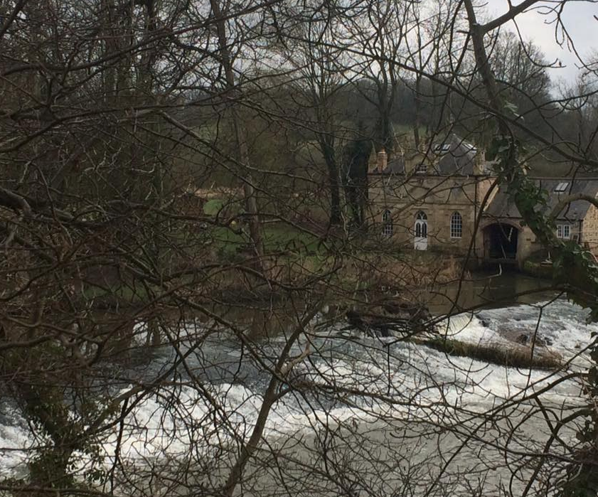
As predicted by the fishermen, I soon came upon t’mill, an old building with all sorts of odd machinery around it. It was a pretty spot and I waved hello to some kayakers who were trying to drown themselves in the churning water below. I ambled on toward t’bridge when a man, squeezed into a wetsuit, walked towards me in the opposite direction. ‘Had a swim?’ I asked. ‘Been kayaking,’ he said with a smile, nodding towards where the others had been. I asked him if I would find Kirkham by turning right on the bridge ahead. ‘Yes, but you should take a look at Howsham Mill first before you go if you’ve not seen it before.’ He explained how I might find it, what it was all about and wished me a pleasant day. Just as I neared the bridge, a long parade of tractors drove past in a riot of noise. Only in Yorkshire, I thought as the last of the farmers gave me a cheeky wave as he passed by. I crossed the bridge to the far side of the river, ducked underneath it and walked the short distance to the mill.
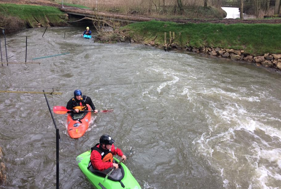
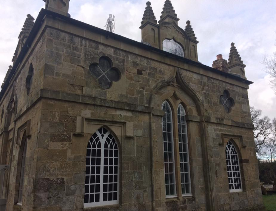
The kayakers had made their way there two and were tackling a slalom course complete with gates and masses of very fast flowing water. I had absolutely no idea that you could do kayaking like this so close to York. After watching them, a man came out of the building and walked towards me. I felt like a bit of an interloper, but said that the kayakers had suggested I come and take a look at the building. The man was very happy to have a visitor and I was given a personal tour. Apparently Howsham Mill was built in 1755 by the family who owned Howsham Hall. They didn’t enjoy looking out from their estate windows onto a working mill (how ghastly!) so they had a faux hunting lodge designed and constructed by York architect John Carr to obscure the mill from view. It featured a lead statute of Diana, the hunter on its roof. The mill served the local area, grinding their grains and animal feed for 200 years. The mill fell into disrepair in 1947 but in 2003, it was purchased and the Renewable Energy Trust was formed to save the building. It has since been completely restored, including a replica carbon fibre statue of Diana on the roof. A replica water wheel has been fixed into place and you can watch it churning away with impressive power. But even more impressive are two huge Archimedes screws that act as electricity generators. The power they generate not only gives the building electricity, but it’s also fed back into the national grid, which in turn pays the site money for continued redevelopment. The entire place is now completely sustainable with rain harvested water, its own generated electricity and composting toilets. It is used as a place schools can take children to teach them about nature, history and engineering. And it can also be hired as a quirky, private venue. It’s still a bit rough around the edges but it’s a lovely space and I was very pleased to have found it. I thanked the man for the tour and headed back the way I came. I saw the kayakers again, this time changing out of their wetsuits. ‘Worth the detour?’ the chap I’d spoken to earlier asked. ‘Absolutely,’ I said and thanked him for the tip. ‘You enjoy the rest of your day now,’ he said. Every single person I’d met on that short walk had been absolutely bloomin lovely. 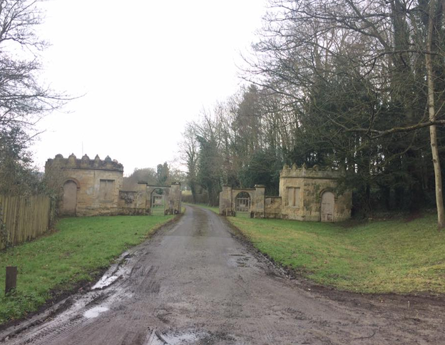 The grand entrance to Howsham Hall By this point I was starving. That’s one of the problems of leaving in a huff. You forget to pack food. I picked up the pace so that I could get back home for a bite to eat. My route back was along a very quiet road towards Crambe. As I approached the level crossing just outside the village, the station manager was just swinging the gates closed as a train was coming. ‘Ey up luv, I’ll hold ‘em open for ya. The train’s not here yet. By ‘eck, your face is red!’ I thanked him for holding the gates for me and explained that I was walking fast, hence the bright red complexion. He seemed to find it hilarious. He confirmed that I was heading in the right direction for Kirkham, and got back to his gates. At last I came to a footpath sign for Kirkham – 1¼ miles. I followed it up a very steep hill, where a fellow walker sat with his picnic in front of him, admiring the view, which was spectacular when I turned around to appreciate it. After pointing me towards the right gate, I walked the last part of the route through a forest on the top of a hill, before rejoining the road down the steep hill into Kirkham. The best walks are the ones you find by chance and manage to navigate with the help of friendly locals rather than a map. I'd stumbled upon a serendipitous three hour, roughly 7-mile walk dotted with some of a friendliest folk I’ve yet to meet on a walk. My anger had completely gone. Fresh air, a chance discovery and beautiful scenery had performed their tonic. It's amazing what you find when you just put your boots on.
Walk details:
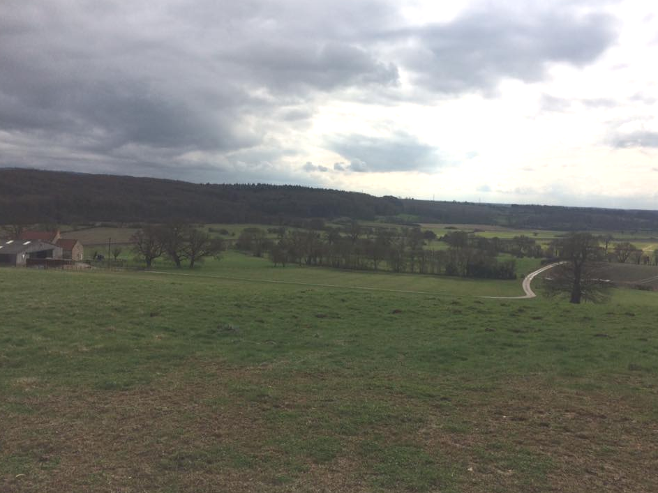
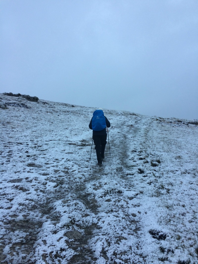
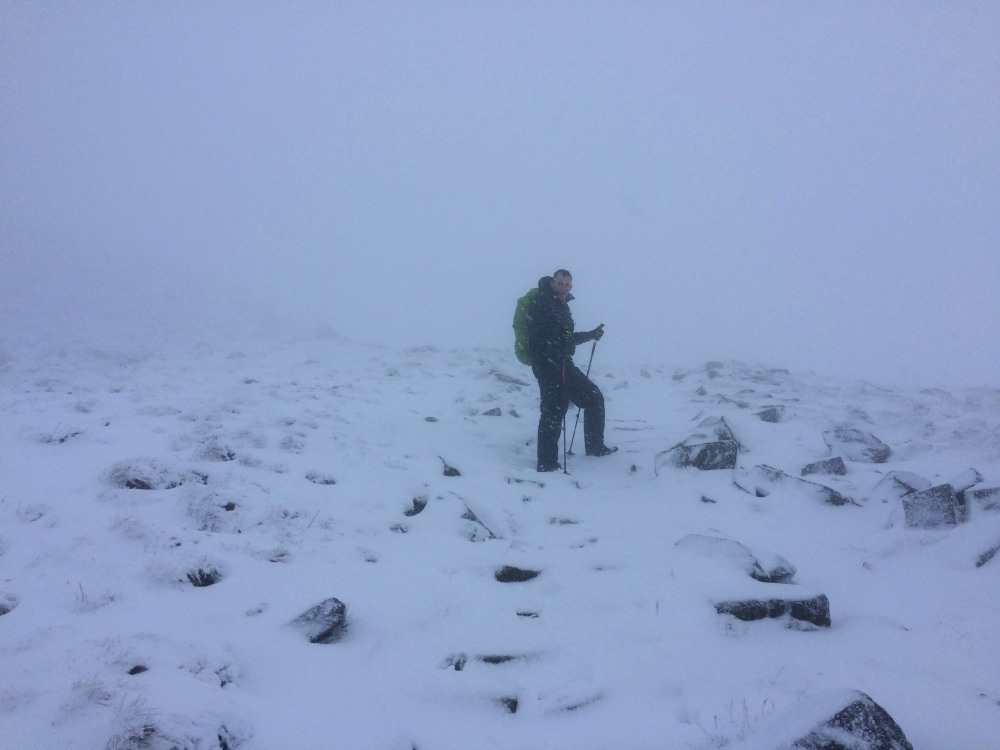
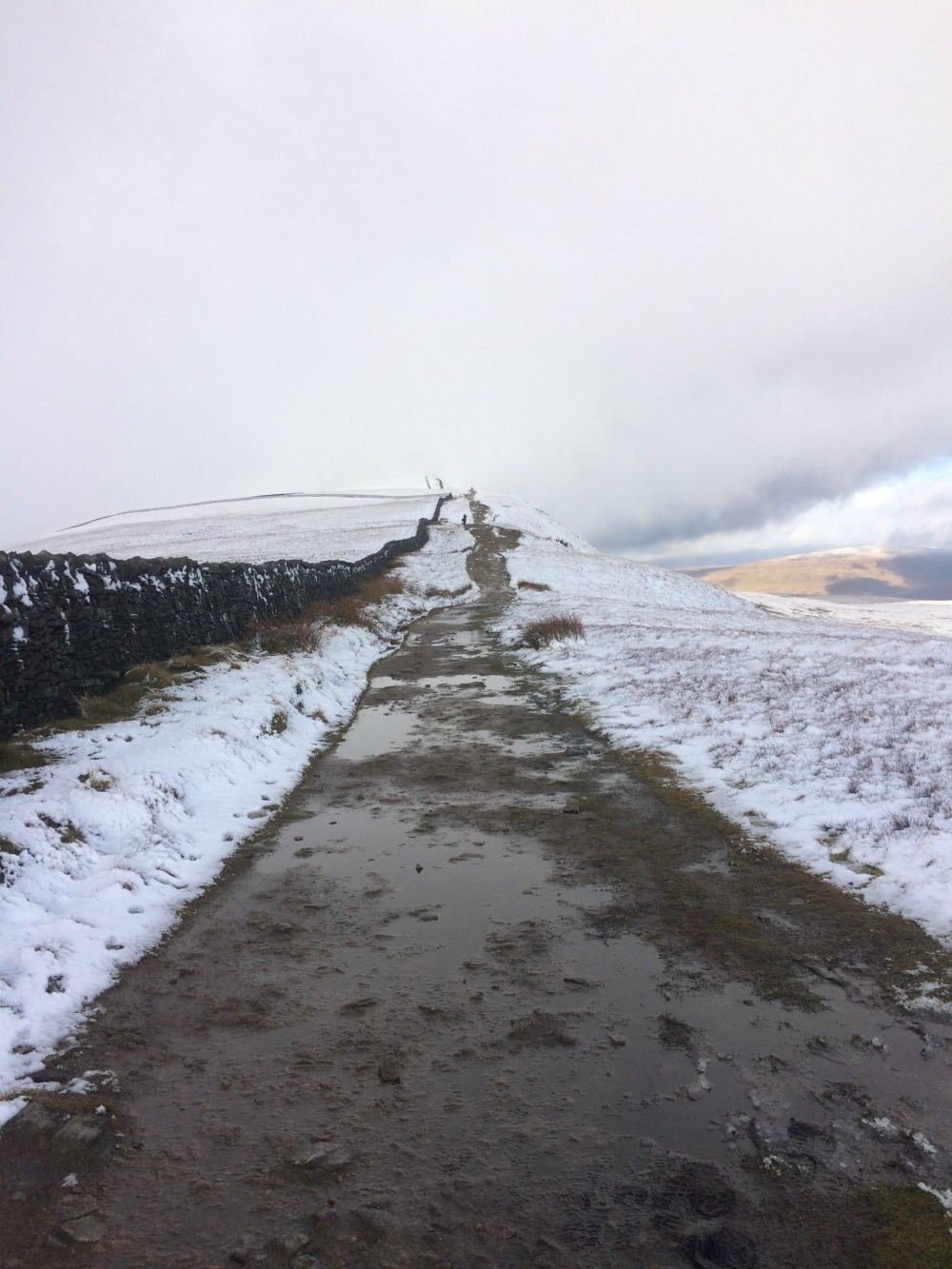
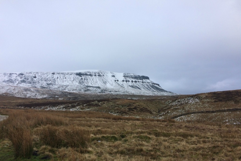
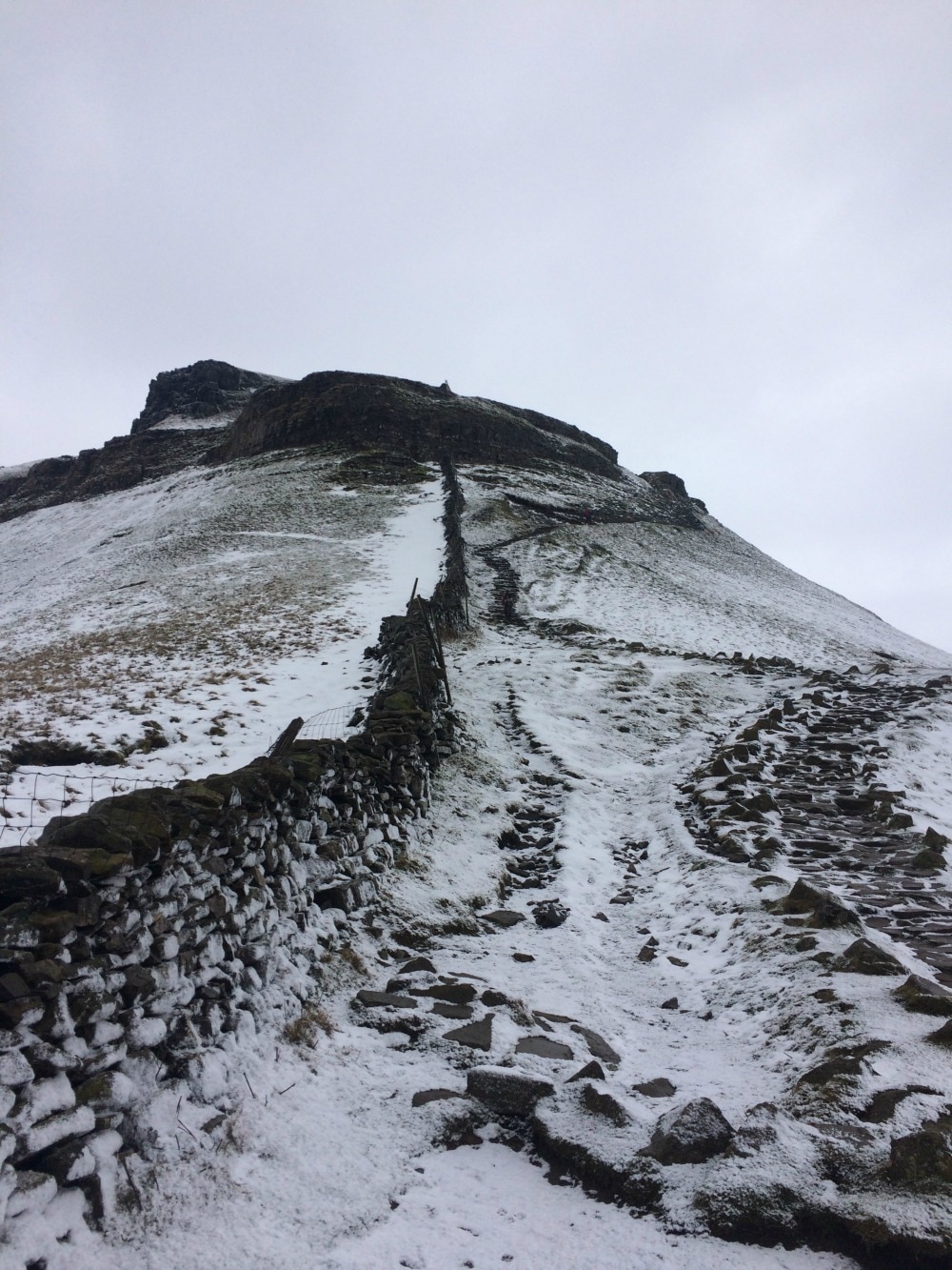
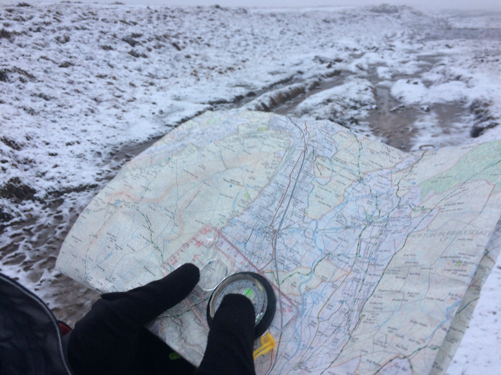
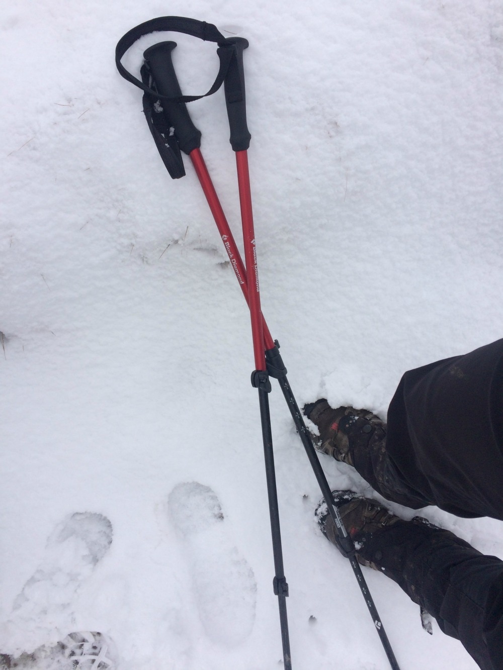
What to take: Wellies! Or good boots. A picnic for the spot at the top of the hill. I did this walk alone, but it would have been fab with company too. If you battle to find people to walk with, join Glamoraks, an online global community of women who walk.  The Yorkshire Three Peaks of Pen-y-ghent, Ingleborough and Whernside are notoriously done as a challenge in which you climb all three and walk the 25 mile route in under 12 hours. Perhaps it was this level of exertion that had stopped me from visiting the area. But in need of a final big stomp and taxing hills as pre-Kilimanjaro training, I thought it was time I tackled them ..... over two days. Given the lack of daylight hours in winter, I felt this to be the more sensible option instead of getting lost in the dark. I'd walked in the Yorkshire Dales as part of the Coast to Coast. My impression was that of rolling green hills, bubbling rivers, lots of stone walls and derelict stone barns. It was pretty and gentle. The Three Peaks bit of the Yorkshire Dales National Park is nothing like that. It's dramatic, stark and vast, with pockets of picture-book prettiness like the Ribblehead viaduct in between. It's a place that absolutely should be on your bucket list to visit. The route The challenge route typically starts in Horton-in-Ribblesdale, goes up Pen-y-ghent first (694m), then onto Whernside (736m) and ends with Ingleborough (723m) to wipe you out. It can be done clockwise or anti-clockwise and you can also be started in Horton, Chapel le Dale or Ribblehead, all of which have accommodation. We decided to base ourselves in Horton, arriving on the Friday night so we could head off bright and early on Saturday. Our plan was to go in reverse, taking in Ingleborough and Whernside, catching the train from Ribblehead back to Horton-in-Ribblesdale in the evening, and then climbing Pen-y-Ghent directly from Horton the next morning, skipping the long trudge between Pen-y-Ghent and Whernside. This would give us time to get back and collect kids from long suffering friends. But in hindsight, we could have done this a lot better. At just over an hour and a half from York, we could have got there for 9.30 and saved ourselves the cost of accommodation for the first night (and the breakfast disaster the following morning - more below). We could have parked our car in Horton and climbed Ingleborough and Whernside, staying at the Station Inn at Ribblehead overnight. It offers B&B rooms, plus it has bunk barns and camping as options. The staff we met were friendly, the food is hearty and it is right on the Three Peaks route meaning you don't have to divert and add extra miles. On day two, we could have walked to Pen-y-ghent, climbed it and returned to our car. You can also catch a train from Horton as it's on the Settle Carlisle line. 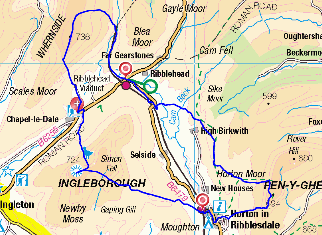 Accommodation In Horton-in-Ribblesdale there are two pubs - The Golden Lion and the Crown. Choose the Crown. We made the mistake of choosing the Golden Lion. The staff could not have been less friendly. The 'continental breakfast' (which is all you can get if you want an early start) was four plastic tupperware boxes of stale cereal, a jug of milk and some artificial orange juice. No tea, coffee or toast. The second morning we were there, we'd arranged for the Full English for 8.30, the earliest they will serve it. Except they didn't. No-one turned up. So I would avoid it and choose somewhere else to stay. There is a pub in Chapel le Dale - The Old Hill Inn - which gets good reviews. And the Station Inn mentioned above is another option depending on where on the route you want to break. 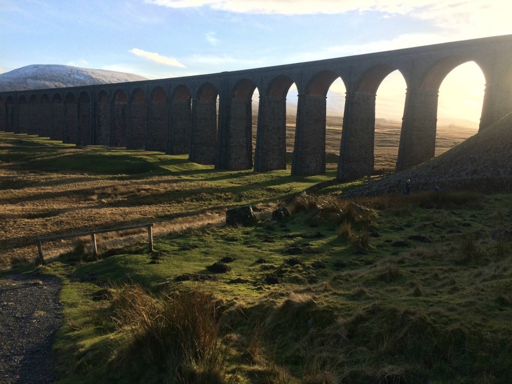 The walking Each of the peaks has one side that is steeper than the other. If you're going anti-clockwise starting with Pen-y-Ghent, you hit the steep bit on the way up with a more gentle descent. Whernside has the gentler ascent and a very steep down, while Ingleborough has a very steep ascent and more gentle descent. Obviously these are all reversed if you do them in a clockwise direction. Whichever way you do it, you are going to have at least one very steep ascent and one very steep descent. There are also plenty of flat bits and more gradual inclines and declines in between. The route is signposted but I would strongly recommend taking an OS map (you will need Ordnance Survey map OL 2) and a compass too. When we walked, we were hit with a blizzard and we could easily have got lost without our map and compass as visibility was non-existent. In fact the trig point on top of Ingleborough was just 4 metres from us when it finally became visible through the snow. Should the clouds clear, the views from the top are breath taking (as is the climb to get there), and it makes all the huffing and puffing worth it. There were a few challenging bits. The climb up Pen-y-ghent going up the steep way from Brackenbottom, was particularly tough because the snow the day before had iced over. There is a section where you need to scramble up boulders, which when icy, didn't give a very firm grip. Similarly, the steep descent down Ingleborough (bearing in mind we did it clockwise so we had the steep bit going down) was tough on the knees, while the slog up to Whernside was particularly unrelenting with a climb that never seemed to end. Pen-y-Ghent was the busiest of the three peaks, Ingleborough the least busy but that may have been due to the weather which hit at the time we climbed. Ingleborough and Whernside above. Pen-y-ghent below What to take You will need proper waterproof walking boots for this walk and I'd strongly advise gaiters too. I used walking poles and found they helped both on the ascents and descents, as well as keeping balance in the icy patches. Definitely take layers, including warm stuff, hats, gloves and snood, plus waterproofs. The weather at the top of the peaks can be pretty fierce so it's best to have everything you might need. Take plenty of water and a thermos of hot tea is very welcome on a cold winter's day. You will need a packed lunch as you are out for a fairly long time with few (any?) places to get a bite. The Station Inn serves food all day, but most other pubs seemed to only open after 5 or 6pm in winter. Don't forget a camera for the incredible views! Glamorak tips I wouldn't recommend walking this on your own in winter. It gets properly fierce up there, so for safety, I'd go with others and at least someone who can read a map. You will need a reasonable level of fitness to get up the hills. For a girly weekend, it would be great, starting in Horton, staying in Ribblehead or Chapel le Dale, and returning to Horton the next day. Don't expect luxury accommodation. The pub rooms will be very basic and the food more filling than gastronomic. But you just need a place to lay your head, a hot shower, a warm meal to refuel and a glass of wine or beer after a big walk. And you'll certainly feel as though you've been away for a lot longer than a weekend. If you want to meet other women to go on walks like this with, join the Glamoraks global online community.  |
Categories
All
Archives
January 2021
|


 RSS Feed
Get social. Follow us.
|
Don't get left out.
Add your email to be alerted about any Glamorak events, walks, get togethers, challenges or news.
Success! Now check your email to confirm your subscription.