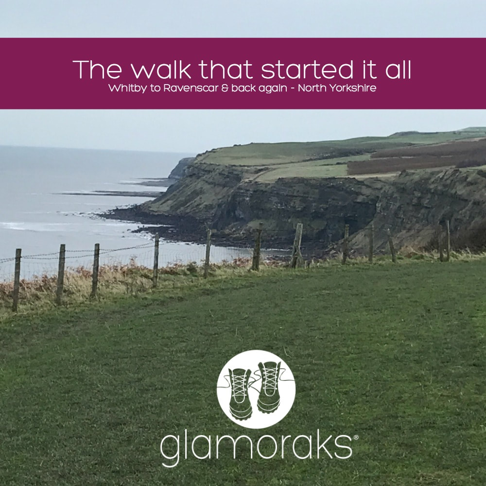
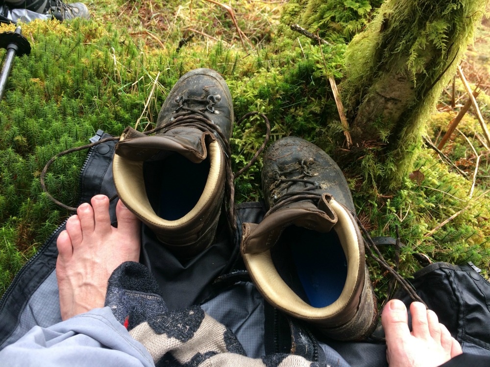
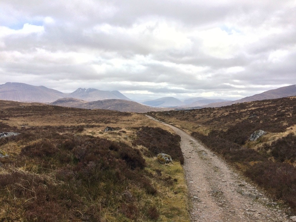
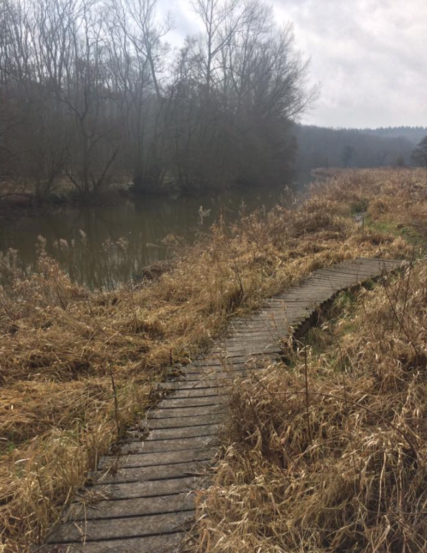
 I first wrote this blog post in May 2014 on a now defunct blog. But thanks to the wonders of the internet, I could find it. So here it is - the walk that started my love of walking: Dont get me wrong, I like other people. But occasionally I do like to head out on a little adventure all by myself. It makes it slightly more scary, slightly more liberating and it gives me plenty of time to think. Or sing aloud with no-one listening. As I have no children this week (I know, how did I wangle that one?) I decided to buy some hiking boots and a small backpack and attempt a bit of the Cleveland Way. If you did the Cleveland Way in its entirety, you'd have to walk 110 miles. I didn't have the time to do that and did I mention I had new boots? So my grand plan was to catch a train from York to Scarborough (somehow going on a train always makes any trip seem that much more of an adventure), then walk from Scarborough to Boggle Hole Youth Hostel just before Robin Hoods Bay. And then after a night in the hostel, walk to Whitby, where I'd catch a bus and go home. Except on the morning of my trip, the Met Office gave a yellow warning for rain all along the Yorkshire coast, with not insignificant winds just to add to the mix. Given the walk is a clifftop coastal walk, which does get very muddy and you walk quite close to the edge at times, I started to have second thoughts. After much deliberation while the heavens poured down outside, I decided to drive to Whitby, walk to Boggle Hole and then retrace my steps. That would make a shorter walk and if the weather really got too vile, I could simply turn around and drive home. The weather was pretty vile. But I wish I'd stuck with my original plan because it was manageable. And there is something utterly liberating about walking in the rain. If you have good shoes on, your feet stay dry. This is important. If you wear natty waterproof trousers as I did, your bottom half stays dry (even though you will look like a telly tubby). If you wear a really not very good supposedly waterproof jacket, you will get wet. But once you're wet, you're wet. And who bloody cares when you get to see this: 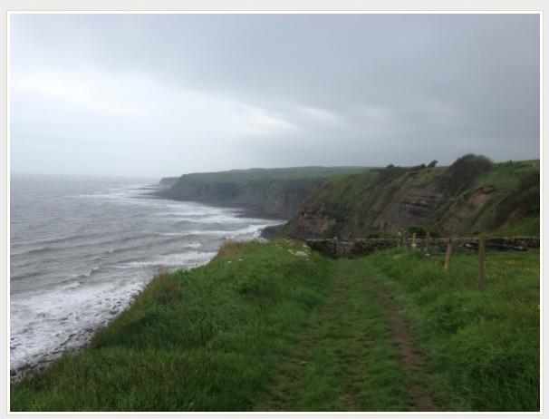 I walked for a good hour that morning before I saw a single other person. It was just me and the cows and the sheep and the seabirds and fields of buttercups dancing in the wind. And because no-one was there, I could sing out loud (Sound of Music was my preference) and talk to myself (yes, I know its the first sign of madness but it helps to talk out loud when you're trying to build a plot for a book). It didn't matter that my clothes were filthy, that my hair was in knots, that my face was make up free and rather sweaty. I could just be me. It was lovely. When you stand on a clifftop, with the wind pelting rain at your face, looking out at the vast curving expanse of sea in front of you, you get a real sense of the earth's size, shape and beauty. While pretty huge, it makes you realise just how tiny it is in relation to the rest of the universe and how tinier still we are. And that puts any problems you might have into perspective, which is why you end up singing like a loon to a field of cows in the rain. Because why not? If you like me sometimes yearn for head space and clean air to just revel in nature, I can highly recommend doing this walk (or one similar near you). Here's how to do it: I found this website very useful, with lots of info on the trail depending on where you want to start and how much of it you want to do. It also has plenty of other trails to try out. I started in Whitby. To find the start, just walk up the steps to the Abbey, walk through the gates as though you are going to the Abbey, but then follow the road to the left and you'll see a sign showing you where to go: 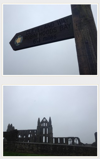 The path is clearly signposted. You will walk through a caravan park (less lovely) but once you're through that, it's just miles of gorgeous coastline to enjoy. 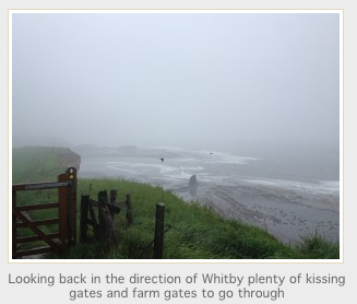 You will pass an old fog horn, which mercifully wasn't blaring out because it was foggy but the thing would deafen you! That is swiftly followed by a lighthouse. 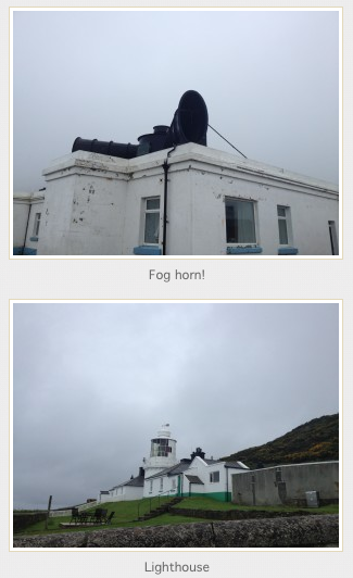 Besides those two landmarks, really the route is just a series of undulating hills. There are one or two places to stop for a snack at caravan park cafes, which thankfully are off the path so you can avoid them entirely should you not need food. Large bits of the walk are flat, but you do get steep inclines and declines, with plenty of little streams to cross some by bridge, others by stepping stones. You do occasionally have to walk through fields with cows (something I am not a fan of) but mostly you simply walk past the sheep and cows grazing on their side of the fence. In places the path does get very close to the edge of the cliff. I made sure I walked as far from the edge as possible due to the wet conditions and the erosion that is visible the entire length of the coast. It really does feel like the sea is taking big bites out of Britain and one day there will simply be no land left! 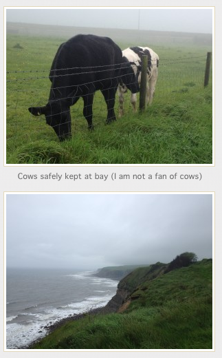 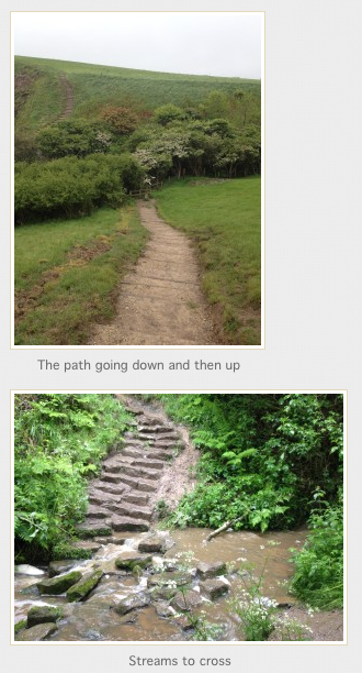 Walking into Robin Hoods Bay, you head down a very steep hill. If you've never been to Robin Hoods Bay, it is an old fishing village with houses stacked on top of each other, clinging to a steep hill as though they are afraid they might topple into the sea. I stopped for a cup of tea and scone with jam and cream at the bottom of the hill just what was needed on a very wet day. 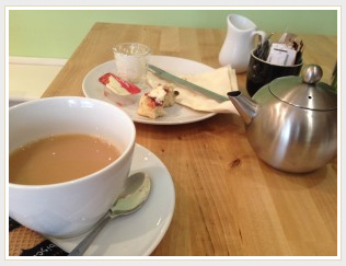 I got to Boggle Hole (about a 1/2 mile after Robin Hoods Bay) but I felt I hadn't walked enough (I'd only done about 7 miles) so I kept going to Ravenscar. I passed the Peak Alum ruins, saw deer in fields and climbed up a steep hill through beautiful woods to get to Ravenscar. Sadly, when I got there, the fog had set in so thick that I could see nothing so had to turn around and head back to Boggle Hole. 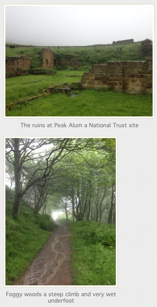 I have stayed at Boggle Hole Youth Hostel before. This time I had to stay in a shared dorm, not something I have done since I was about 21. But it was fine the showers were hot, the beds not too uncomfy for bunkbeds and frankly all I wanted to do was sleep after eating a meal and having a small bottle of wine. After wolfing down my full English (£4.99 from YHA) this morning, I set off retracing my steps. This was the view that greeted me this morning: 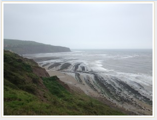 I was amazed that I had no blisters given I had new boots, but my feet were fine, if a little stiff. Like the rest of me. Who knew walking up and down hills in slippery mud could tire you out so much? After almost reaching the end, and after stopping for a moment on a bench to admire the view and complete solitude, I begrudgingly got up and did the last slog back to Whitby. Slog, because my feet were tired by then and I had to see other people. Didn't they get the memo that the Yorkshire Coast was mine, and mine alone? 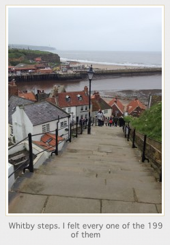 And then I rewarded myself with a proper Yorkshire lunch of chips n gravy. 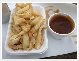 And that was it. By my reckoning, about 23miles in total walked. I now have the walking bug (not to mention the boots and backpack) so will be doing a whole bunch more of it. Coast to coast perhaps? 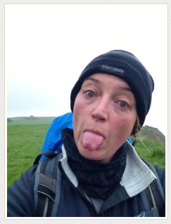 Since I wrote this back in 2014, I have gone on to walk the Coast to Coast, the West Highland Way, climbed Snowden, walked the circumference of the Isle of Wight and have climbed Kilimanjaro - plus heaps of other walks in between. All because on that rainy weekend, I decided to put my boots on and go have an adventure. Why don't you try it? You may just find yourself in the process.
If you are a woman who loves to walk, join Glamoraks, a global online community of women who love to walk. Find new walks, meet new people and get out there more often. And sign up to be on my mailing list so I can keep you informed of any news.
0 Comments
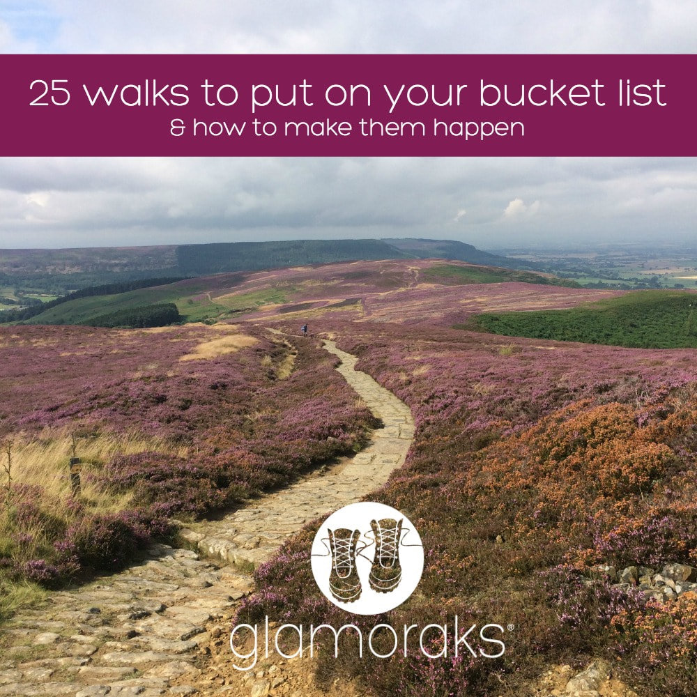 I recently did a survey asking women - who like walking - which walks were on their bucket list. I've listed the top twenty five in terms of votes received, plus a few of my own suggestions.
Time to tick a few more off my list! Which do you want to do? Got other suggestions? Tell me in the comments. Let's get women from around the world tackling walks that are dotted around the world.
So what's on your list? And having a list is great, but you really need to take action if you want to ever tick things off that list. How to turn a bucket list into reality
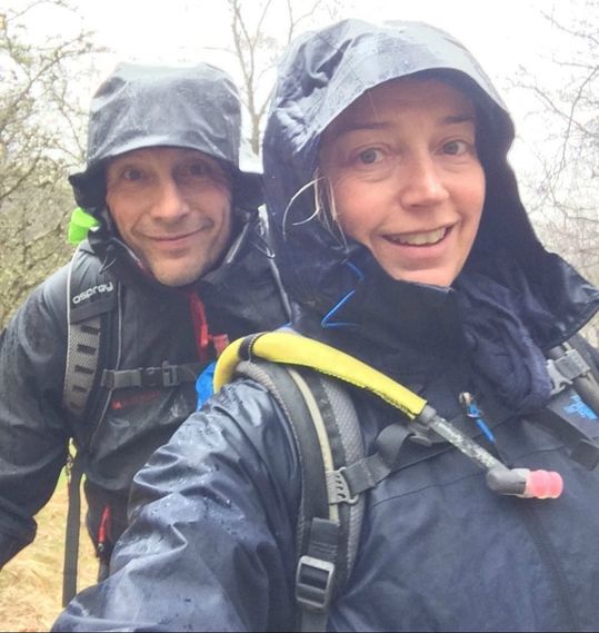
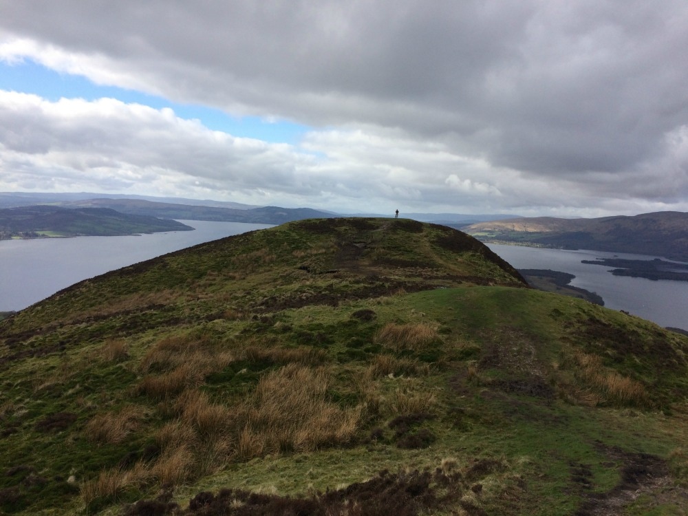
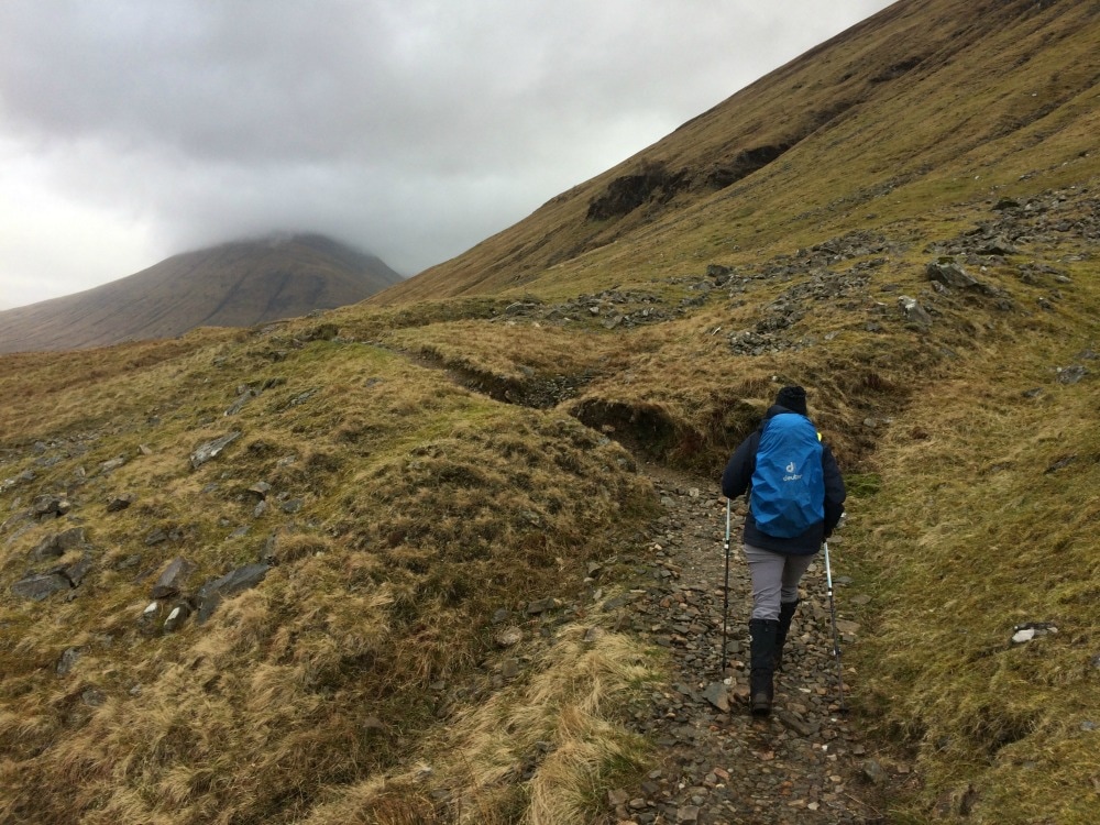
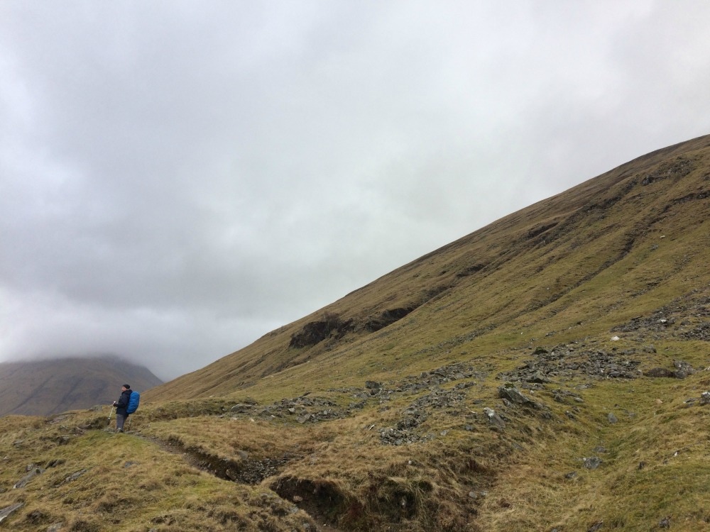
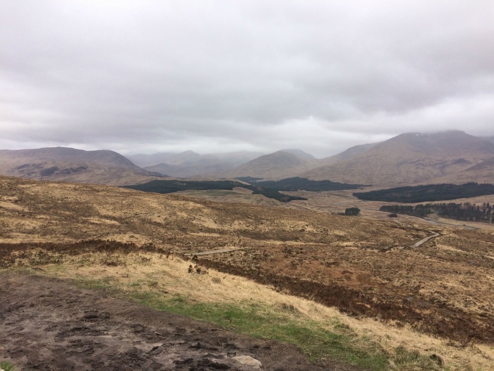
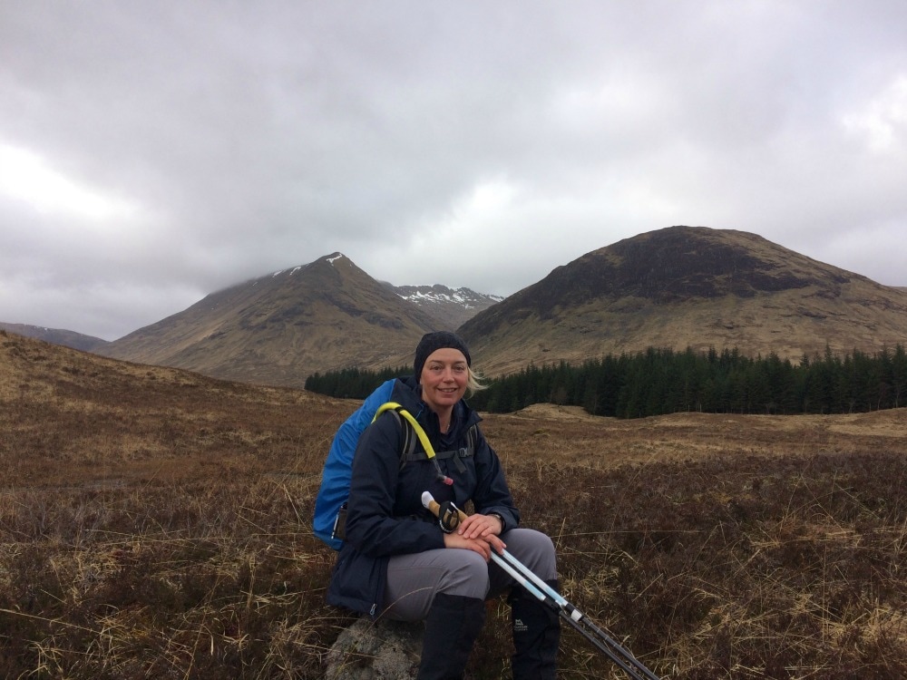
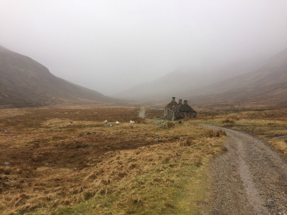
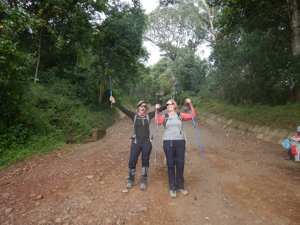
Now crack on! P.S. If you are a women who likes walking and want to find other women who you can go walking with, join Glamoraks. 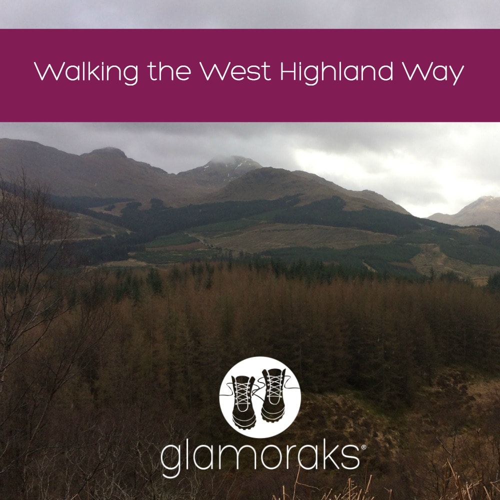 I have wanted to walk the West Highland Way for a long time. It's a 96-mile walk in the Scottish Highlands starting just outside Glasgow, running the length of Loch Lomond, then hitting the stunning scenery of highland hills and moors, before reaching the final destination of Fort William. This walk was a little different for me for two reasons: 1. I was walking it with my husband (I normally walk alone or with female friends) 2. I hadn't planned it. He had. Or rather, he'd arranged a travel company to do it. While getting to spend a full week with my husband without kids was lovely (and a rarity), I found the lack of planning on my part took away from the sense of adventure I get when going for a walk. When I walked the Coast to Coast, I spent ages plotting out our route, choosing accommodation and getting familiar with what was in store. This time, we simply paid a travel company to plan the route and accommodation for us. And while that saves time, it doesn't give you the same satisfaction you get from doing it yourself. It also means that if there are any problems en route, we could just call the travel company to solve it. But again, this makes you feel like less of an adventurer. And apparently I like feeling like an adventurer! So the first decision you have to make when deciding to walk the West Highland Way - or indeed any walk - is what level of adventure do you feel like having? Do you like the comfort and ease of having someone to arrange it all for you, book you comfortable accommodation, ensure your bag is moved and have them on call should something go wrong? Or would you prefer the other extreme of plotting out your route, carrying all your kit on your back and wild camping your way along the route? Or something in between? What you choose will depend on your budget and appetite for adventure and potential discomfort! Before I describe our experience of doing the route the easy way - i.e. staying in comfy accommodation with someone moving our bags with shortish days, here are a few things to note about the walk: Number of days This depends on your fitness level. We did it over 7 days, some do it in 4 or 5, others take up to nine for rest days or to spend a day climbing one of the many hills en route. You can even add Ben Nevis, the UK's highest mountain, as a bonus challenge at the end. When to do it You can do it year round, although to do it in the winter months you need to be pretty hardy and you will find more of the accommodation options closed. Summer months mean midges. And lots of them. Spring and Autumn seem to be the preferred months, with fewer midges and milder, if unpredictable, weather. How tough is it? I found it very manageable and a lot easier than the coast to coast. Lots of the walking is flat, but there are plenty of hills to challenge you. The bits that sound scary - like the Devil's Staircase - actually aren't bad at all. Conic Hill is a big climb but it's the descent that is harder on the knees more than anything. And day 3, scrambling around the northern parts of Loch Lomond are more tiring that you may expect, particularly if you're carrying a big pack. People of all ages and fitness levels do it - just know your own abilities and factor in enough time to go at a pace you're comfortable with. Where to stay We stayed in a mix of hotels, inns and B&Bs. Of the three, B&Bs were by far our favourite with better breakfasts and much better service. But there are also plenty of low cost options like bunkhouses and camping pods on the way. And if you're into proper camping, wild camping is allowed in Scotland and there are stunning spots to do it. If you're able to carry your own kit, this is definitely a good option. That said, if the weather is against you, you may hanker for a hot shower instead of a cold tent! Where to eat There are places to pick up food most of the way along - whether it's stopping for a pub lunch or getting snacks from a campsite shop. So bar one or two days, you don't really even need to preorder packed lunches as you can mostly get something along the way. Maps needed We had a map but didn't need it as the path is so clearly signposted. It was useful to get an overview of where we were heading. But I am a big fan of the Trailblazer guides which have simple to follow maps, with useful info on things to see on the way. We used the West Highland Way Trailblazer guide and it served us admirably. My husband took a compass with him, mainly because he is ex-military and likes to point to maps saying things like, 'We're here and the enemy is here', but seriously, a compass wasn't needed (unless you plan to go walking off the track). Kit (not including camping stuff)
How to get back It's a one way walk. To return to Glasgow (or Milngavie if that's where you left your car), you can get a train to Glasgow and back out again to Milngavie, or catch the Citylink bus but be sure to book a seat in advance. Ask the driver to drop you off at the stop closest to Milngavie and then just get a taxi (Uber operates there) back to get your car or catch the bus straight to Buchanan Station in central Glasgow. 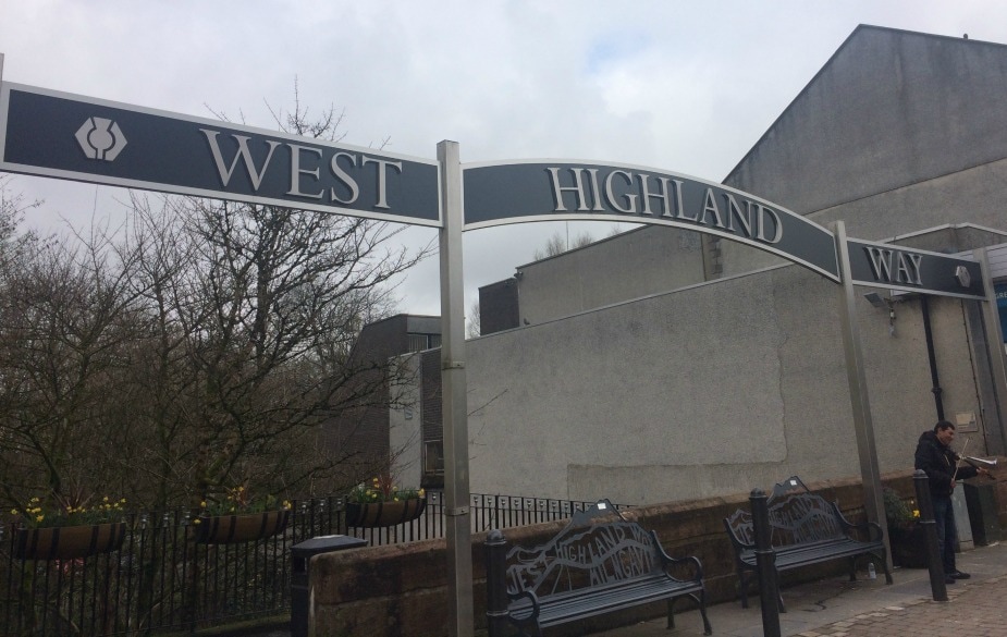 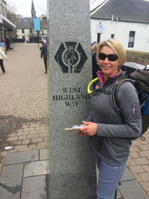 Day 1 - 12 miles: Milngavie to Drymen On Saturday 1 April, we found ourselves in Milngavie (pronounced Mullguy). As we'd had to drive from York that morning, we'd missed the baggage moving company so had to drop our bags off at a taxi station (recommended by the travel company) who would move them to our first night's accommodation. We then parked our car at the Premier Inn, which lets you park your car for free for the week and it's pretty safe as it's next to a police station. You can also get a train from Glasgow to Milngavie if you don't have a car. Next we had to figure out how to get to the start of the walk, which proved to be the trickiest navigational part of the entire expedition as the actual walk is very well signposted. But we found the obelisk and giant West Highland Way sign in the centre of town and were soon on our way. The first part of the walk takes you through Allander Park, which is pretty enough with a bubbling stream keeping us company. But it's still urban and not quite the highland experience I had envisaged. We left the park behind us, passed through Mugdock Wood, passed two lochs and a bunch of quirky wood chalets that looked like something out of Hansel & Gretel. We began walking across fields, with the first glimpses of the hills in the distance. At one point we passed what we thought was a ranger station where a very friendly 'ranger' hailed us and offered us free tea, coffee or water. I happily took up the offer of water as I'd had a 'little accident' with my water pouch (i.e. I'd somehow managed to drain its contents accidentally and it was bone dry). We had the option of making a donation and he was at great pains to assure us that one was not necessary. But we made one all the same. I have since seen statements on the West Highland Way website that no donations should be made to anyone other than directly via the WHW website. So I have no idea who the chap was, but hey, he gave me water so I was happy. 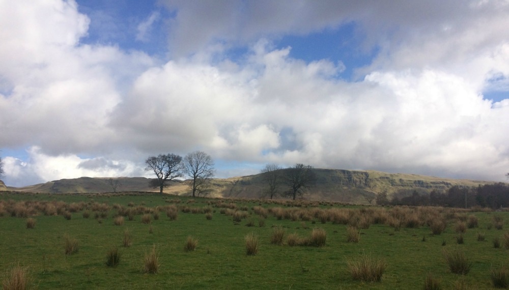
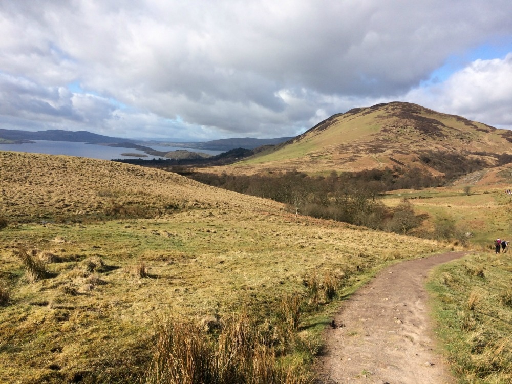
The scenery began to give us a taste of what was to come. Although not rugged, it was still fairly gorgeous. We plodded on along a farm track as the skies darkened and just as we reached the sign for the Glengoyne distillery, the heavens opened. So we diverted off the path and opted for a tour learning how whisky is made. As regular consumers of single malts, we felt it was our duty to know more about where it came from. And getting a wee dram was a bonus. After smelling the yeast infused barley and water bubbling away in giant vats, and seeing the immense effort that goes into distilling and ageing the liquor, we felt obliged to purchase two half size bottles. They were tucked into our backpacks, in case of emergency! 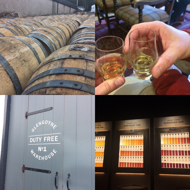 After a picnic in the sunshine that had returned, we headed back to the path. It paralleled the busy, noisy A81 road and was fairly uninspiring to be honest. We eventually veered away from the road and headed into countryside that looked like it could be The Shire, from the Hobbit, and indeed, several signs seemed to indicate that it was. 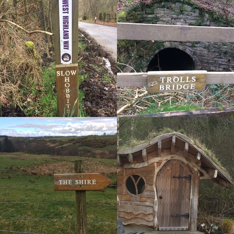 We finally arrived at Drymen (pronounced Drimin as in drip, not Dry as in dry - why would you have a word that sounds like it looks?) We stayed at the local Best Western hotel and despite it having a pool, spa and steam room - great for tired muscles - it just didn't feel like a hotel for walkers. So day 1 was good but hardly the epic landscapes I'd been envisaging. That said, the glimpses of highland scenery were a tantalising taste of what was to come. Day 2 - 15 miles: Drymen to Rowardennan via Balmaha After the first of many, many full Scottish breakfasts, we were on our way, bright and early. We retraced our steps to where we had diverted from the path the day before and immediately climbed a steep hillock in glorious sunshine. A boggy, wet and muddy field on the other side awaited us, reinforcing the need for good boots and gaiters. We soon entered a forest with wide, dry paths and easy walking. 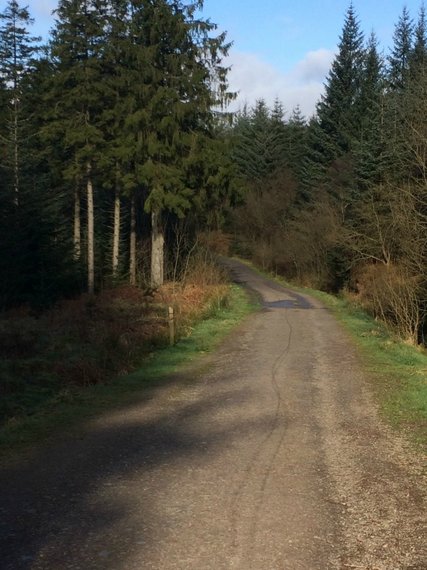 We got glimpses of Loch Lomond and Conic Hill, our first proper climb of the walk. It's 170m up, but the views from the top over Loch Lomond are well worth it. 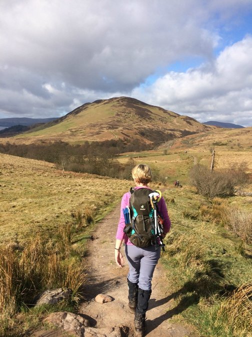
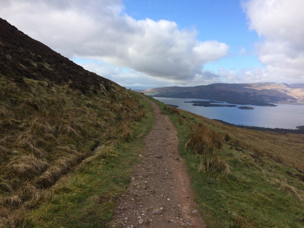
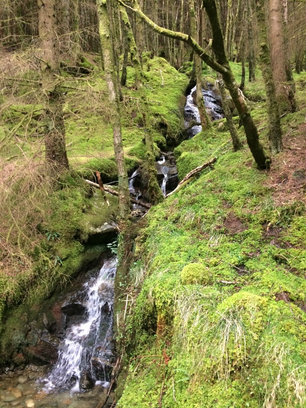
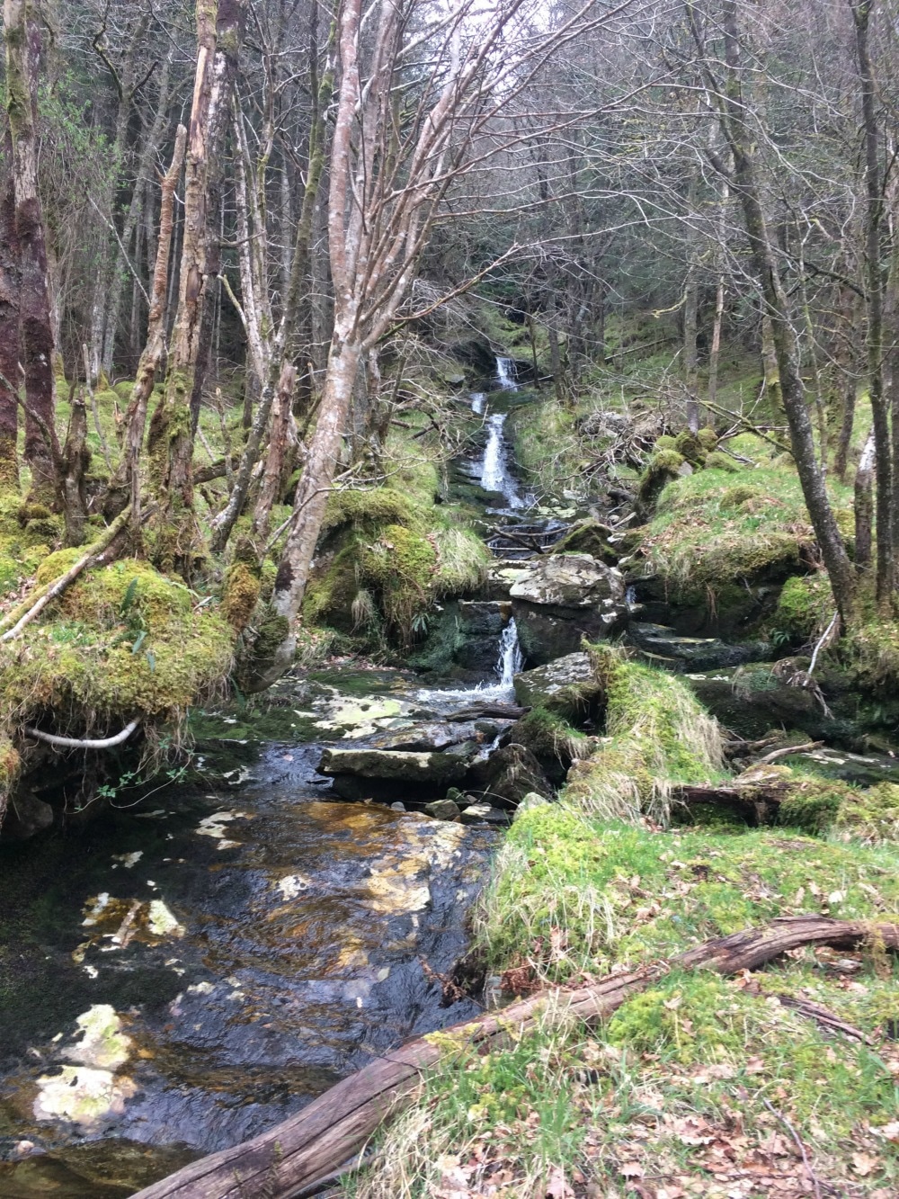
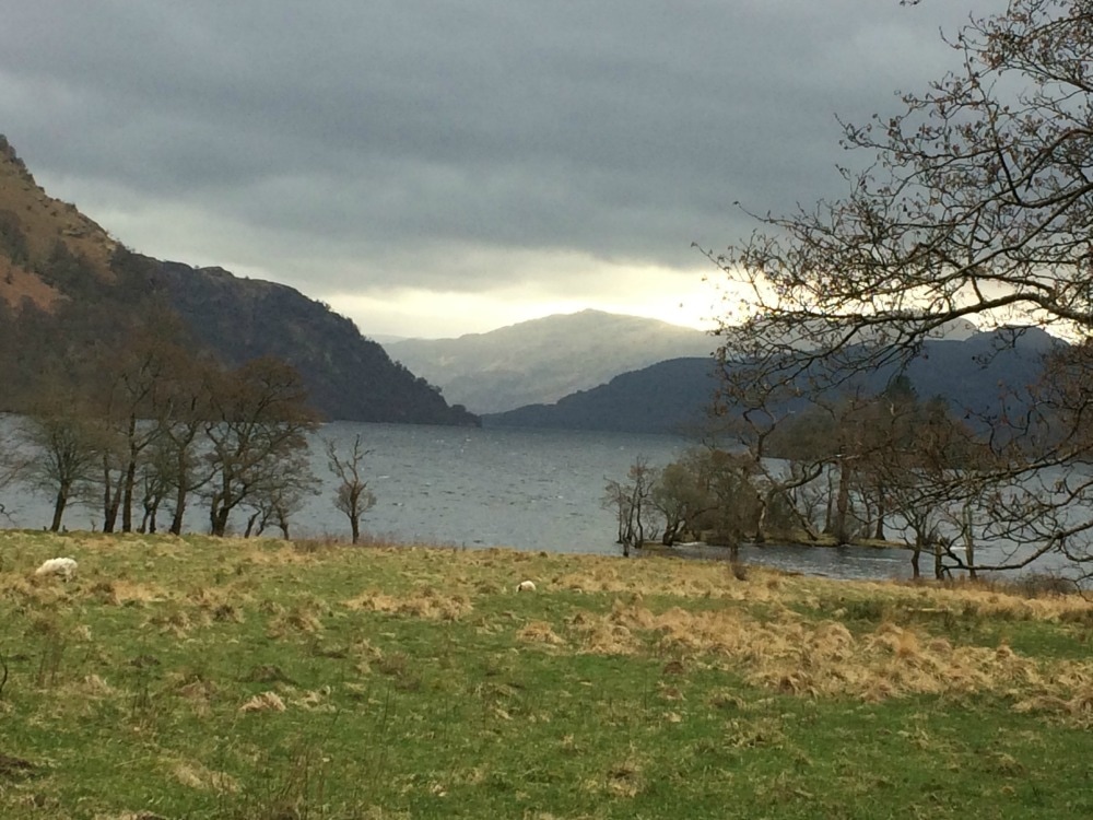
After admiring the stunning setting for a while, we headed down, while scores of day trippers were heading up, sweating profusely. The downhill was actually tougher going than the up as our knees, not yet used to it, felt the strain. At last we popped out in Balmaha where several cafes and shops offered us a choice of lunchspots. We opted for a quick and easy sandwich from the village shop and enjoyed them in the sunny park next to the Loch. We had the statue of environmentalist Tom Weir for company. 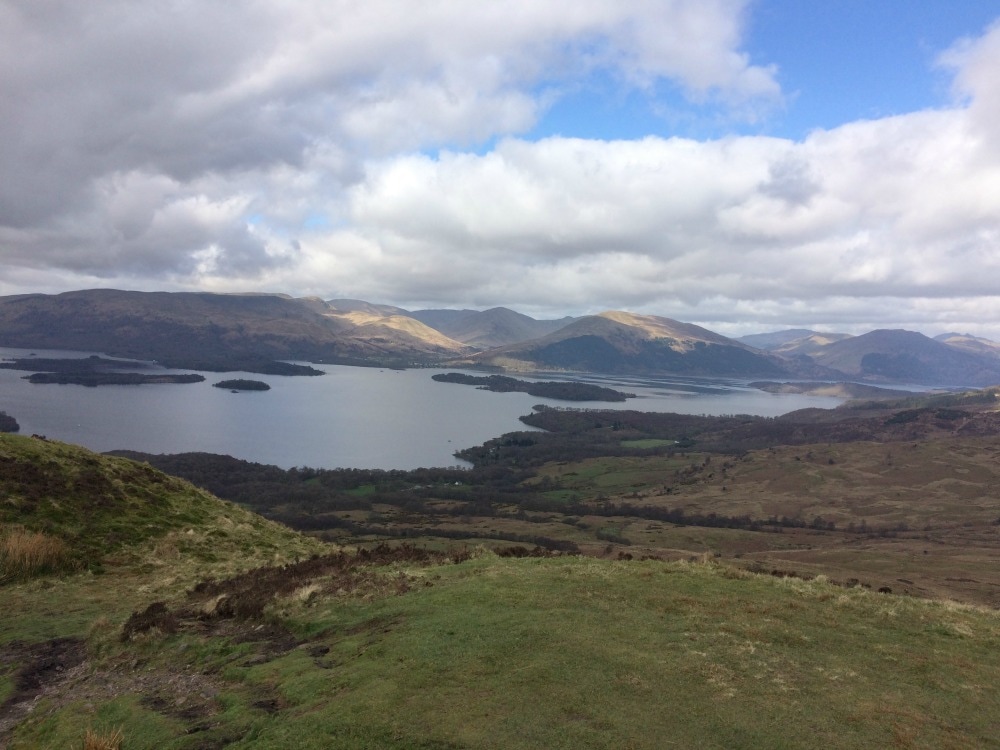 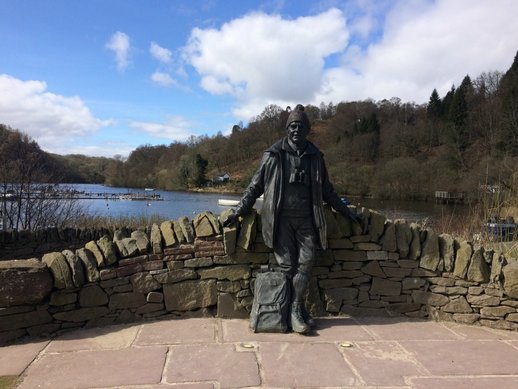 Having done our first 7 miles for the day, we had another seven to go. We began our long walk along the banks of Loch Lomond, regularly singing: O ye'll tak' the high road, and I'll tak' the low road, And I'll be in Scottland a'fore ye, But me and my true love will never meet again, On the bonnie, bonnie banks o' Loch Lomond. As it was a sunny Sunday, the loch was busy with many people having BBQs on the sandy beaches. We followed the undulating track, finding a number of gorgeous coves that would be perfect for a dip if the water wasn't freezing. Although it was very pretty, it still didn't feel like the wilds of Scotland that I had imagined. We got to our hotel - the Rowardennan Hotel (or Rhodedendron as we nicknamed it) - at last. It is right on the path and had a sunny beer garden with views of the loch. So we took our boots off and enjoyed a pint - although sadly most of Glasgow seemed to have the same idea. Perhaps a less sunny, non weekend day would have made for a quieter stop. If you wished to and had a spare day, you could head off to climb Ben Lomond (974m) and Ptarmigan summit (731m) from here, which would make a great day walk. We weren't going to be doing that and had another early night instead - two days of walking in fresh air makes an 8pm bedtime a stretch goal! 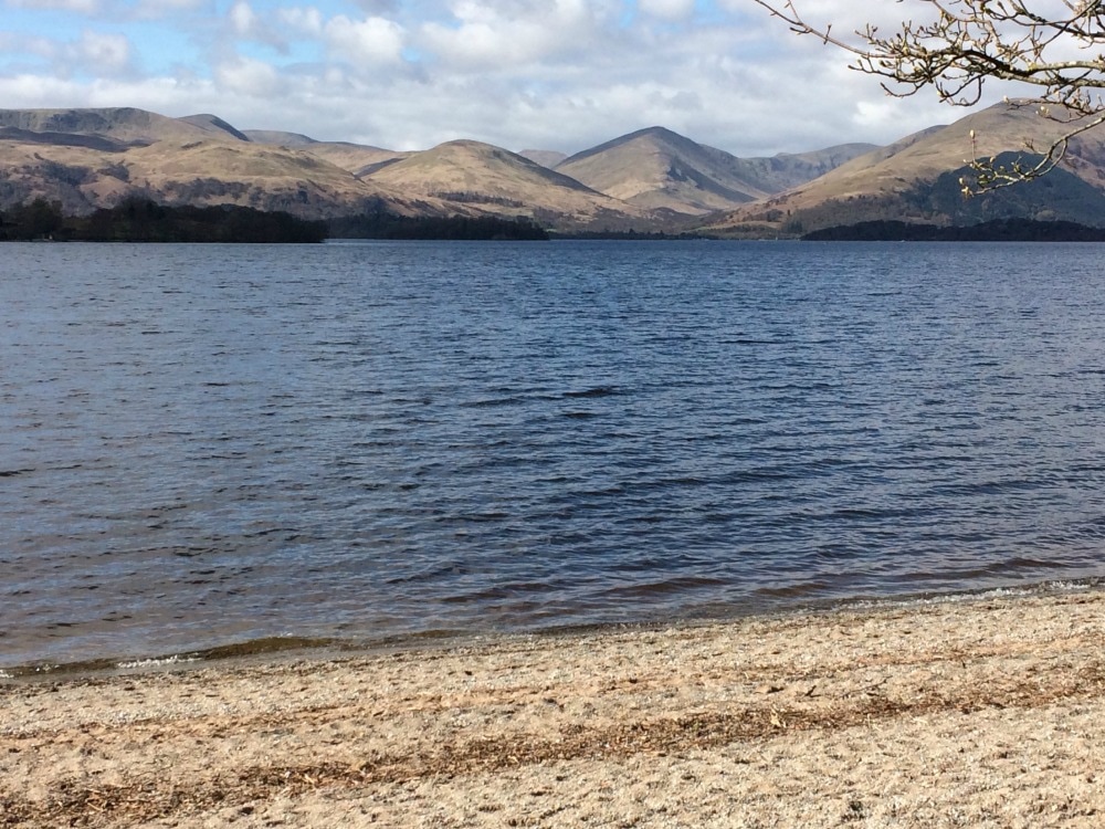 The sandy beaches of Loch Lomond with gorgeous mountain views Day 3 - 14 miles: Rowardennan to Inverarnan Waking to beautiful views of the mountains, we got up bright and early as rain was forecast later in the day and we wanted to get most of the miles out of the way before it set in. After another huge artery clogging breakfast, we set out at the same time as another couple of walkers. The first two hours sped by as we chatted, barely noticing the stunning scenery to our left as we walked easily along a broad plantation track. There are two choices of paths here - the easy one which we did, and the other than runs closer to the water but was described as far more challenging and may potentially have been closed due to a landslip. Given the rock scrambling that was to come in the afternoon, I'm glad we chose the easy one. Waterfalls cascaded down rocks to our right at regular intervals. Trees and rocks covered in bright green moss made for a ridiculously pretty backdrop. Bubbling burns every few paces gave a calming soundtrack. It was idyllic and much quieter than the busy path of the previous day.
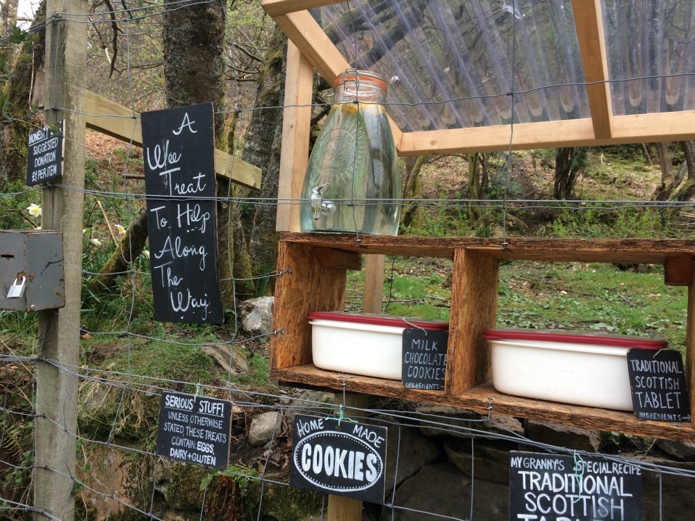
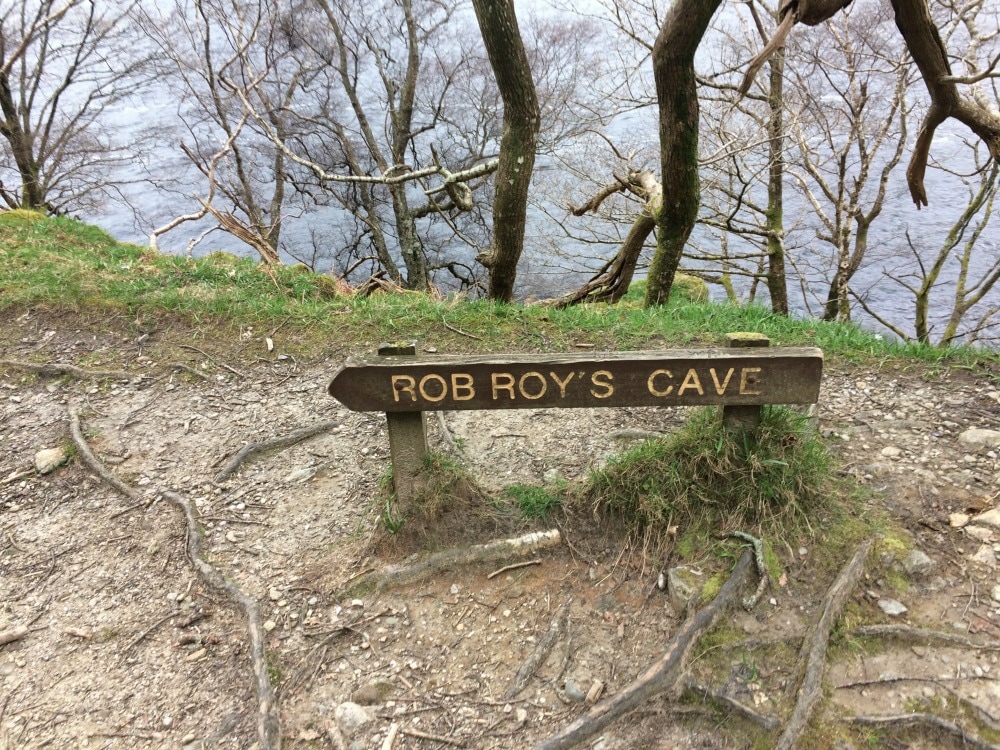
After following the undulating path for some time, we crossed a bridge over an impressive waterfall, before arriving at Inversnaid Hotel. We had ordered packed lunches from our previous hotel, but as it turned out, we hadn't needed to as the hotel was serving food (the guide book had said it only did this from Easter). So we stopped for a quick bite to eat and a warm drink, before adding a few more layers and heading out. The bad weather was definitely approaching, with strong gusts of wind whipping up white horses on the loch. The path seemed to match the volatility of the weather. Our smooth easy way of the morning was replaced with a path the bucked and bent every few paces. At times it was almost at the Loch edge. At others, you climbed and scrambled over rocks with sheer drops down to the water below. The wind whipped up waves that crashed relentlessly on the shores while the trees groaned and creaked above us. It was fabulous. And a little exhausting. We saw the sign for Rob Roy's cave, but had it on good authority that it wasn't worth going to investigate. So we didn't, as we still had a fair way to go and the rain was inching closer. We also passed a lovely little snack stop for walkers, using an honesty system to refuel if necessary.
Our friends from the morning, who'd fallen behind us, came charging past in a tearing rush to catch the ferry to Ardlui, where they were spending the night. We meanwhile stopped to admire the feral goats, something the guide book had told us to look out for, so we were rather pleased we'd found them. To be fair, they looked like normal goats but on a day where the scenery involved beautiful - but repetitive - water, trees and rocks, goats made an interesting diversion. As we reached the very top of the Loch at Ardleish, the rain set in. Our last few miles were a damp splodge along a track into Glen Falloch. At last we got to Beinglas campsite, with many miserable looking campers attempting to put up tents in the rain. We walked on to the famous Drover's Inn for our night's accommodation instead.
 Getting wet! The Drover's is an ancient inn, which trades on its history rather than it's exceptional service, food or rooms. The plethora of stuffed animals that greet you in the entrance hall definitely add to the ambience, but we both agreed it was our least favourite stop, despite its 'must see' reputation. Nonetheless, after several glasses of wine we agreed that we'd still rather be there than sleeping in a wet tent. 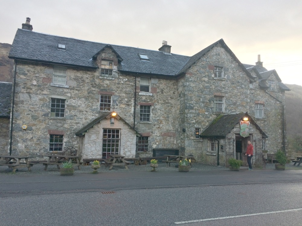 The Drover's Inn 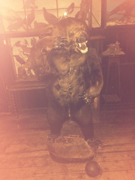 The doorman that greets you.... Day 4 - 12 miles: Iverarnan to Tyndrum We woke to a drizzly day, had another full fat breakfast and headed out, stopping at the Beinglas campsite shop for a sandwich for our lunch. Having done several multi-day walks, I have long since learnt that there is no need to pay for the packed lunch as they invariably include a piece of fruit (that gets squashed), a biscuit (that gets squashed), a carton of orange juice (that tastes foul) and a sandwich. My top Glamorak tip is to take your own snacks and just stick with the sandwich. Our walk took us alongside a river, the rushing noise of which helped masked the noise of the A82 road running nearby. This was a feature of the West Highland Way that I hadn't appreciated. It basically follows the road for a good stretch of the walk. And while the surrounding scenery is gorgeous, it hadn't yet felt wild and remote, which is what I had expected. 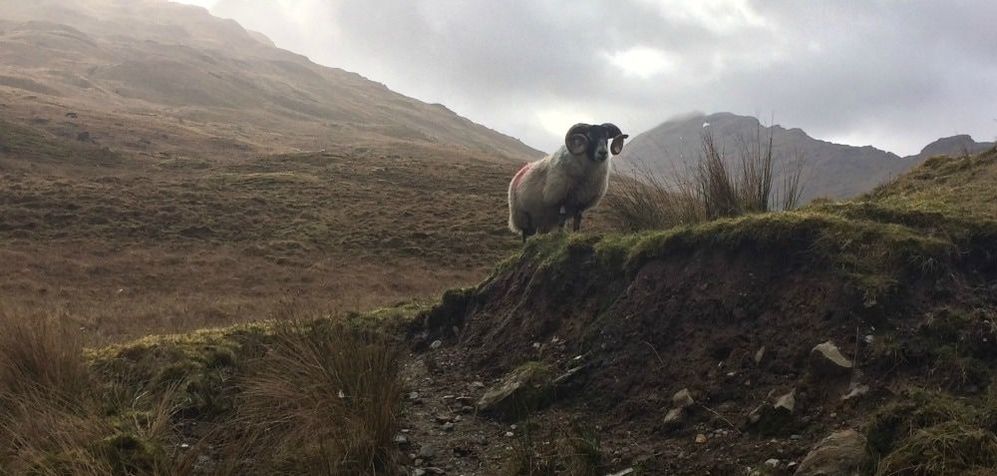
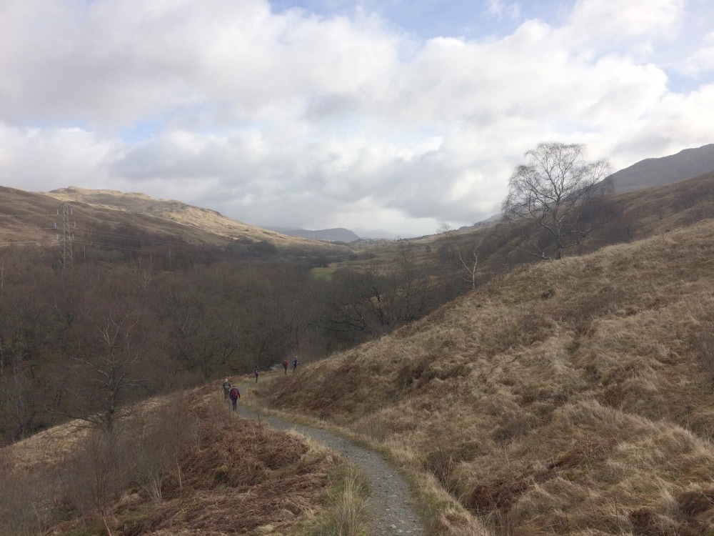
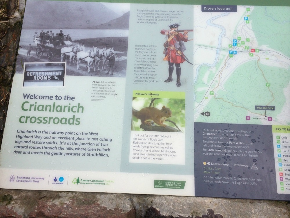
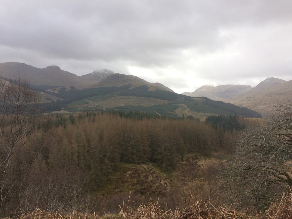
The wet weather came and went with showers on and off throughout the morning. Using an underpass we crossed underneath the A82 and made our way up the hill on the other side before coming across what is apparently known as cow pat alley. The track runs to a farm, which is frequented by cows. At times the muddy cow pat mixture was lapping up to my ankles and my gaiters were worth their weight in gold. We passed a cow that seemed to be in some kind of distress, possibly calving? We attempted to contact the farm but had little joy. To our relief we saw a land rover approaching the cow, so we assumed that someone had alerted the farmer to the poor cow. Leaving the bovine drama behind us, we climbed a hill to Crianlarich crossways, the official halfway point of the West Highland Way, before climbing higher to a viewpoint spot and then on through mossy forests with pretty streams every few minutes. The path plunged down again, crossing a river in the valley before climbing again. We took our time as we only had 12 miles to go. We found a picnic spot on the crest of a hill with views out below us and had our lunch while our feet aired (at military husband's insistence!)
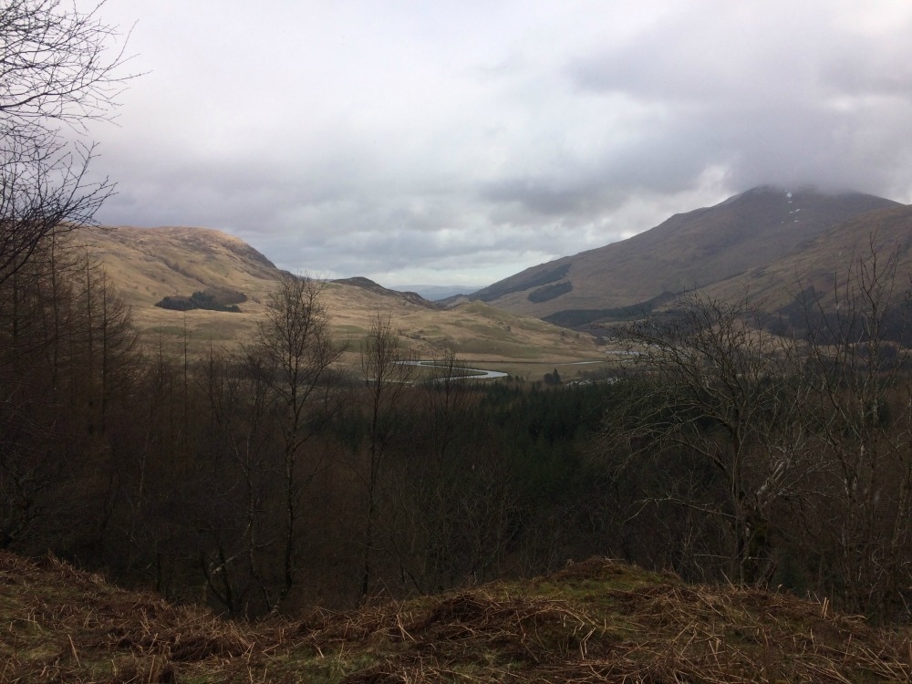
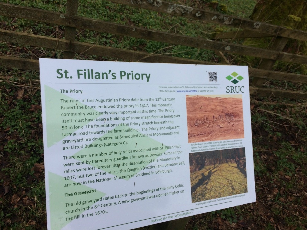
 Evidence of cow pat alley on my boots! After lunch we followed a relentless downhill path (I felt very sorry for the few people coming up the other way), before passing underneath an old arched stone bridge. We crossed the A82 again and walked on towards St Fillan's priory, with views of Ben More in the distance. There's not much left of the priory, but interesting noticeboards give its history. As we arrived at Wigwams, a little campsite at Strathfillan, the rain came down again so we took shelter under the shop awning and hat a restorative cup of tea. Once the rain cleared, we headed back out passing another little piece of history - the place where Robert the Bruce had the battle of Dalrigh and a little loch where it was rumoured his sword had been thrown (but never found). I wondered how many ghosts still wandered the area.
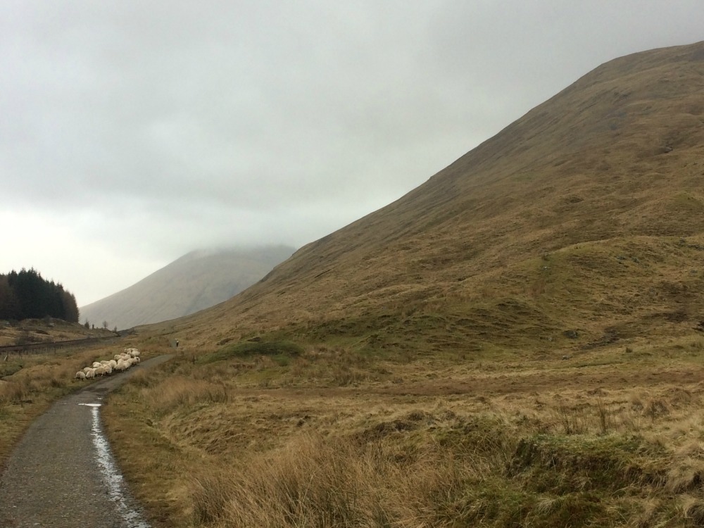
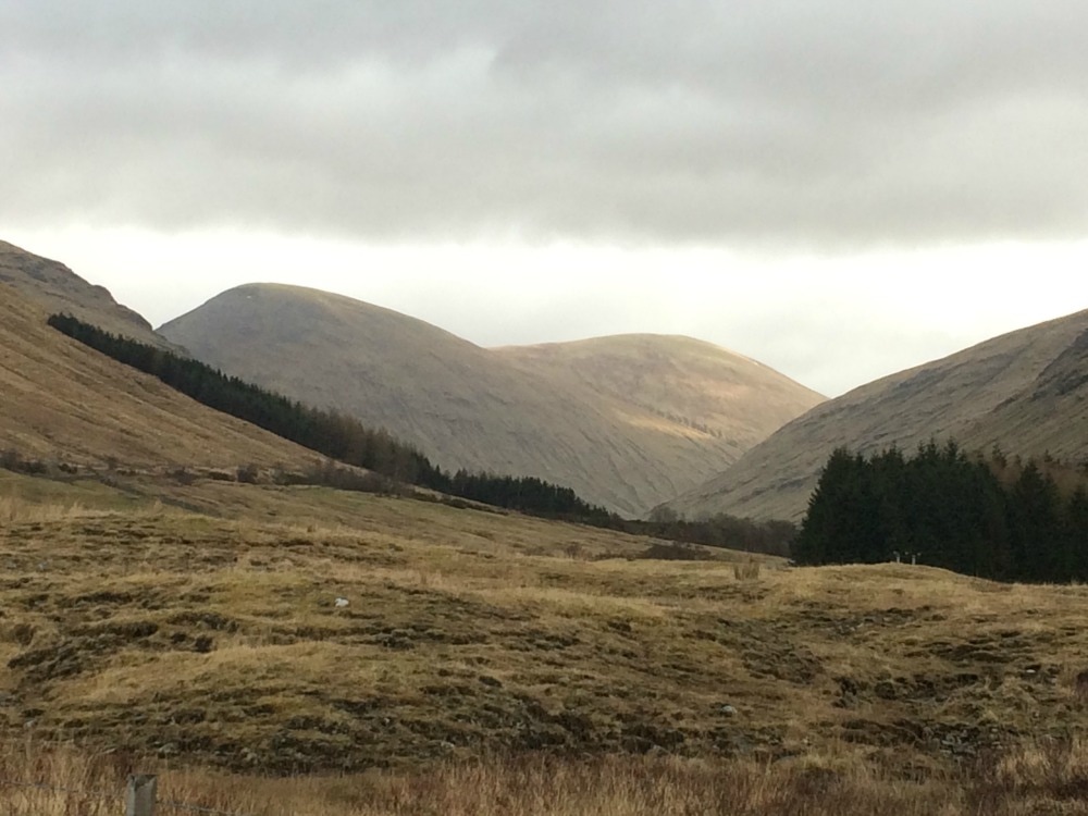
Despite our dawdling, we still got to our Tyndrum B&B before 3pm, the time it opened, so we loitered looking at pretty streams of which there are several thousand (or so it seemed) on this walk. After checking in and husband dutifully cleaning the remains of cow pat alley off our boots and gaiters, we ambled into the town centre for a pub dinner. There is a gap in the market for someone to open a really good curry house or pizza joint along the Way as ye old Scottish pub faire - while lovely - starts to become a bit repetitive. We would play food bingo with every menu. Haggis? Tick. Black pudding? Tick. Whiskey sauce? Tick. Macaroni cheese? Tick. A highland burger? Tick. Venison of some kind? Tick. Sticky toffee pudding? Tick. Despite walking many miles every day, this is not a walk you do to lose weight! Day 5 - 19 miles: Tyndrum to Kings house This was the day I had been waiting for. While the scenery had been getting steadily more wild and more beautiful, this was the day that promised really spectacular and wild Scotland. It didn't disappoint. After an excellent breakfast by our hosts at Glengarry House B&B, we headed off, for once with a packed lunch that sounded worth getting. Beef and horseradish and ham and pickle sandwiches, two chocolate bars and a cereal bar. Now that's more like it. It was a gorgeous start along a lengthy military road, which initially ran parallel to the A82 but soon separated from it. The views were simply breathtaking. When the clouds cleared we could see the munros of Ben Dorain (1076m) and Beinn an Dothaidh (1004m), which are options for anyone wanting an additional hill climb while on their trip.
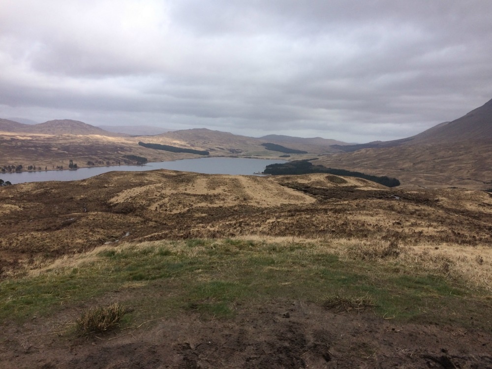
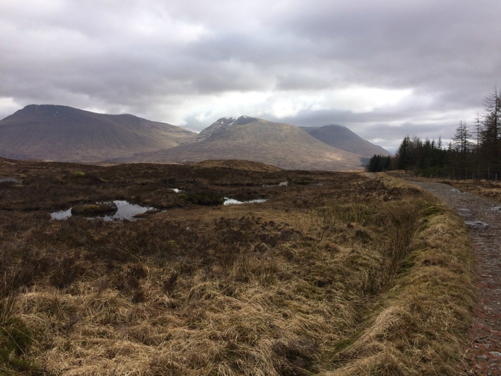
Thanks to the relatively flat path, the walking was easy and we made the seven miles to the Bridge of Orchy in just two and a half hours. As it was still early, we stopped at the Bridge of Orchy hotel for a coffee. It was the best coffee and friendliest service of the entire route. Keen to get on though, we headed out again and climbed up and up and up through a plantation until we reach a cairn at 320m with views over Loch Tulla and Rannoch Moor. We descended to Inveroran, not to be confused with the recently visited Inverarnan. Here you will find a hotel and had we not had our exciting packed lunches, this would have made a good lunch stop to break up the day. But we soldiered on, past a very pretty spot ideal for wild camping next to a little river. We headed up towards Rannoch Moor, stopping for our picnic lunch next to a little burn. Obviously a sock rotation was required....Then it was time to tackle the moor.
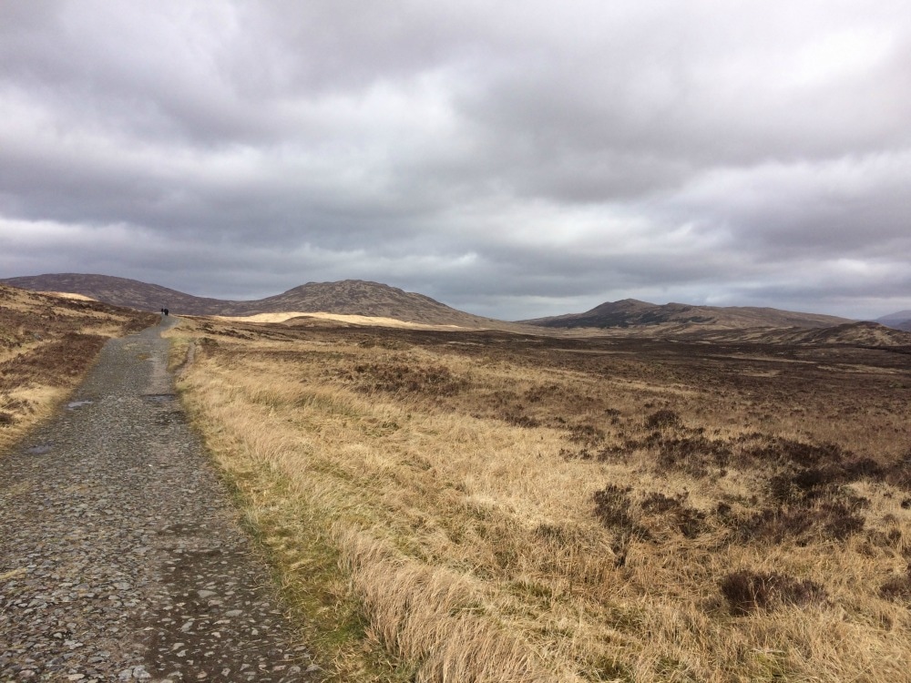
 We were crossing ten miles of exposed moorland - the largest uninhabited stretch of land in the UK - with exceptional views of Coire Ba, the largest mountain amphiteatre in Scotland. It was spectacular and exactly how I'd (naively) imagined most of the Highland Way to be. The path we walked along was the old cobbled drovers road, still in use until the 1930s. It also really hurt your feet to walk on it due to the cobbles. You are warned to take plenty of kit to protect you from the elements for this stretch, but we were lucky and had just the odd spot of rain and chilly gusts of wind coming off the snow topped mountains to contend with. A bigger issue was trying to find somewhere to have a pee privately. The flat expanse of land didn't offer up much privacy to the walkers stretched out along the route.
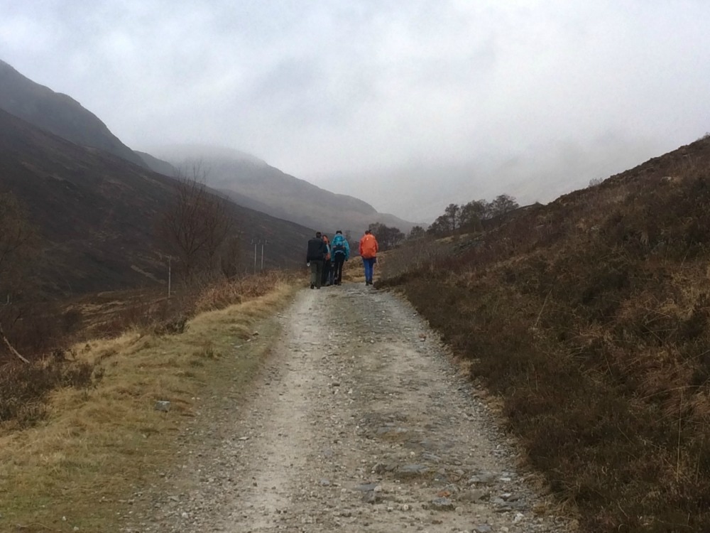
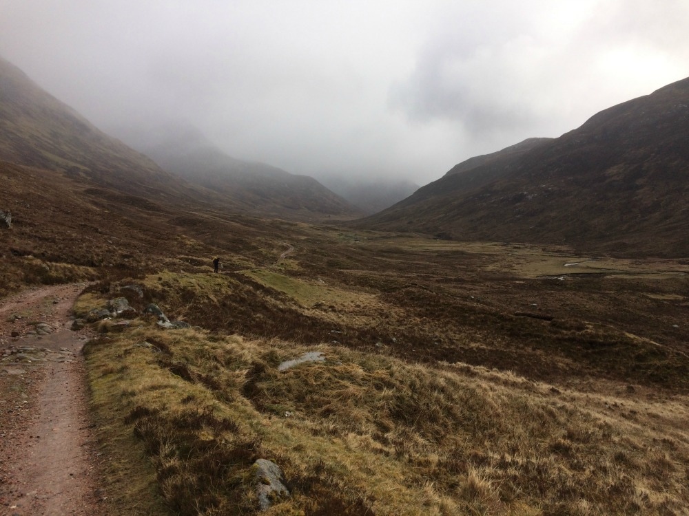
At last we saw the Glencoe Ski Centre's chairlifts and knew we were getting close to our destination of Kingshouse. Despite the 19 miles, we both felt strong and filled with the contentment you can only get after a long walk in a beautiful, remote place. We made our way to Kingshouse, which has a hotel (closed for refurbishment at the moment) and a bunkhouse, with handy cafe. It's here we passed some time while waiting for a taxi to pick us up and take us to our accommodation in Ballachulish for the night. There are plenty of day walks from here if you want to break up your trek. Day 6 - 9 miles: Kingshouse to Kinglochleven This short day seemed a doddle after the 19 miler of the day before, but it featured something called The Devil's Staircase, which sounded terrifying. Particularly when you'd drunk a little too much red wine the night before.... We returned by taxi to Kingshouse and set off along a path running alongside the noisy A82. If you can block out the road, the mountain views are spectacular. We soon veered away from the road and headed up the dreaded Devil's Staircase, which as it turned out was far less daunting than it sounded. Yes it was a fairly steep climb with quite a few zig zags to reduce the gradient, but we'd had tougher hills on the walk and this one made up for it with stunning views at the top.  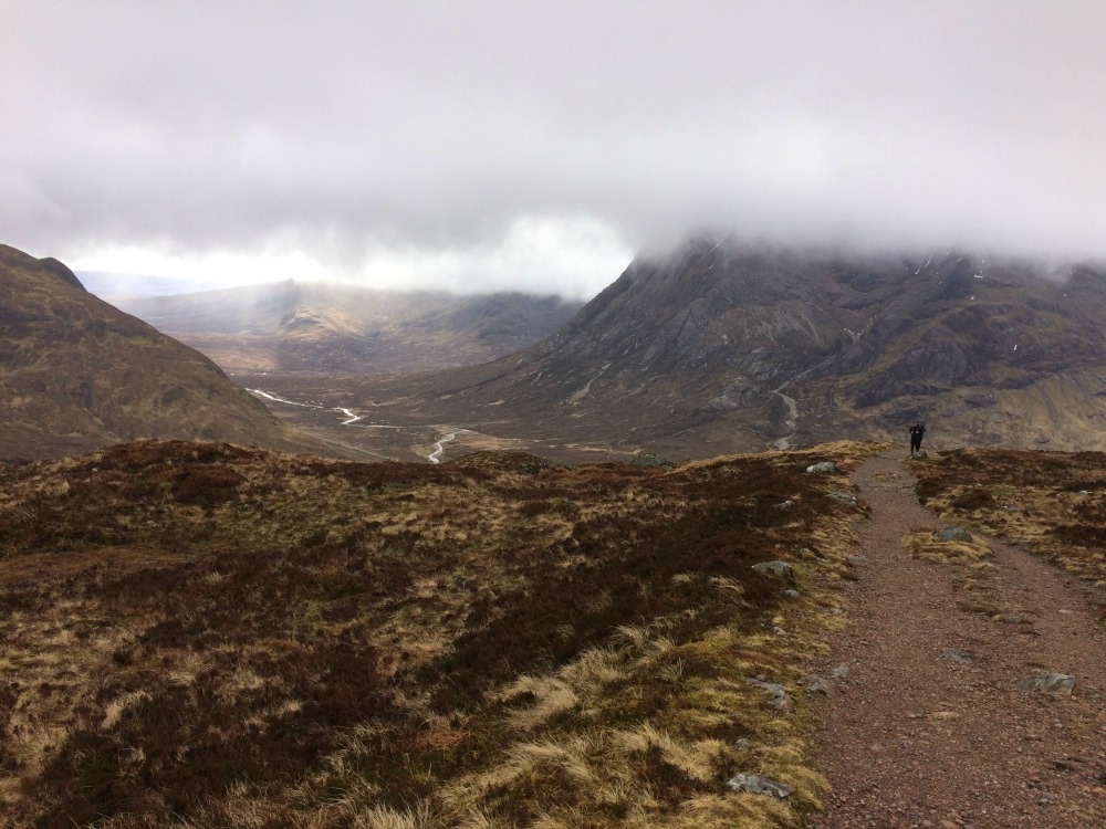 A West Highland Way ambassador I'd met the day before while waiting for our taxi had said that the climb up wasn't the problem. It was the descent that killed you. And so we began the descent, which was long and slow. My husband said he didn't see what the problem was. But several hours later, he'd changed his mind. As had I. The way down never ended. You see Kinglochleven away in the distance and think it won't be long before you get there. But down the stony path goes, threatening to twist ankles with every step taken. Each step jars the knees and challenges the toes. We took note of the Blackwater Reservoir we were passing, but frankly, our concentration was purely on how to stop the pain in our knees. It may only have been 9 miles, but they were nine exhausting miles and we were VERY happy to stumble into the Ice Factor, an indoor ice climbing centre, for a sit down and a spot of lunch. My husband who had said at the start of the day that he was keen to have a go at the ice climbing funnily wasn't feeling quite as keen anymore. So we just chilled out, headed to our B&B - Allt-na-Leven (the best place we'd stayed all trip) and spent the afternoon having a lazy nap. A very casual dinner was grabbed from the pub next door and we happily spent the evening with our feet up, doing not very much at all! 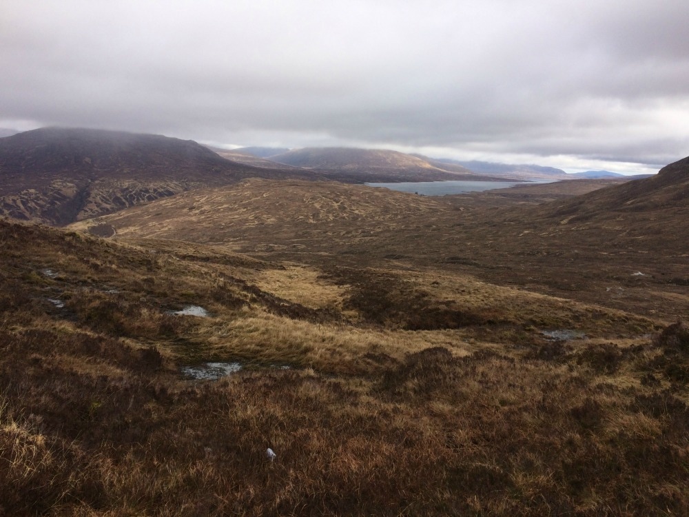 Blackwater Reservoir 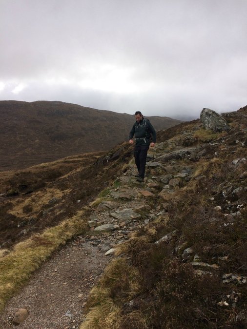 Lots of going down 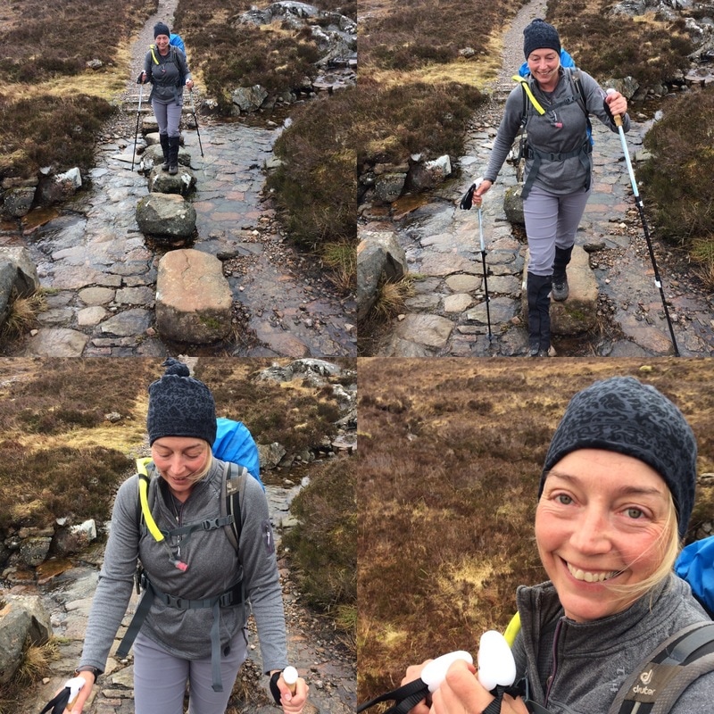 Stepping stone fun Day 7 - 15 miles: Kinlochleven to Fort William And so the final day dawned. After an exceptionally good breakfast at our B&B, and a quick stop at the co-op across the road for a lunchtime sandwich, we headed out of town. Almost immediately we had a hill, which gave the Devil's Staircase a run for its money. As always, our way was dotted with bridges, burns, little waterfalls and mossy trees. Quintessential highland terrain. At the top of the hill, we followed an old military road that continued into the descending mist along a valley between two high hills on either side. The mist gradually turned to rain and wet weather gear was called for once again. While blue skies would have made an incredible backdrop, there was something very atmospheric about the rain and swirling clouds. Old stone ruins would emerge spookily and the sense of old tales lingered over them. It was easy to imagine highlanders from hundreds of years before galloping horses along the track swathed in faded tartan. That image almost became reality when, having stopped for a short break, a young man came strolling along the path. He wore a button down shirt, tartan tie, full kilt with sporran, a Harris tweed waistcoat and blazer, long woollen socks, an old fashioned haversack on his back and a shepherd's crook as a walking pole. The only nod to modernity was his hiking boots, but even they looked the part. 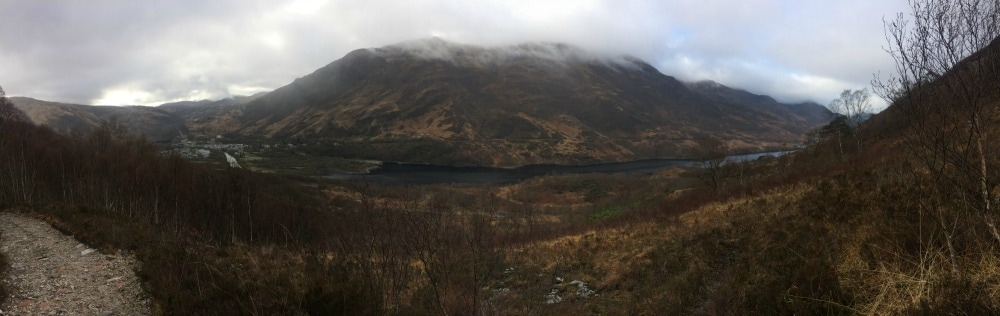 Looking back down on Kinlochleven
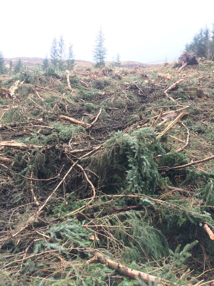
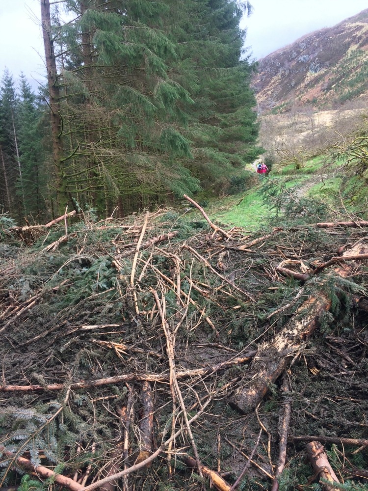
As the sun came out, we left the barren scenery behind us and instead were faced with what looked like a scorched earth policy put into practice. Warning signs earlier in the path had said that the way was closed and that a diversion had been put in place. The path was now reopened but it was easy to see why it had been closed. Forestry operations had felled hundreds and hundreds of trees, which lay strewn across the path. In places we had to scramble over the fallen logs. While the smell of pine was lovely, the site was horrible and a far cry from the pretty plantation we might have been walking through. It wasn't quite the ending we'd hoped for.
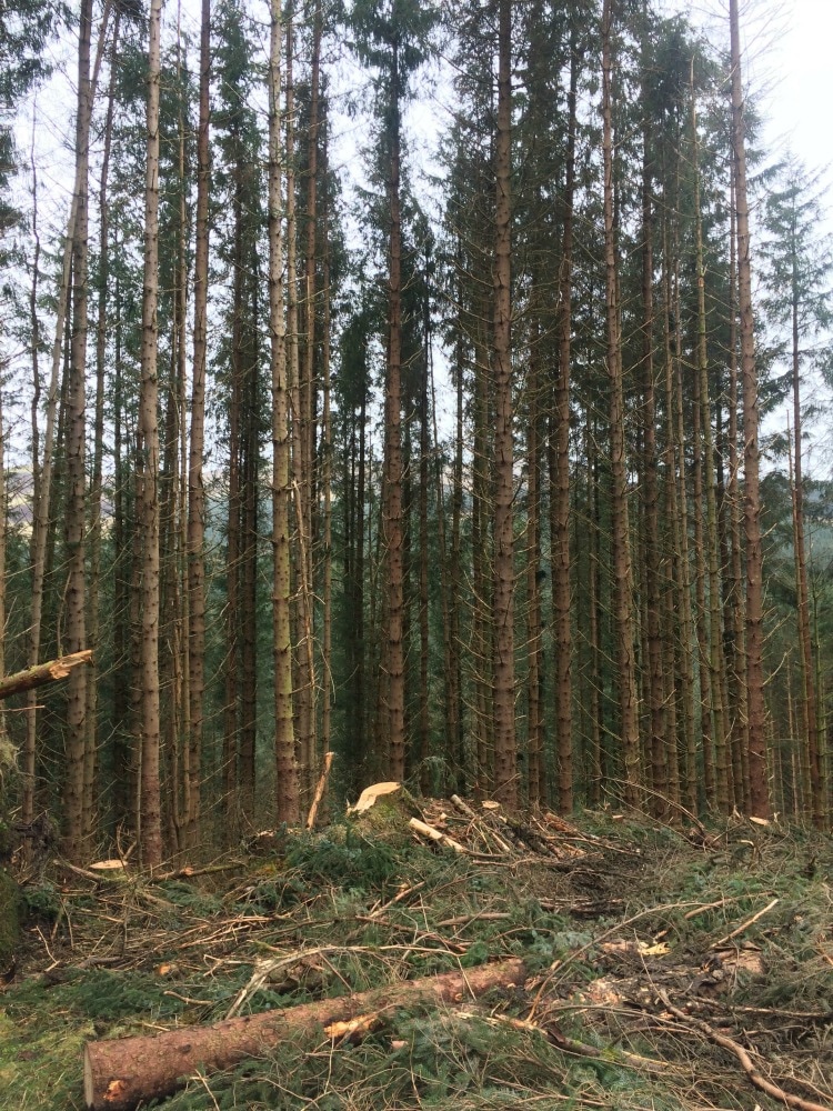
We stopped for a picnic on two of the tree stumps, before heading up a final hill. We could have diverted off to see an ancient iron age fort, but we'd reached the stage where we just wanted to take our boots off. With views of Ben Nevis ahead of us, we began our final descent down to Fort William on a wide forest path. Here at least the trees were still standing. 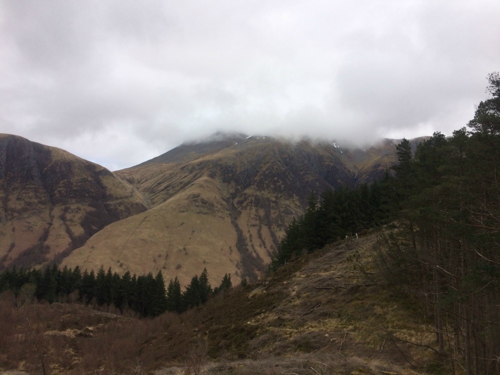 Ben Nevis shrouded in clouds The West Highland Way ends rather drably with a walk along a busy road into town, so we opted for an alternate route that the book suggested. We stayed on the forest path, skirting around cow hill and only dropped down into the town at the last minute. Our final short stretch was along the bustling high street until we found the West Highland Way end sign. We saw many of our fellow walkers there, all getting their pictures taken. We chatted to a few, although I found that we'd met fewer people on this walk than I had on the coast to coast. I'm not sure why, but there just didn't seem to be the same bonhomie as I'd experienced before. But we settled down for a pint at the Ben Nevis arms with a couple of them and toasted our achievement. The bar kindly (and with a hint of clever marketing) gave us free certificates acknowledging our success. And that was it. A final walk to find our accommodation for the night. A final menu featuring haggis, black pudding and sticky toffee pudding. A final bottle of wine and a final single malt. Our Scottish adventure had ended. 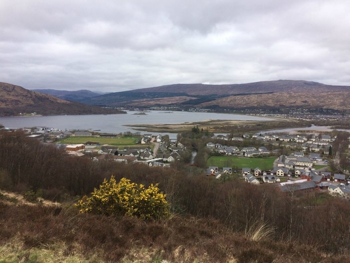 Fort William 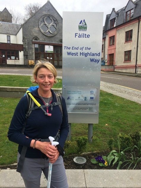 So would I recommend it? It's a great trail with some incredible scenery. You get a mix of lochs, moors and mountains. It's relatively easy and there is accommodation, wild camping and plenty of food stops on the way. I just wish it didn't follow the road for as much of it as it does. It didn't feel as wild and as remote as I had hoped. That said, it's still worth doing. And if you're short on time, I'd recommend starting at Tyndrum and heading north as those are the best bits scenery wise. I'd also make sure you go when the midges aren't out as EVERYONE mentioned them. If you are a woman who would love to do this walk but don't have anyone to do it with, join the Glamoraks community and find a walking buddy. 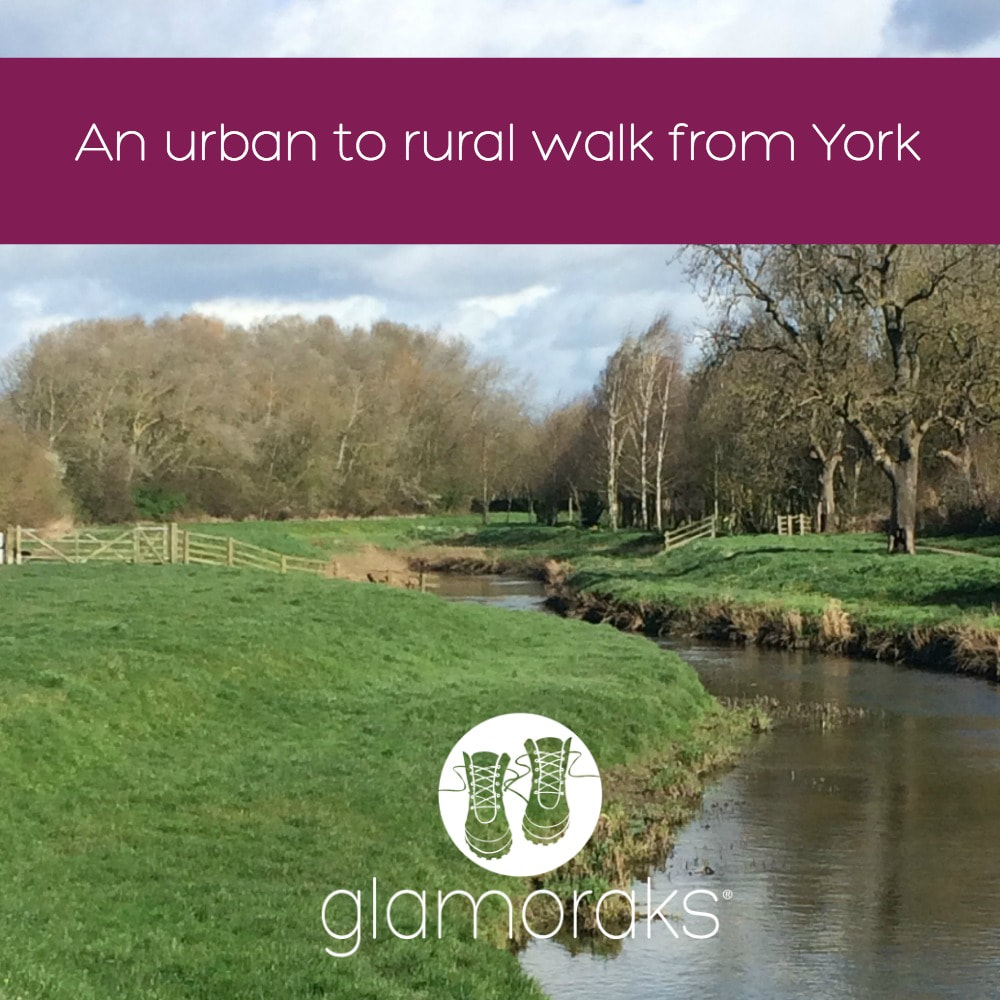 Distance: 11.8 miles (although I missed the last 0.8 as a friend picked me up for a coffee...) Type: Urban to rural Terrain: Riverside path, fields, some roads and some muddy bits I am lucky enough to live just outside the York City Walls. The downside about living in the city though, is that I typically have to get in my car to drive to some countryside for my walks. But I recently discovered that the Centenary Way starts right outside the York Minster, a mere five minutes walk from my house. The Centenary Way was created to celebrate the 100th anniversary of the York County Council and was opened in 1989. It runs from York to Filey on the North Yorkshire coast, spanning 83 miles. Besides the Minster and Sheriff Hutton Castle, both of which are in this first part of the walk, it also includes the Howardian Hills and Yorkshire Wolds, letting you see Castle Howard and the abandoned medieval village of Wharram Percy. It links up the Foss Way, Yorkshire Wolds Way and Cleveland Way. I confess that I was unsure of what to expect. Some of York's residential areas aren't exactly uplifting for the soul. I didn't really fancy an urban walk, but I headed out from the Minster after being pelted by a snow storm. The forecast was strong winds and they weren't wrong. The walk around the Minster is one I know well, starting from the Southern transept, heading down Chapter House Street and the haunted Treasurers House, before going along Ogleforth (so named as Vikings found owls living along a river there - I've been told - ogle meaning owl.) You pass beneath Monk Bar, one of the ancient city gates, cross busy Lord Mayor's Walk and then head down a little lane past a not very attractive car park. This is what I feared. But that experience was short lived. I quickly found myself walking through the Groves, a residential area with a pretty snickelway running through it. Before long I popped out on Huntingdon road and got to walk along the Foss River. I am amazed at how quickly you felt as though you weren't in a city anymore. Yes there were houses lining each side of the path, the Foss can be a bit grotty in places and the Nestle Factory is hardly a rural idyll (although the chocolate fragrance wafting overhead was lovely), but it was a peaceful, tree-lined river walk. All the way from New Earswick to the outer ring road, the river was lined with houses that were lucky enough to have gardens with water frontage. Again, I wasn't aware that all these properties existed. There was so much green space and I was still in the city! After walking along the river for a good distance, I finally ducked under the outer ring road where it immediately felt more rural despite walking past Earswick, another suburban village. The wild weather kept coming - intense sun one minute, rain, sleet and bitter winds the next. I eventually diverted from the river briefly to head through Haxby and along Towthorpe Road. This was probably the least fun bit as it meant walking on the grass verge alongside the road, with cars rushing by. But it didn't last long and I headed off across fields once again in the direction of Strensall. I picked up the river again until at last I reached Strensall bridge. This would be a good place to stop if you didn't want too long a walk (about 8 or 9 miles). And there is a pub - The Ship Inn - in Strensall should you need some lunch. And there is a bus that runs back into York right past the pub. However, I kept on going, following the river for another good long stretch. It's here you can tell that it used to be a canal and according to the guide, also has some Roman remains somewhere along the way. I was too busy dodging the mud to notice, as the path had suddenly turned into a bog. As I reached an old metal footbridge, I had to veer away from the river, through a wood, across and field and past a farm. By now my feet were starting to hurt. I headed into the pretty village of West Illing and saw that there was just 3/4 of a mile left to Sheriff Hutton. However, I'd arranged for a friend to meet me for a coffee so she scooped me up and we drove that last bit. When a latte and chocolate brownie call, walks end abruptly! There is a lovely coffee shop in Sheriff Hutton, so it's worth walking there for a spot of lunch or afternoon tea. There is a bus that runs from the village back to York, but it's infrequent so you may need to get a friend to pick you up or call a taxi. All in all it was a lovely, a very surprising walk that took me from a busy city centre to peaceful, rural countryside, right from my doorstep. If you haven't explored it yet, give it a try. You can download the entire Centenary Way route for free here Why not join the Glamoraks community and meet other women to go walking with? 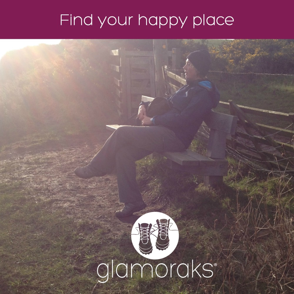 Millions of women put the happiness of others before their own. It's not something we intentionally set out to do. And we're not trying to be martyrs. It just happens. This is particularly true if you are a mother. We sacrifice our weekends, our hobbies, our careers so that we can drive children to and from their activities, cheer them on as they take part in their sports or clubs, and simply be there for them even if they don't want you there.
We become a spectator, rather than a participant, in life. But it's not just kids that we put first. We tend to put our family, parents, partners, friends, jobs, cleanliness of our homes, and our voluntary work before ourselves. Somewhere in your 30s, you look up from a pile of nappies and wonder where the old you disappeared too. Or perhaps it's in your 40s that you realise your teenage kids no longer want you around quite as much or your job just doesn't fulfil you anymore. Possibly it's your 50s when your children are leaving home and you're faced with a stark reality of having to redefine your role. Or it could be your 60s when you retire from a job you've done all your life or a health scare wakes you up to all you've been missing. Whatever your age, we all reach that point when we realise that we've put our happiness last and it's time to fix that. I think this is what people refer to as a mid life crisis. But you don't need to sell your house and backpack around the world or buy a convertible car or have an affair with a toy boy (but hey, feel free if any of those appeal!) All you need to do is put on a pair of boots, open your front door and start walking. There are numerous studies that prove the benefits of walking:
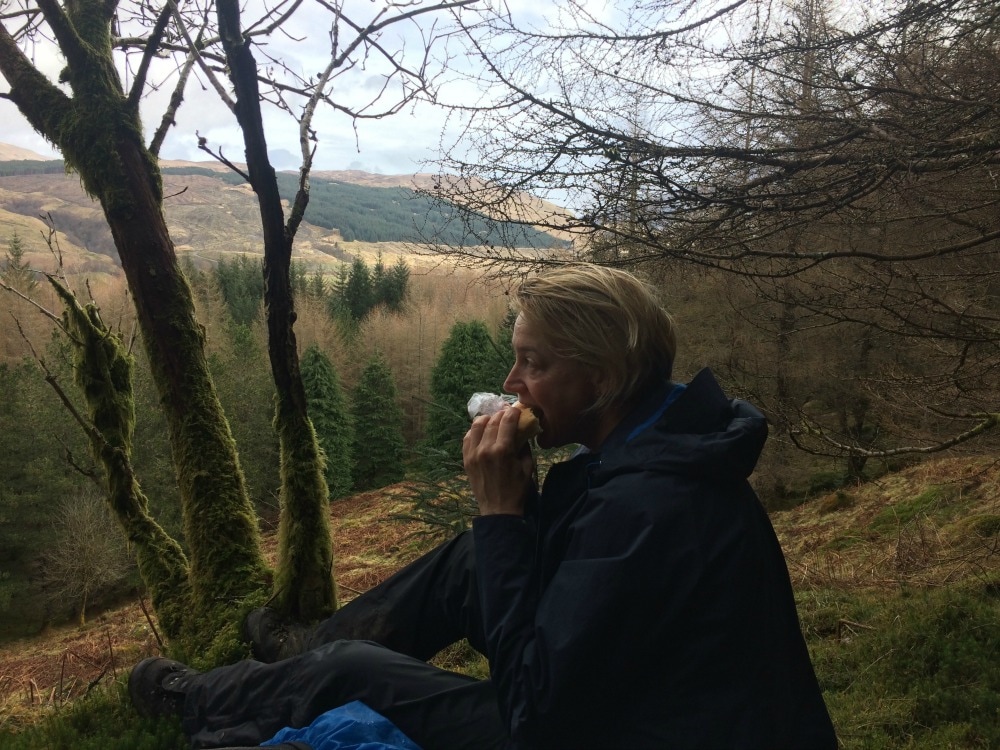
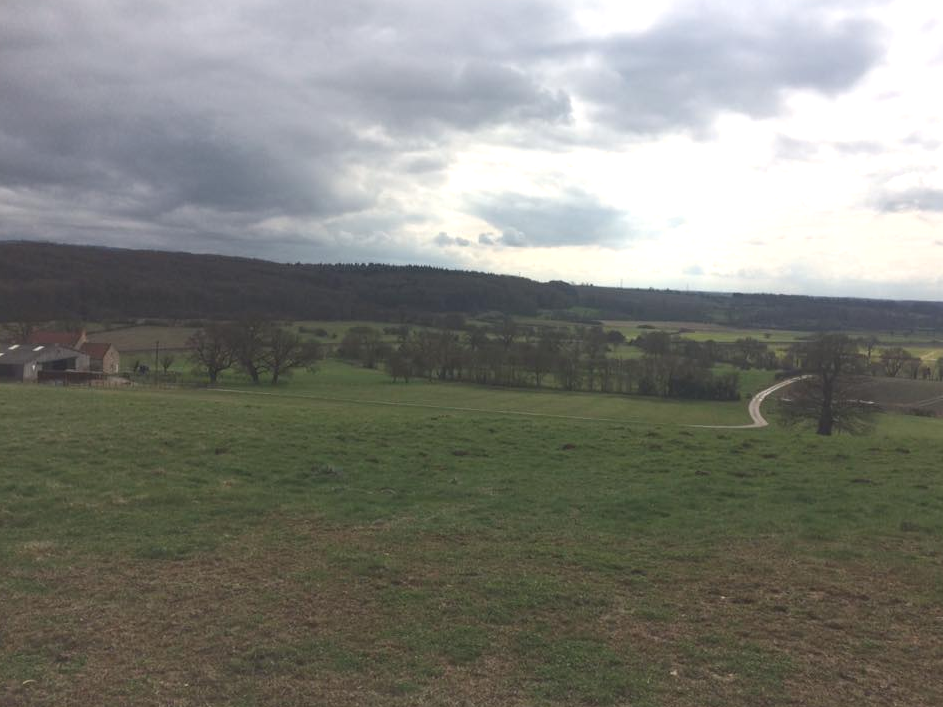
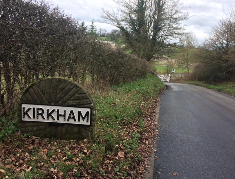
There are countless studies out there about the benefits of walking. But I want to focus on the last two on that list. Because those are the ones that I think women need most. When you've spent years putting others first, even though you are immensely capable and probably juggle a million things with the dexterity of a circus performer, you don't feel successful. That's because you're facilitating things, rather than doing them. You're watching rather than experiencing it. Walking is a very simple, low cost way to gain a sense of achievement and stimulate your sense of adventure. Perhaps walking around the block is a big effort for you. Perhaps walking further than 5 miles is a challenge. Perhaps walking on your own seems scary. Perhaps heading to the hills where you need a map to find your way seems brave. Perhaps walking for several days in a row would be hard core. What about taking on a mountain or an epic multi-month through hike? Everyone has their own challenge depending on where they are in life. But regardless of the size of the challenge, by doing it, you will be flooded with a sense of confidence and self belief. And that is what will make you feel genuinely happy. Hidden inside all of us is a sense of adventure. When you tap into it, you will realise what you are capable of. It's good to feel a little bit scared or a tad uncomfortable. It makes you feel alive. And feeling alive is what makes you feel happy. So I challenge all you ladies to take up the #FindYou challenge. Go for a walk. Walk further than you usually do. Walk a different route. Plan a walking weekend. Go out in wet and windy weather. Just head out. Embrace the elements. Let yourself discover things. Slow down. Chat to strangers. Get lost. You may just find yourself - and happiness - in the process. You in? Tell me in the comments or join the Glamoraks community of women who all put their boots on to get happy. 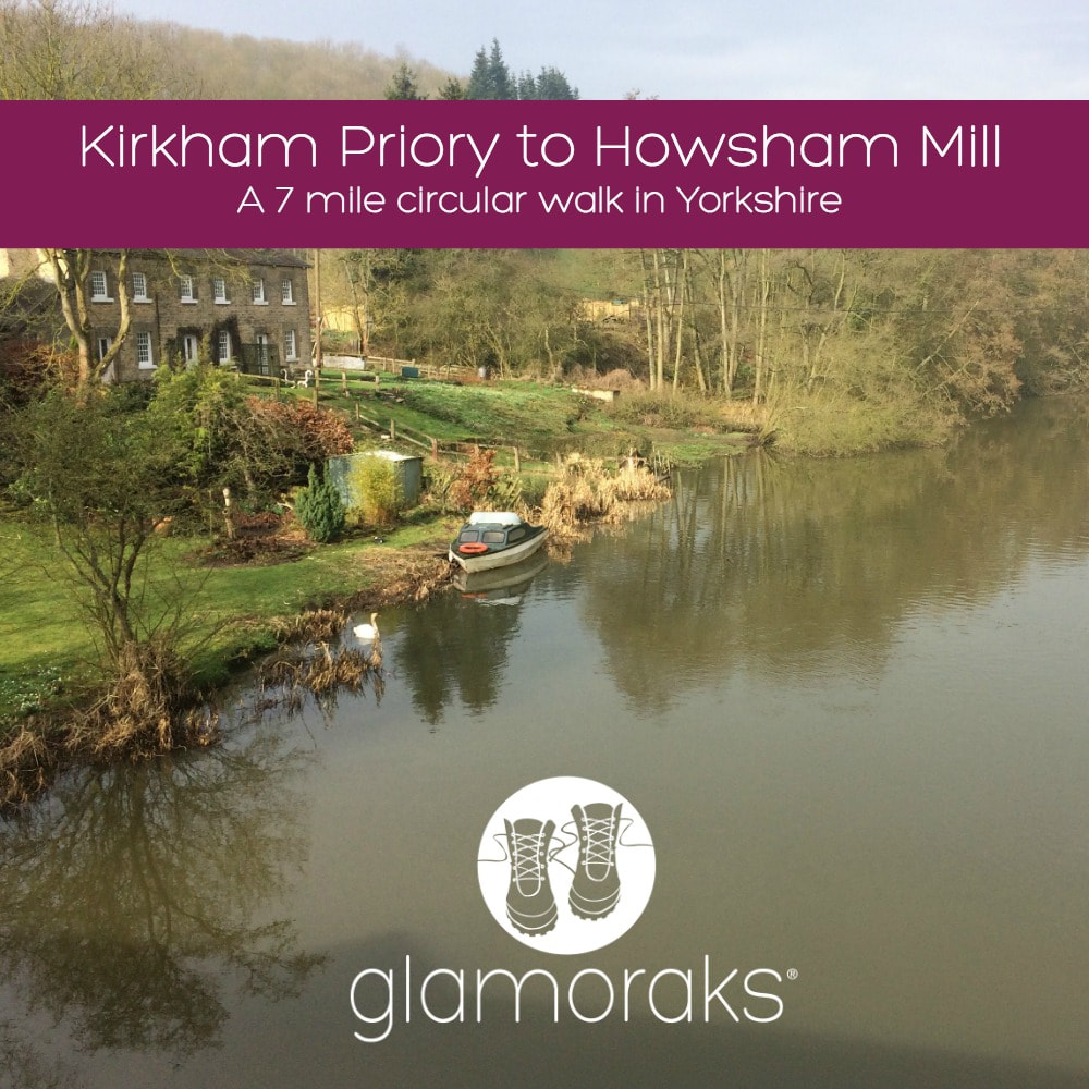 Yesterday morning I was a bit cross. That is a euphemism for how much of a rage I was actually in. I grabbed my boots, filled my water pouch, shoved a waterproof jacket into my backpack and headed out. I needed miles of space to help me simmer down. But it had to be somewhere not too far from York and I wasn’t in the mood for my normal stomps. I recalled having cycled past Kirkham Priory once, which is set along the banks of the Derwent River. A quick Google search showed a circular walk from the priory. ‘Right, that’ll do,’ I muttered and drove off. Fifteen minutes later I found myself in the peaceful sanctuary of Kirkham. Getting out of the car, I turned to Google to check the route, only to discover that there was no internet signal. Ah. Well the good thing about the UK is that you don’t have to walk far before you stumble upon a public footpath sign. So that’s what I did. Leaving my car at Kirkham Priory carpark, I walked back over the bridge and found a footpath sign pointing left along the riverbank. I vaguely recalled the walk being along the river, so I set off. 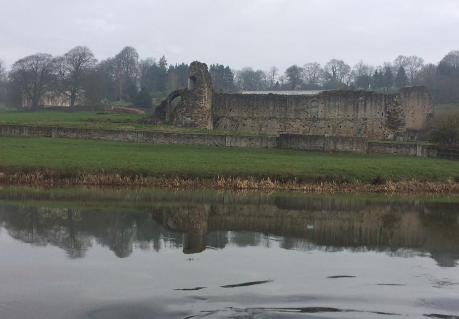 Kirkham Priory ruins
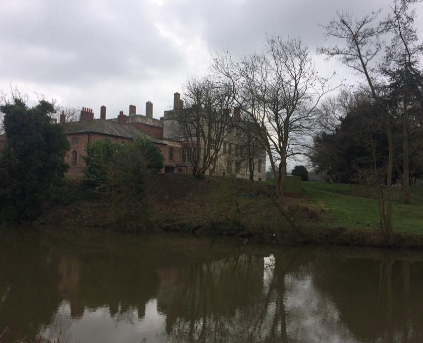
It was a pretty setting with the fast flowing river tumbling over a weir and the ruins of the priory brooding in the mist. I followed the path, which quickly resembled a bog. Cursing the fact that I hadn’t bothered with gaiters, I soldiered on still too cross to care how muddy I got. After about 20 minutes I passed a fisherman relaxing in the perfect spot. He gave a cheerful greeting and told me that one of the bridges further along was down but that I should be fine. I kept walking. It was hard work, the slippery mud making each step a good deal more difficult than it should be. I was feeling less angry but still hadn’t found my happy place. I kept walking. After about an hour I began to wonder if I was indeed on the route I’d read about because it seemed to just go in a straight line along the river, whereas the route I’d seen online mentioned all sorts of diversions and was only 5 miles long. I checked my phone and there was just enough of a 3G signal to show me that I was indeed going in the entirely opposite direction to the one I was meant to be heading in. Excellent navigational skills by me then. I looked on Google maps and saw that the path would intersect a road eventually and that I could walk back to Kirkham along that road, which would be significantly easier than stumbling in the mud. Shortly thereafter I came upon two lovely fishermen. Reet proper Yorkshiremen, who confirmed that there was a road up ahead, ‘just by t’bridge and t’mill.’ I asked them about the imposing building on the opposite bank and was informed it was Howsham Hall, a private residence. Not a bad pad really. After a bit more of a chat, I carried on with a cheery, ‘Av a good day luv,’ ringing out behind me. My rage from the morning had dissipated. I began to feel a smile creep on my face.
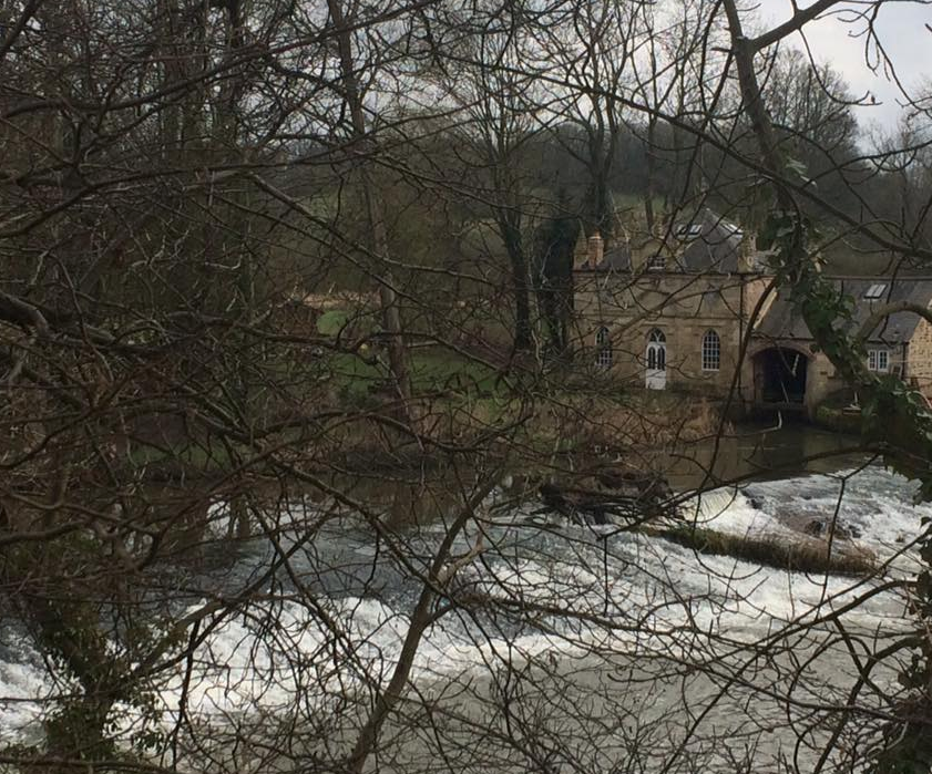
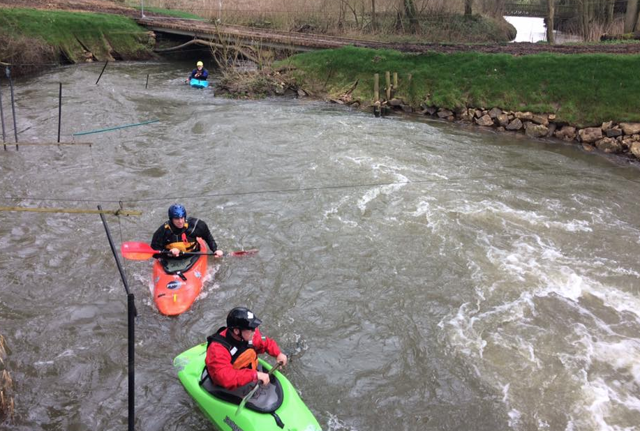
As predicted by the fishermen, I soon came upon t’mill, an old building with all sorts of odd machinery around it. It was a pretty spot and I waved hello to some kayakers who were trying to drown themselves in the churning water below. I ambled on toward t’bridge when a man, squeezed into a wetsuit, walked towards me in the opposite direction. ‘Had a swim?’ I asked. ‘Been kayaking,’ he said with a smile, nodding towards where the others had been. I asked him if I would find Kirkham by turning right on the bridge ahead. ‘Yes, but you should take a look at Howsham Mill first before you go if you’ve not seen it before.’ He explained how I might find it, what it was all about and wished me a pleasant day. Just as I neared the bridge, a long parade of tractors drove past in a riot of noise. Only in Yorkshire, I thought as the last of the farmers gave me a cheeky wave as he passed by. I crossed the bridge to the far side of the river, ducked underneath it and walked the short distance to the mill.
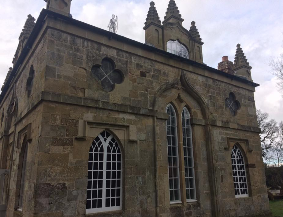
The kayakers had made their way there two and were tackling a slalom course complete with gates and masses of very fast flowing water. I had absolutely no idea that you could do kayaking like this so close to York. After watching them, a man came out of the building and walked towards me. I felt like a bit of an interloper, but said that the kayakers had suggested I come and take a look at the building. The man was very happy to have a visitor and I was given a personal tour. Apparently Howsham Mill was built in 1755 by the family who owned Howsham Hall. They didn’t enjoy looking out from their estate windows onto a working mill (how ghastly!) so they had a faux hunting lodge designed and constructed by York architect John Carr to obscure the mill from view. It featured a lead statute of Diana, the hunter on its roof. The mill served the local area, grinding their grains and animal feed for 200 years. The mill fell into disrepair in 1947 but in 2003, it was purchased and the Renewable Energy Trust was formed to save the building. It has since been completely restored, including a replica carbon fibre statue of Diana on the roof. A replica water wheel has been fixed into place and you can watch it churning away with impressive power. But even more impressive are two huge Archimedes screws that act as electricity generators. The power they generate not only gives the building electricity, but it’s also fed back into the national grid, which in turn pays the site money for continued redevelopment. The entire place is now completely sustainable with rain harvested water, its own generated electricity and composting toilets. It is used as a place schools can take children to teach them about nature, history and engineering. And it can also be hired as a quirky, private venue. It’s still a bit rough around the edges but it’s a lovely space and I was very pleased to have found it. I thanked the man for the tour and headed back the way I came. I saw the kayakers again, this time changing out of their wetsuits. ‘Worth the detour?’ the chap I’d spoken to earlier asked. ‘Absolutely,’ I said and thanked him for the tip. ‘You enjoy the rest of your day now,’ he said. Every single person I’d met on that short walk had been absolutely bloomin lovely.  The grand entrance to Howsham Hall By this point I was starving. That’s one of the problems of leaving in a huff. You forget to pack food. I picked up the pace so that I could get back home for a bite to eat. My route back was along a very quiet road towards Crambe. As I approached the level crossing just outside the village, the station manager was just swinging the gates closed as a train was coming. ‘Ey up luv, I’ll hold ‘em open for ya. The train’s not here yet. By ‘eck, your face is red!’ I thanked him for holding the gates for me and explained that I was walking fast, hence the bright red complexion. He seemed to find it hilarious. He confirmed that I was heading in the right direction for Kirkham, and got back to his gates. At last I came to a footpath sign for Kirkham – 1¼ miles. I followed it up a very steep hill, where a fellow walker sat with his picnic in front of him, admiring the view, which was spectacular when I turned around to appreciate it. After pointing me towards the right gate, I walked the last part of the route through a forest on the top of a hill, before rejoining the road down the steep hill into Kirkham. The best walks are the ones you find by chance and manage to navigate with the help of friendly locals rather than a map. I'd stumbled upon a serendipitous three hour, roughly 7-mile walk dotted with some of a friendliest folk I’ve yet to meet on a walk. My anger had completely gone. Fresh air, a chance discovery and beautiful scenery had performed their tonic. It's amazing what you find when you just put your boots on.
Walk details:
What to take: Wellies! Or good boots. A picnic for the spot at the top of the hill. I did this walk alone, but it would have been fab with company too. If you battle to find people to walk with, join Glamoraks, an online global community of women who walk.  Throughout this series of blog posts, I have included tips on what you will need and what the experience is like. But what you seldom read about is what happens to you when you get back.
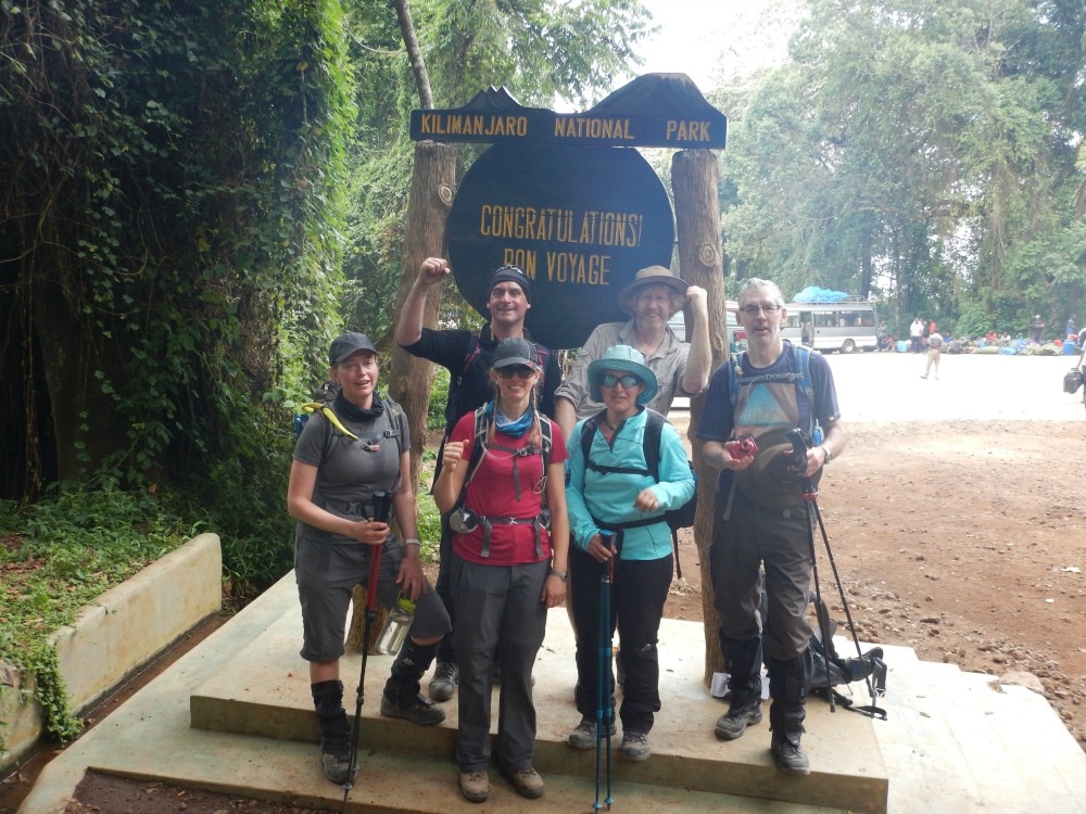
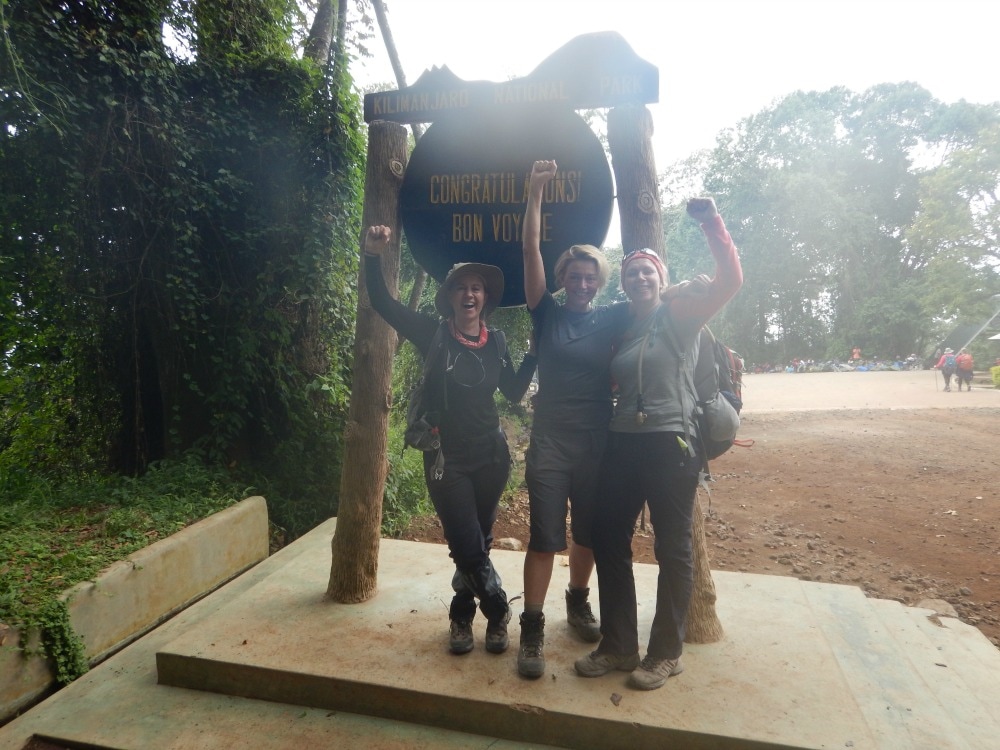
First of all, you will look at the incoming group of poor sods about to tackle the mountain and will smile knowingly into your beer, not wishing to be them for a single minute. And then you realise that the team who came down the same time we were about to head up were looking at us in exactly the same way. Secondly, your body can have a delayed reaction to the exertion, high altitude and temperature extremes you've gone through. Here are some of the effects we experienced:
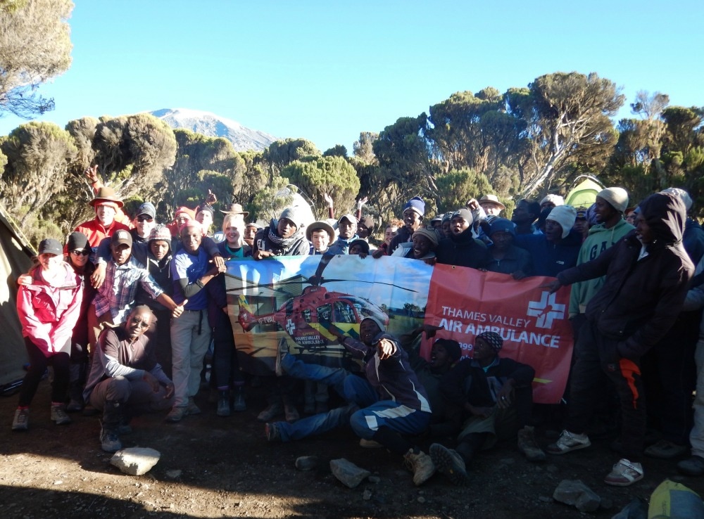
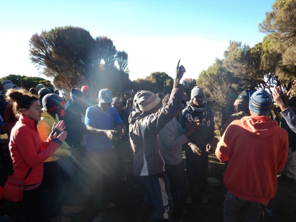
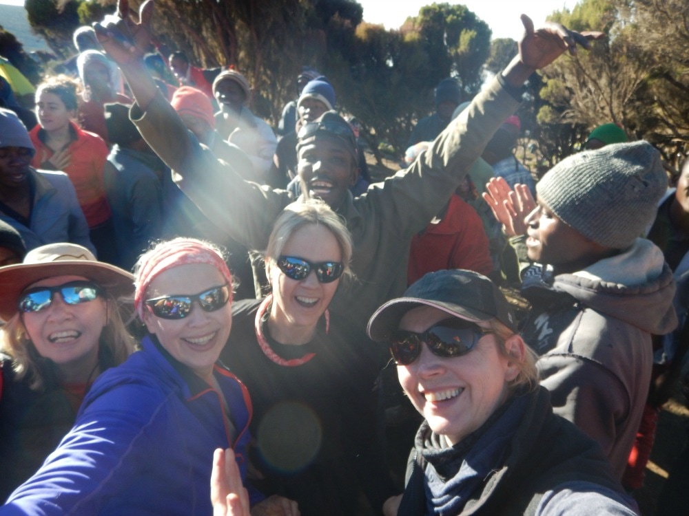
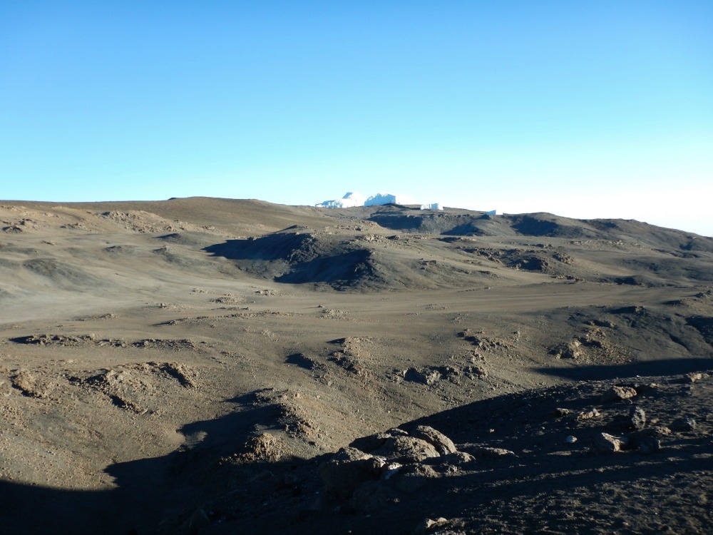
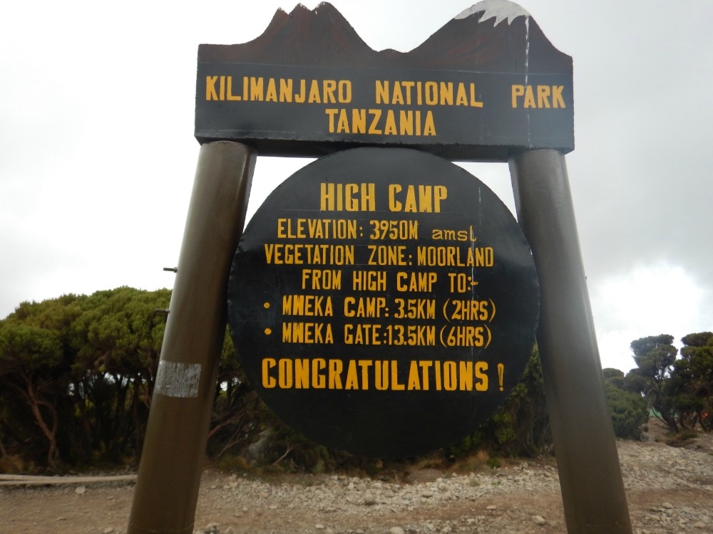
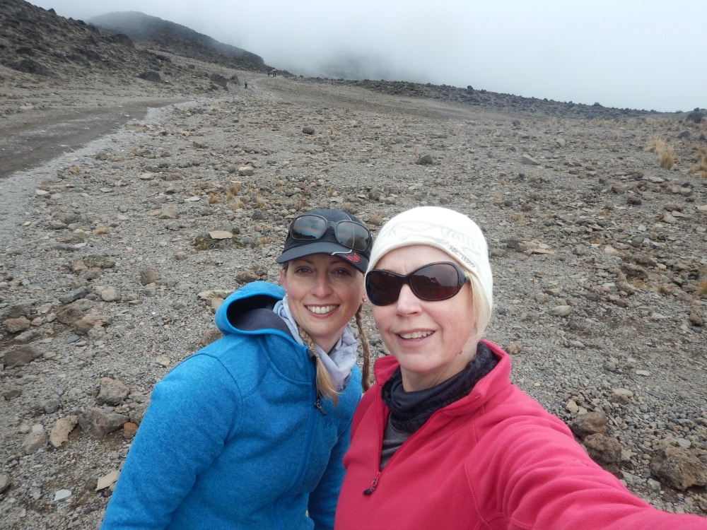
Yip – it’s all glamour. But is it worth it? Yes. Would I do it again? No. Am I glad I did it? Absolutely. Go back to day 1 Want to meet other women who like going on hiking adventures? Join Glamoraks. 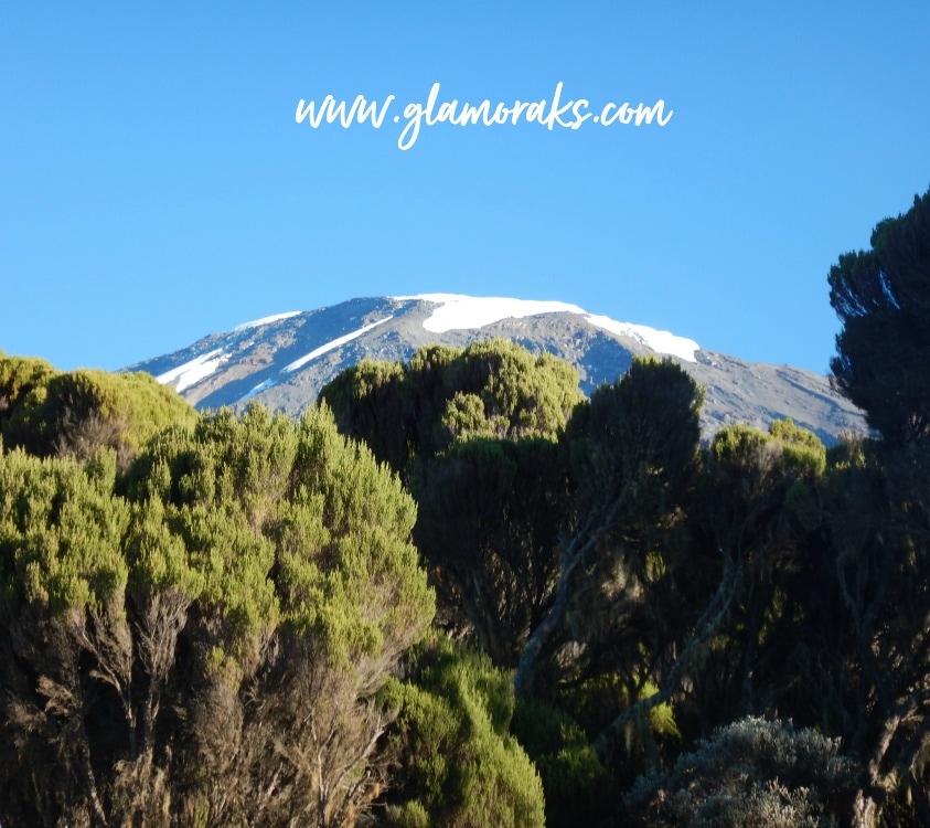 Start height: 3950m End height: 1800m A 6am wake up call by our coffee porter, revealed a gloriously sunny day. The snow covered peak set against a bright blue sky seemed surreal. We’d been there. We’d done it. All the exhaustion of the previous day had gone and we could at last celebrate our success. A brilliant breakfast of delicious (yes, really) porridge was followed by pancakes, fruit and Vienna sausages, which no-one except me seemed to like, so I ate my body weight in them. It was our last time packing up tents, our last time of putting on filthy clothes. There was a spring in everyone’s step and laughter throughout the camp. Donations of kit were made to the porters, some of whom trek up the mountain in ancient crocs with holey socks and thin sweaters. They thanked us by singing and dancing for us again. We all joined in. It’s amazing what a bit of extra oxygen will do for you.
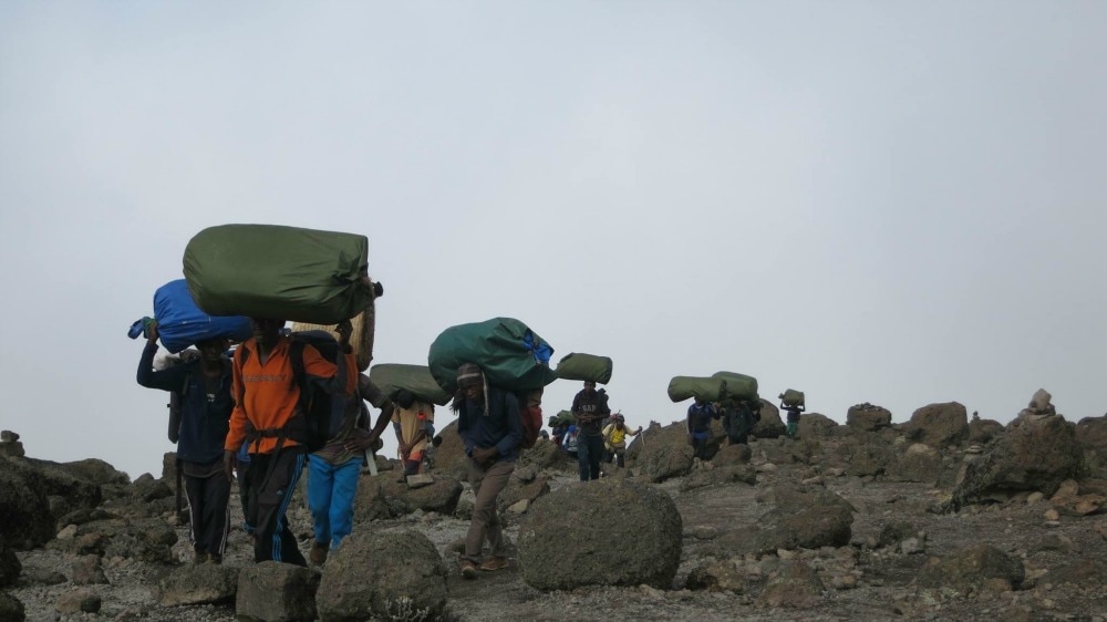
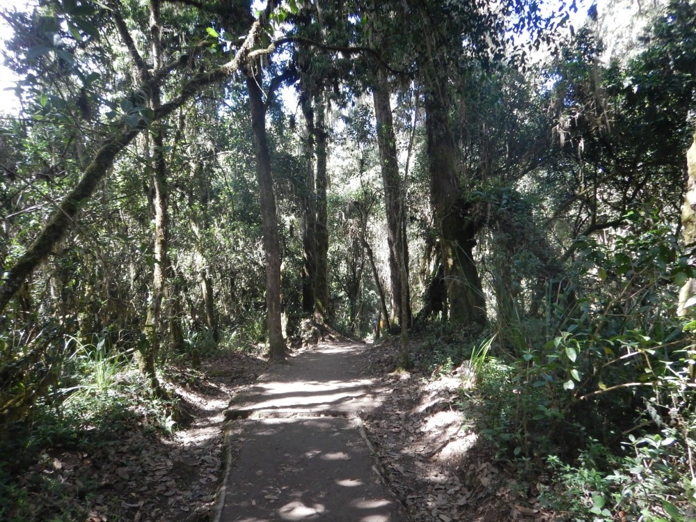
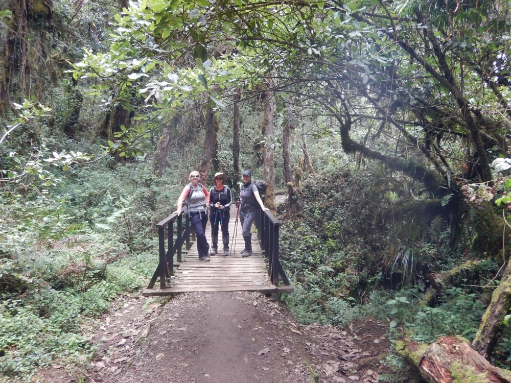
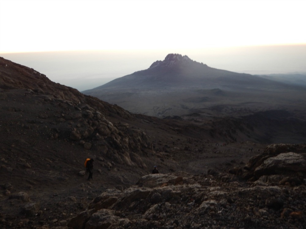
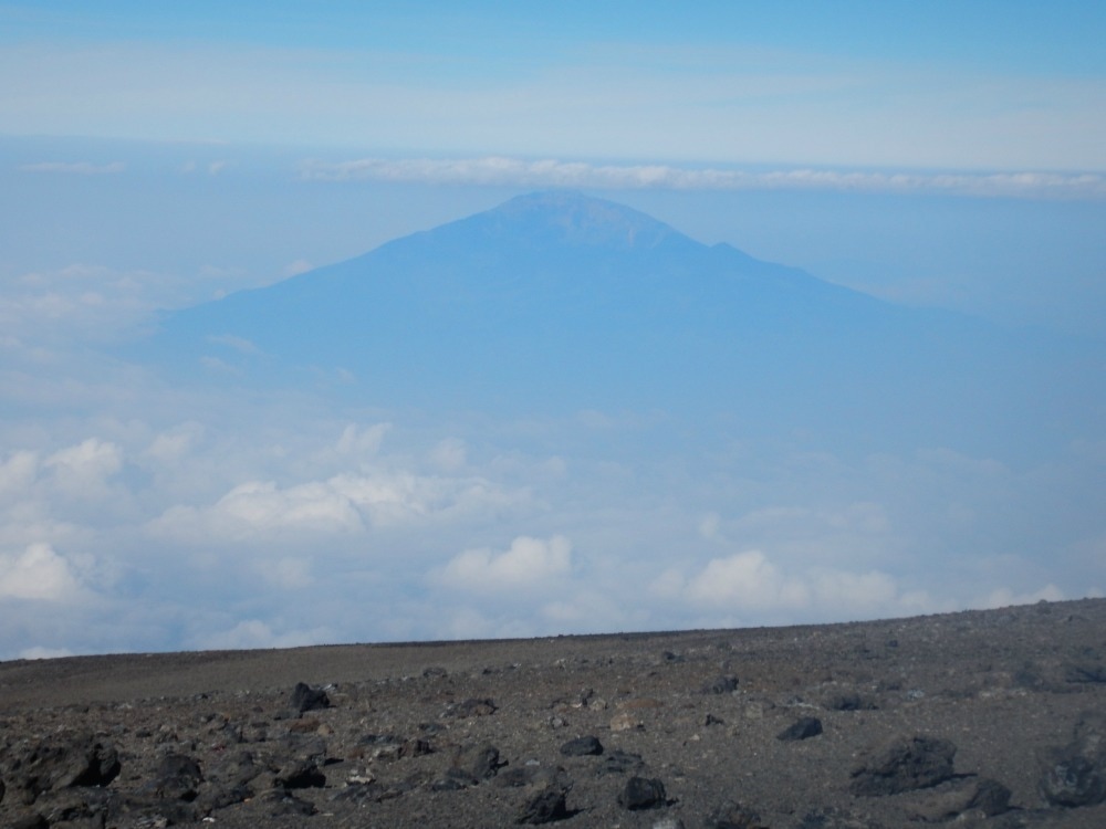
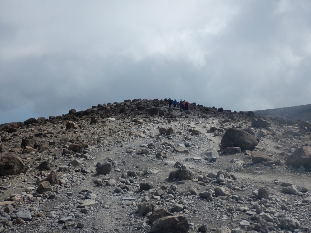
 We bid farewell to the camp after group pictures and began a long, steep descent. The path started with more rocks to clamber down, which reminded tired legs of the pounding they’d taken the day before. Knees and toes put up a protest, but there is only one remedy – keep walking. We were joined by one of the guides Godfrey, who filled us in on plenty of local plant knowledge, local customs and tales from his portering days when he was required to carry 40kgs on his back, unlike the regulated 20kgs now. We passed through Mweka camp and instantly the vegetation changed from alpine to rainforest. The path was smooth, gently sloping and shaded by trees. I couldn’t help myself – I had to walk fast. In fact I practically ran a good portion of it, just to feel speed for the first time in a week. Over pretty bridges, past incredible trees. The path just went on and on for about four hours. 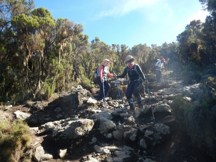 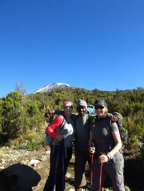
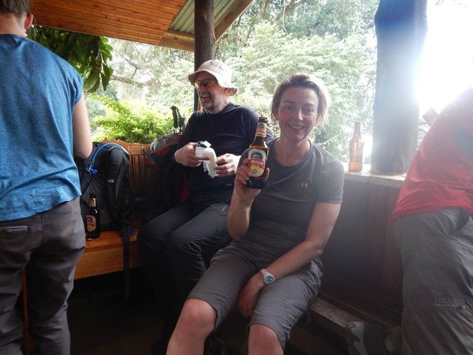
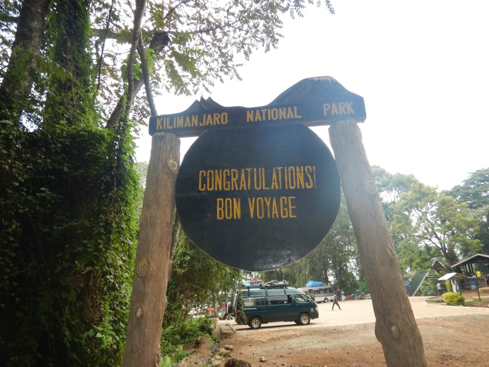
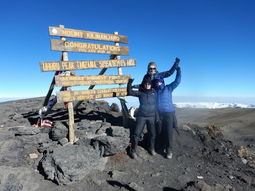
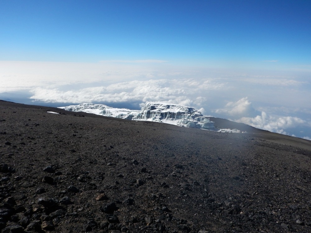
Finally, just as my knees and toes were ready to throw in the towel, the end sign came into view. And that’s when it happened. The feeling that I expected to get at the summit – but didn’t – kicked in. Tears. Lots of them. I’d done it. I’d gone there and back to see how high it was. It’s high. It was hard. But it was absolutely worth it. A celebratory beer and samosa awaited us. The heavens opened in a tropical deluge. But nothing was going to dampen our spirits. We had just conquered the highest freestanding mountain in the world. We’d stood on the roof of Africa. We’d seen the curvature of the earth and watching the sun rise beneath us. We’d pushed ourselves to our limits and survived with a smile on our faces. Thank you Kili. You challenged us. But we won.
 Go back to day 6 - summit day
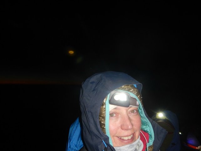
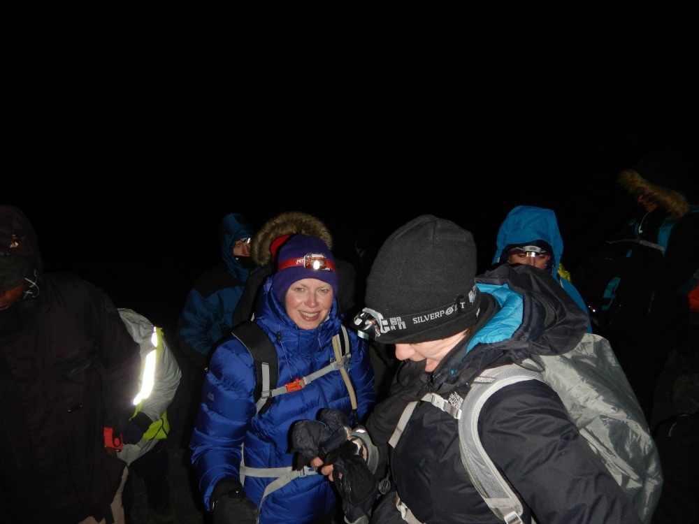
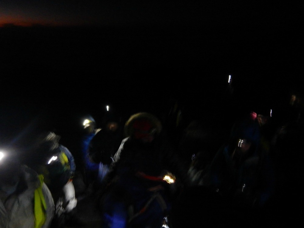
Read on about what happens to your body afterwards Join the Glamoraks community of women who love to walk, hike and have adventures. 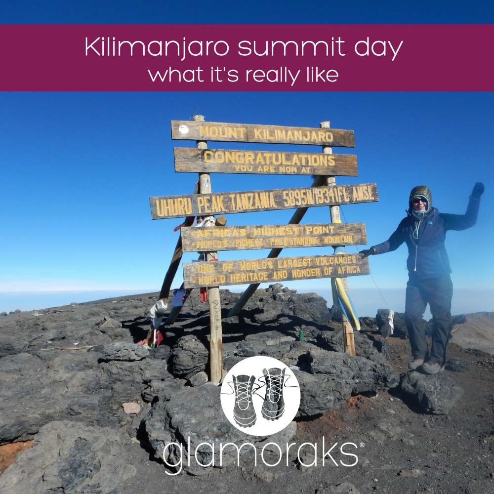 Start height: 4600m Midway height: 5895m End height: 3950m Looking like Michelin men, we waddled into the mess tent at 11pm for some ginger biscuits and porridge with heaps of sugar for energy. Nervous energy fizzed through the camp as people faffed with their water bottles, wondering whether 3 litres would be enough but unsure whether carrying more would be too much on such a tough climb (Tip: take at least five and ask a porter to carry it for you). Head torches were adjusted, hand warmers stuffed around water bottles, into boots and gloves, layers were added or removed. Finally at 11.45pm we set off, single file, pole pole. We were told that we would probably get hot during the first hour as it is steep, involves hauling yourself over some boulders and it’s not yet really too cold. They were right. But there was no way to remove layers, so zipping and unzipping became the order of the evening, not easy with bulky gloves on. The path became more even, a steady zig zag traversing the mountain, nine steps one way, nine steps back again. As we looked up, we could see a row of gently swaying lights like a magical lantern parade, weaving up and up and up. No matter how far back you tilted your head, the lights continued until eventually it was impossible to tell which lights were head torches and which were stars. We had a long, long way to go.
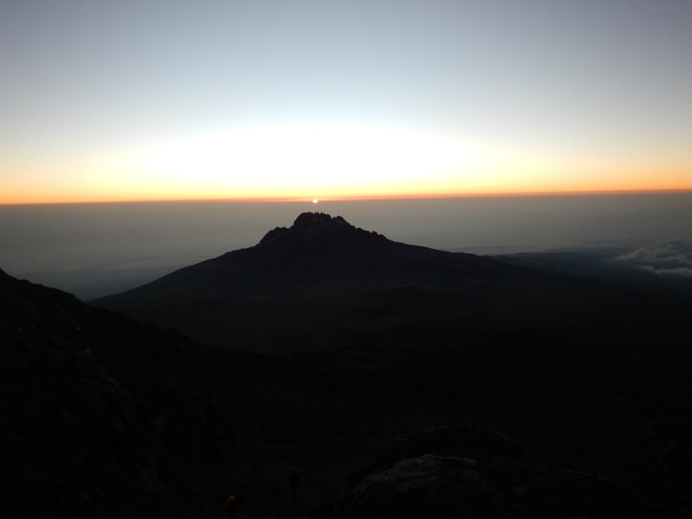
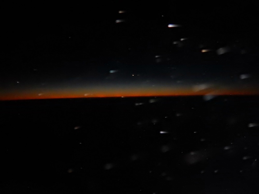
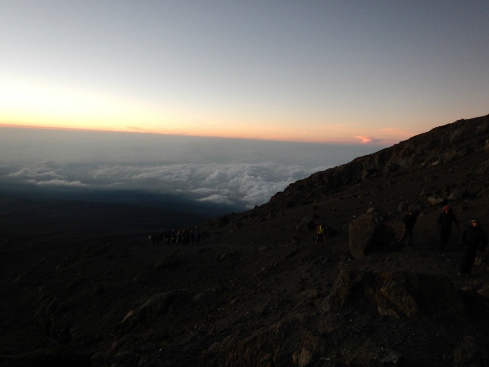
 As it grew colder, it became a mind game. Follow the boots in front of you. Listen to your music. Look out at the stars. Spot the southern cross. Look down at the far away lights of Moshi and Arusha miles and miles below. See the orange flashes of lightening storms in clouds far beneath us lighting up the sky like a Renaissance painting. One step. Another step. Breathe. Sip. Step. Breathe. Sip. Step. Take a moment to smile and revel in the awesomeness of where you are. Try to circle your neck, stiff from looking down. Try not to feel the three layers of waistband digging uncomfortably into your skin. Try to wriggle your toes to stop them freezing. Blow into your camelbak tube to stop the water in it freezing. Notice how the water you’re sipping turns into slush gradually, until eventually it freezes solid. Try to take the odd bite of an energy bar. Step. Breathe. Step. Breathe. For seven hours we did that, stopping only for an occasional pee break. Any last vestiges of modesty are well and truly thrown to the wind on summit night. You can step off the thin path to pee, but there is nowhere to go. You will find yourself squatting – as I did – next to several blokes standing alongside you peeing. You can choose to show your butt or your ‘front bottom’ to the passing traffic stream. As it’s dark and they’re looking at the boots in front of them, they probably won’t notice. But if they turn their head torch onto you, your naked glory will be caught in their beam. You genuinely will not care. You will be too busy trying to figure out how to pull all your layers back up before your butt freezes. At around 5am, the winds blew their hardest and coldest and it became increasingly difficult to hang onto any positive thoughts, which were driven away on the snow flurries. But soon thereafter we saw the first glow of dawn stretching in a pinky gold line along the curvature of the earth. It was magnificent and quite literally breath-taking, at such high altitude. That glimmer of light served as a tonic. We watched as the line of gold along the horizon grew, casting a strange bronze colour across the mountain face we were still traversing. At last the burning ball of a star that we call our sun popped its head over the horizon and instantly night was gone. To look down on a rising sun is a magical experience and unlike any other I’ve had.
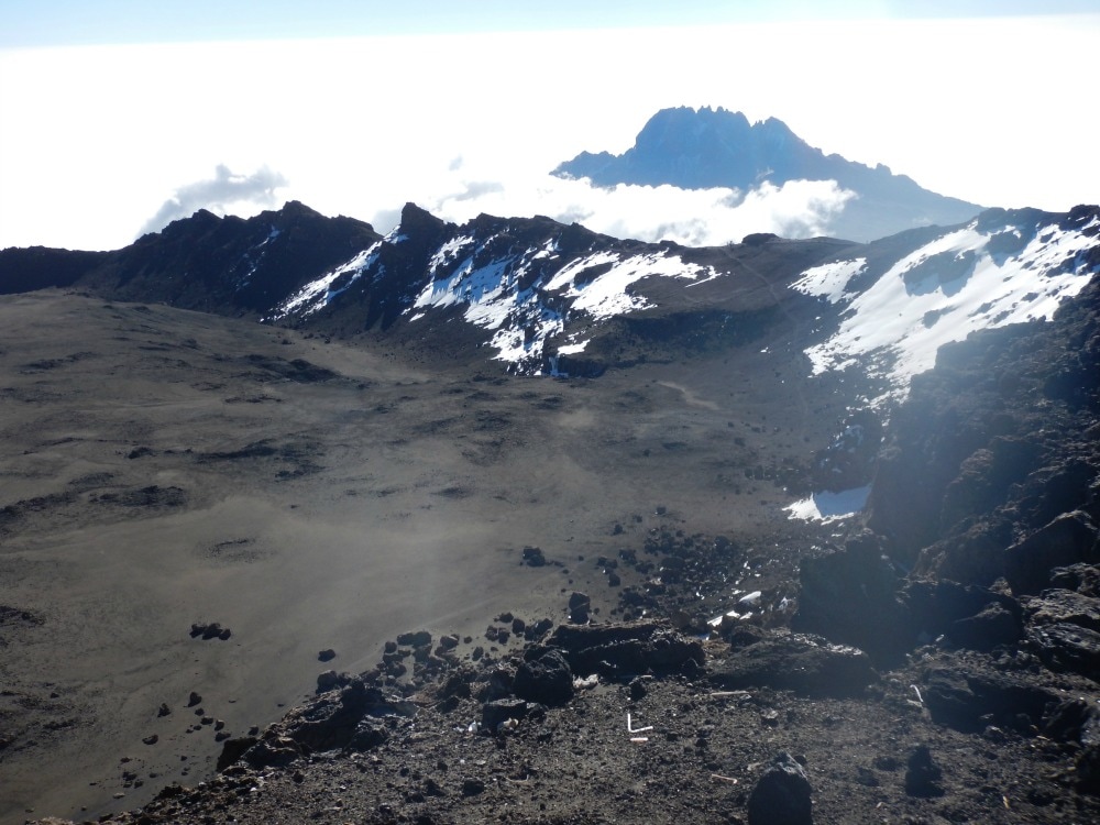
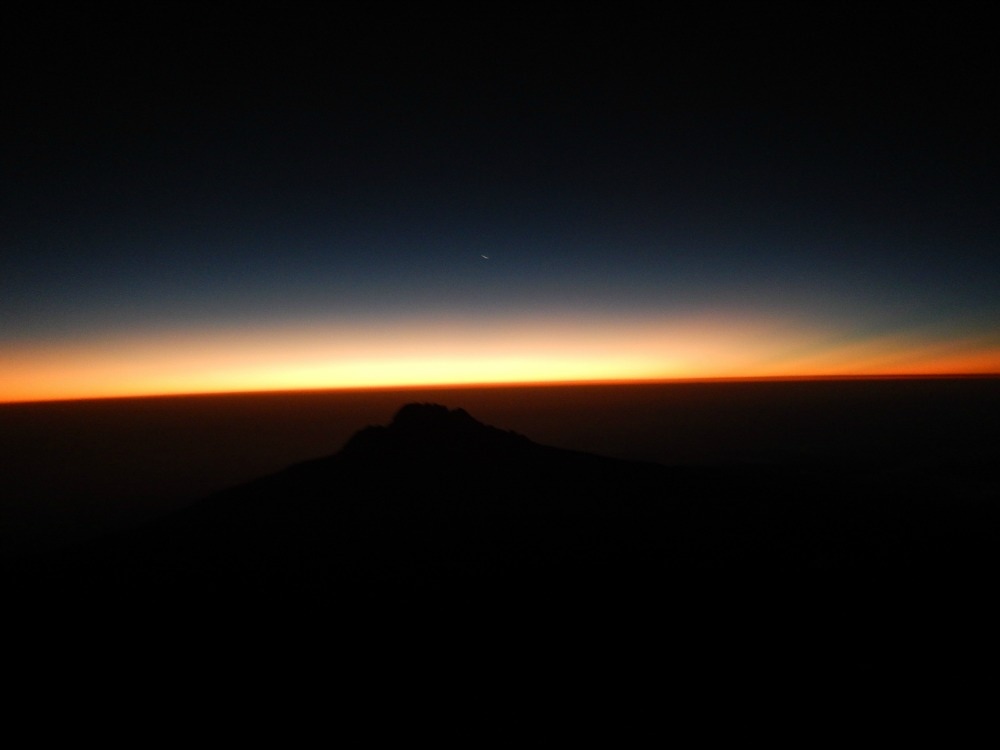
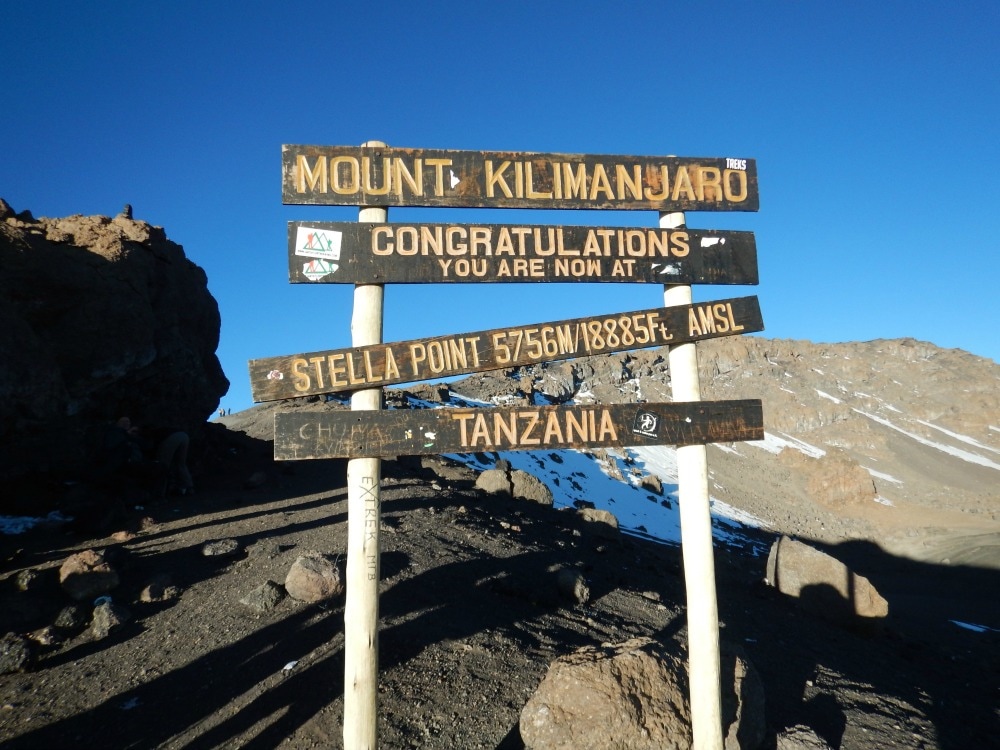
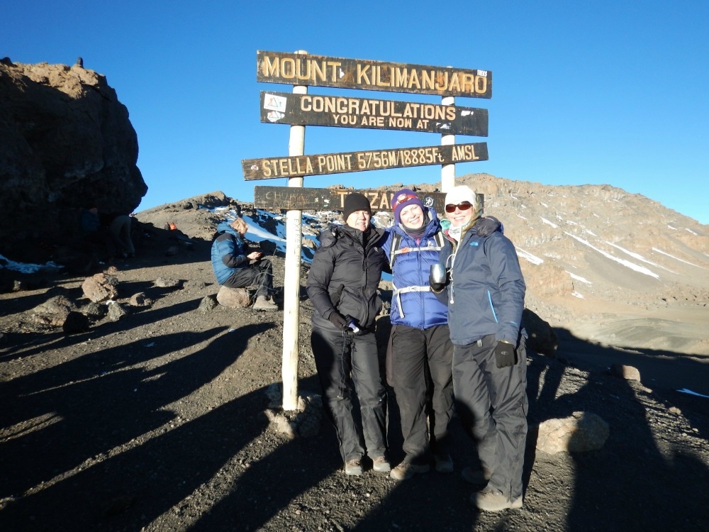
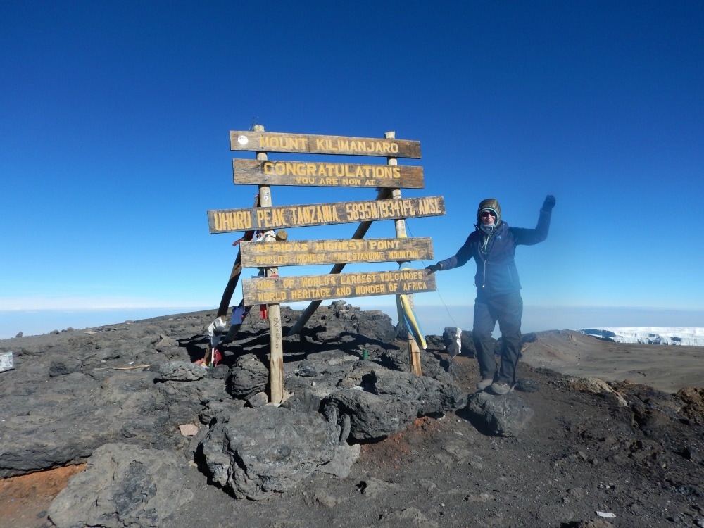
 Sunrise over mount Mweka The euphoria of sunrise was short lived. We could now see the top of the mountain. Only the height of Snowdon left to climb, one person cheerily said…. The last push up the mountain to Stella Point is the toughest. Loose scree and dust, a steep gradient, very little oxygen and a path that never seems to end all start to take their toll on your good humour. My chest began to feel as though it had icy needles in it. For the first time, I allowed myself to think ‘what ifs’. What if this is pulmonary oedema? What if I can’t breathe? What if I don’t make it? I had been ignoring thoughts like these the entire trip, but when your reserves are low, it takes every ounce of your mental strength to push them aside and just keep walking. Every step takes an epic amount of effort, despite a painstakingly slow pace. Finally at about 8am we reached Stella Point at 5756m. A welcome cup of ginger tea helped revive me somewhat, but a walk to find a rock for a pee just about wiped about my final reserves. Looking along the rim of the crater, I could see Uhuru Peak in the distance. It was so close, yet it felt like an entirely different country. Gradually members of our group arrived at Stella in varying states of health. Some – like me – were tired, breathless and having to dig into deep energy reserves, but were nonetheless well. Others were less lucky, seriously battling to breathe, looking green after a night of relentless vomiting, staggering with dizziness and disorientation. We learned two of our group had had to turn back at 5300m, four couldn’t continue from Stella Point, and one was practically carried to Uhuru Peak and who we later learned had cerebral oedema.
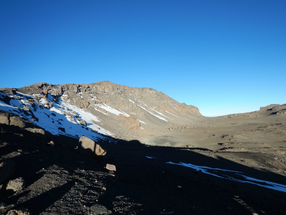
There wasn’t enough air to stand about, so we soldiered on to the final bit of the summit. It should be a gorgeous 45-minute walk with views over an ancient volcanic crater and carved glaciers glinting in the sunshine. But you don’t focus on that. You simply put one foot in front of the other in a determined effort to get to the top. At last, you reach the famous sign. There is no moment of jubilation. Well there wasn’t for me. Relief flooded through my body that I had at last reached the top. But that was it. My focus was simply to get my picture taken (it’s a bunfight up there as everyone wants to get their shot) and get the hell down so that I could release some of the tightness in my chest. After no more than 20 minutes at the top, I headed back to Stella Point. It was only at this point that I realised I still had to go down. Nine hours of walking and we were nowhere close to being done yet. They say that when you think you have spent all of your energy, you stilly have at least 40% in your reserve tanks. It was time to dig into those reserves.
 The crater rim The path down hill is different to the one going up. No gentle zig zagging traverses, just a scree slope to slide down. This might be fun if you had any strength left in your legs, but there were few who did. The dust kicked up by the scree gets into your lungs and it takes a huge deal of concentration not to trip over hidden rocks. As you head down, the day heats up. All those layers you needed in the early hours of the morning are shed and added to your pack. The weight of your water, which you have now almost completely run out of, is replaced by the weight of your discarded clothes. Porters kindly took the daypacks of many. I wasn’t one of them. There are no words to describe this downhill, three-hour slog. You simply want to get back to camp. It became apparent why those people we’d spotted the day before weren’t smiling. Nobody prepares you for the down. Everyone is too busy thinking about summiting. But getting to the top is just half-way. You haven’t conquered Kili until you get to the bottom.  Looking dreadful on the way down. I eventually staggered into camp around 12.30pm, having walked for just over 12 hours straight. I downed a litre of water, stripped off my boots and collapsed on my mattress, instantly falling into a deep sleep for an hour. I woke up coughing. The icy splinters I’d felt in my chest on the way up combined with the volcanic dust on the way down made for delightful grey sputum. Apparently it’s called the Khumbu cough, caused by low humidity and sub zero temperatures experienced at altitude and is thought to be triggered by over exertion. Tick, tick, tick. I was indeed a perfect Khumbu cough candidate. Lunch – our first proper meal since 5.30pm the night before – was an eclectic affair of pineapple, pancakes, vegetables and chips. But no-one cared. It was fuel. There wasn’t much conversation, just thousand mile stares and lots of coughing. Despite us all looking like extras from a zombie film set, we had to pack up our bags and carry on walking. There is no water at camp to replenish our stocks and certainly not enough oxygen to spend another night at Barafu. 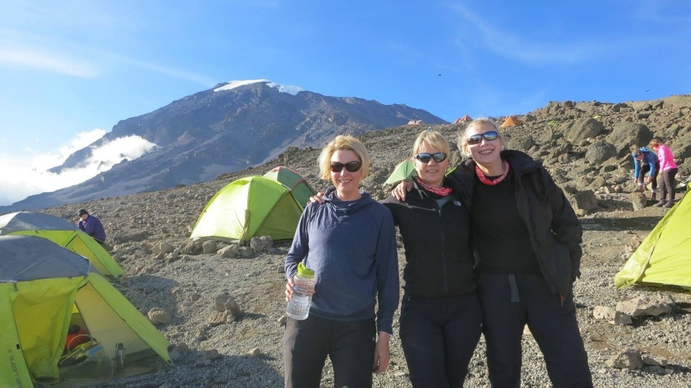 Slightly restored after a nap, food and water By 3.30pm we were back in our boots, trudging down the hill in fog. This path was however, a kind, gentle slope. Every step took us to more oxygen and strangely I felt stronger, rather than more tired the further I walked. The same can’t be said for some others who were feeling the exertions, particularly in their backs, knees and toes. Even with the extra oxygen, I was still ready to call it a day eventually. We arrived at High Camp at around 6.30pm, after what seemed like the longest day ever. Once again the porters had beaten us to it and served us ‘plain soup’, which tasted remarkably like all the other soups but still felt like liquid gold going down. Chicken and rice followed. I vaguely recall acting as mother for both mess tents as everyone sat staring blankly, unable to help themselves. We collapsed into bed. My sleep deprivation made me think that cleaning between my toes at this time was a good idea. It wasn’t. I gave up and passed out. The reality of what we had done drifted through my mind just as my eyes closed. We had summited Kilimanjaro! Thanks to my hot water bottle and the extreme exertions of the day, I actually slept the entire night without having to pee, my first time in a week.
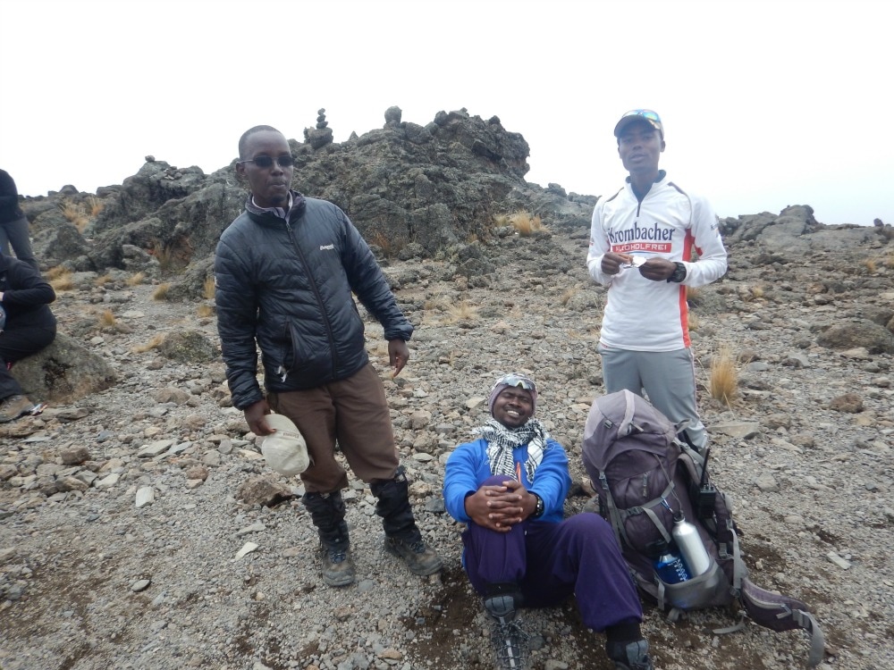
Start height: 3995m End height: 4600m I woke at 5am, listening to the sounds of the camp, before plugging in my audio book in an attempt to drift off again. I couldn’t. Although it was only Friday morning and we were only due to summit on Saturday morning, summit day would be starting on Friday night. We were in the final stretch. I assessed the hygiene levels of my smelly clothes, shrugged and opted for breakfast instead. The usual porridge greeted us along with a jazzy new addition of Vienna sausages stuffed with vegetables. Eating is hard work. There’s lots of passing of cups and plates. The chairs either list dangerously as they’re set on uneven ground or slope backwards, ready to tip you out the tent. Someone acts as mother to help everyone else from having to get up, slopping ladles of porridge into tin bowls. The pill popping commences. General discussions about how everyone is feeling do the rounds. And then it’s time to head out again for another day of walking. Standing on a rock, brushing my teeth before leaving, the clouds swirled around me, occasionally clearing to reveal the spectacular views. I was reminded of just how lucky I was to be doing this incredible challenge. It’s not glamorous. But it makes you feel alive. If you ignore the bustle behind you, it’s just you and the clouds on the top of the world. The walk was a short, but steep one through the strange alpine desert until it kindly levelled out for a while. Rocks, dust, stones that sound like shattering glass, a few scrubby plants and very little air kept us company as we walked. Despite the ever-thinning oxygen, it was a jovial walk full of banter and laughs as we tried to take our minds off any nasty side effects. Cheese jokes. Debates about Wookie genitalia and indeed whether Wookie’s were male or female. It kept us smiling all the way up the steep climb to base camp.
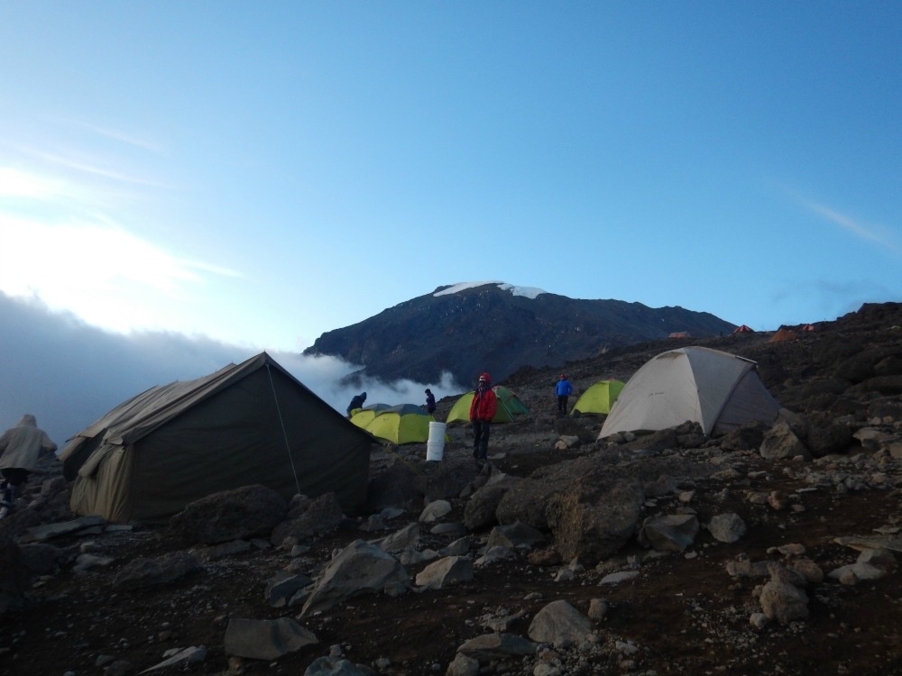
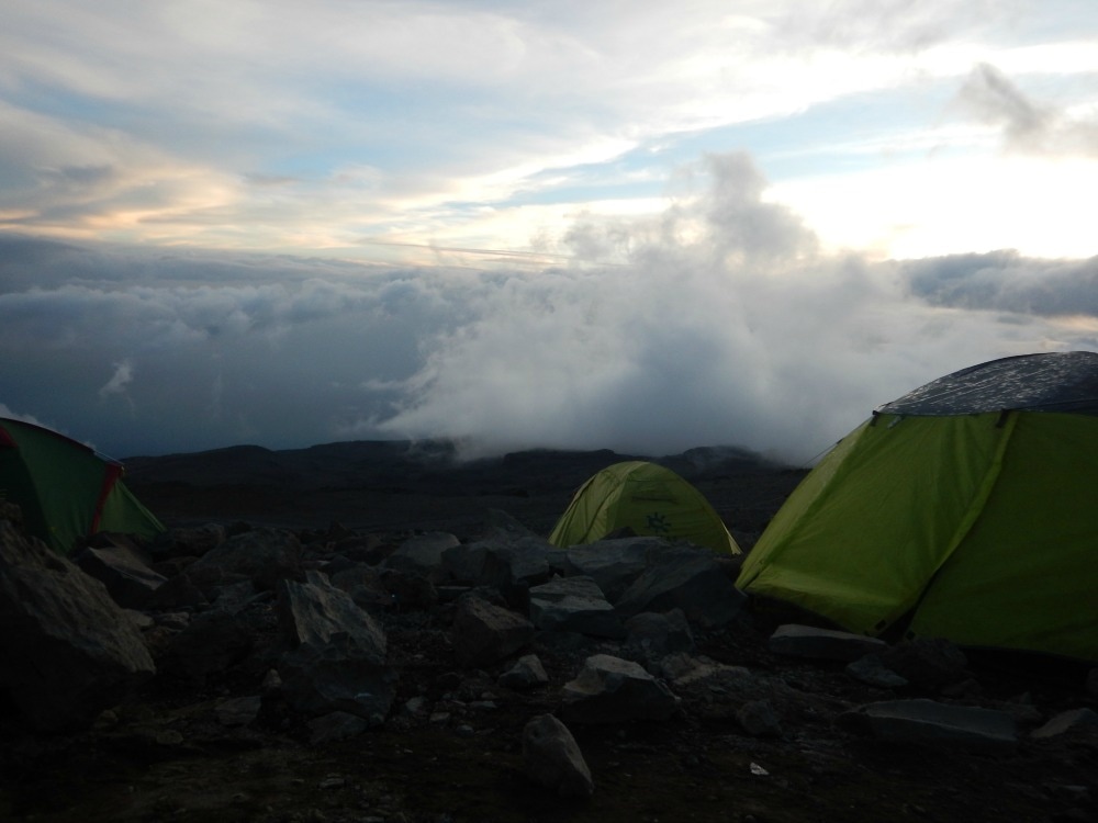
 We arrived at Barafu Camp, a barren, inhospitable place full of rocks and tiny patches of cleared ground for tents. Situated at 4600m, everything takes effort. Unpacking your sleeping bag, taking off your boots, trying to walk the 15 metres to the loo – it is all hard work that leaves you panting. I had yet another toilet disaster upon arrival. The toilet tents hadn’t been set up yet and there was nowhere even remotely private to pee, so I raced into my tent and grabbed my urinal (a spare given to me by a friend). I had used it effectively for the last two nights so had no qualms about using it now. Except I forgot about the pathetically weak plastic which had obviously reached the end of its life. Cue pee all over me, my clothes and the inside of the tent. When you have very little air to breathe, trying to mop up pee with wet wipes and change out of wet clothes is exhausting. Such fun. The weather at base camp is something out of the Book of Revelations. One minute it is so hot you can feel your skin frying. The next the clouds roll in, the winds blow and it is freezing. Hail is hurled down, thunder crashes below you and lightening zig zags the sky. It’s easy to believe you are losing your sanity.
Lunch was pasta, veg and fresh pineapple washed down with a briefing talk that made all of us wish we hadn’t eaten. Our resident medic explained what would happen on summit night. We could expect to vomit, get raging headaches, suffer from hallucinations, battle to breathe and potentially suffer from High Altitude Cerebral or Pulmonary oedema. So that was comforting. We were also told to expect 25km winds, temperatures of -15c and up to 20cm of snow. We were advised to rest all afternoon. We didn’t need to be asked twice. Stumbling to our tents we noticed a stream of people who had obviously summited and were on their way down. Not one of them was smiling. Where was their elation and whooping and air punching? They looked like walking zombies. It didn’t bode well. After ‘sleeping’ through thunderstorms, snow showers and melt-your-face off heat for a couple of hours, we had an early dinner at 5.30 and were told to get to bed as we’d be woken up at 10.30pm. You try and sleep when you have a carnival of emotions jostling inside you... After zero sleep, we got up at the allotted time, got dressed into as many layers as we could and got ready to face the summit. 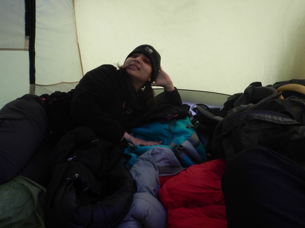 My roomie - ready to roll. Go back to day 4
Click here for day 6 - summit day Join the Glamoraks community of women who love to walk, hike and have adventures. |
Categories
All
Archives
January 2021
|

 RSS Feed
Get social. Follow us.
|
Don't get left out.
Add your email to be alerted about any Glamorak events, walks, get togethers, challenges or news.
Success! Now check your email to confirm your subscription.