|
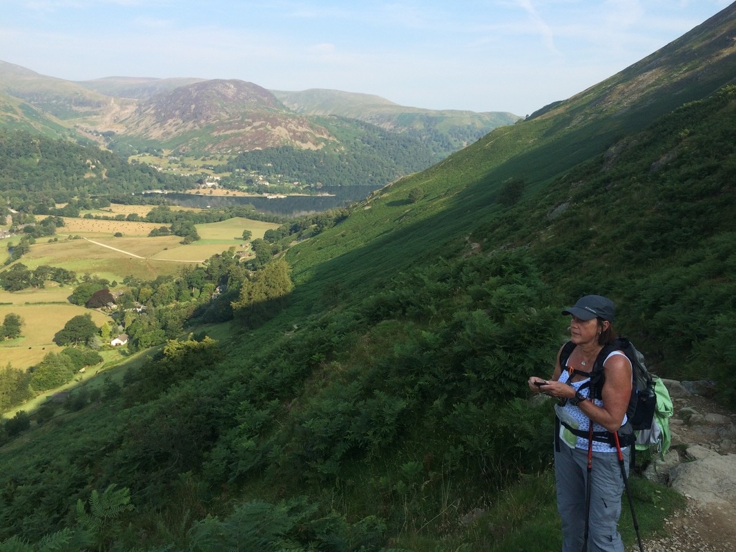
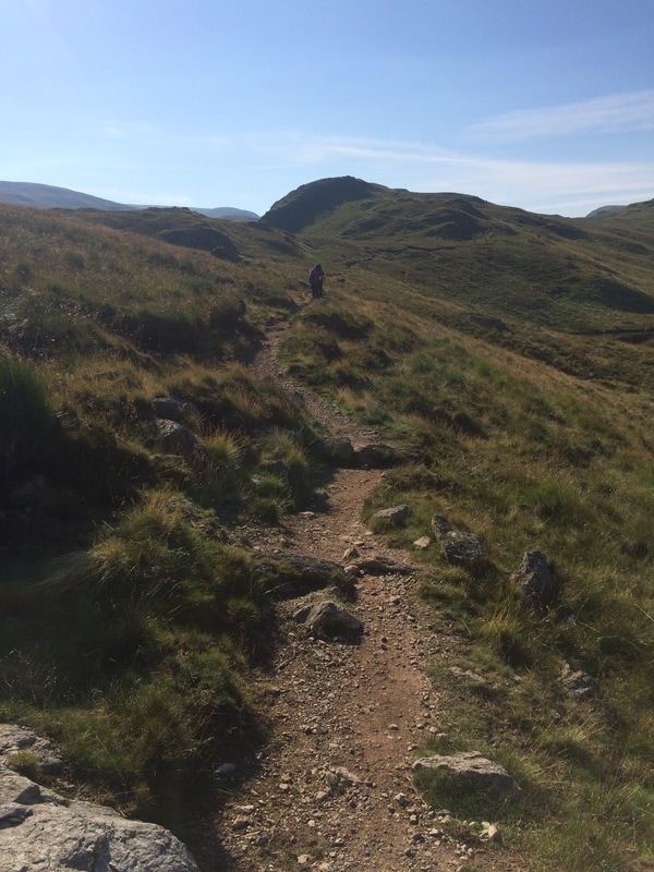
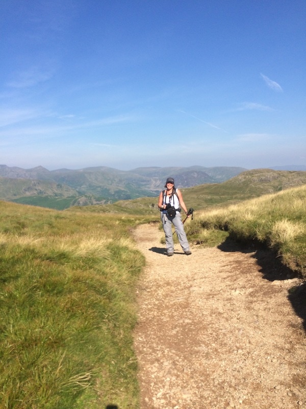
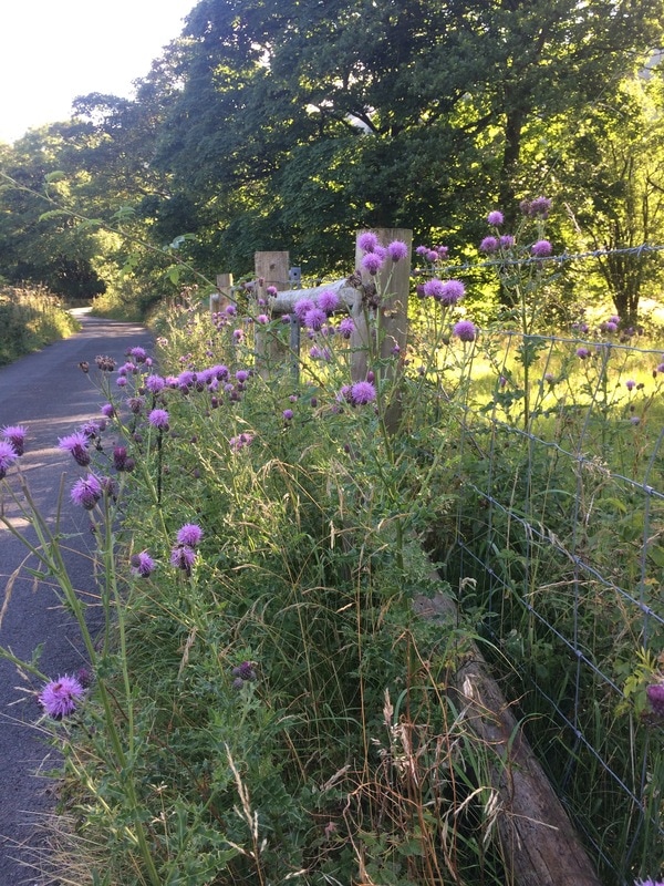
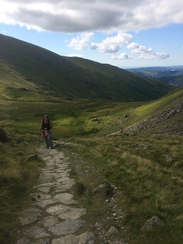
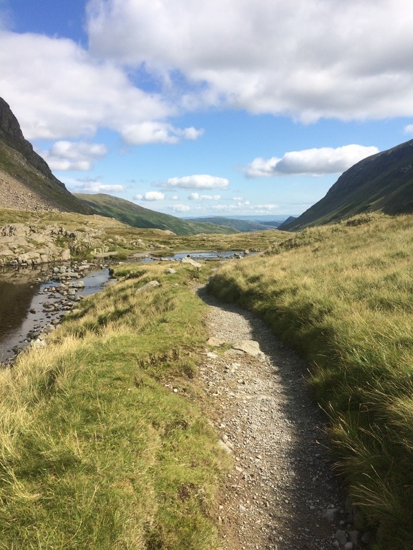
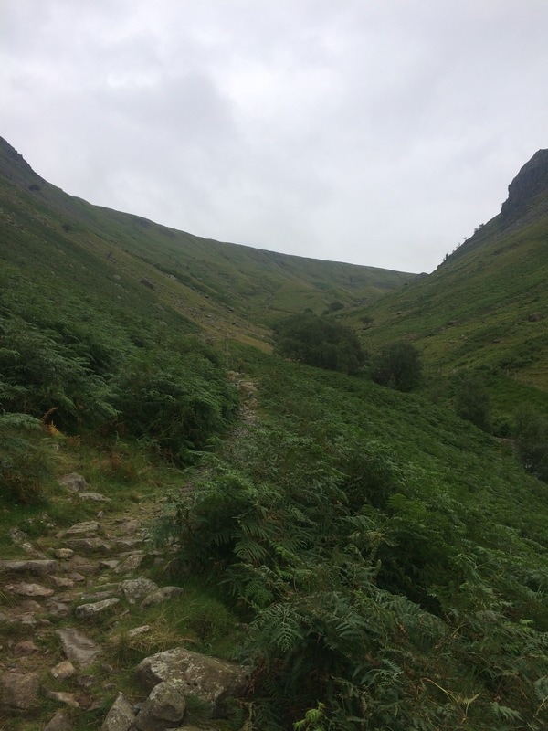
Distance: 15.5 miles The book had warned us that day 5 was a bit of a beast. 15.5 miles and over 1300 metres of climbing, including the C2C summit – Kidsty Pike. Luckily, our feet felt better. Perhaps they were toughening up at last. We hadn’t got much sleep as the pub was right on the road and every time a truck went past, it sounded as though it was going to plough through the wall and into the room. Luckily we avoided that fate and tucked into a full English (again) in preparation for a big day of walking. Glorious sunshine greeted us as we headed off by 8.15am, ready to seize the day. We immediately hit our first climb, as was rapidly becoming the C2C norm. Up and up we went, ‘huffing and puffing’ as predicted by the book. At last we got to Boredale Hause, a flat bit where the book tells you that you’re likely to get lost. We actually had to pull out a map and compass for this bit to ensure we were heading in the right direction. (Just a side note on signage - in the Lake District, there are very few C2C signs. Those that are there are typically handmade by well-meaning people. That's because Wainwright's C2C is not an official national trail so doesn't get funding for signs. Later in the walk, in the Dales and Yorkshire Moors, there are more signs.) Fairly confident in our route we headed off and then noticed a man walking just as purposefully in the opposite direction. Not wanting to be like the Australians from day 3, we called out and asked if he was doing the C2C. He was. We politely pointed out that he may be going the wrong way. He agreed and decided to follow us. Possibly not a wise choice given our track record but we didn’t tell him that.
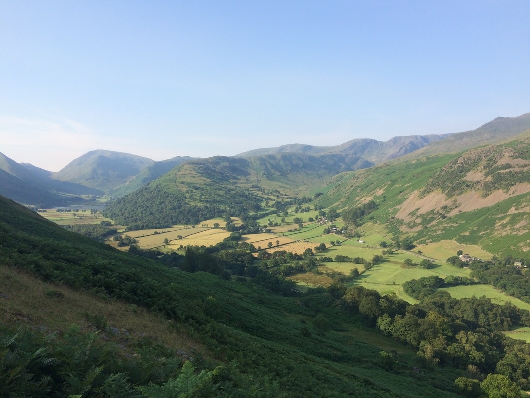
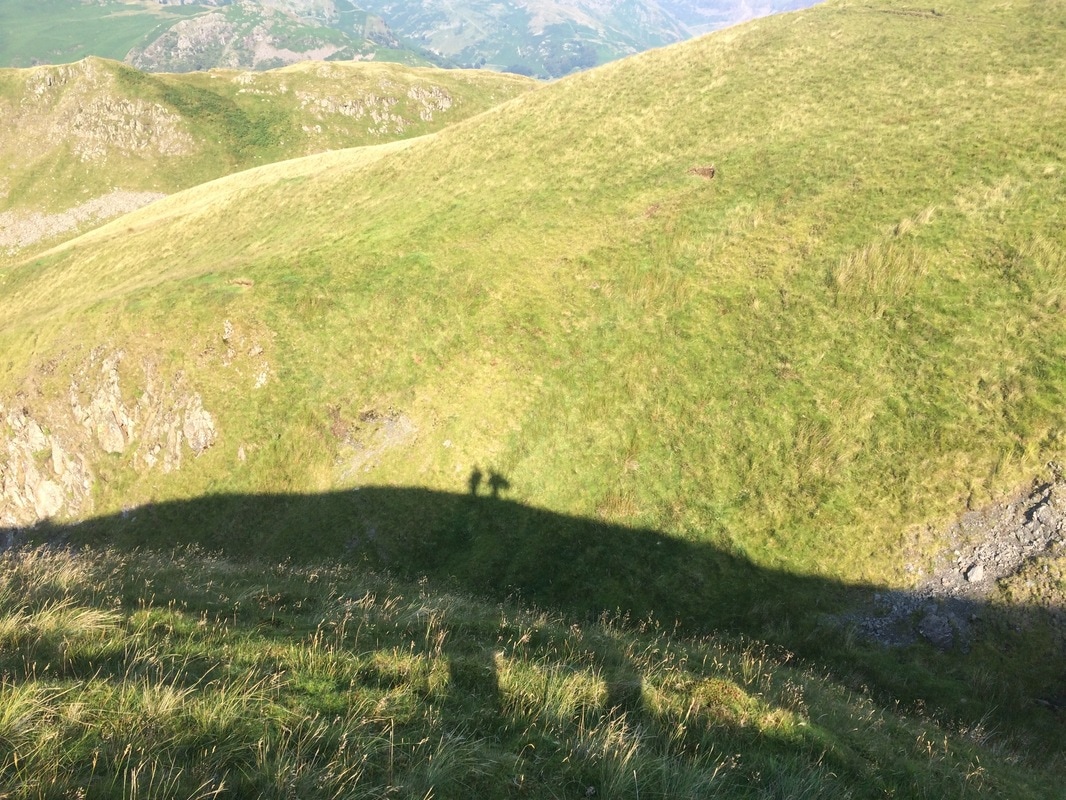
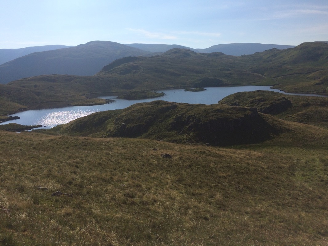
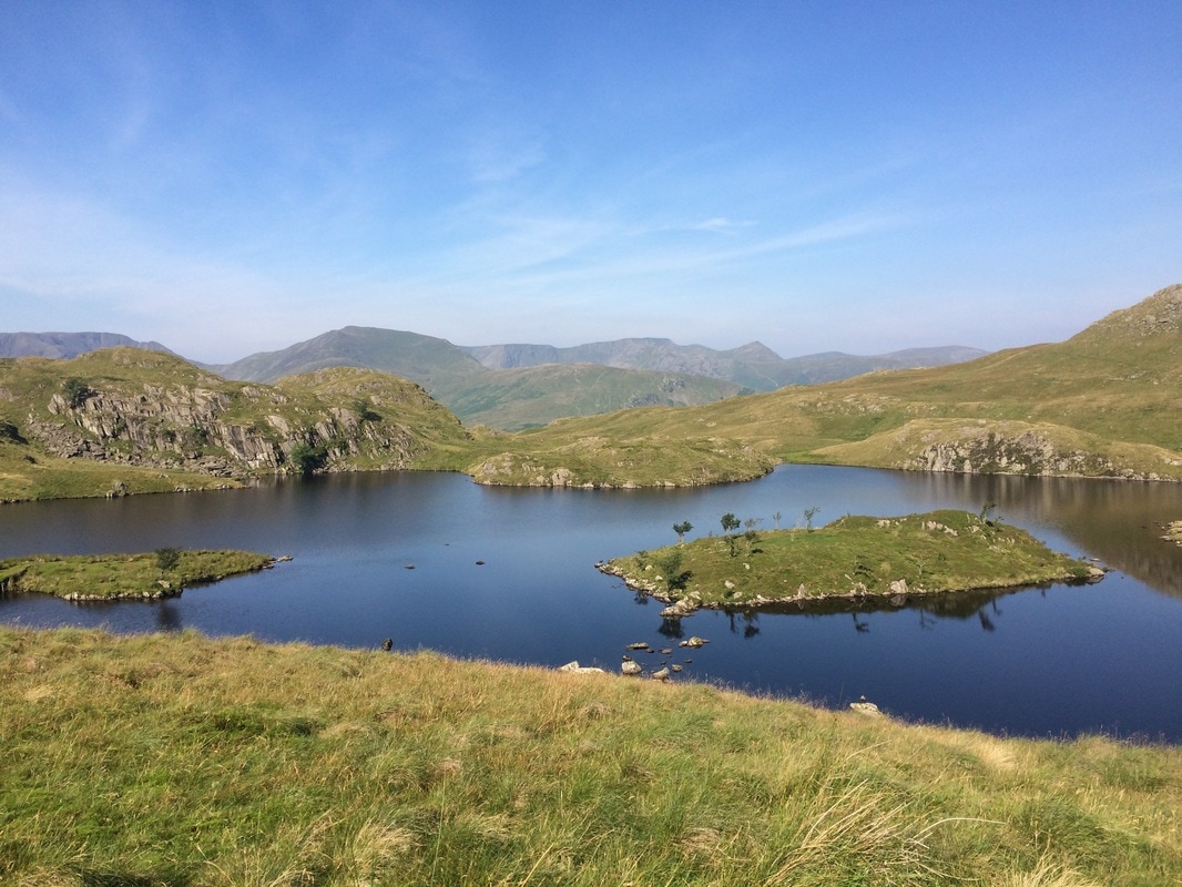
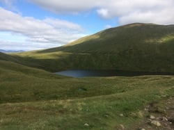
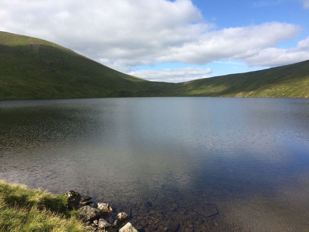
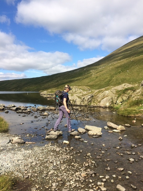
We could not have chosen a more gorgeous day. As we walked along a hillcrest, we could see our shadows far below us. It’s little moments like these that put a smile on your face and make you want to sing ‘What a wonderful world.’ We met another walker, perched on a rock, having a snack. He told us that we had stunning views awaiting us and that a herd of red deer were just over the ridge. That’s the thing about walkers, they’re friendly. They’re happy to stop for a chat. We walked on and came to Angle Tarn, another jaw droppingly beautiful setting for wild camping, which indeed several people were doing. They also told us that deer were nearby. So we walked on quietly, keeping a keen look out. Finally we were rewarded – a herd of deer dotted along the side of a hill in frankly majestic scenery. Sadly they were too far off for a decent picture.
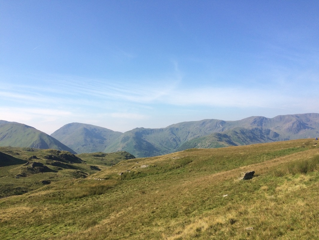
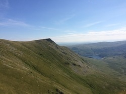
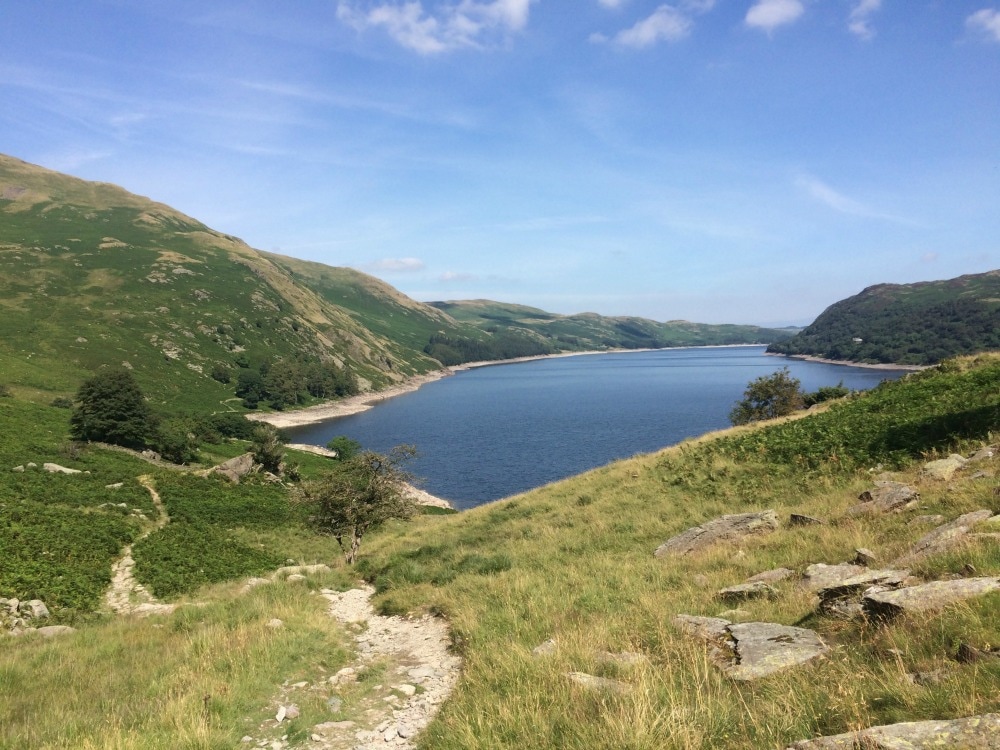
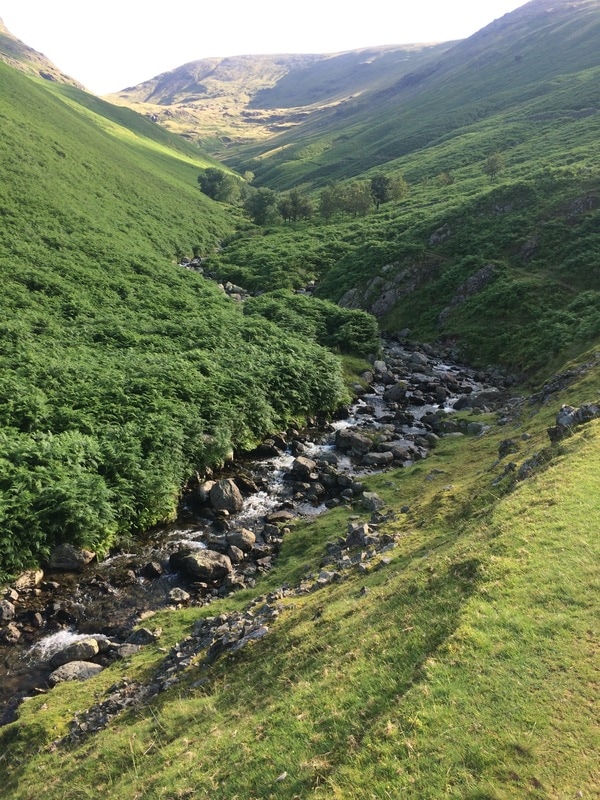
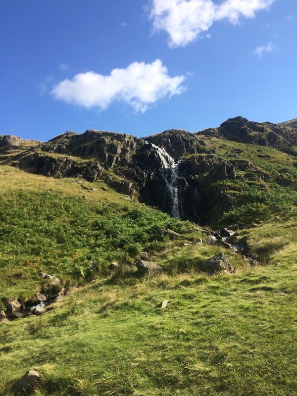
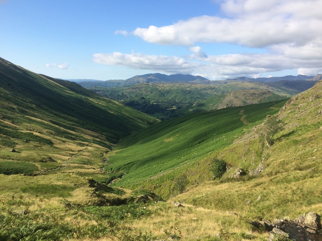
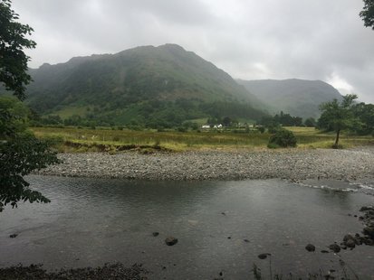
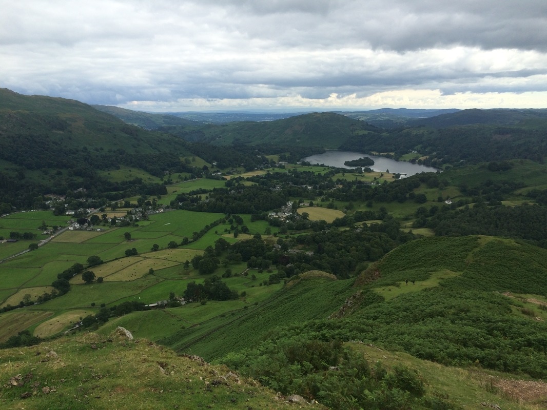
After watching them for a while, we had to bid them farewell as we still had a very long way to go. We started our second ascent. It was long and hot. Finally, it plateaued, but we weren’t done with the hills yet. We still had to ascend Kidsty Pike, the highest point on the C2C. Reaching the top at last we surveyed the amazing scenery, behind us overlooking Scaffel, Helvellyn and St Sunday’s Crag and ahead of us, the glistening Haweswater.
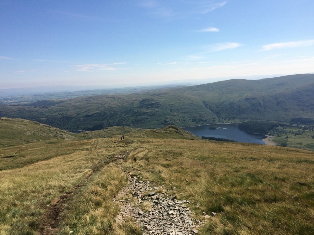
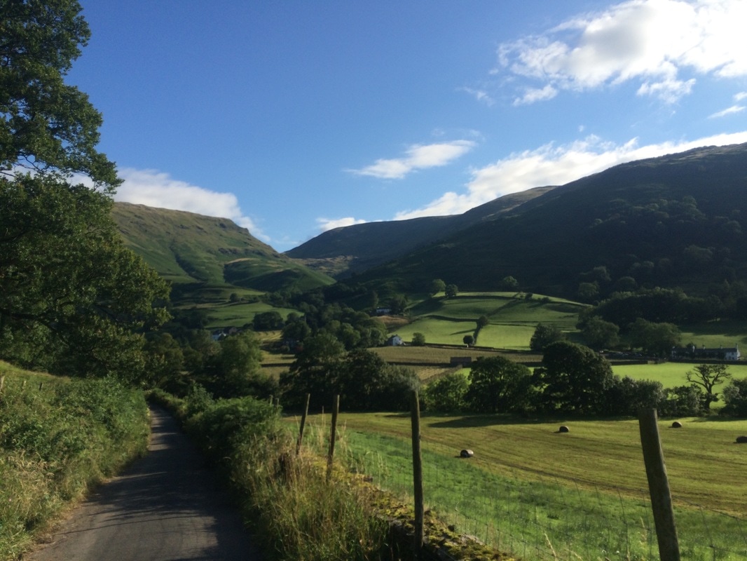
And then it was time to say farewell to the Lake District and head down. The only thing more exhausting that going up, is going down. By the time we reached a bubbling stream at the bottom, our knees were speaking to us in curse words. But we took our boots off, cooled our feet off in the stream and had a lovely chat to the US bloke called Ken who we’d prevented from going astray early in the morning, and the crazy campers who had spent another night wild camping next to a tarn. Fed and watered we hoisted ourselves back up and tackled the long, hot two-hour, fern-lined walk along the banks of Haweswater Reservoir. It has plenty of ups and downs, including one described as ‘annoyingly steep’ by the book, and indeed it was.
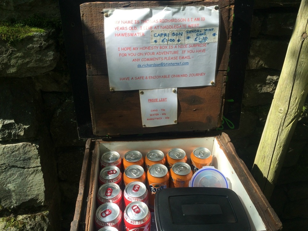
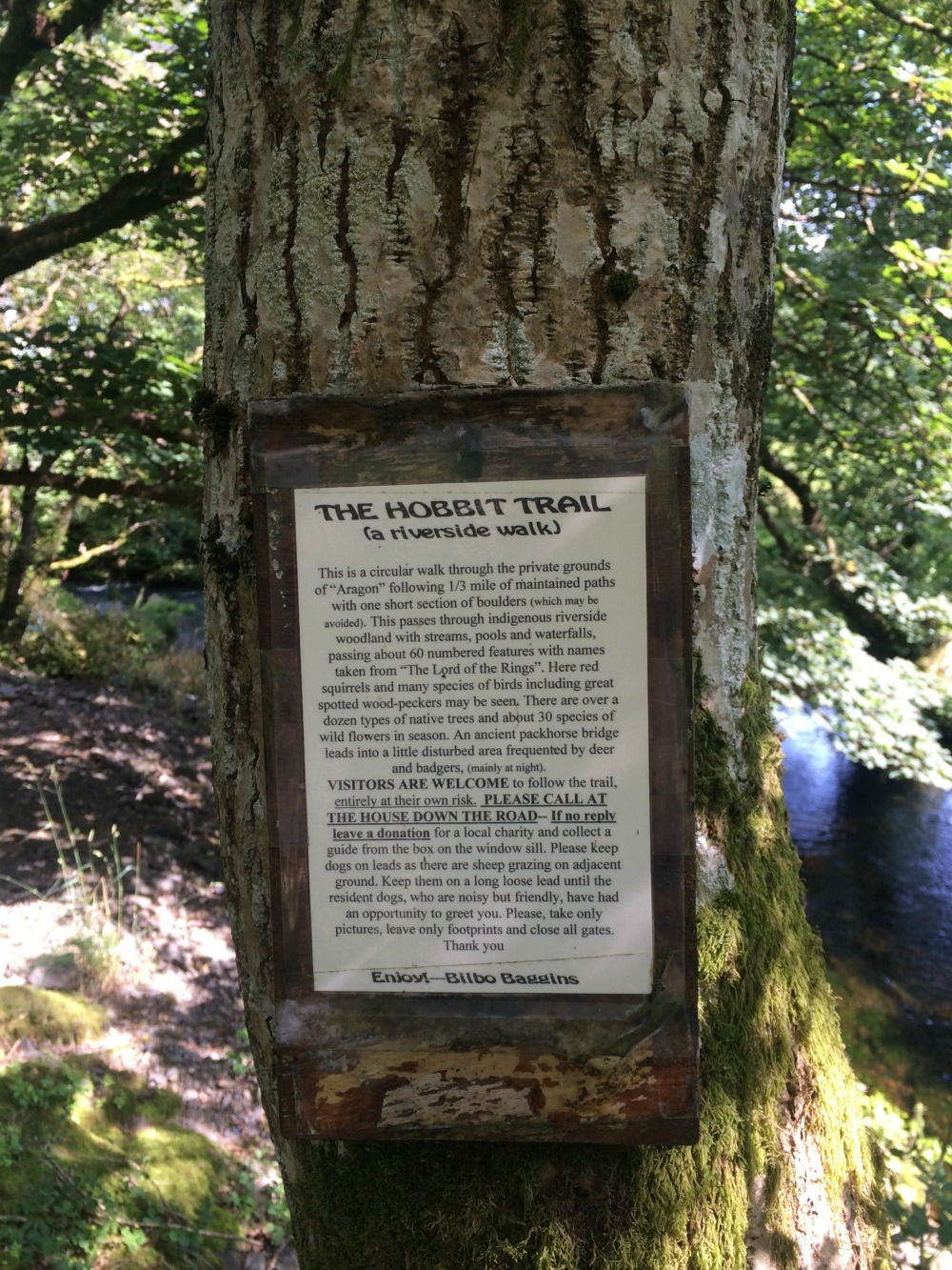
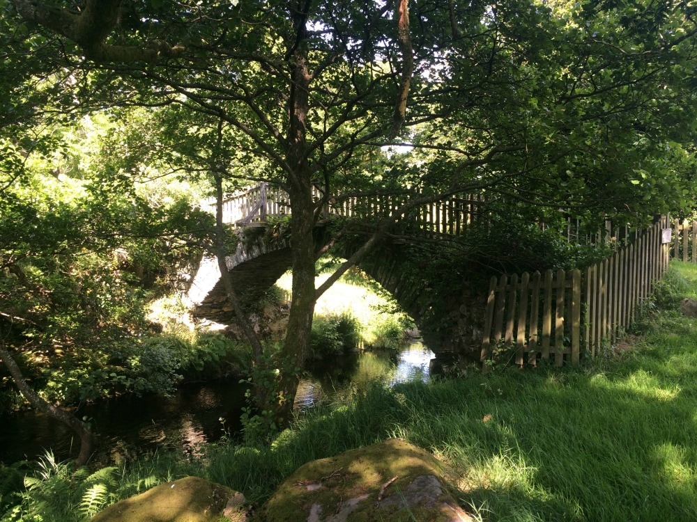
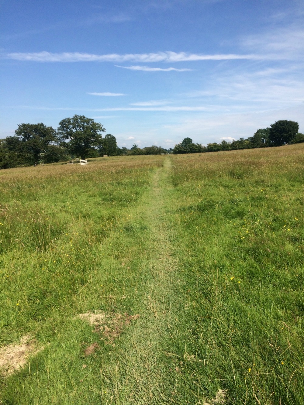
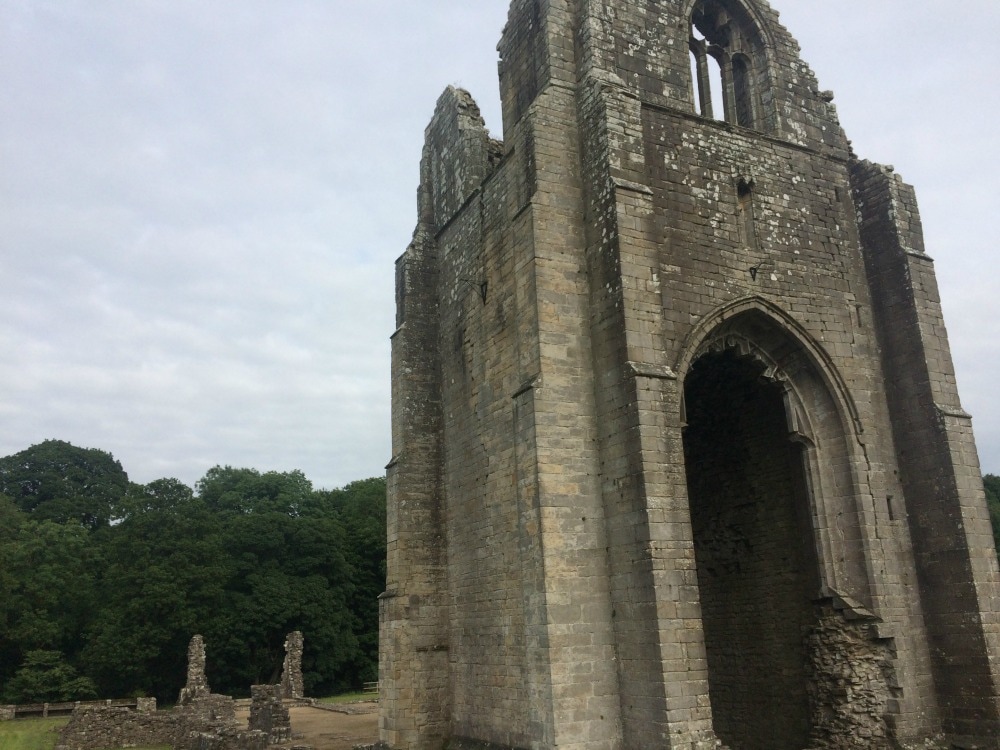
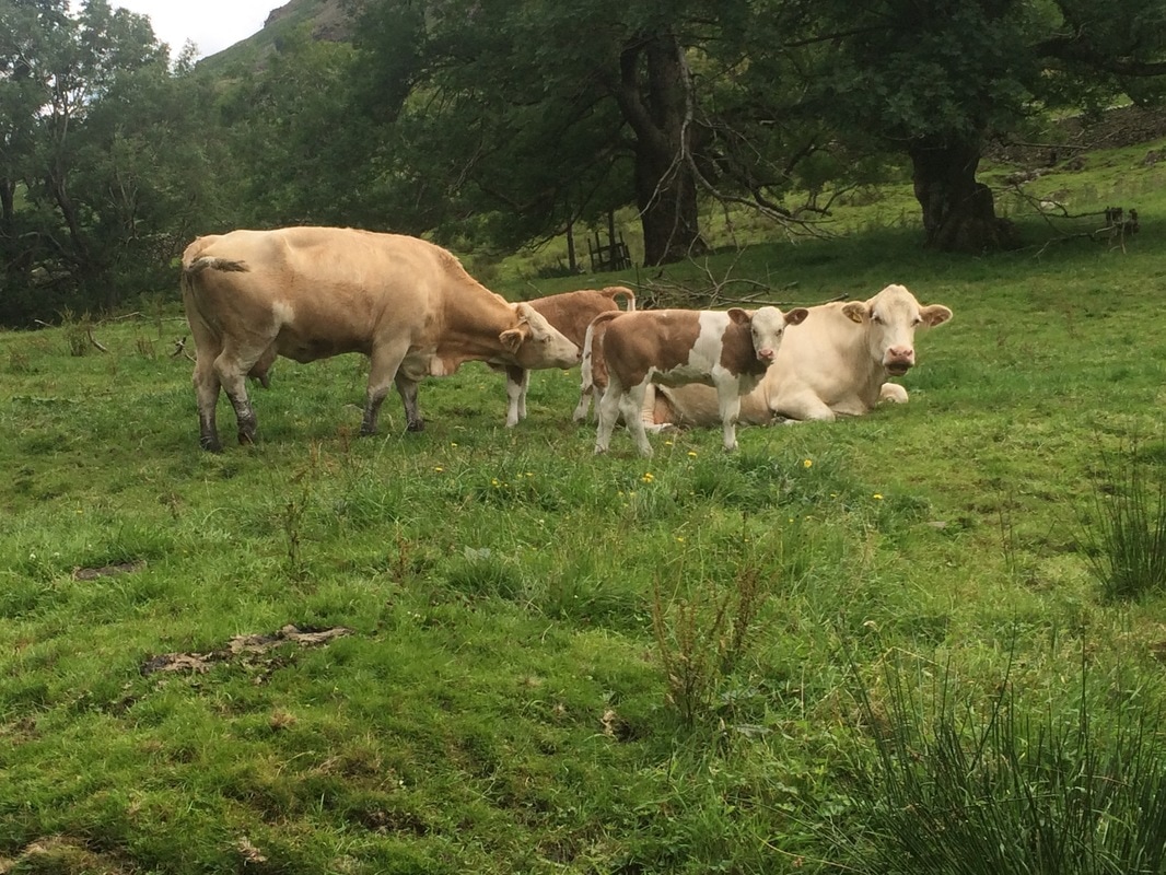
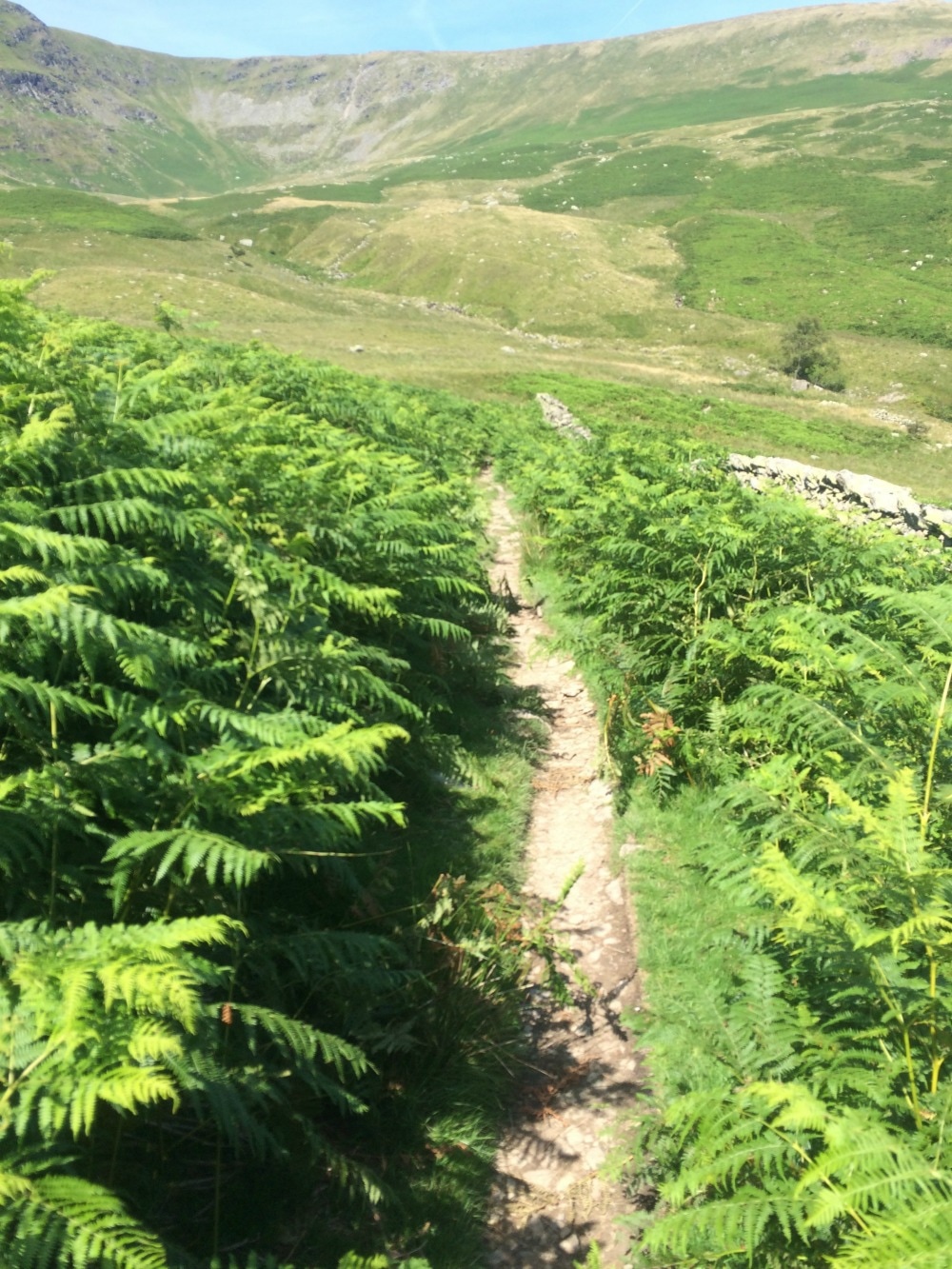 The never ending path alongside the reservoir At last we arrived at the pretty village of Burnbank. We walked through shady woods, enjoying the cool, when we came across one of the little delights you find on long distance walks - an honesty box. A sign told us that the box was managed by a 13 year old boy. Opening the box we found cold soft drinks and chocolate bars. What a treat after a long hot walk! And how fabulous that we live in a world where you can leave a fully stocked box and the accompanying money and it doesn’t get nicked! We continued through the woods, passing a sign for Hobbit Walk alongside a pretty stream. Then on through field after field of buttercups and wild flowers before at last, catching a glimpse of Shap Abbey. At this point we were tired, but we had a problem. Cows. Lots of them with calves and they didn’t look the friendly variety. So we skirted their field, adding on an extra 20 minutes (we both vowed to eat beef that evening as payback). We arrived at Shap Abbey and had just a very brief look around because frankly by this point our feet were telling us they’d had enough.
Late afternoon we finally emerged at our hostel for the night, New Ing Lodge, a very nice independent hostel, complete with the useful services that make walkers' lives easier - like boot drying and laundry. Beef wasn’t an option so we headed out to the local chippy that had a bring your own beer policy, which we did, before heading back and collapsing in our beds. We had a 20 miler to face the next day. 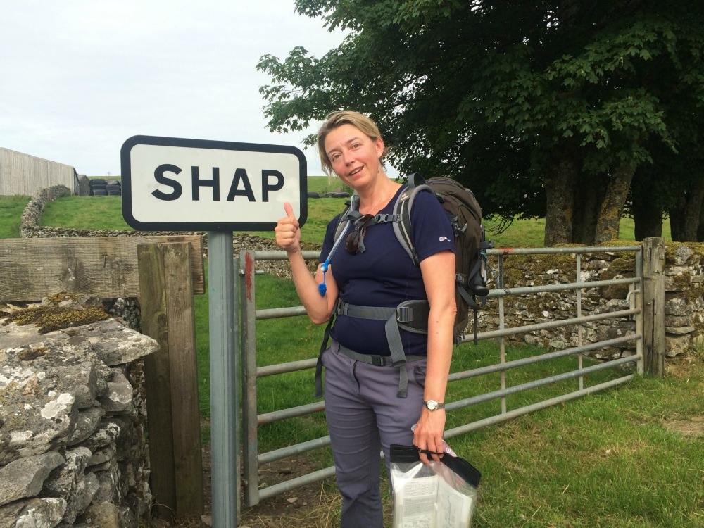  They know their market well. On to day 6
Back to day 4 Back to day 1 How to plan for the Coast to Coast Want to walk the coast to coast? Join the Glamoraks community and find a walking buddy.
1 Comment
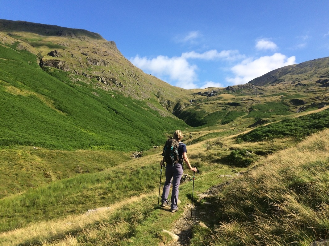
Distance: 8.5 miles This was the shortest and easiest day on the walk, according to the book. We had a choice of three routes: Option 1: The easy valley walk Option 2: The middle way going up St Sunday's Crag (lovely views) Option 3: The long, high, terrifying route along Striding Edge and Helvellyn (need new pants afterwards) If you have any done exercise of any kind that you're not used to, you will know that it's not the day after you exercise that hurts. It's the day after that. And if you happen to exercise even harder on this second day, it spills over into day 3. So by day 4 we hurt. A lot. Our feet in particular were feeling it. We used a magic physio stick every morning and evening to massage our legs and feet, but even this diligence couldn't stop the pain we had in our feet after being on them solidly for three days. So as we perused our options of which route to take, we were both in ready agreement that we should take the easy route, not least because we had a mega day to follow. We tucked into our full English with gusto before bidding farewell to our hostel and heading out into glorious sunshine. For about 20 minutes we walked past farms along flatish terrain but this is the Coast to Coast, which apparently means every day starts with a mega climb. This day was no exception.
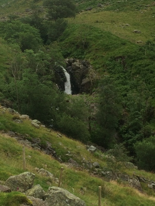
We entered a beautiful valley with a bubbling stream and ferns aplenty . In the morning sunshine it was glorious. However, we were quickly stripping off as the climb continued up and up. Mr Stedman's name was being taken in vain once again as he had described it as a 'simple walk' in his book. We eventually got close to top where we admired the spectacular view behind us, cooled off in a lovely waterfall and then climbed a steep track to finally crest the hill. One of the amazing things about walking long distance is the ability to look behind you and see how far you have come.
Leaving the valley views behind us, we didn't have to wait long for the next bit of jaw dropping scenery. As we crested the hill we could see Grisedale Tarn shimmering in the sunshine ahead of us. Some of the crazy campers, as they came to be known, had wild camped there the night before. What a beautiful place to wake up in the morning. This really felt so remote and untouched, the way the world should be.
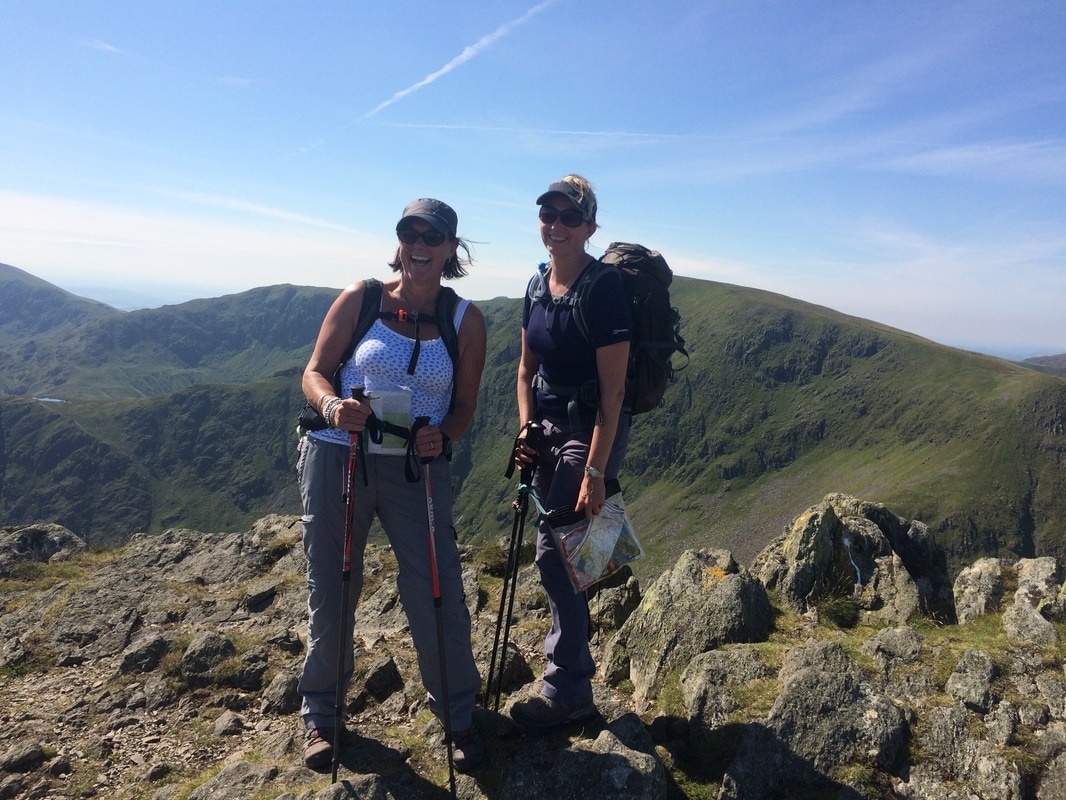
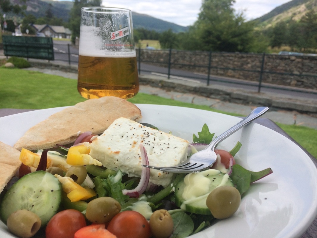
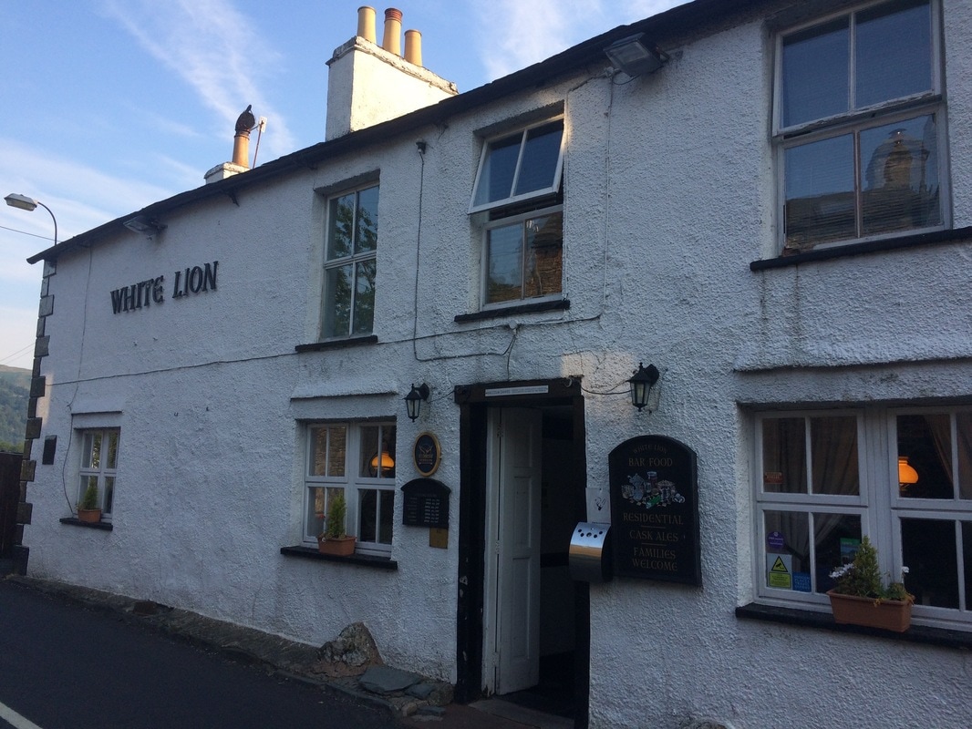
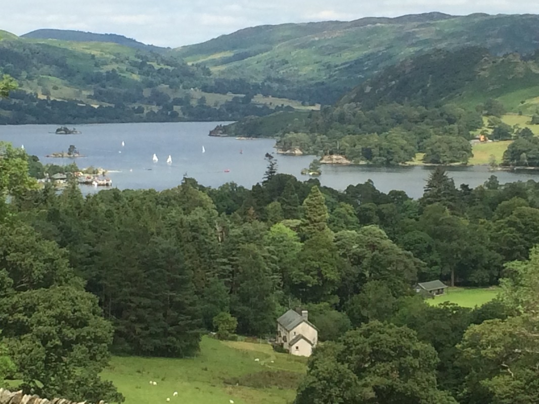
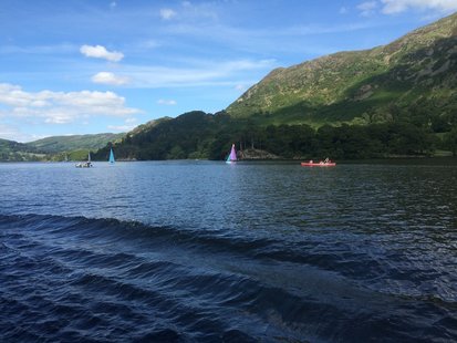
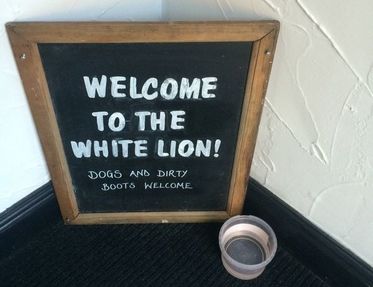
After playing hopscotch on some stepping stones we came to yet another stunning view across the valley we had to walk down. It was a long slow climb down on uneven, rocky paths. We peered up at the high routes we could have taken and did have a moment of 'should we have....' but we needed an easy day and the climb up and ensuing down, while short, weren't easy. If I did it again, I would do the St Sunday's Crag route just for the views. I'm not sure I'll ever be brave enough for the other option. Apparently Wainwright waxed lyrical about Striding Edge being the best bit of the whole walk, but Stedman's description put me off: 'The climb is arduous and, having reached the top, you then face a nerve-tingling drop on a crumbling slope above Red Tarn, followed by a knife edge walk along Striding Edge.' Nope. 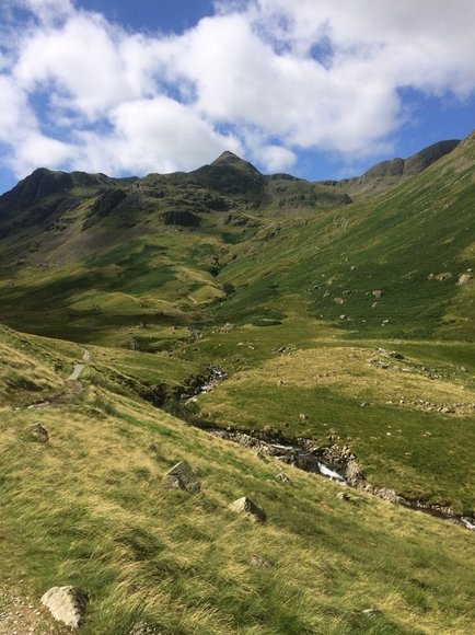 I think the pointy bit in the distance is Helvellyn Once we reached the valley floor, the rocks gave way to a nice soft path flanked by woods. Pretty cows greeted us and the phrase green and pleasant land sprand to mind. A final field led us into Patterdale. After just 4 hours 15 minutes of walking, we were done for the day. And it was only lunchtime! So that meant stopping at the Patterdale Hotel for a pint and salad (as you do) for lunch. Not sure quite what to do with all our free time, we walked on to Glenridding and caught the Ullswater ferry. For two and a half hours we simply sat, soaking up and sun, enjoying the views and mostly resting our feet. And we talked. About everything. That's the thing about a long distance walk. It gives you the chance to really connect. It's impossible to make small talk for that many hours a day, so you start to talk about deep topics, the stuff most of us never have time to think about, much less discuss, in our hurried lives. As the day was drawing to a close, we walked the final stretch to our home for the night - the White Lion Pub. The pub was a typical village pub with small rooms and big food portions, but across the road was the brilliant Patterdale Village Store, which has been put on this earth to serve walkers. It had everything you could need from blister pads to energy bars not to mention the famed Pork Rib sandwiches (which we sadly didn't try). But best of all was the noticeboard outside, which left encouraging messages from walkers who had met other walkers on route, telling them to hurry up or sending a cheery farewell. That board captured everything that is lovely about walking. Simple, honest, motivating and friendly. We got an early night as the book said the next day was the toughest of the trip....
On to day 5
Back to day 3 Back to day 1 How to plan for the Coast to Coast Want to walk the coast to coast? Join the Glamoraks community and find a walking buddy. 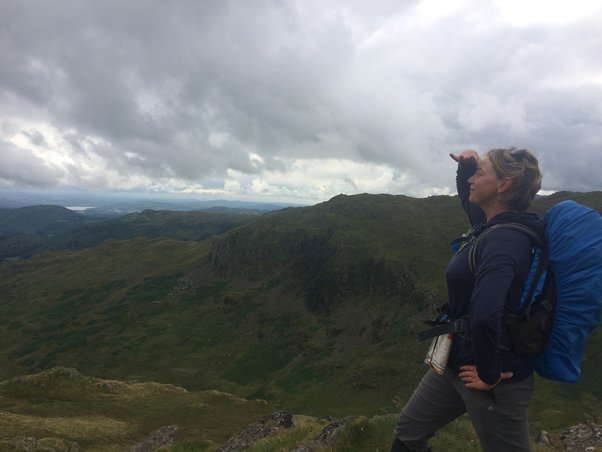 Distance: 9 miles NOTE: Due to life getting in the way, I stopped writing the C2C blog posts after day 2. But I took plenty of notes, so I am returning to them, with a few details missing that have been lost in the mists of time. We woke up very stiff. The epic day before coupled with two-day-old stiffness from day 1 meant everything hurt, particularly my ankles. Walking to get breakfast proved painful, so the day's climb didn't fill me with joy. We couldn't face a full english for a third day, so after a light breakfast of toast and cereal, we headed out nice and early. It was a drizzly, grey start but stunningly beautiful lakeland scenery as we walked through Longthwaite, Rosthwaite and Stonethwaite - all of which make you sound as though you have a lisp when you say them.
We walked along a river that had a series of pretty waterfalls, with a gorgeous looking campsite on the opposite bank. As though to send us on our way, two military jets flew low overhead, performing a victory roll, before disappearing over the hills leaving us with just the sound the river again.
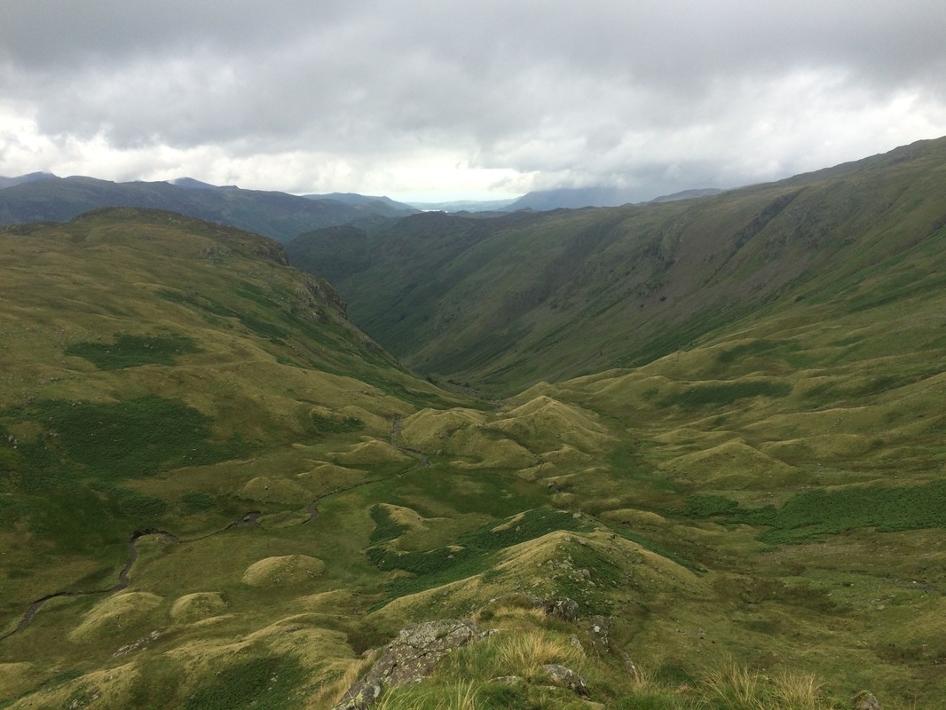
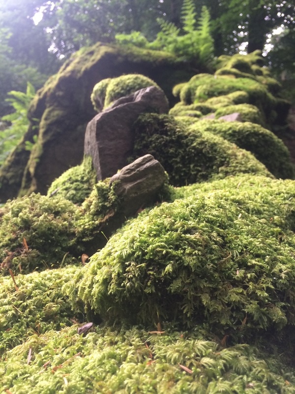
We knew we were heading for something called Eagle's Crag and the towering hill that loomed ahead of us let us know that we had yet another climb early in the day. The path got steeper and steeper, a never ending climb until we were well above Eagle's Crag and could look back down on it. We finally reached a strange little valley filled with drumlins. We aren't geography experts. Mr Stedman's guide book told us that we'd reach a valley of drumlins, which are weird hobbit-like grassy mounds. They are apparently created by glacial action. So there you are. Now you know what drumlins are. See the pictures below for an exciting visual reference.
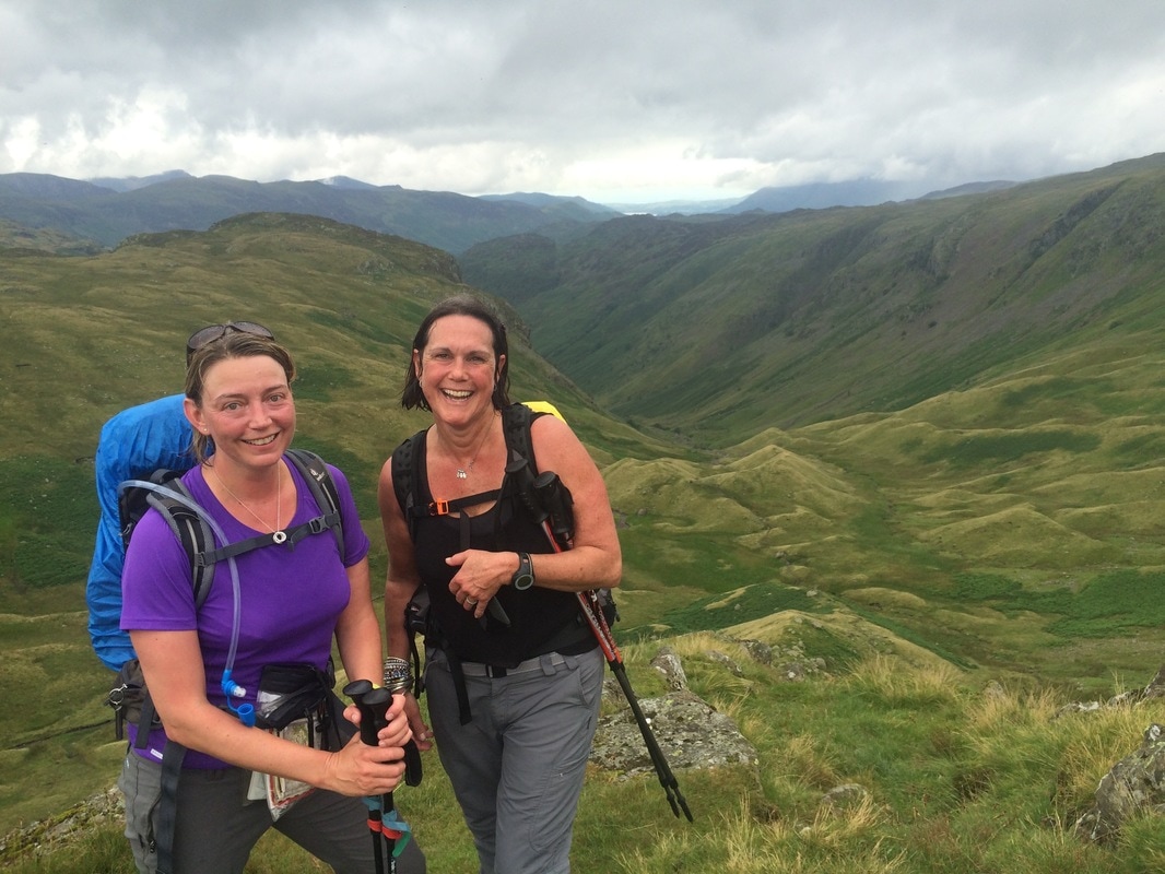
After a short breather, a snack of dried mango and a chat to a chap who was practically running the c2c on his own (fool) and after trying to spot England's highest peak - Scafell Pike - through the clouds, we headed further up. We had to put our poles away for this bit as it was so steep, it required hands to clamber up the boulders. Huffing and puffing we got to the top of Lining Cragg, where we got to admire the views some more and celebrate the fact that we could walk on the flat for a while. 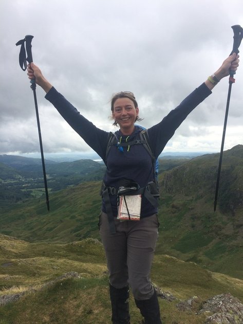 We proceeded across the boggy fells towards Greenup Edge. The book advised us that we may get lost here. And we would have, had we not followed some walkers ahead of us who seemed to know where they were going. A short, sharp downhill climb just to remind us that we had knees followed, before yet another up where we came to a junction. At this point we could choose the easier valley route down to Grasmere, or the high ridge. Feeling plucky, we chose the latter and stopped for our lunch on a rock called Calf's Crag, looking out across the ridge line we'd be following (below) to amazing views across the valley. Simply gorgeous. 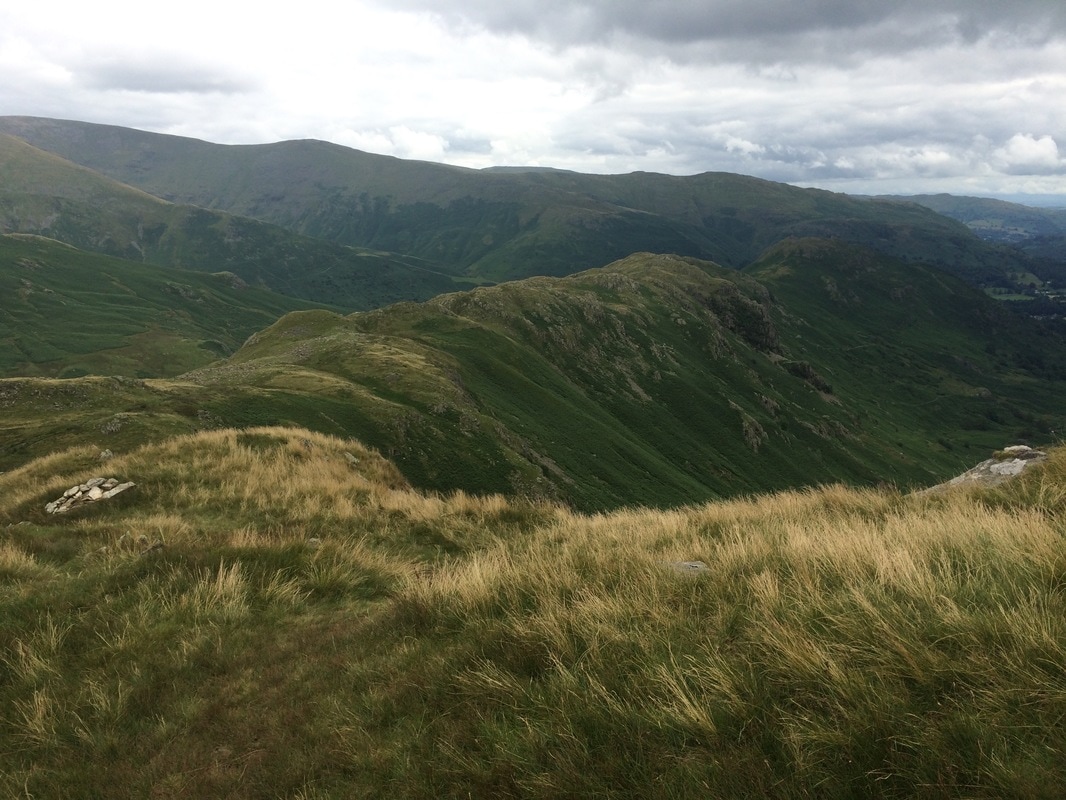 We headed off confidently in the wrong direction after lunch. It wasn't like we were blissfully unaware that we were going the wrong way. We just weren't sure which the correct path was. It was then we caught the dulcet tones of an Australian couple who said, 'Look, those gals are going the wrong way,' and they proceeded off on the right path. We felt this was terribly unsporting. After all, walking the coast to coast is not a competition and this lack of friendly walker's assistance pitted the South Africans against the Australians from thereon in. Our paths crossed repeatedly as our journey unfolded.... Safely on the right path we followed the ridge dotted with sheep. The views were stunning, but the walk was tiring with uneven, boggy ground and lots of ups and downs. And then the thing that most walkers dread happened. No. Not falling off a cliff. Needing to have a poo when you are miles from a toilet. What I am about to describe is probably going to fall into the category of too much information, but I feel these things need to be shared, should you ever find yourself in a similar situation. First tip: DO NOT EAT VEGETARIAN CHILLI THE NIGHT BEFORE A STRENUOUS WALK. Second tip: When the landscape is barren with few trees and only long grass and a few boulders for cover, get a friend to stand on Kaka Kaka duty. Kaka Kaka is the noise you make should someone approach your squatting position. It was invented by my son who decided it was a natural sounding noise, much like a bird so would fool fellow walkers. He wasn't aware that Kaka means shit in several languages. Apt. Third tip: Realise that vegetarian chilli looks exactly the same coming out as it does going in and will in no way be confused for sheep poo. Grab a large handfull of grass as camoflage. Absolutely no-one will be convinced but you'll feel slightly better about yourself. Fourth tip: Be sure not to be doing any of this near a walking path. Have tissues and a bag for the used tissue to hand so that you don't leave anything unnatural behind. (Other than the chilli....) 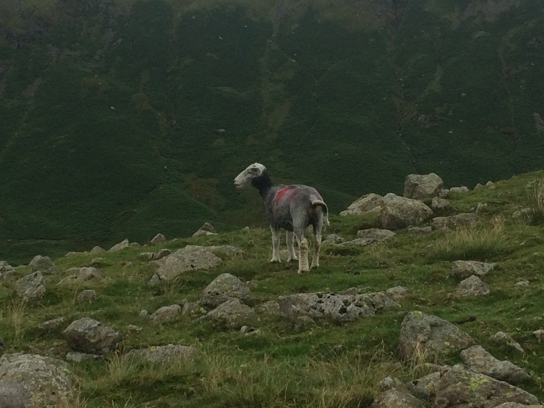 Sheep looking on in disdain Feeling suitably lighter we made our way along the ridge line, taking in Gibson's Knott. People traffic increased a lot as daytrippers from Grasmere made their way along the ridge for the spectacular views. Here is how Stedman describes it in the book: 'The ground is often saturated but the climbs up to the various summits take only a few minutes and give some great viewpoints down to Easedale Gill and Easedale Tarn glistening below. It's a long hard walk with rocky steps and bogs; allow at least 90 minutes from the gateposts to Lancrigg Woods. That is the price of surveying Castle, Lang and Silver Hows (hills) behind you and Helvellyn and Great Rigg beyond. By the time you reach Helm Cragg overlooking the following stage, the steep descent to the north-western outskirts of Grasmere may well finish you off!'
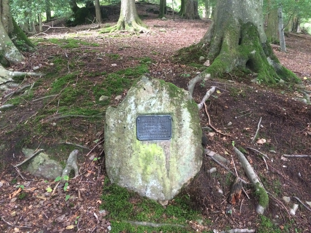
The man wasn't lying. We finally reached Helm's Cragg and took on the never ending descent to the woods at the bottom. Our knees by this point had had enough. When we finally got to the bottom though, we were rewarded with a beautiful walk through Lancriggs Woods along Poets Walk. This features a memorial to Wordsworth's sister Dorothy. What a lovely peaceful place.
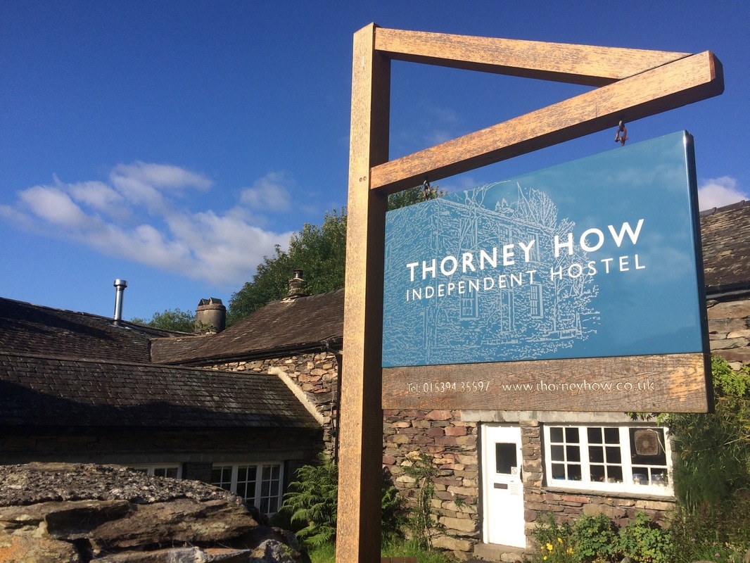
 Despite only being 9 miles, our feet were feeling it so when we stumbled into the beautiful gardens of the Lancrigg Hotel it seemed rude not to stop and have a nice cup of tea with a scone, jam and cream. Never underestimate the healing powers of a cream tea. 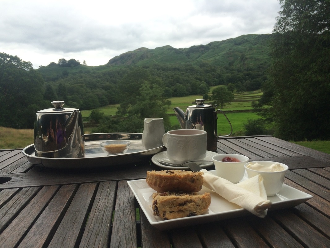 Feeling suitably revived, we had a wander through the pretty town of Grasmere and spent a small fortune on more hiking socks, browsed shops, found the Wordsworth Daffodil Garden and the Storytellers Garden. By which time it was absolutely time for a glass of wine, which we enjoyed on the outdoor terrace of a lovely spot called The Potting Shed. Finally we headed back to our hostel - Thorney How - an independent hostel with excellent boot facilities and top grub. Beef casserole for me, pork and leek pie for Lynda, sticky toffee pudding and a whole bunch more wine. Funnily enough we felt a bit sick by the end of it. We fell into bed, ready for day 4. On to day 4
Back to day 2 Back to day 1 How to plan for the Coast to Coast Want to walk the coast to coast? Join the Glamoraks community and find a walking buddy. 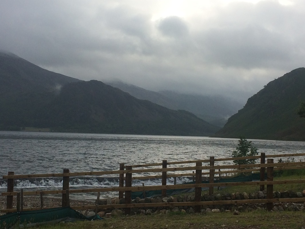 Ennerdale Water - at the start of day 2 Distance: 15 miles on paper. 18.04 miles walked according to Mapmywalk. 1917 calories burned. 8 hours 45 minutes walking. After an excellent night's sleep, we woke feeling stiff, but not as bad as we feared. I got out of bed gingerly testing my achilles as I went. The trick - if you ever have an achilles injury - is to give your ankles a really good swirl around while you're still lying in bed rather than making them take a step without warming up. Tops tips. You're welcome. We managed to make it down the stairs to breakfast where we enjoyed our first of many FEBs (Full English Breakfasts). Actually, I opted not to go for the FULL English because that is an obscene amount of food when you have to climb big hills. 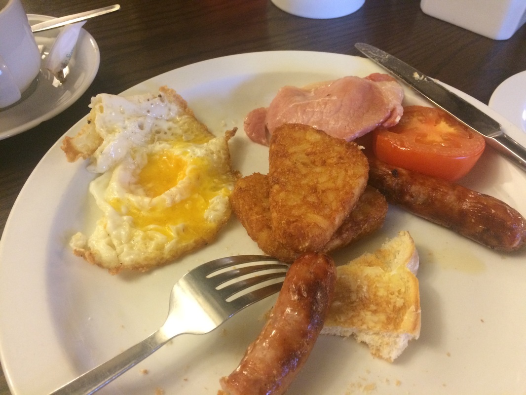 Artery clogging breakfasts to fuel you up for the day After collecting our packed lunches for the day from the bar staff and having packed up our bags, which would become the MOST tedious part of the trip, we were ready to roll. Incidentally, if you're not familiar with a bag carrying service, they are great. You just leave your bag at your location with with the name of the next place you're staying at printed on a sticker - which the company provide - and off you go. When you reach your destination, your bag is magically waiting for you. You never see the bag moving fairies but they do exist. The nerves of day one had disappeared and we were ready to face the day, despite the forecast of torrential rain. We saw our friends from the day before at the pub and enquired why they were wearing shorts. When they saw our full wet weather gear, we had a bit of a discussion about whose weather forecast was correct - ours or theirs. Safe to say ours was, as we would later discover. I found this weather site for the Lakes to be good. We headed out of Ennerdale, waving goodbye to the pretty little church, before we headed up a hill. It was only day 2 and already the hill-first-thing was getting old. But it quickly levelled off and after a bit of road walking, we got to the start of the lakeside walk along the Southern bank of Ennerdale water. Just as we debated taking off our wet weather gear, the heavens opened. Looking up the lake to the hills with the rain clouds hanging down to the water, was a magical view and made up for our feet which weren't dry to start with and weren't about to get any drier. 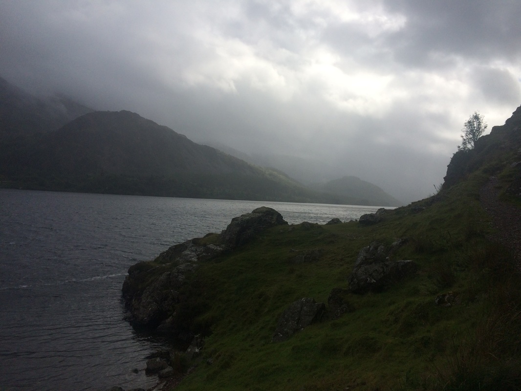 The beauty of the lakes The guide book said that on wet days, the lakeside 'path will become a river; at this time consider the track on the North side of be prepared to wade'. The book was correct. Thus commenced a long, tricky walk over uneven cobble stones that quickly formed a river bed, with flowing water. It was hard going, having to look where you placed your feet with every step. We then arrived at a seemingly benign rocky outcrop called Angler's Crag. The book didn't give it any particular mention, so we clambered over the steeps rocks until we reached an 'Oh shit' point. The way down was a sheer drop on very slippery rocks. One false step and we'd fall head first down onto the rocks and lake below. It was a long drop. There was nothing to grip onto. Our hands were wet. The rocks were wet. Our wet weather clothing was wet. I started to make my way down and realised that I was stuck. If I made another move, I'd topple down. My leg was wedged awkwardly against the rock to stop me from slipping. I was genuinely very scared. Lynda managed to slide on a slightly less steep bit of rock down to the path below. I threw her my backpack. She held onto one end of my pole, I the other and I jumped, with her grabbing me as I landed on the narrow track below. Recovery chocolate was immediately required. It wasn't pretend scary. It had been seriously life or death dangerous, yet no real warning was given in the book. It turns out, we discovered later, that a woman had fallen to her death in exactly that spot just a few months before. So if you are going to walk the C2C, as you approach Angler's Crag, make sure you look for a high path before you get to the rocks. Apparently there is one, which is less dangerous than the route we took. We then proceeded to walk for what seemed like a very long time along the edge of Ennerdale water getting increasingly wet. It was beautiful, if damp, with cheeky sheep spying at us from behind trees, lots of mini waterfalls and streams. 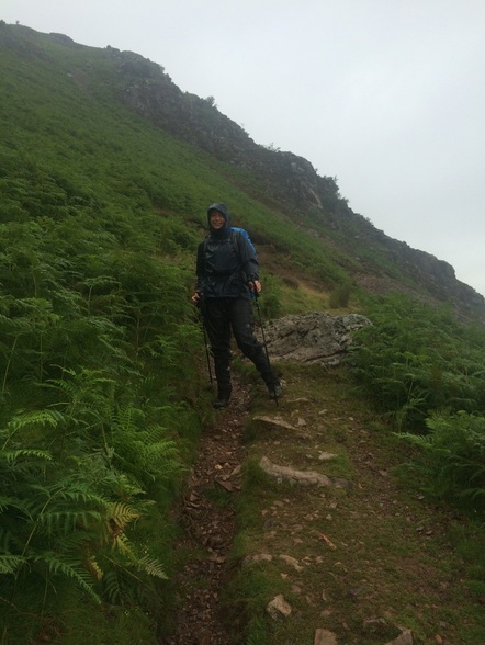 Heading away from Angler's Crag - and rocking the Glamorak look 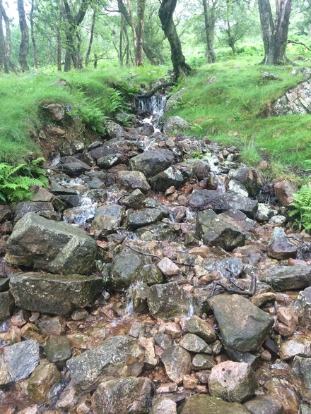 Streams turned to mini waterfalls. Beautiful greenery  Sweet little sheep hiding from the rain  A quick stop for a snack and map check before carrying on. We finally reached the end of the water. We were beginning to realise that the timings given in the book were optimistic to say the least. In fact author Henry Stedman should be given the title - Master of Understatement. If the book said it would take you 40 minutes, you can bank on it taking three hours. And we're not particularly slow walkers. I think Mr Stedman may be a fell runner. We had to consult our maps for the first time in a while and had a choice of following an easy forest track or going a prettier route along a river, 'which has been washed away in places.' We'd had enough of fording streams so decided to follow the forest track. Just as well, given the chap below was waiting on the other path, not looking too pleased with life. 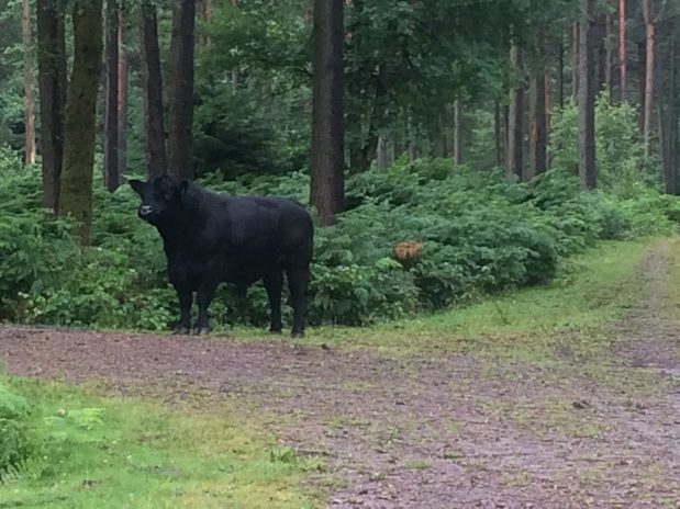 One very big, very pissed off bull We met a group of four people who we called 'The Italian Job' for the remainder of the trip, despite there only being one Italian in the group. After debating the merits of avoiding the bull, we bid them farewell and continued a long but uneventful walk along a forest track. The book describes it as follows: 'Still walking through the forest plantation; still hot, still tedious.' But it was neither hot or tedious. It had gale force winds and horizontal rain but it was less wet than the lakeside path. We were secretly rather pleased that the weather had set in as it meant there was no way we could choose the high route, which would take in Red Pike (755m) and High Style (805m). I think we may have died of exhaustion had we attempted it. 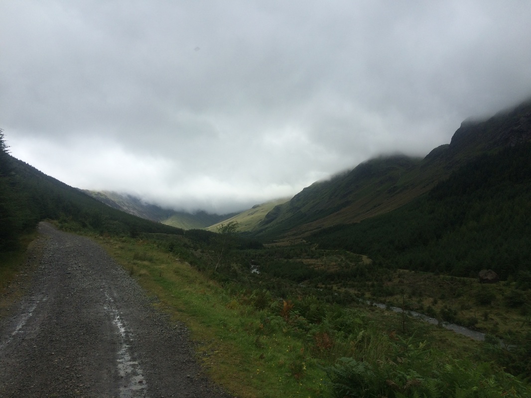 The track heading towards Black Sail Hut, with the clouds that prevented us doing the high route (phew) Our route took us past Ennerdale Youth Hostel before finally arriving at the idyllic Black Sail Hut, a little stone bothy reachable only by foot and surrounded by hills. Run by the YHA, it is a welcome respite from the elements for walkers. We traipsed inside where several other wet people sat huddled over mugs of tea and flapjacks, which they'd got from the honesty kitchen. We quickly did the same, ate our packed lunches and attempted to dry our wrung out socks on a radiator. I suppose sunning yourself on an exotic island somewhere drinking mojitos may be seen as a better holiday, but I can honestly say that a warm cup of tea, some squashed sandwiches while drying out our feet was marvellous. We chatted to our fellow walkers who came from the UK, Canada, Italy, Holland and Japan. It felt like we were part of some privileged club lucky enough to be sharing the isolated beauty of the place. 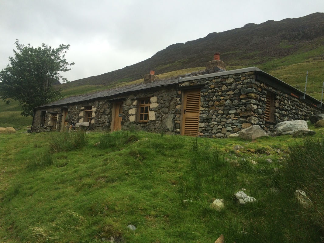 Black Sail Hut - the most wonderful place 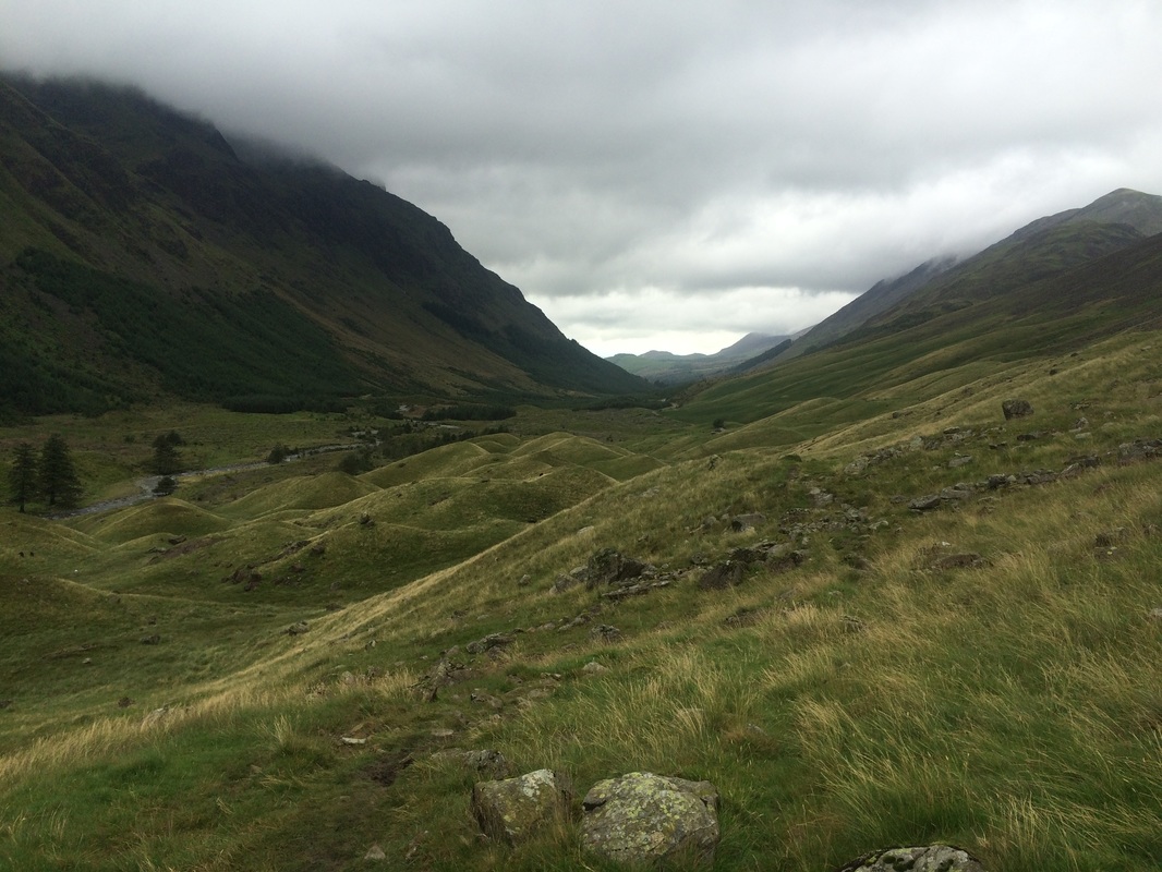 Views from Black Sail Hut, looking back towards Ennerdale 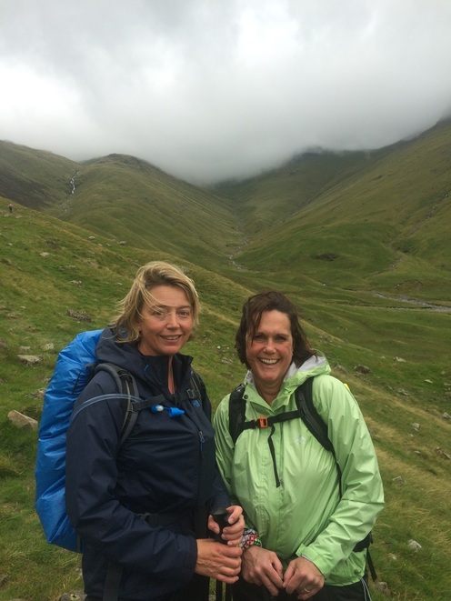 Setting out from Black Sail, suitably revived and ready for the big climb - up that hill behind us Fed and watered we headed out into a slightly drier afternoon and prepared to do the big climb up out of the basin we were in. While the scenery is absolutely breath-taking, it's the hill that will really take your breath away. It was a long, steep climb up but the views from the top were absolutely worth it. At the exact moment we crested the hill and started the walk across the boggy fells on top, the sun broke through the clouds, giving us this magnificent view over Buttermere and Ennerdale. 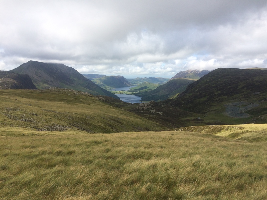 We continued plodding across boggy fells for some time, seeking out the odd stone cairn as waypoints, before finding an old tramway leading to Honister Slate Mine. Despite initially heading off on the wrong path, and having to retrace our steps across more bogs, we finally got onto the tramway and went down a ridiculously steep, slate bank towards the mine museum. After day 1's steep hill down to Nannycatch Beck my knees weren't enjoying the downhill but we got there without breaking an ankle. A quick pit stop at the museum loo and we set off again, on the last part of the day. By now we were tired. I began to feel a hot spot on my foot, the makings of a blister, thanks to walking in very wet socks all day. A compeed plaster came to the rescue and we continued on, hooking up with our friends John, Jimmy and Rob from day 1. Chatting to Jimmy and Rob about their wedding plans passed the time and we quickly got to the pretty hamlet of Seatoller. A last walk along a river and through Johnny's Wood, which included walking along more rocks, but this time with a handy rope to stop you falling in the water, we finally arrived at our hostel for the evening - Borrowdale YHA. The building was basic, the room small, but once again, set right next to a babbling brook, which is a lovely bedtime accompaniment. We quickly went into our evening routine - shower, muscle massage, boots in drying room, lager, big bowl of food (vegetarian chilli - yum!), map reading for the next day and bed. We were exhausted! 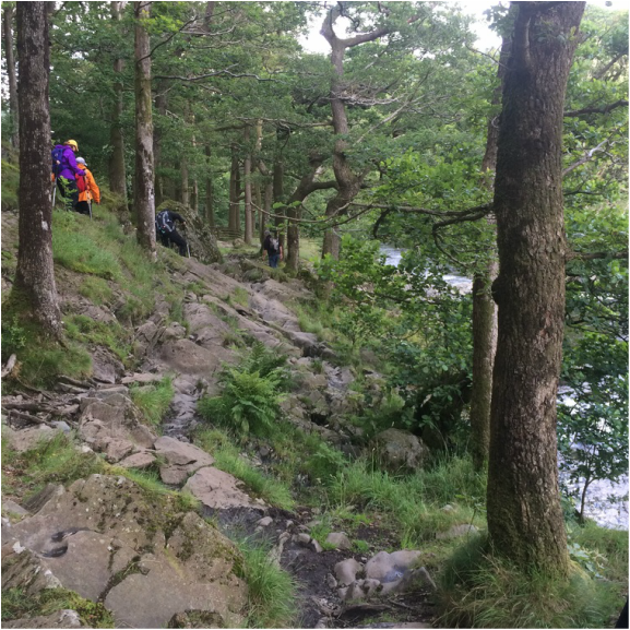 Heading through Johnny's Wood 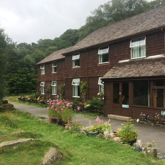 YHA Borrowdale 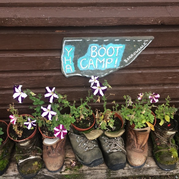 Where old boots go to die  Not a bad hostel setting On to day 3
Back to day 1 How to plan for the Coast to Coast Want to walk the coast to coast? Join the Glamoraks community and find a walking buddy. Distance: 14 miles on paper. 17.29 miles walked according to Mapmywalk. 1771 calories burned. 7 hours walking. I'd like to say that I was well-prepared for the start of the Coast to Coast, in full fitness. But I'd be lying. My training had been somewhat scuppered by an achilles injury in the build up to it. ( I shall write a separate post about how to prepare for the C2C and what to pack.) So it was with quite a bit of trepidation that my cousin and I set off from York at 6am, my long suffering husband driving us to Kirkby Stephen where we would meet our C2C Packhorse Van for a lift to St Bees. We almost immediately had a near disaster. We were so nervous as we met up with the coach and sorted out our bags that I left my guide book and maps in the car. Luckily my eagle-eyed husband spotted it and got it to me before we pulled away. Phew. As we drove to St Bees, crammed in a misty windowed van with about 14 other nervously excited walkers and cyclists, we tried to catch glimpses of the landscape we would soon be walking through at a far slower pace than we were whizzing past now. 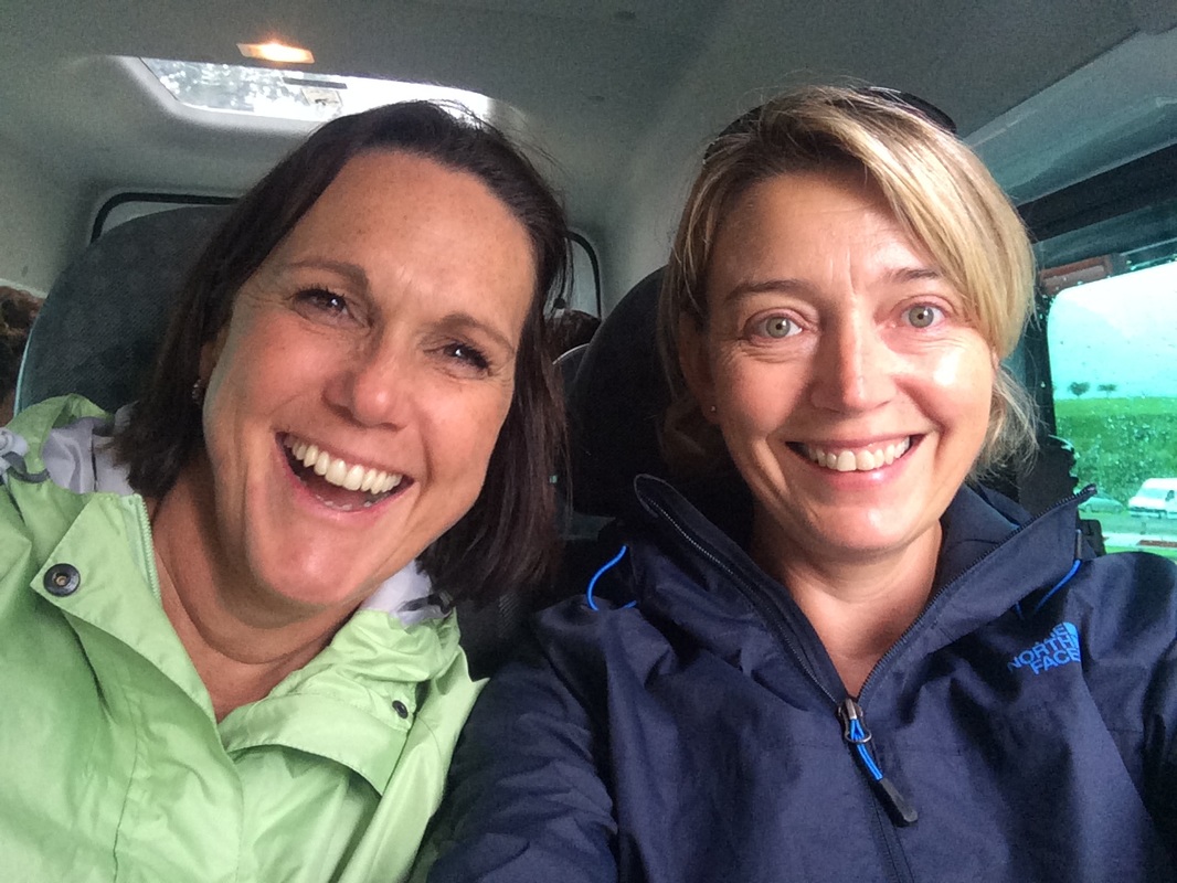 Our smiles hide the nerves we were feeling as we travelled to St Bees We arrived at St Bees under heavy grey skies. Strong winds whipped the rain into our faces as we posed at the Start of the C2C sign. It didn't do much to settle the butterflies. I kept thinking how ridiculous it was to feel nervous about going for a walk. But I was. I didn't want to fail. I wanted my achilles to hold up. And I wasn't at all confident it would. 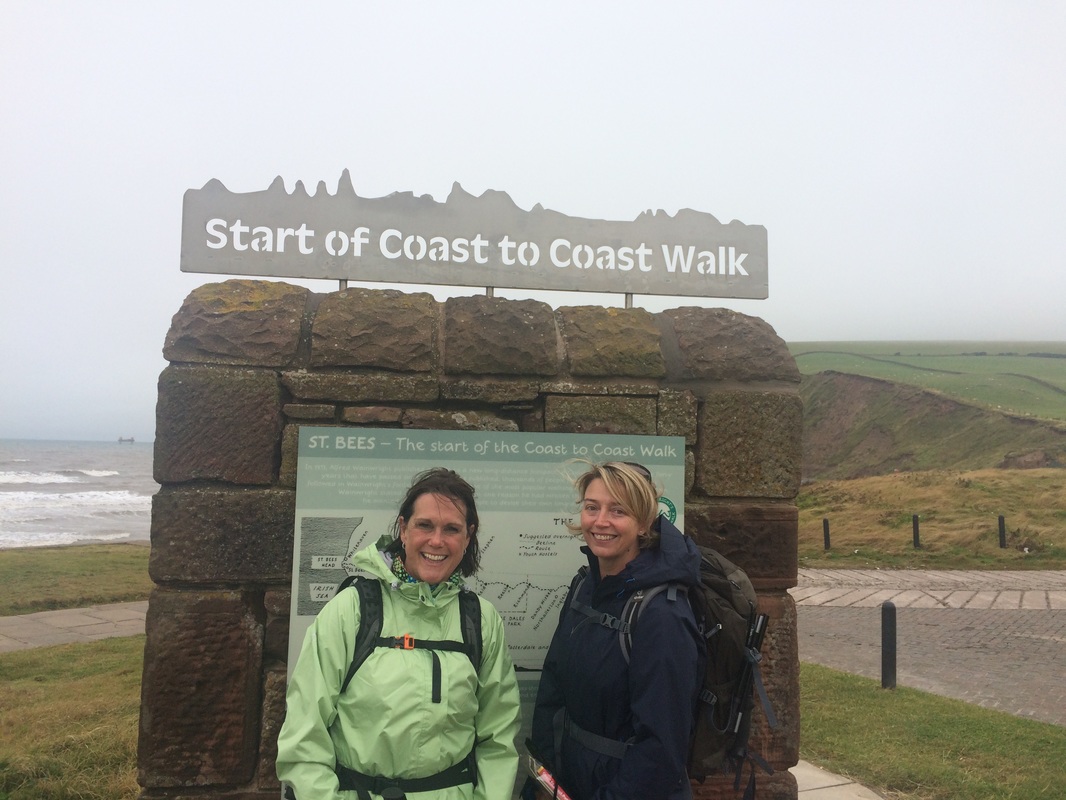 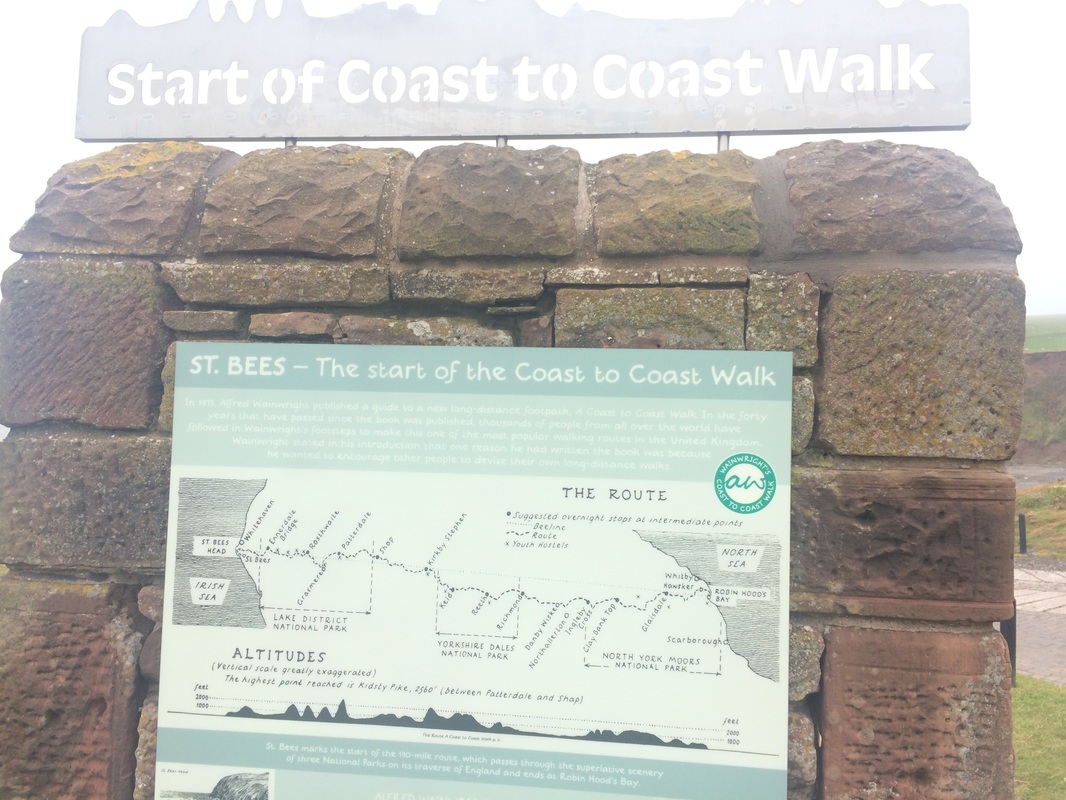 Our route - all 192 miles of it (not counting the extra miles for diversion, gradient and getting lost) We hopped down to the beach to collect two pebbles, one to keep and one to lob into the North Sea should we make it there. Realising there was no reason to linger, we started the climb up the coastal path away from St Bees. , That first hill up to the sea cliffs certainly got the blood pumping and set the tone for most days of the rest of the trip - a big fat hill to climb first thing. We spoke non-stop, as you do when you haven't seen someone for a long time, barely taking in the views over the Irish Sea. We glanced at the Old Lifeguard Station, which looks like a forlorn and discarded Star Wars movie prop, and noted the St Bees lighthouse to make sure we were on the right track.  Our first point of navigation came at the turn off after Birkham Quarry, where a handy signpost told us where to go. The sea mists were starting to roll in and things were taking a turn for the decidedly damp. We left the sea behind us and headed inland towards Sandwith, an energy bar to fuel us. 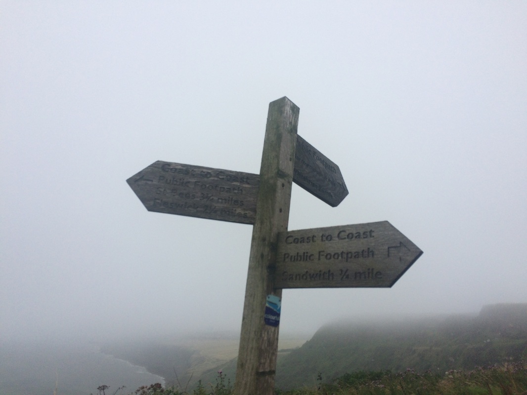 It was at this point that we met our first fellow Coast to Coasters - John, his son Rob and Rob's partner Jimmy. We struck up a pleasant conversation, while navigating our way through farm buildings, under railway lines and along an old disused railway line to Moor Row. Perhaps it was the bleak weather but Moor Row isn't the most beautiful village and we had rather hoped that the Pop In Walkers cafe as advertised in the book would be open. But either it had shut down or we were lost, but we failed to find it. All hopes of a nice cup of tea were dashed. So we plodded on in the wet to Cleator. According to the book, this was the last place with a shop until we reached Grasmere. But we were fully stocked up and frankly, the shop was 1 mile out of our way, so we weren't going to investigate it. We did walk slightly off course to find somewhere for a late lunch. We stopped at the Brook Inn where they served Sunday Roast or a Sunday Roast. Lynda and I opted to share a Sunday Roast - we didn't think we could walk with a belly full of Yorkshire pudding and roast potatoes. Our fellow walkers weren't as shy and filled their boots with pints of beer and a full plate of food. Something they may have regretted when they realised what came next. We said goodbye to our new friends and prepared to tackle our first proper hill of the walk - Dent Hill (roughly 350 metres in height). In contrast to some of the hills we had to come, it was nothing really, but for a first day when your fitness levels aren't quite up to muster, it's a long climb up. It starts with a very wet, boggy walk through a track in the forest, which we eventually left in favour of walking through the stunningly beautiful pine and moss covered forest floor as it was marginally dryer. It was like a fairy land, with countless mushrooms (or toadstools?) growing. 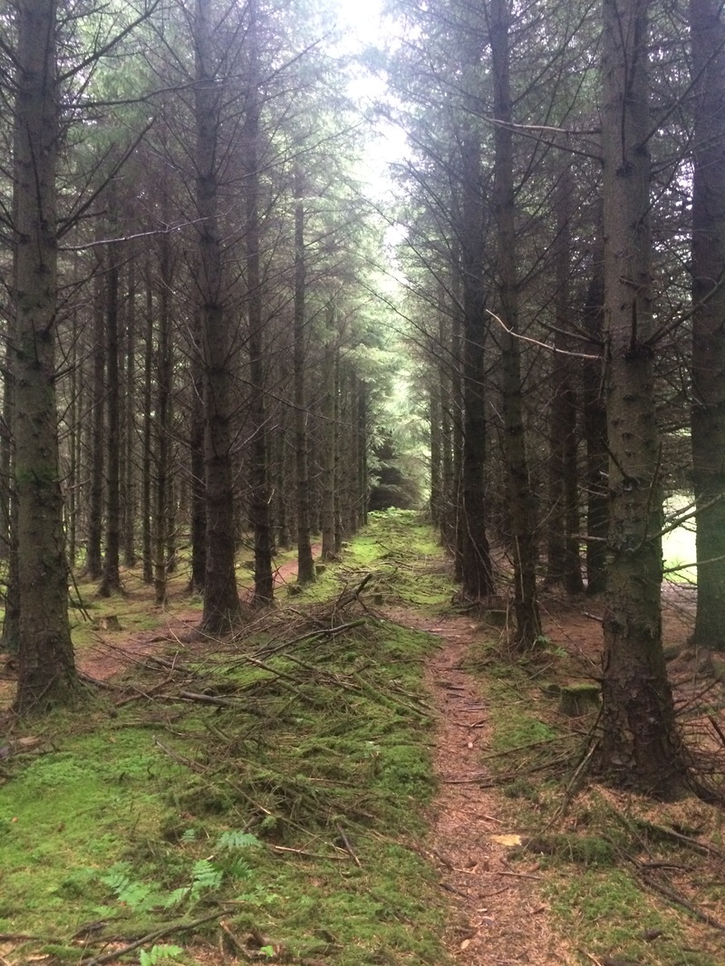 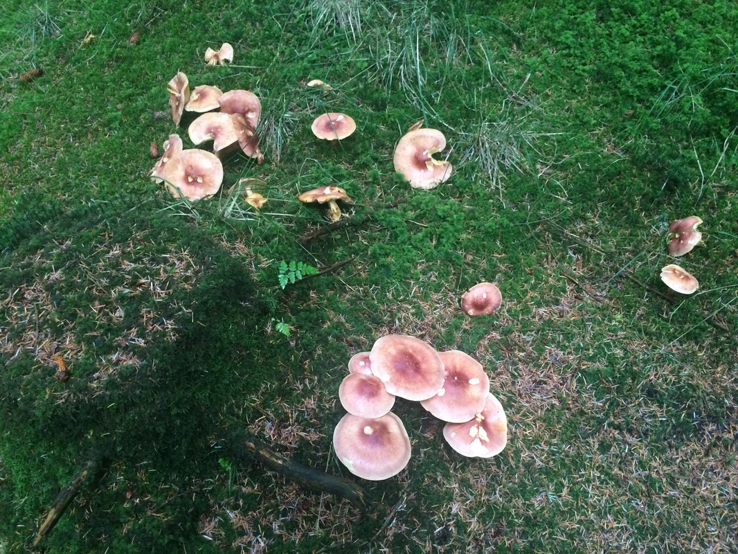 By now we were realising that our waterproofs boots were not actually waterproof after all. Excellent. We climbed and climbed through ever-thickening mist so that by the time we reached the cairn at the top of the hill all we could see was white, rather than the advertised views of 'the Lakeland Fells ahead and the sea behind.' 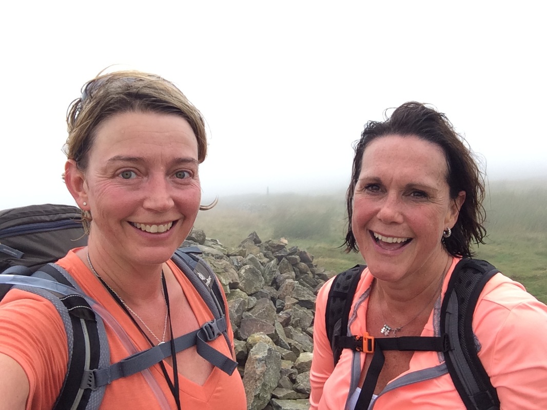 At the top of Dent Hill. Views of clouds Suitably puffed out by the climb, we now faced what according to Mr Stedman's book was 'the steepest part of the whole trail - mind your ankles!' Called Raven's Cragg, it apparently wasn't on Wainwright's original Coast to Coast but it has become the de facto route. It was indeed very steep, a grassy slope straight down that made my knees ache. The walking poles my husband had laughed at me for buying came into their own. (Note: walking poles may make you look like a super geek, but they are absolutely necessary on this walk, unless you have knees of steel). 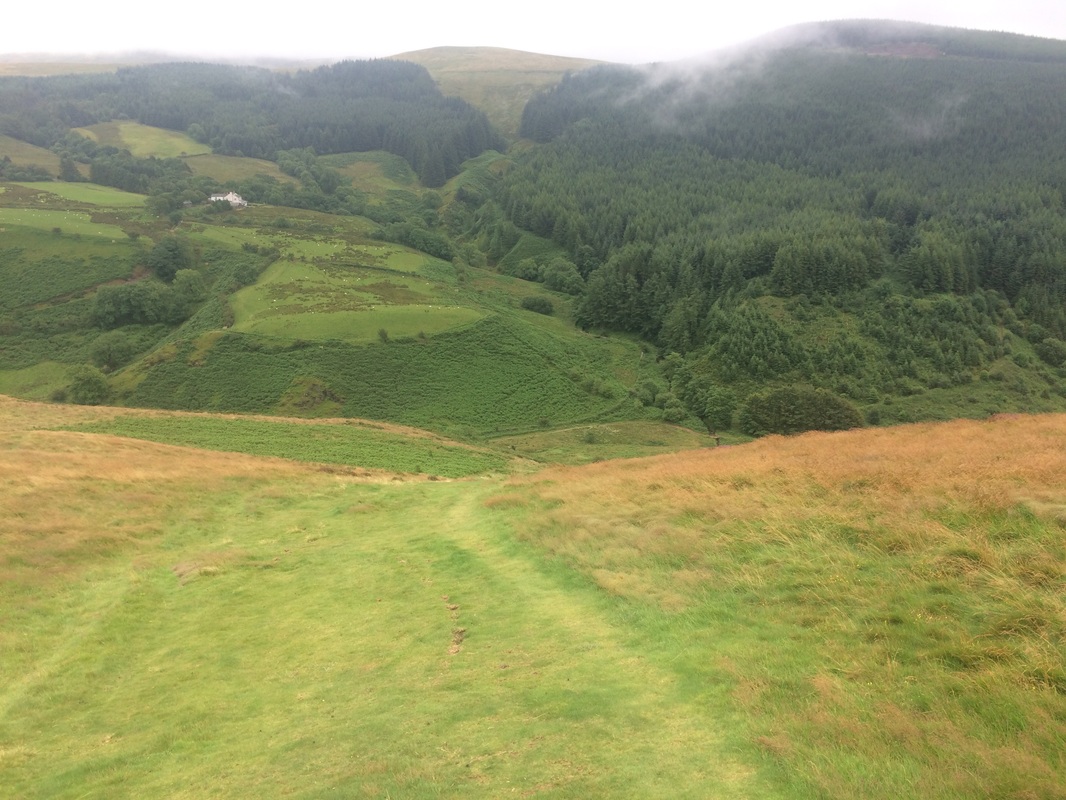 The picture doesn't do the gradient justice. It just kept going down, down, down The knee knackering slope is absolutely worth it for the stunning Nannycatch Beck you find at the bottom. This beautiful, narrow valley has the beck bubbling it's way along it, birds of prey soaring above it. We had to zig zag our way over the stream numerous times, sometimes on bridges, but often on stepping stones or just wading through it. Once your boots are wet, they are wet and it makes very little difference. 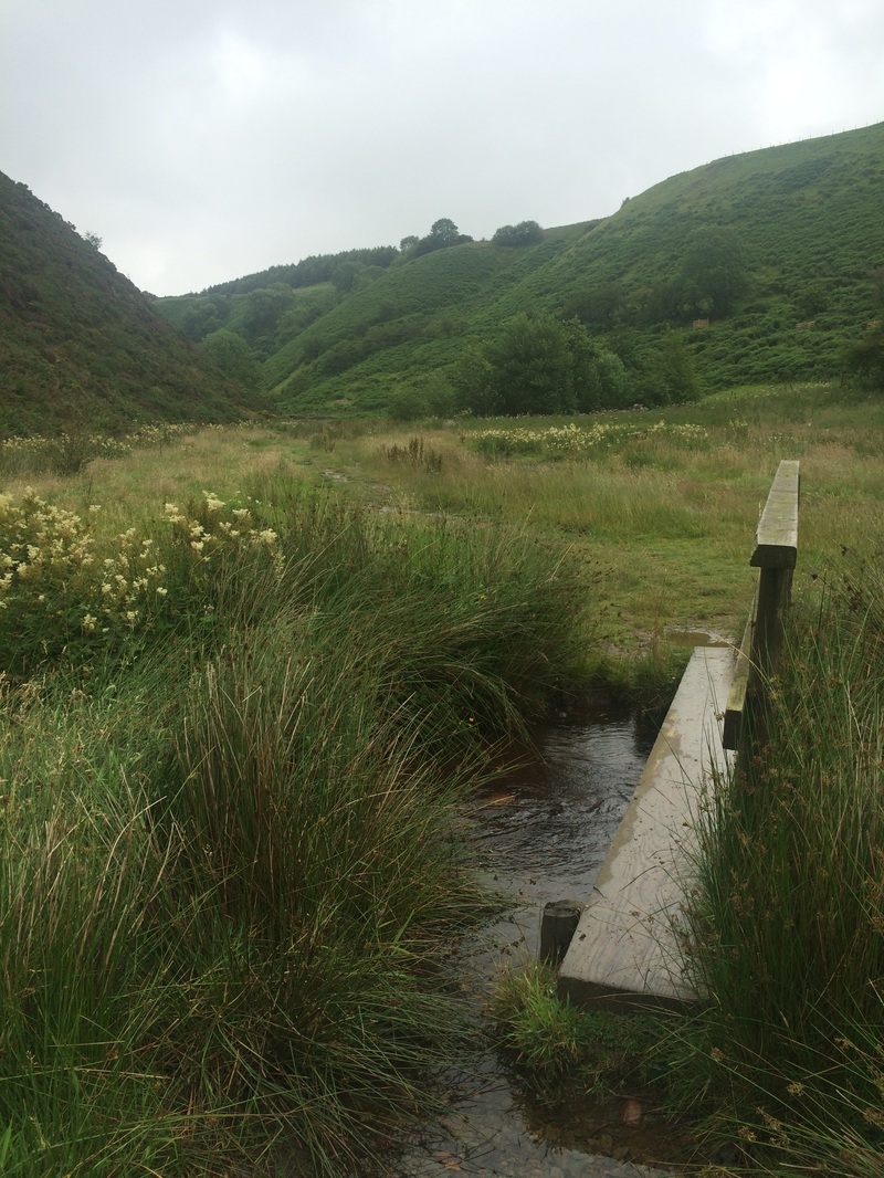 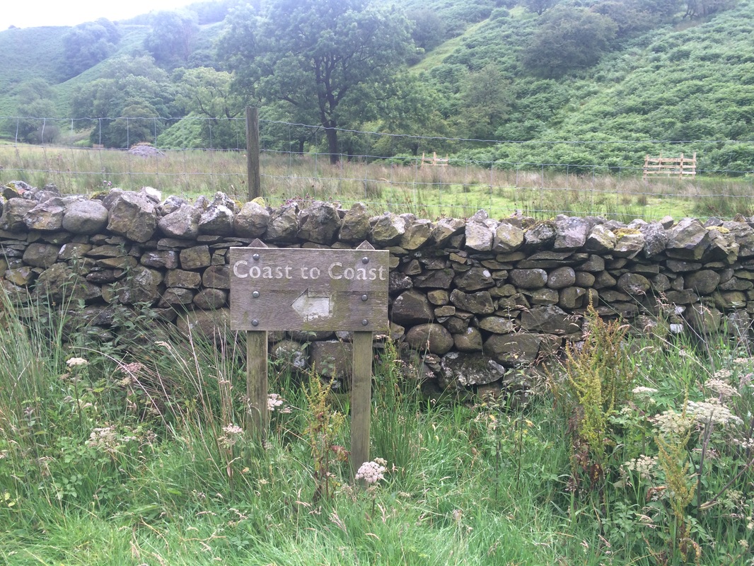 We finally left the valley and walked the last part of day one towards Ennerdale Bridge, views of the hills we'd be climbing the next day in the distance, the tops of which were hidden by clouds.  What awaited us on day 2 We finally arrived in Ennerdale Bridge, a very pretty little village with another bubbling brook rushing right past the pub we were staying at - the Fox & Hounds. We were given a warm welcome by the pub staff and shown the boot room where we could dry out our boots (although there was no newspaper to put inside them, which would have helped). Like magic, our bags were waiting for us. We immediately realised the error of our ways in packing such a large bag. When you've walked 14 miles you really don't want to have to lug a huge bag up a flight of stairs to your room. But we did. We set about doing stretches, rubbing all sorts of gels and creams into aching muscles and having a much needed shower. My achilles had held up but the test would be what it felt like the next morning. I enjoyed a giant burger and chips for dinner - given the number of calories I'd burnt off, it was fully justified. One pint of beer and I was a pathetic mess, barely able to keep my eyes open after the early morning start, a blast of fresh air and lots of walking miles on unfit legs. I was fast asleep by 9pm, the sound of the stream bubbling along outside the window a gentle lullaby at the end of day 1. 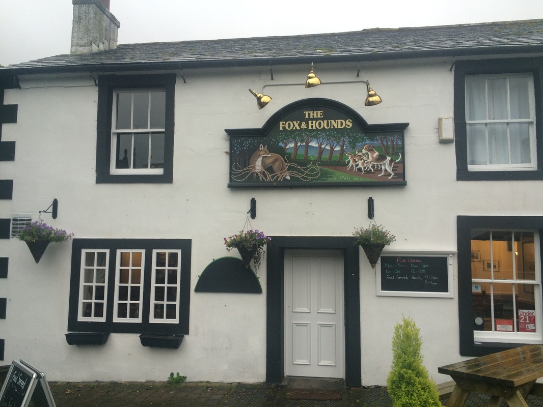 Our very welcome accommodation for night one. 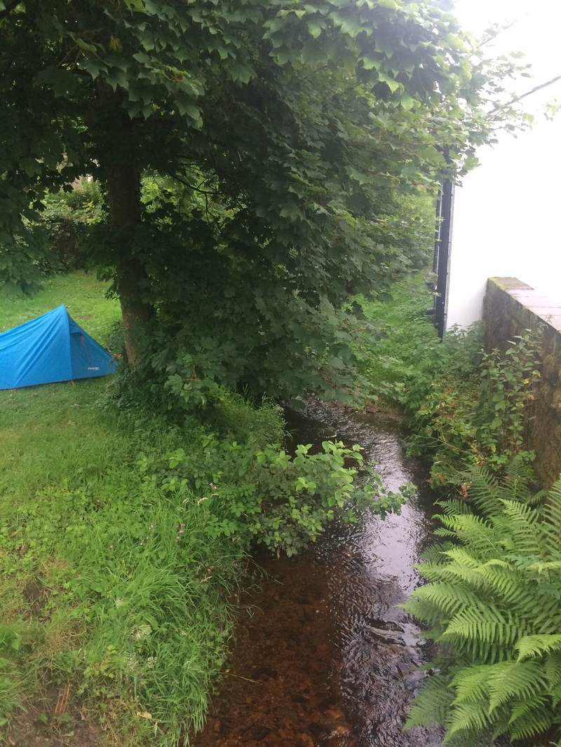 The little stream running right outside the pub - camping is available in the field next to the pub. On to day 2
How to plan for the Coast to Coast Want to walk the coast to coast? Join the Glamoraks community and find a walking buddy. 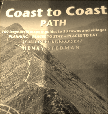 The best ideas just happen. They aren't things you dwell on and ponder over. They will simply pop into your head and make you take action. Instantly. Without overthinking it.
It was an idea like that which resulted in me walking almost 200 miles in 14 days. You see, in January this year I made a resolution to walk more. I had done a few walks along the Cleveland Way the previous year and realised that I loved it. Something about the slow pace, the quiet, the scenery, the adventure, the time to reflect, the fresh air...it was all brilliant. So I bought a book: Coast to Coast Path - a Trailblazer guide by Henry Stedman. I hadn't even read it when I posted on Facebook: 'Would anyone like to walk the coast to coast with me?' I had no idea what it entailed. I didn't know where it went or what it involved. It just seemed a good idea. I expected tumbleweeds to blow past my Facebook post. But then a surprising reply appeared. 'I'll do it.' That was from my cousin - Lynda - who lives in South Africa. Even by my fly-by-the-seat-of-your-pants standards, flying 11 hours to do a walk seemed a little out there, but she was serious. It occurred to me then that I probably ought to read the book. So I did. Some of it sounded faintly alarming - words like 'relentlessly uphill' and 'extremely boggy'. But I glossed over those bits and looked at the nice sounding pubs and B&Bs we could stay in instead. It sounded like a grand lark. And so I set about booking it. The adventure had commenced and will unfold right here ..... (In my next post I will explain exactly how I planned out our route, accommodation and baggage in case you are thinking about doing this.) |
Categories
All
Archives
January 2021
|


 RSS Feed
Get social. Follow us.
|
Don't get left out.
Add your email to be alerted about any Glamorak events, walks, get togethers, challenges or news.
Success! Now check your email to confirm your subscription.